With today’s trail run I have completed all of chapter 12 of Afoot & Afield – well, except for hike number 91, a 15-mile suffer-fest climbing all of the Five Peaks Challenge in one day. That’s scheduled for next spring. Today’s A&A hike is a fantastic example of the absolutely wonderful neighborhood canyons that are hidden throughout San Diego.
October 17, 2020
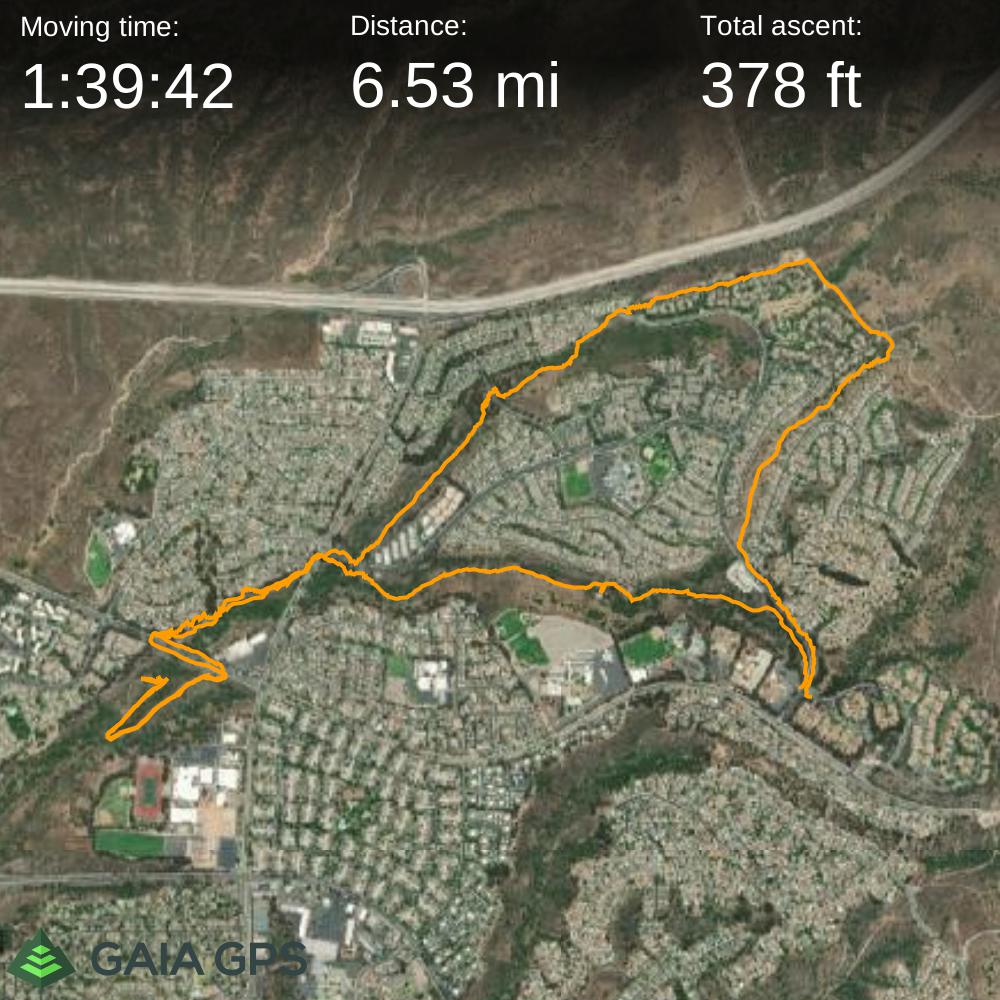
Miles: 6.5
Elevation Gain: Flat!
Gaia Track
The hike described in Afoot & Afield only covers East Shepherd Canyon, and is less than three miles as an out-and-back. I wanted to get in at least six miles today, so I Gaia’d together a loop that toured all fingers of this open space, including a sliver of the far western edge of Mission Trails Park.
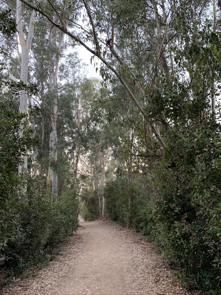
I know I’m a broken record but I just love these neighborhood canyons throughout the city. Obviously this one was no exception – it made it into Jerry Schad’s book, after all. My favorite part is always seeing the little side trails that join from the nearby houses and communities, weaving a little bit of nature into everyone’s daily lives.
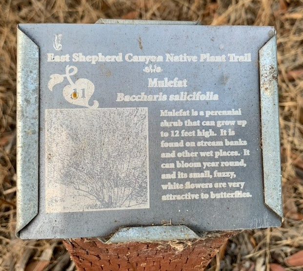
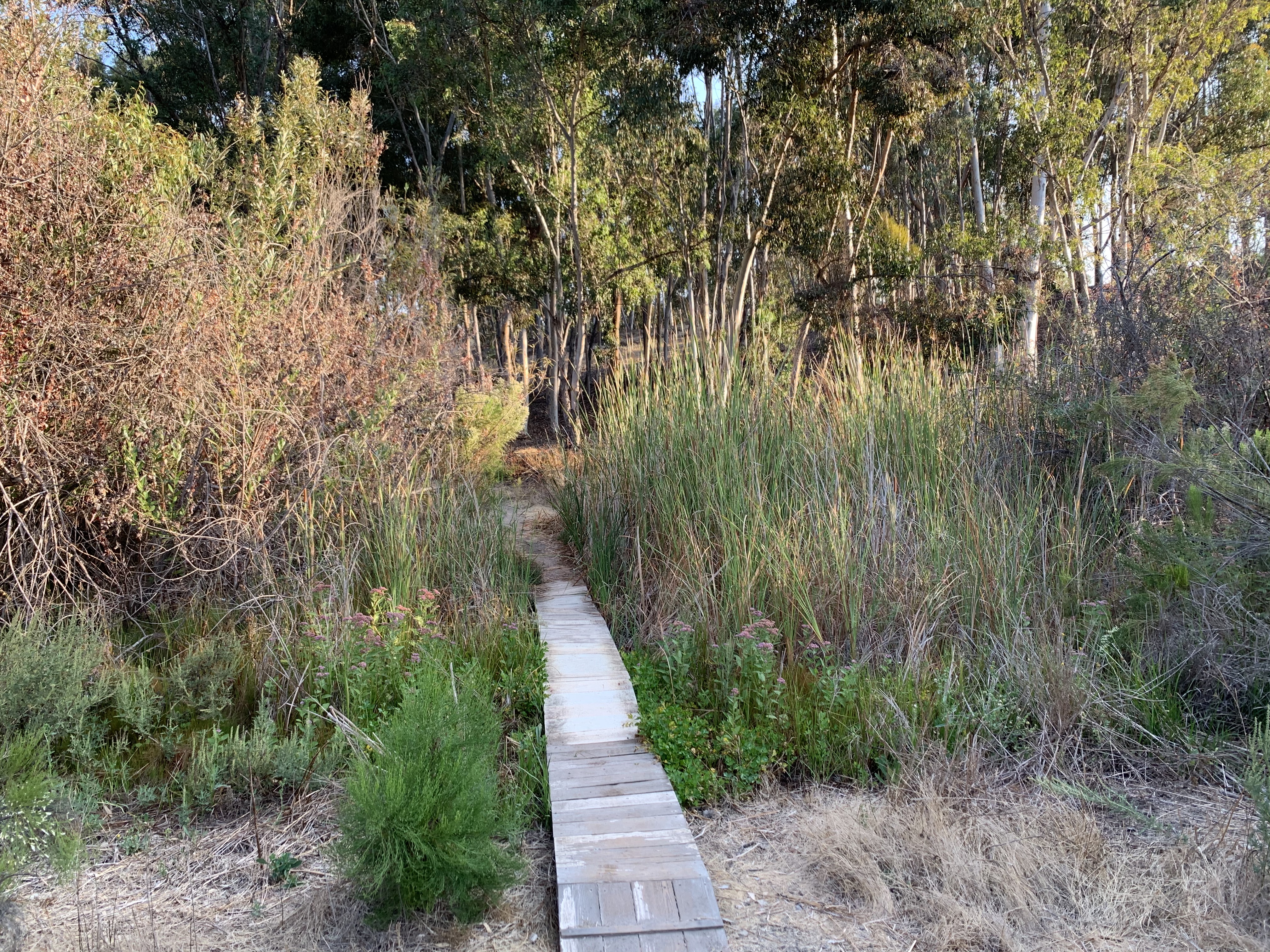
The East Canyon, which I hit first, was definitely the crown jewel and hence its inclusion in the book. It was the primary goal of the morning which is why I did it first – no matter what happened next I could check of hike #92 from my list. A girl’s got priorities. This part of the trail passes Dishwasher Pond, which was unsurprisingly dry here in mid-October. Near the end of the path little signs had been posted for a “Tierrasanta Plant Identification” trail that I learned later was set up by a Girl Scout troop.
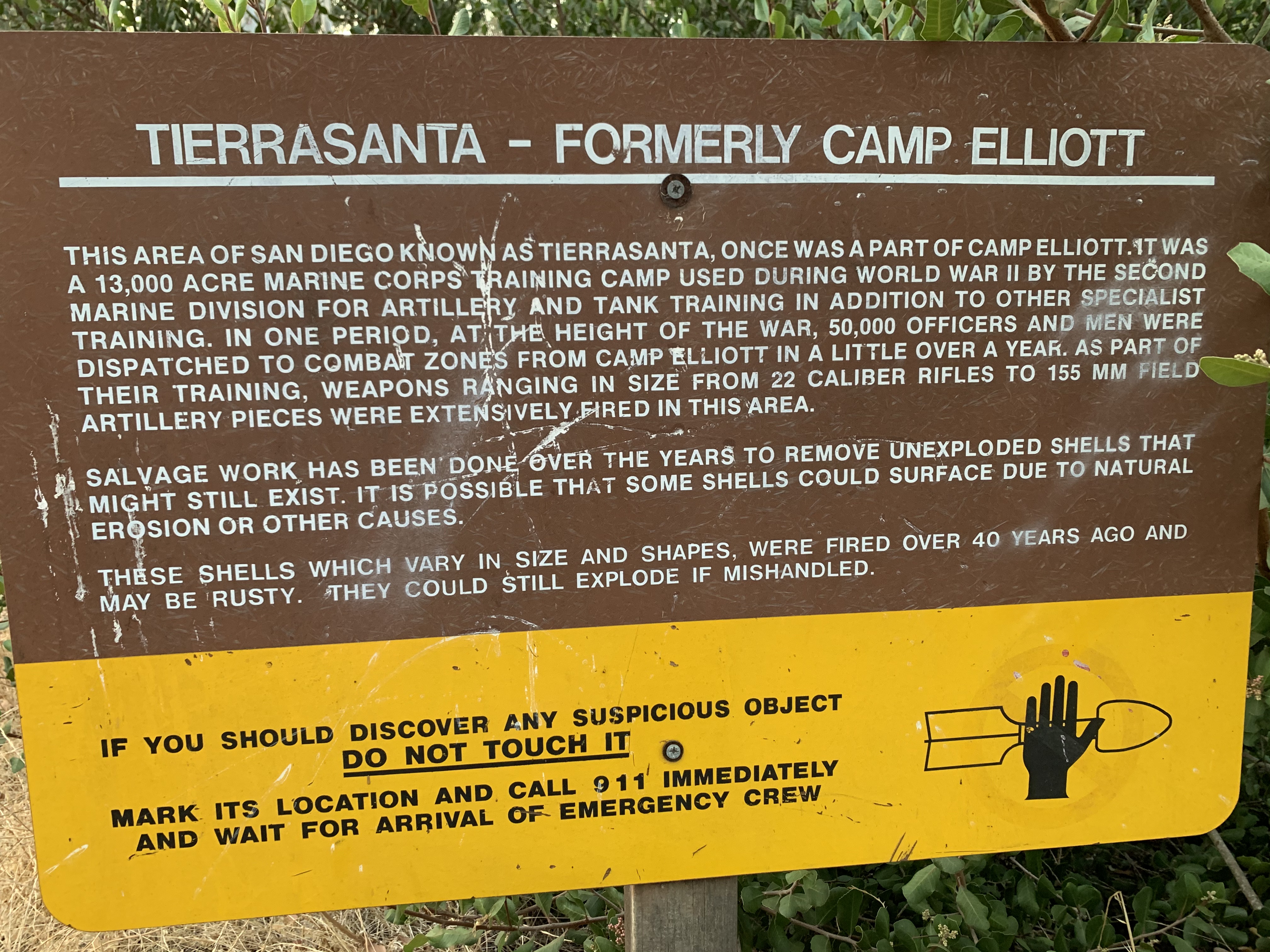
Coming to the end of this first section I arrived at Santo Rd and crossed over to West Shepherd Canyon. At the entrances to all the canyon fingers there are signs warning the public that this area was formerly Camp Elliott, which was a military camp of various types from the 1930s to the 1960s or so. If you see something that looks like a bomb, don’t pick it up.
This leg of my outing cut diagonally down to Clairemont Mesa Blvd. I saw on the map that there is a trail extending further south, nearly down to the 15, and I gave this a try. It started at a gate near the intersection of the two wide roads and headed steeply uphill on a fire road. I followed this until the trail petered out, about halfway as far as the map had indicated. I continued back northward along the bottom of the canyon until that ended in some brush. This was a road maintained for some kind of water/sewage access so it was easy going, but I would definitely recommend skipping this part of the trail as being pretty un-interesting. I bushwhacked a bit to try to get back to the road without backtracking but failed. I think it was doable but I did not want to do that much bushwhacking.
Back on Santo Rd, I crossed back to the east side turned down Antigua Blvd to access Lower North Shepherd Canyon. My favorite part of the whole run was when the trail turned up to Villarrica Way, and the space opened up under old shady oaks, just begging a local family to have a little picnic. What a sweet spot. Of course I suck and did not take a photo of that area, but did get a little footbridge.
Onward to Upper North Shepherd Canyon (really creative with the names here), which curved eastward, south of Highway 52, which I could hear but could not see. This led me to the Mission Trails Portobello Entrance, where I headed southward to another great little neighborhood pathway that was unnamed as far as I can tell and finally over to the main road, Via Valarta. To close my loop I had about a quarter mile jog on the road. Via Valarta has bike paths on both sides so there is no parking. I had parked on a side road, Via Dominique, across from the trailhead. This worked out just fine.