Summiting Mount Whitney via the Mountaineer’s Route

Why It Took Me 17 Years and Deirdre’s Other Questions

It was well past our turnaround time. Or, it would have been, if we’d had enough sense and experience to HAVE a turnaround time. We were 2500 feet below the summit of Mount Whitney, just beginning the climb up the couloir. Actually, to the left of the couloir - since the couloir itself was full of snow. We were already scrambling with our hands on this precipitous pitch. Our upward progress was infinitesimal. This was insanity - but which one of us was going to call it quits? We kept going. That is, until the first drops of rain started to fall. We looked at each other and, without discussion, we knew - it was time to turn around.

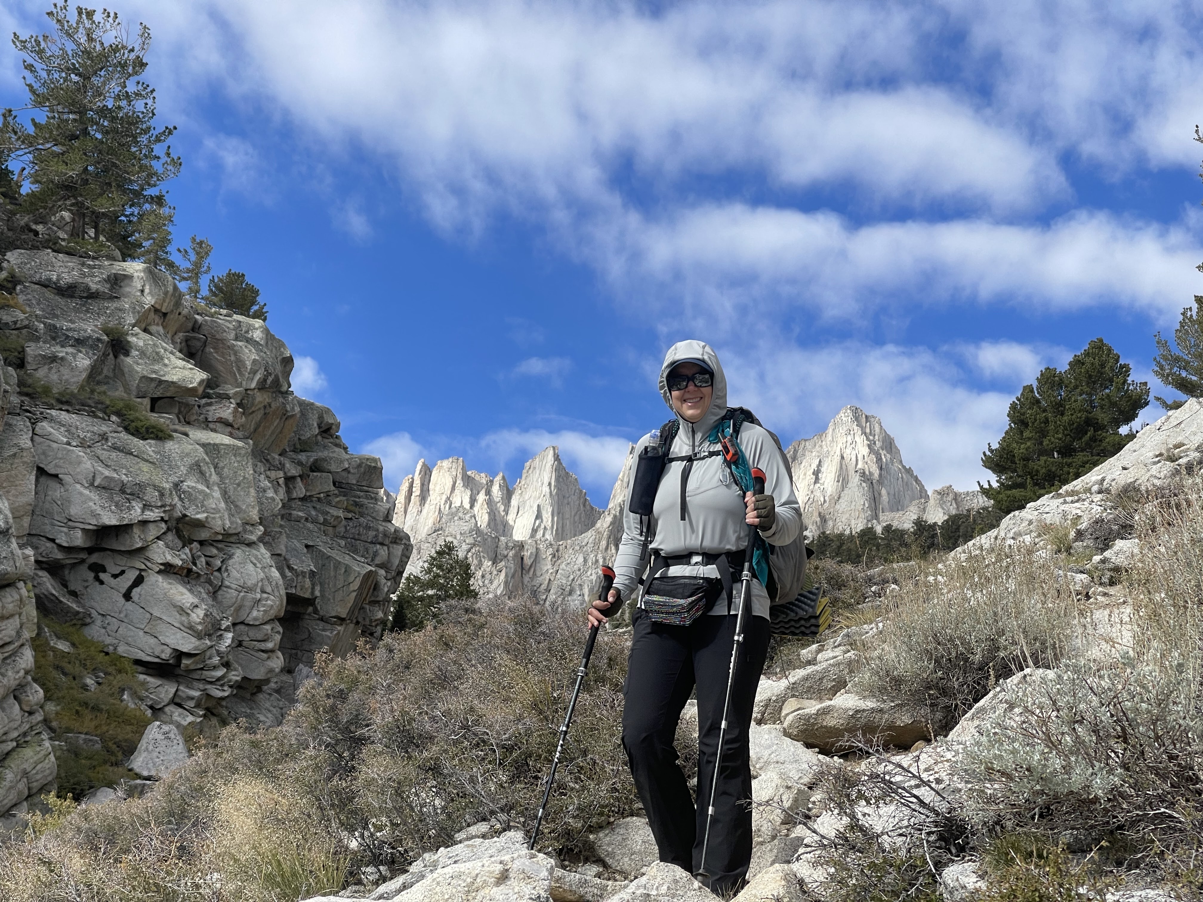
It was early August, 2005. I don’t remember how the plan evolved, but I’m sure I’d expressed to my husband Tad at some point that I’d like to summit Mount Whitney. Several years before that, before Tad & I started dating, he had submitted Whitney with his friend Mark. The two of them had ascended Mount Whitney via the Mountaineer’s Route. At 14,505 feet, Whitney is the highest mountain in the lower-48. There are two primary routes to the summit from the east side: the main Whitney Trail, and the MR. Both routes start at Whitney Portal, at 8400 feet, so they both ascend roughly 6000 feet. The difference is that the main trail is about eleven miles one-way, and the MR is about four. Six thousand feet gain in four miles! And the last 2000 feet to the summit are ascended in the final half mile. Horizontal distance is meaningless on the MR.

Both Tad and Mark had been active on a caving-focused search-and-rescue team, which involved a lot of technical climbing. That, plus being young men in their late-20s, made lots of things seem easier than they really were. Fast forward to 2005, when I expressed interest in this hike, Tad immediately said, let’s do the MR – why hike all those twenty-some miles round trip when you can just do it in eight? Yes, why indeed!

Weren’t we so cute!!!???

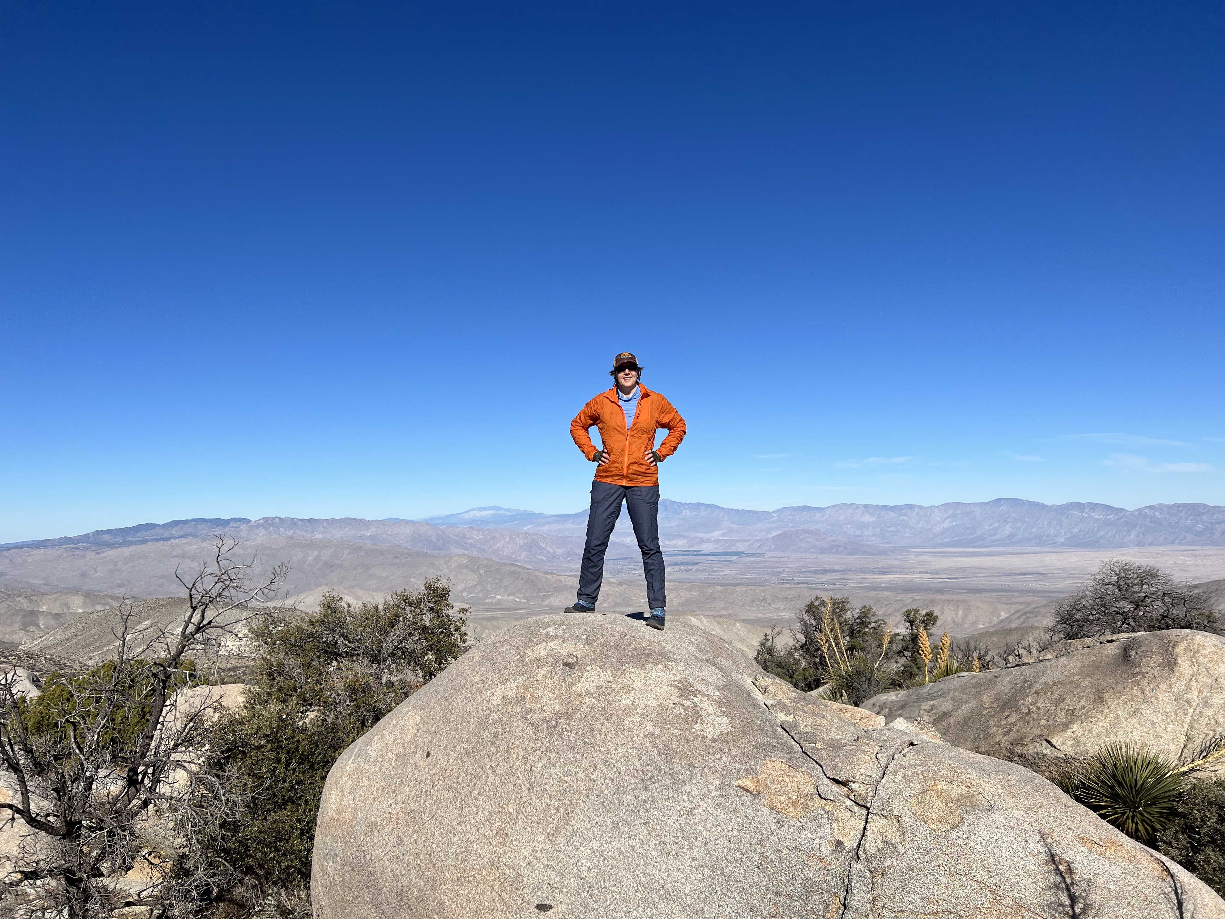
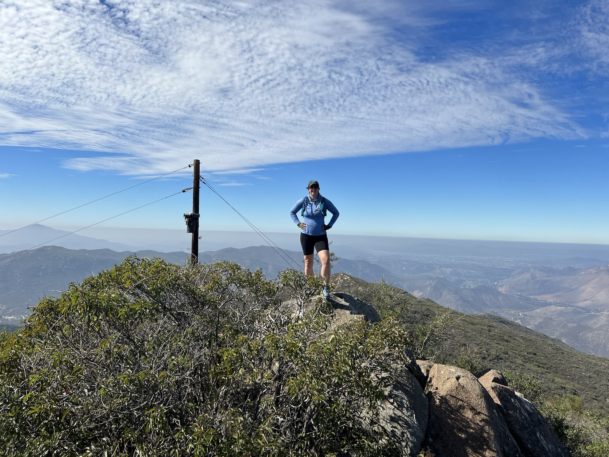
We assembled an intrepid group of five of us who decided to tackle the climb. I did a bit of training, including summiting White Mountain, another fourteener with a much easier hike to its summit; but I was young, and in tip-top shape as an avid triathlete at the time. Fitness would not be the issue. Our plan was the traditional one for this route: day one we’d hike to Upper Boyscout Lake and set up camp. On day two, we’d start early, hike past Iceberg Lake, summit (easy peasy!), and then hike back to our camp. Day three we’d head back down the mountain.

The hike starts out pretty mellow – the first ¾ mile shares the main trail. But as soon as you turn off the main trail, it gets steep. We made slow work across the Ledges (more on that later); and late in the afternoon, when we finally rolled into Lower Boyscout Lake, one of our group was really feeling the altitude. We modified our plan, and decided to camp among the mosquito-infested trees at LBS (setback #1).

Wow, all the snow… that can’t be good.

The next morning, not feeling much better, two of our group decided to turn around. Tad was not feeling great either – he may have been up for it in his SAR days while in his late-20s, but it’s funny how time catches up with you. The two of us remaining were feeling fine, and wanted to push on – but remember that this was 2005. No one had a GPS or means of communication. Tad was our navigator. With rough directions from him, a paper map, and maybe a compass (did we have a compass? I am not sure), we headed up without Tad (setback #2). We started out ok, but eventually got pretty lost somewhere south of UBS (setback #3). Finally we arrived at Iceberg Lake and took a good look at the couloir we were now supposed to ascend. It had been a very high snow year, and in early August, the couloir was still full of snow (setback #4). We started up as best we could until the raindrops started to fall. A sense of self-preservation finally hit us and we turned back.

I don’t remember much of the hike down. I know we spent our second night at LBS when we met back up with Tad, and with such a short descent on day three, we got back to the Portal pretty early. The hubcap-sized pancakes served at the store were amazing.


This hike stayed with me. Years passed: I had children, I stopped doing triathlons, I worked a lot. Shortly after our failed summit attempt – which in hindsight I view as more of a success that we did not manage to kill ourselves, rather than a failure that we did not summit – one of our group hired a guide to get her to the top, and a seed was planted. In 2016, I took the Sierra Club Wilderness Basics Class and started trying to figure out how to get out more, get back to the mountains and backpacking and all that fun stuff. I had a bit of a setback (Project Perky) but finally was able to put a date on the calendar: I’d hire a guide and summit via the MR in 2019.

My best shot of the Ledges is from the 2019 trip.

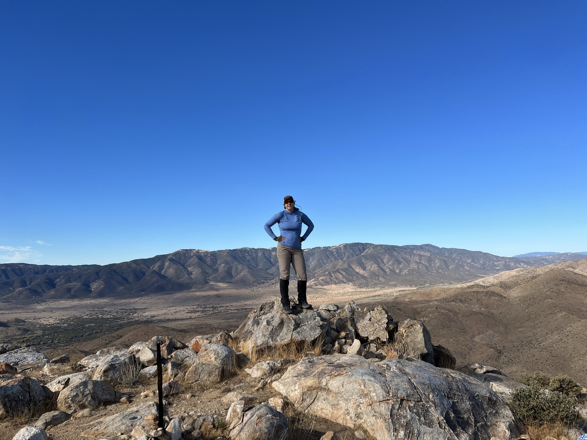
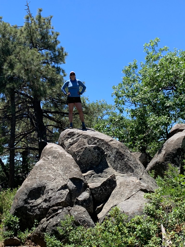
I had some friends who were game, and we spent the summer leading up to our hike getting trained up. It was so much fun tackling some classic peaks in Southern California that I’d never done before: San Bernardino; Mount Baldy; MSJ via Deer Springs. I felt ready, but I was still nervous. I knew first hand how tough this hike would be, and I was starting to suspect that our group of five were at such different levels of experience and hiking paces that even with a guide this might be a tall order.

The story of the 2019 failed attempt is a lot less interesting than our 2005 epic mistake factory. Suffice it to say that we were just not a good mix of skills. We did everything right: plenty of training; all the right gear; hired some great guides; got to Whitney Portal the night before to acclimate. But we were just too slow. We did make it to UBS Lake on day one per the plan, but it took us over eight hours to get there. We got a late start on day two. All five of us (plus two guides) started up the couloir, but after a short time two of our party (plus one guide) turned back. I think we made it maybe halfway up the couloir when Trevor, our guide, said, guys, I don’t think it’s going to happen.


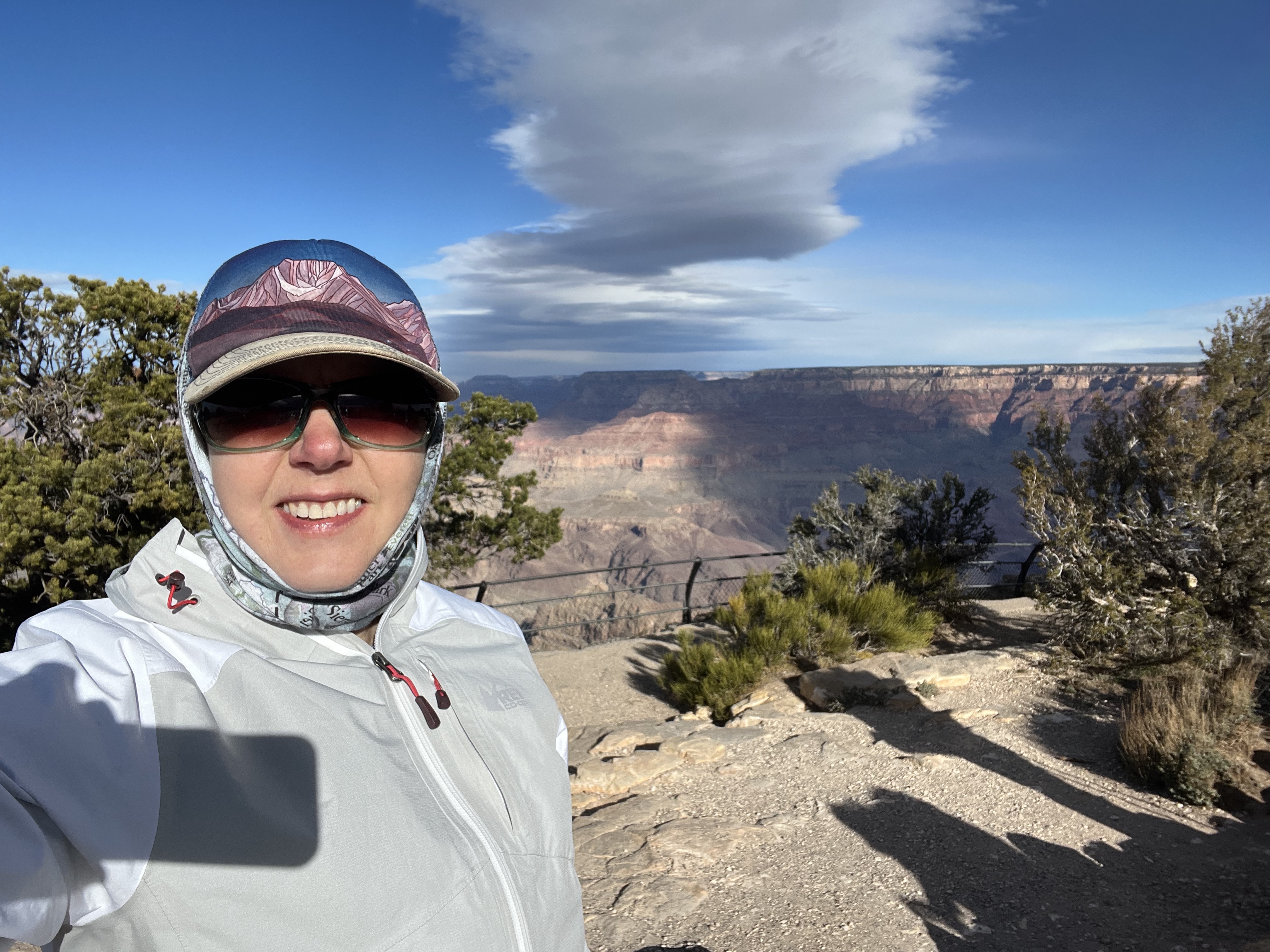
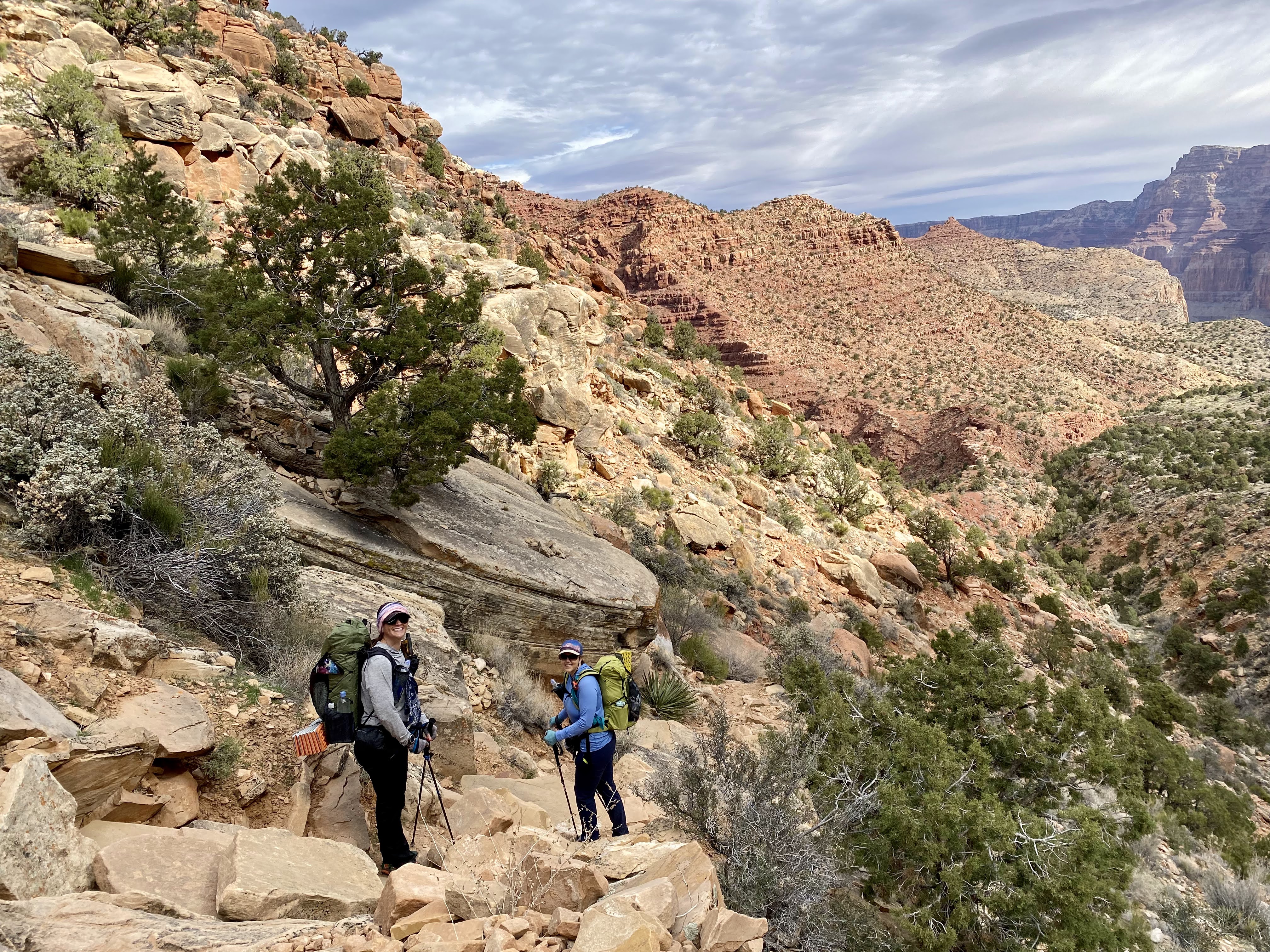
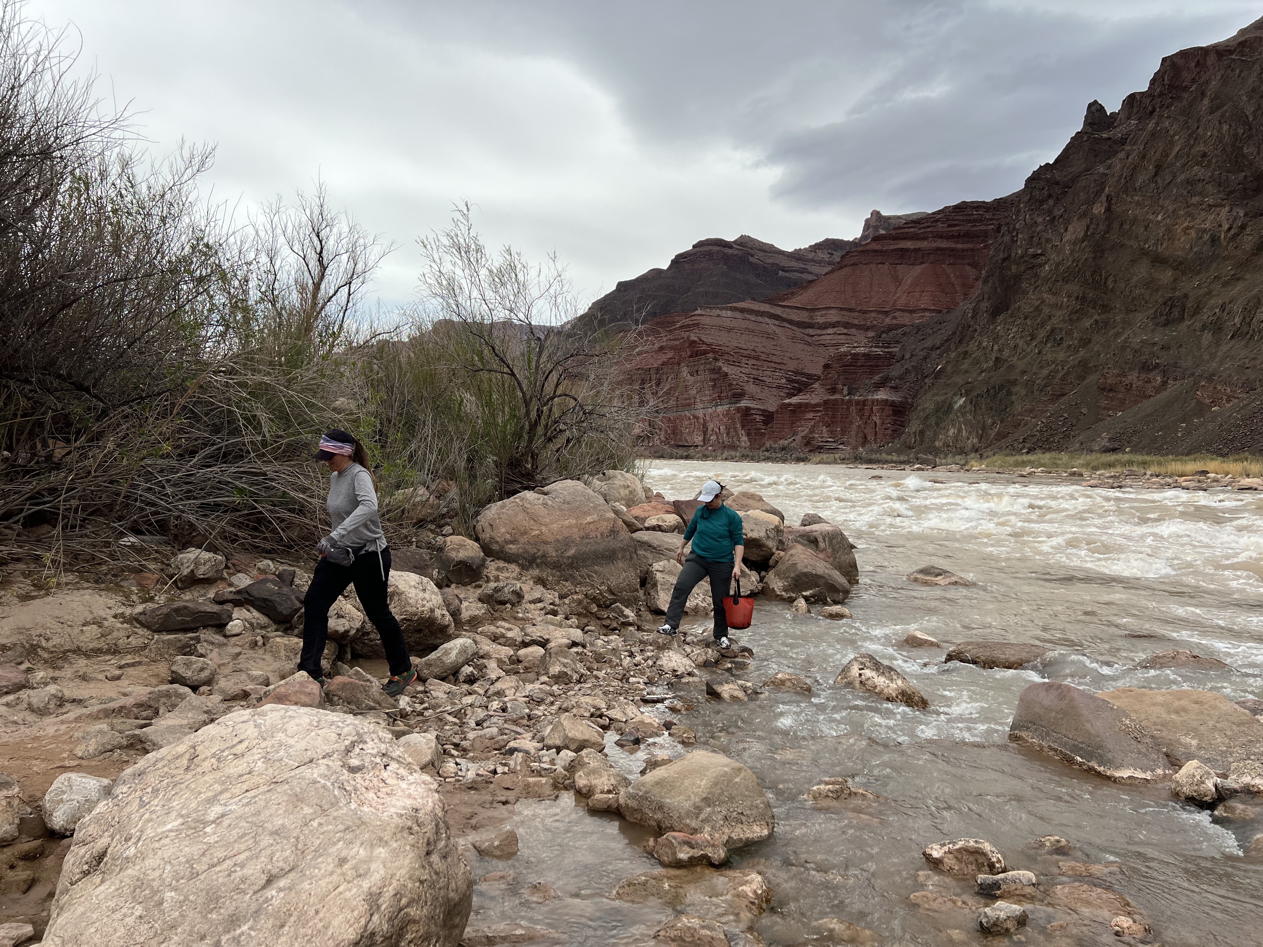
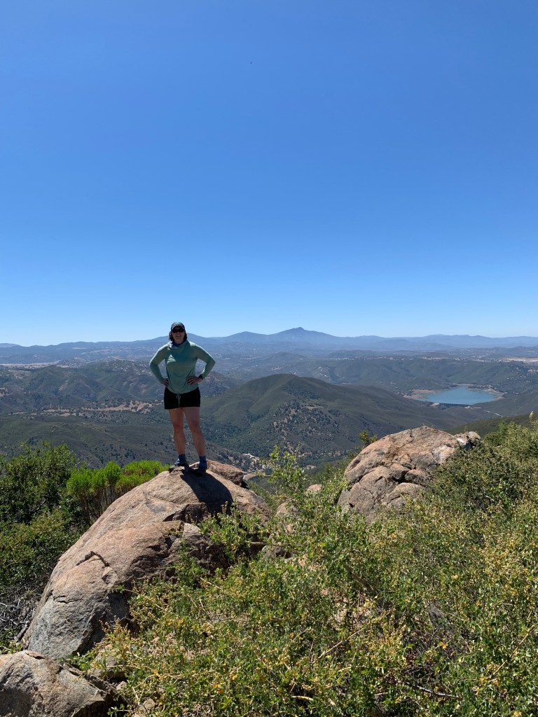
Time for a new plan. In the years since 2019, I have unquestionably hit my goal of becoming an “avid hiker.” I now have a small but mighty group of pals who I call my hiking companions. In 2020 I hiked the John Muir Trail, which included summiting Mount Whitney from the west side. The JMT terminates at the summit of Whitney, joining the main Whitney trail coming up from the Portal about 1000 feet below the summit. We got there in time for sunrise, and it was stunning. In 2021 my hiking buddies and I completed the San Diego 100 Peaks Challenge, which improved my skills significantly in terms of climbing steep terrain on loose scree – maybe not at altitude, but still a translatable skill. I did a few more big hikes in the Sierra Nevada, including Red’s Meadow to Happy Isles, and earlier this year, joining my friends for a couple of days along their JMT route via the Rae Lakes Loop to resupply them. I was ready!

I’d signed up with the same guide service, Sierra Mountaineering International, and was assigned Trevor, the same guide as in 2019! I asked Kali to join me. I realized that for me to summit this difficult climb, I would need to be the slowest hiker on the team. I could not be pulling anyone along; I needed everyone else to be pulling me along. Neither of my two previous failures were due to my own lack of ability – or at least I had not had the opportunity to truly test myself. Kali and I have comparable hiking paces, and she is a stronger climber than I am. On top of that, she is also fifteen years my junior – so that helps.

I’d also planned an extra day of acclimation, and on the Saturday after Labor Day, Kali & I headed up to Horseshoe Meadows, a walk-up campground at 10,000 feet just south of Whitney Portal. The forecast called for rain that night – and it sure did rain – but for it to clear up by Monday. Our plan was to do an easy backpack to Cottonwood Lakes on Saturday, then on Sunday, drive in to Lone Pine for lunch, then make our way up to a reserved campsite at Whitney Portal. On Sunday morning, as we descended back into cell phone coverage, my texts started to arrive… including one from the guide service. Now, they are used to bad weather up here, and as a result, they almost never cancel due to weather – they strongly recommend purchasing trip insurance for this very reason. But the weather forecast on Monday had changed, and was now looking so awful that even Trevor did not want to climb that day. He offered to let us reschedule. We stopped at the Alabama Hills Café for lunch to ponder our options. With resignation and disappointment, we hit the road toward home. What else is this mountain going to throw in my way!!??

But I did not have to wait long. The weather this whole year has been unusual, so I decided to reschedule ASAP before things got worse. My job is fairly flexible, but unfortunately, Kali’s is not. So when an opportunity came to grab a slot two weeks later, I jumped at it – even though it meant going without Kali. It was a hard decision but I really wanted to get this thing done. I was trained, I had the time. I decided to go.

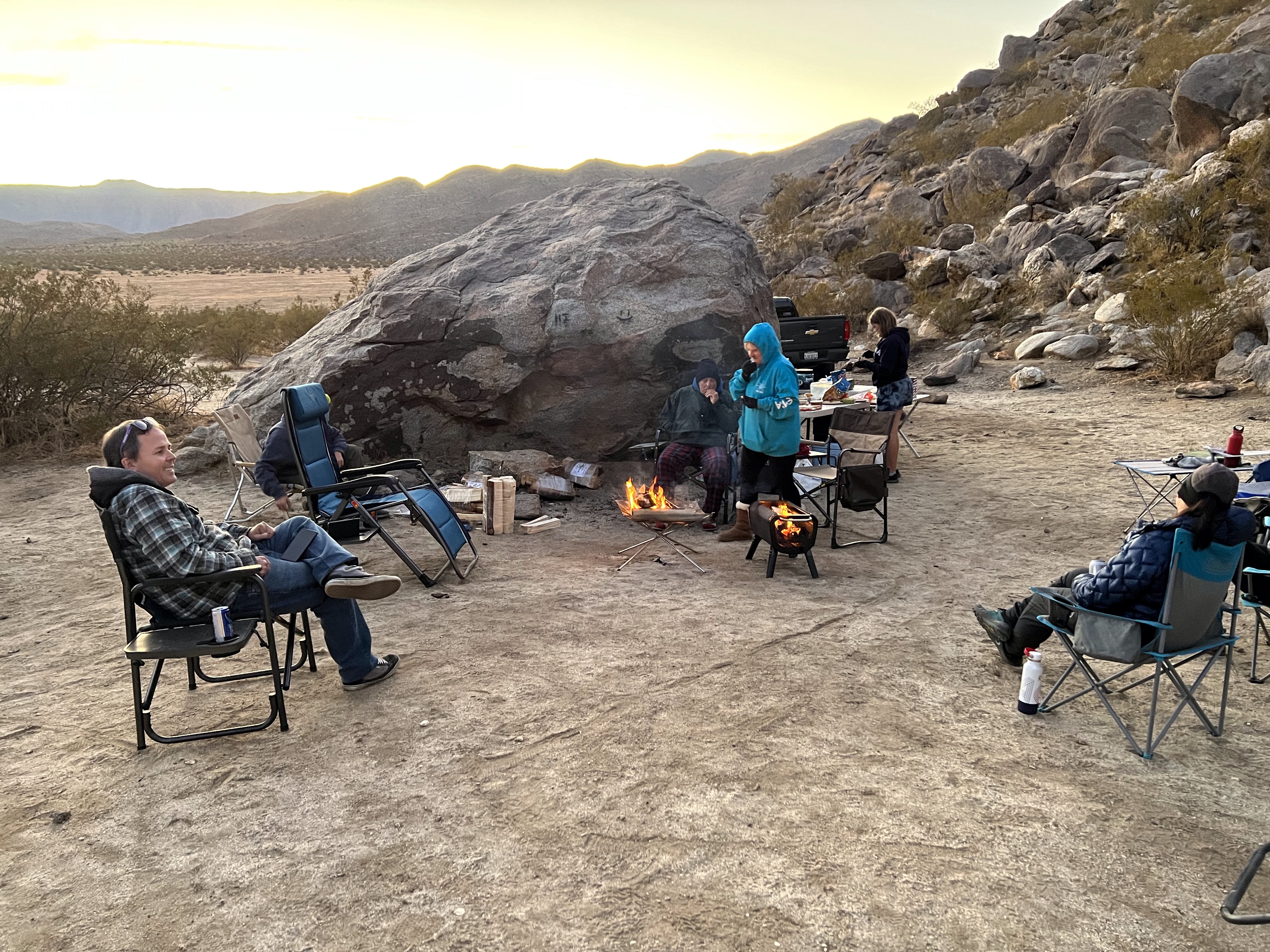
So, early last Saturday morning, I hit the road – again – this time by myself at the wheel of our trusty old minivan. I was giving myself one less day of acclimation, but it would have to do. I arrived in Lone Pine at around 10am and stopped by Big Willi’s to buy a Slog Queen hat, but they were sold out. I lingered in town a little bit – love that place – and got a turkey and avocado wrap to go from the Alabama Hills Café. Arrived at Horseshoe Meadows again around noon. It was surprisingly uncrowded, and the weather was beautiful – such a contrast to two weeks ago. I set up my tent and enjoyed my wrap at the picnic table. In the afternoon I did an easy six mile hike, fashioning a loop up and over Mulkey Pass, southwest for a bit on the PCT, then back down via Trail Pass. The next morning my tent was coated in frost.

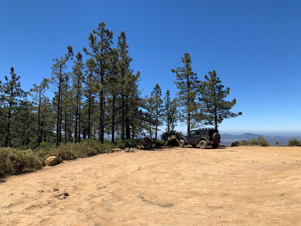
Sunday morning worked like clockwork. I drove to Whitney Portal, parked in the overflow lot, placed a small bag with food and scented items, along with a note indicating when I’d return, into the bear locker. The rest of my few non-hiking items I stashed in a duffel bag tucked away in the back of my otherwise empty minivan and covered it with a towel (bears are smart). Walked up to the store, and chatted with Doug while waiting for Trevor to arrive.

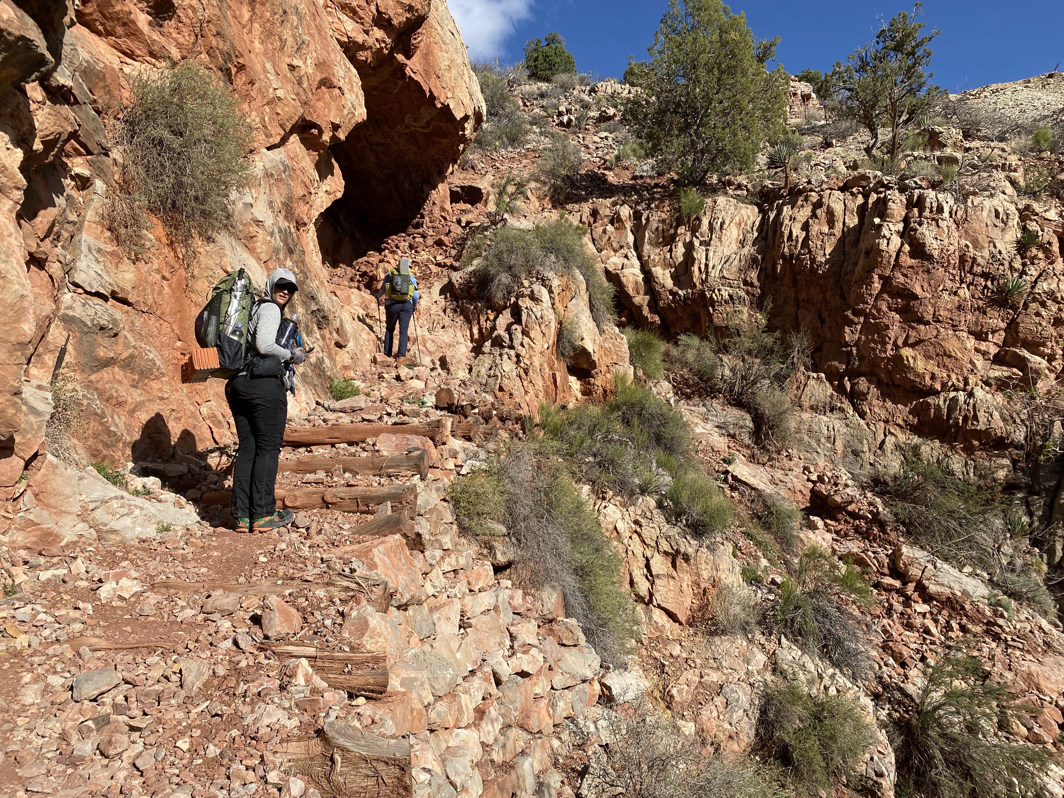
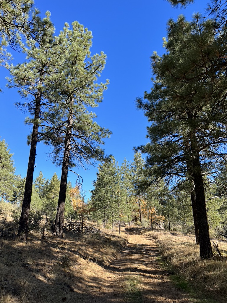
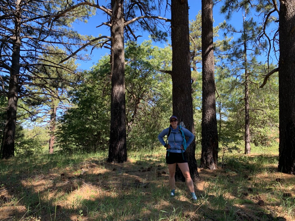
As this was my third time on (most of) this trail, I had it chunked in sections in my head. The first part was the only easy bit along the main trail. We covered this in no time. The turnoff for the MR is unsigned, just before the main trail crosses Lone Pine Creek. The steepness of the climb begins immediately. This section goes through a damp forest and itself crosses Lone Pine Creek twice – it reminds me very slightly of the wooded part of the Mount Baldy Ski Hut trail (just before the saddle), minus all the water and plus a few boulders scrambles.

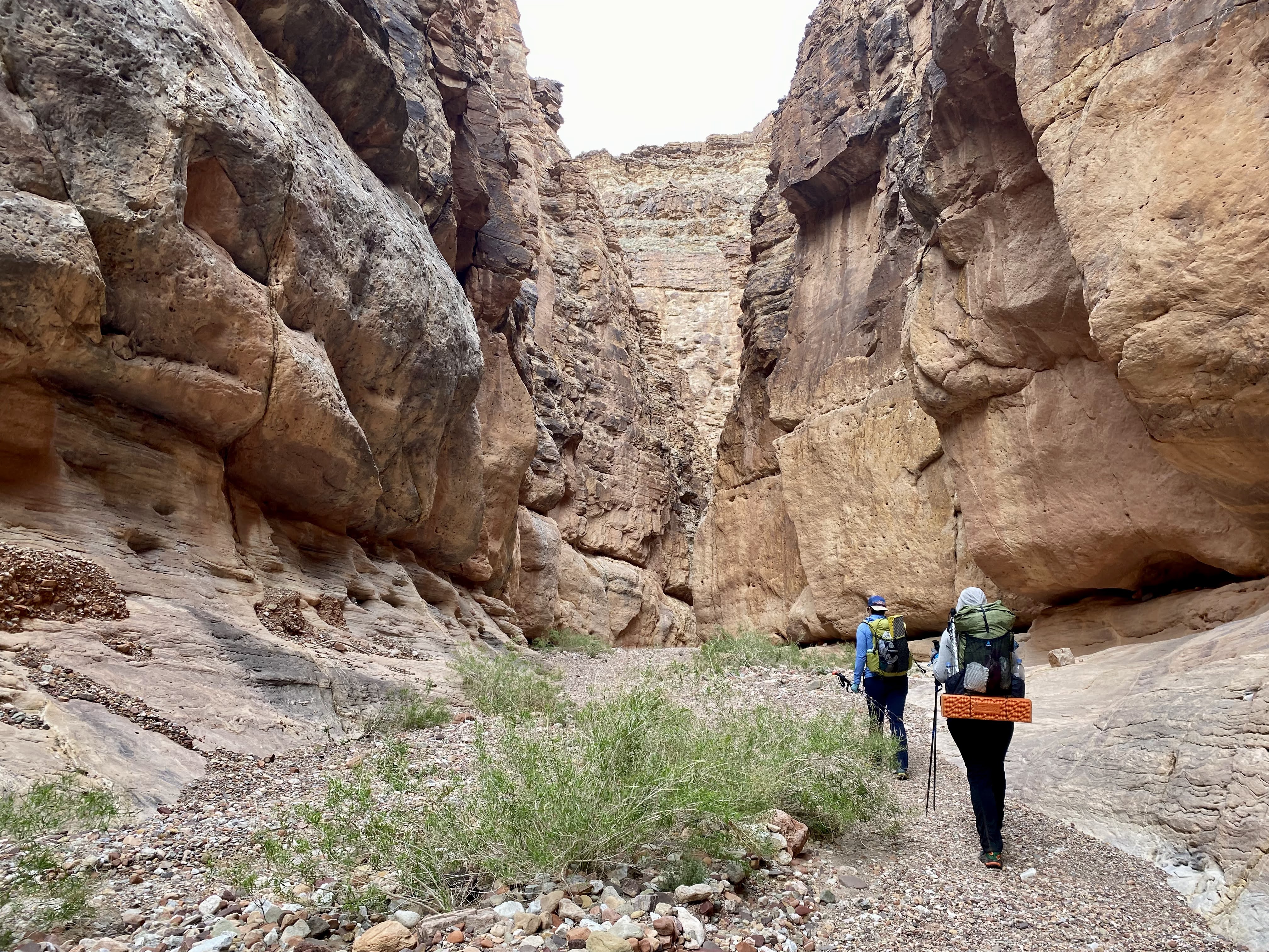
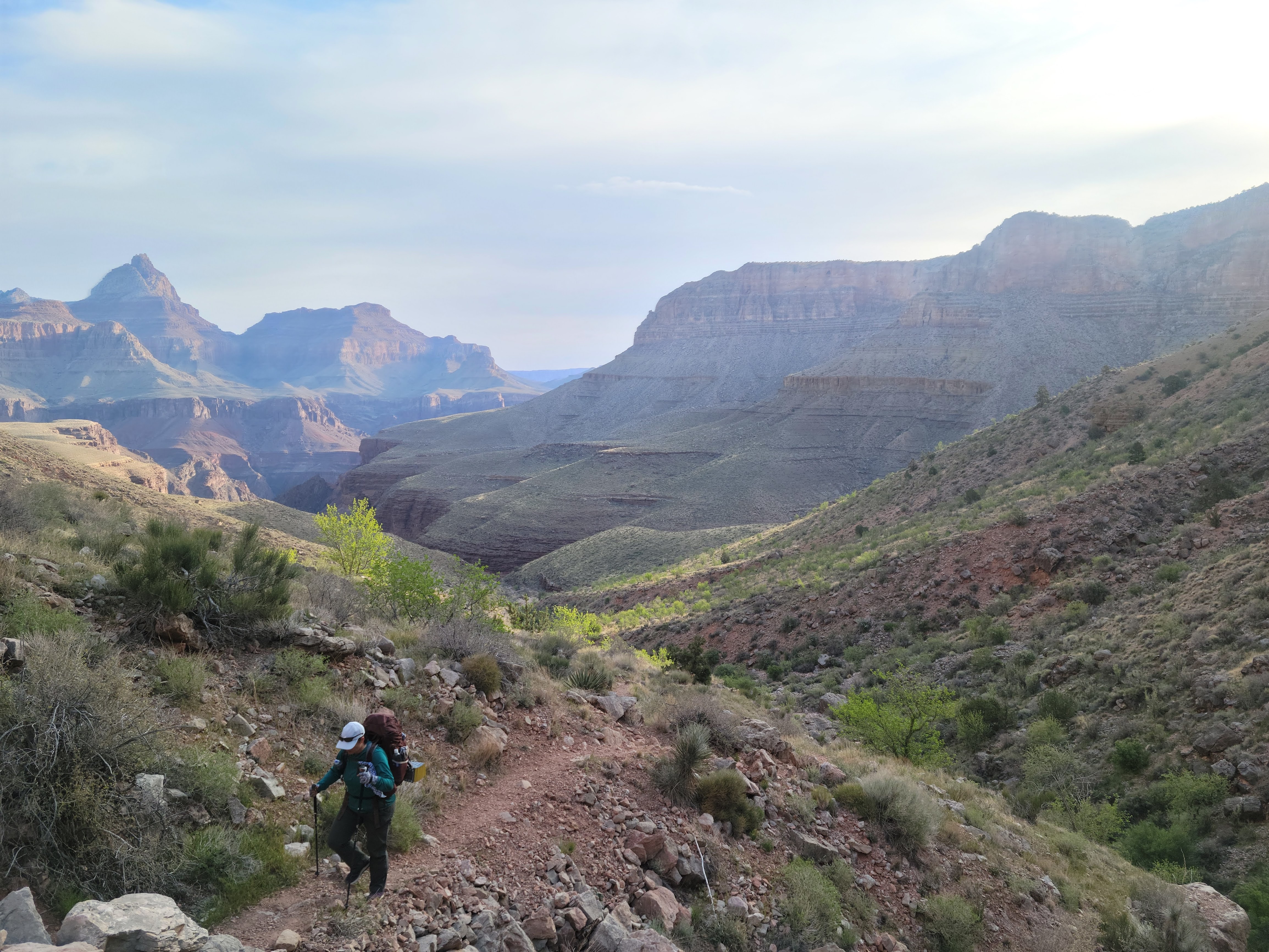
Now you arrive at the first real challenge: the Ebersbacher Ledges, or E-Ledges, or, on trail, just “the Ledges.” The Ledges have no technically challenging bits, just a little bit of bouldering here and there; what makes this section notable is the exposure. The route hugs a sheer cliff wall on one side, and a dropoff on the other. I was glad to put the Ledges behind me, at least until two days from now when we’d have to come back down.

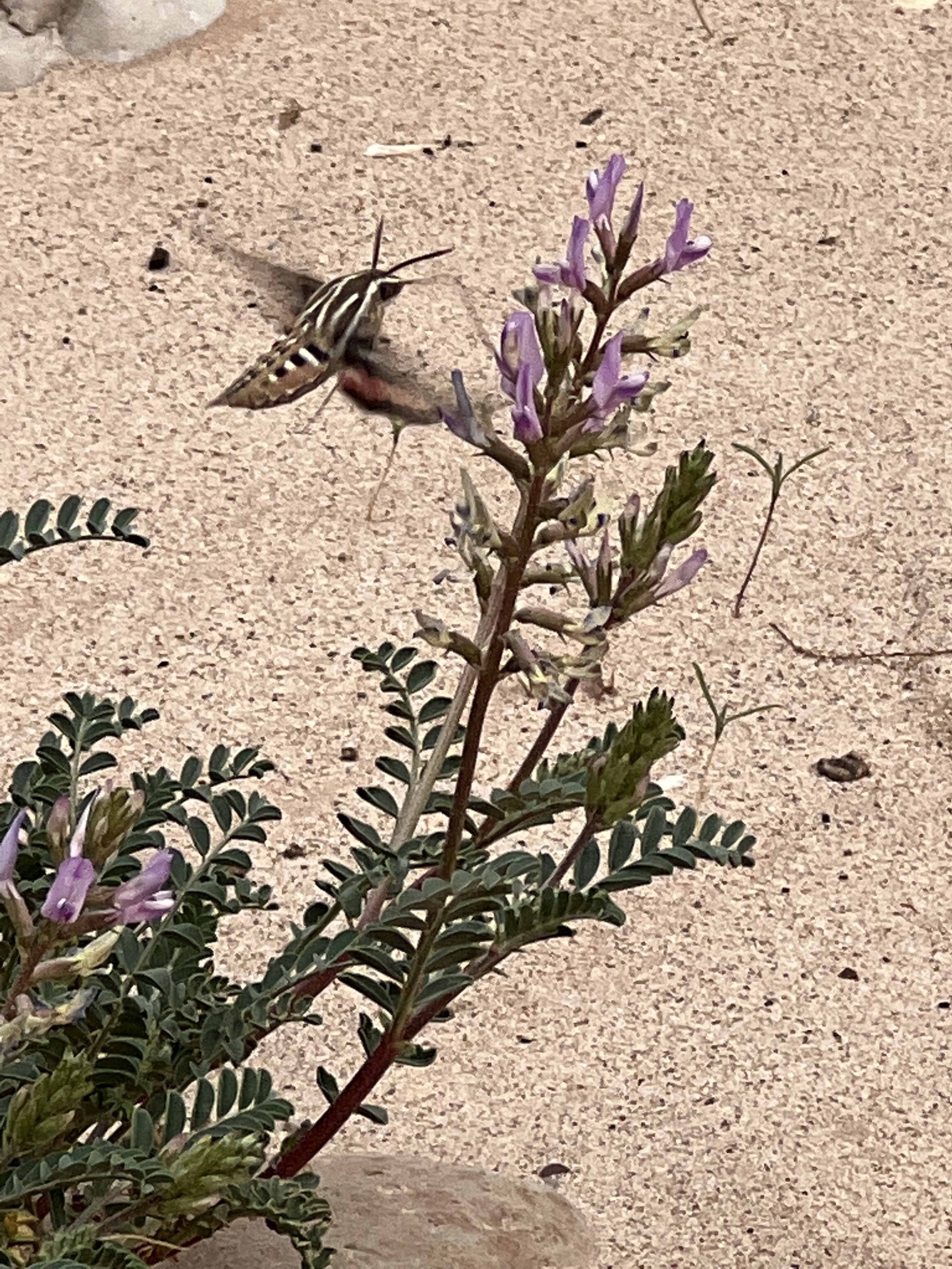
The next section is from the Ledges to LBS Lake, which is straightforward if a bit rocky. All three times I’ve done it now this is the section with the most flowers and the prettiest views – you can look up and see much of what you have yet to hike. At this point Trevor was commenting on what a great pace we were setting – I think he was prepared for something much slower given our 2019 experience. We stopped at the LBS Lake outlet for a snack.

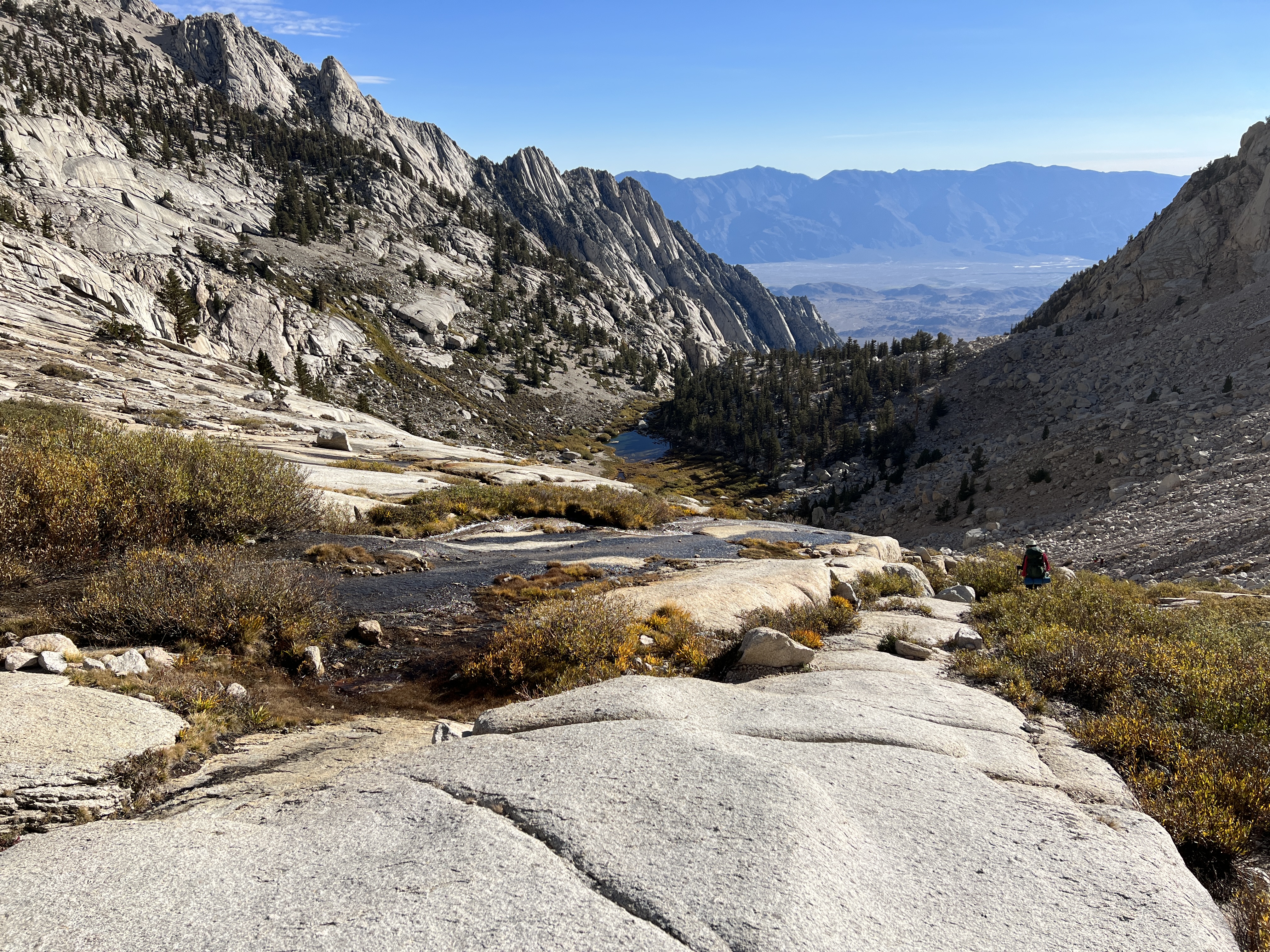
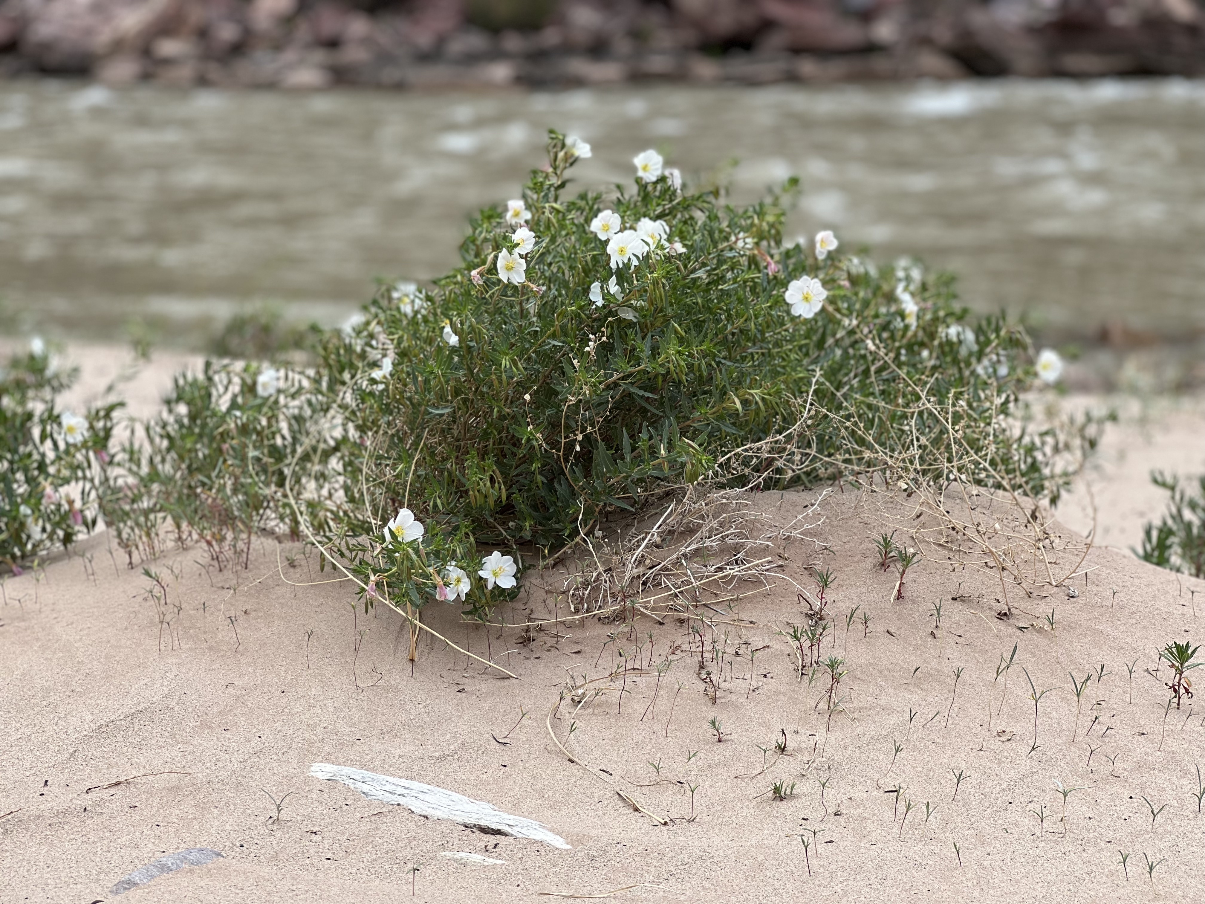
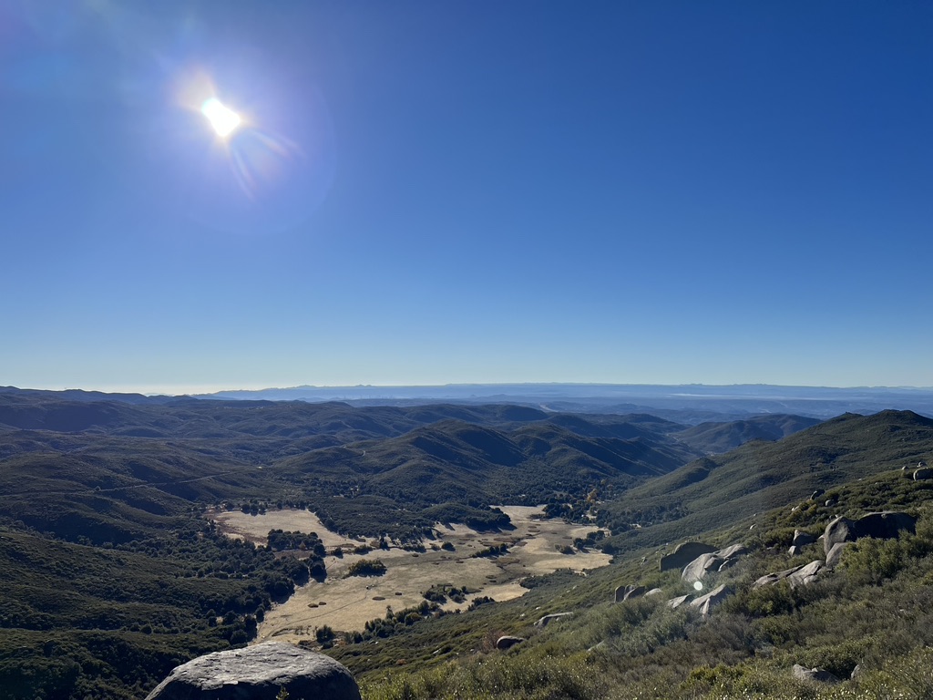
From here there are two more sections before reaching UBS. First there is some pure bouldering as you climb up beyond LBS. The “trail” here offers plenty of choose-your-own-adventure opportunities. Next, the route opens up onto “the Slabs”: sheer expanses of granite with rivulets of Lone Pine Creek flowing down. This is my favorite section of the trail, with nothing separating you from the water but a few feet of stone. It’s a calf-burner on the way up, and a quad-shredder on the way down. Nearly above tree-line at this point, the landscape here at 11,000 feet becomes classic Sierra, with gravel footing, streams everywhere, and scrubby vegetation that I wish I knew the names of.

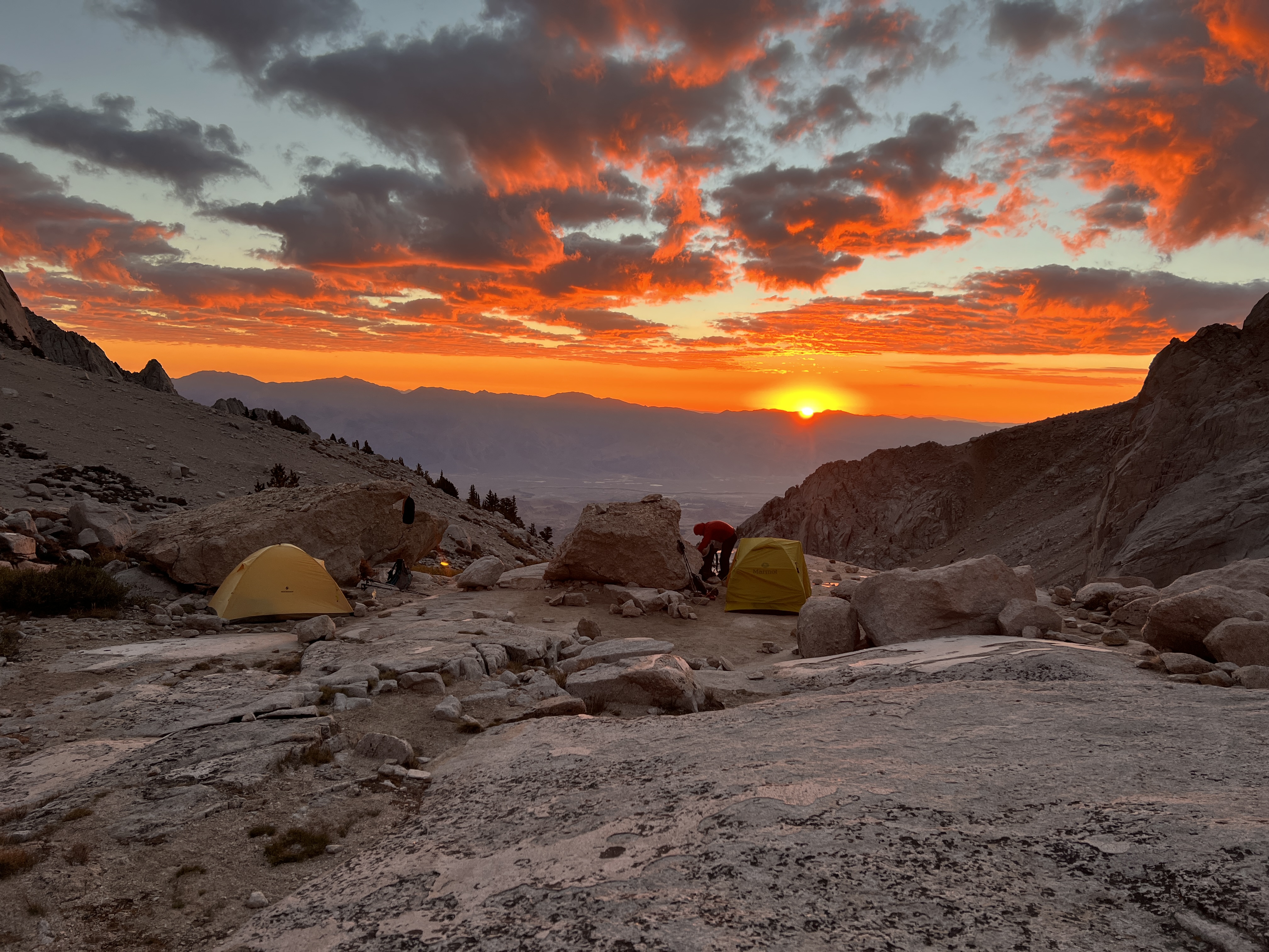
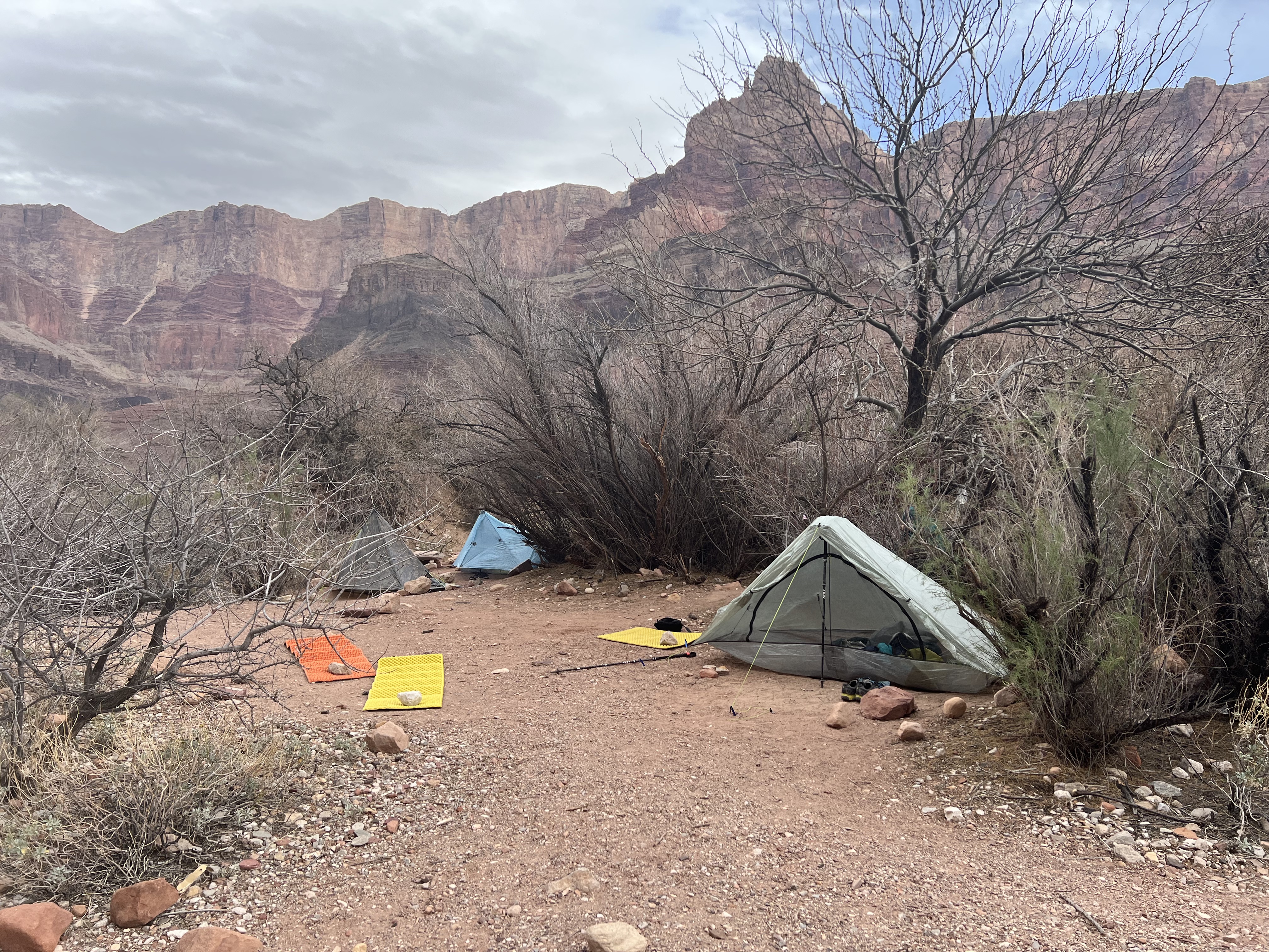
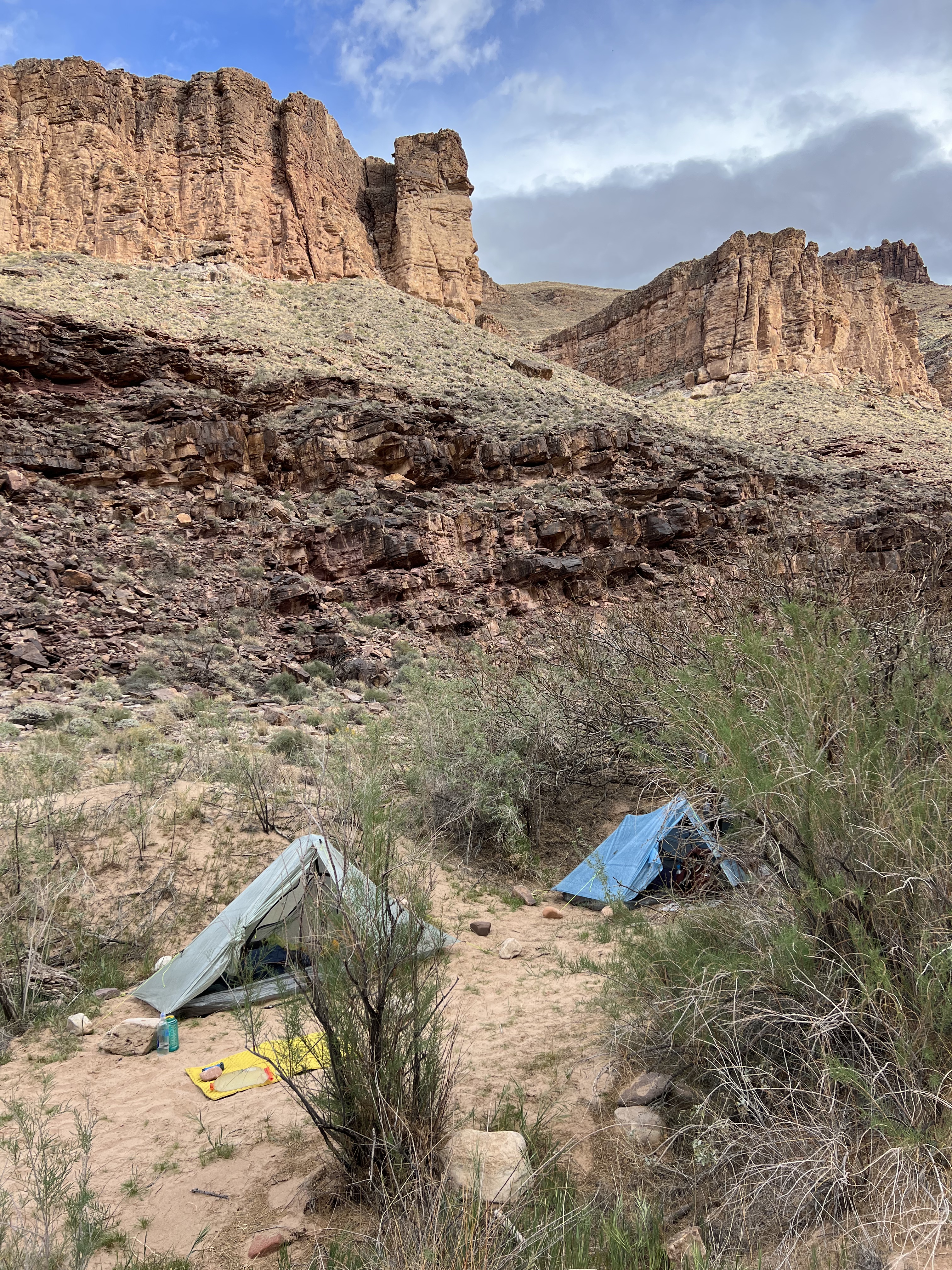
We arrived at UBS Lake at 12:30pm, in exactly four hours – less than half the time it took in 2019! I hate getting to camp early, and this is where having more hiking companions would have been nice (although Trevor was good company). I took a nap, enjoyed the scenery, and searched the stream for fish – plenty of them in the UBS outflow. On this trip I brought my backpacking watercolor kit, which kept me occupied. I could not watch anything on my iPhone – my downloads had failed, of course (my luck) – but that was probably for the best. Our campground had a direct line-of-sight to Lone Pine; if I stood in just the right place I could get four bars of coverage.

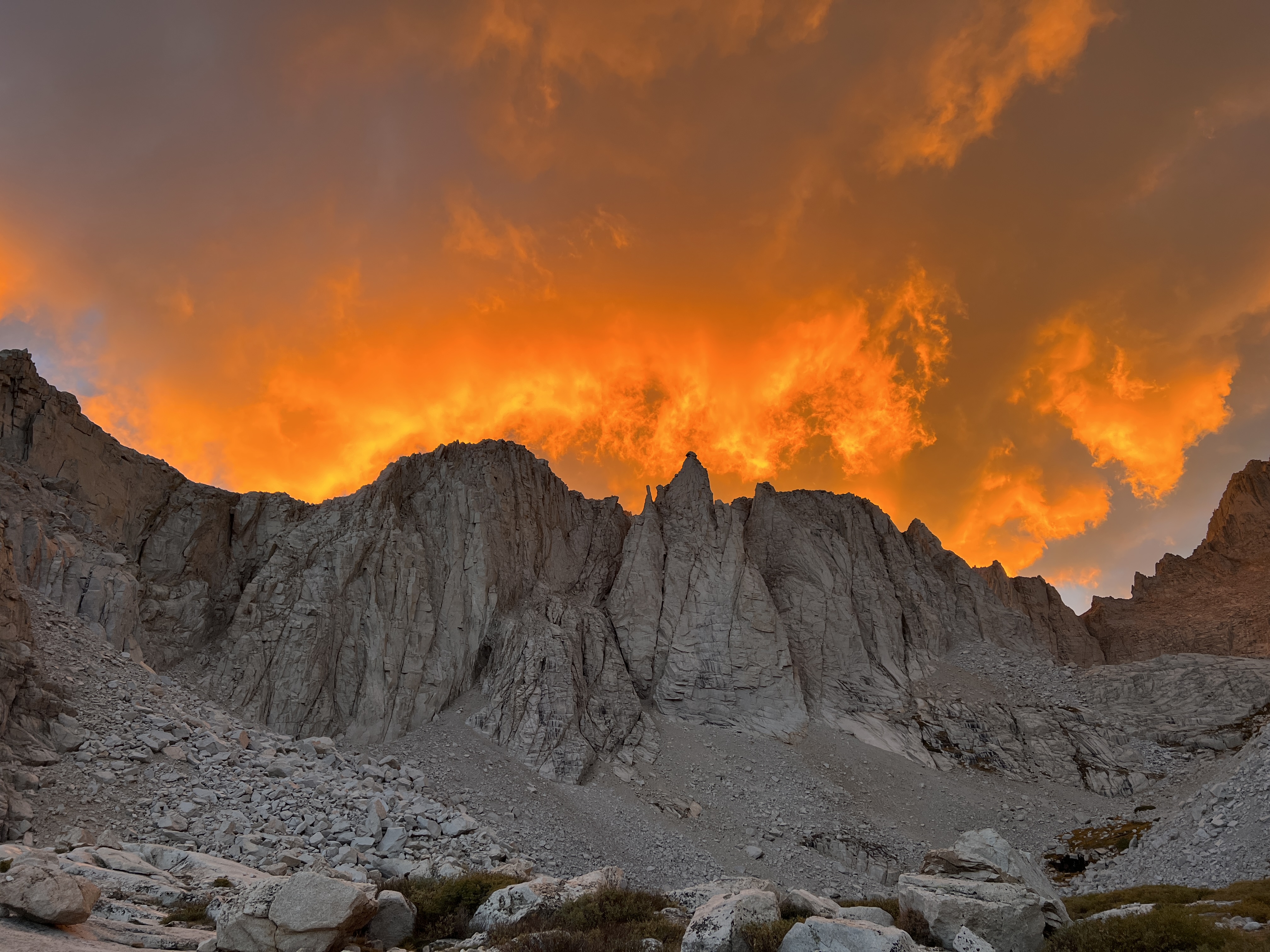
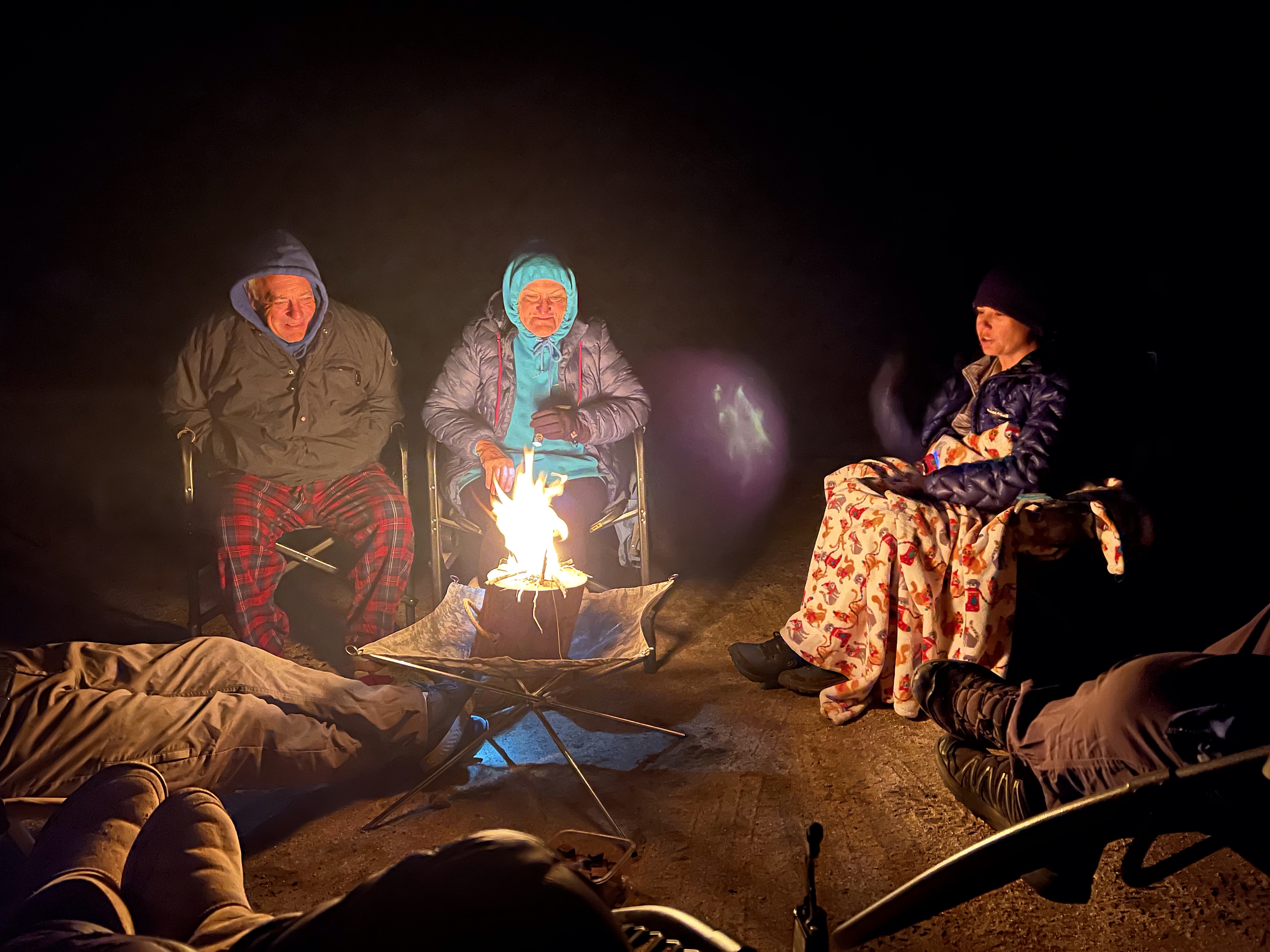
We held out until 6pm when Trevor made a ridiculously good dinner of gnocchi, chicken, and chickpeas in alfredo sauce. No cold soaking this trip! The sky exploded in color as the sun set. I crawled into my tent at 7pm and was fast asleep by 7:30.

Monday morning arrived – today was the big day. There was another group camped nearby and they hit the trail (not very quietly) under headlamps around 5 or 6am. Trevor was confident enough in my speed that he did not feel like we needed an alpine start; we aimed for 7am and actually hit the trail at 6:45. The hike from UBS to Iceberg was another 1000 feet of rocky, alpine ascent; but we covered it with our light daypacks in an hour – getting passed once by some young bucks who were headed up to free solo the East Buttress. Upon arriving at Iceberg, my nerves were peaking – I’d gotten this far twice before!

Setting our trekking poles aside, so began the ascent. The scramble up the couloir is a mix of steep sliding scree steps, with a little bouldering here and there. Sometimes the scree turns to rocky talus – always slippery. As I was “hiking” (if you can call it that), I tried to think of what to compare it to. It was a bit like Indianhead, or the last pitch up to Mile High Peak from Rattlesnake Canyon. On one hand, I didn’t feel like the slope was trying to kill me – no stabby plants! But on the other hand, this just kept going, and getting steeper. Also, eventually we arrived at some patchy snow – sure isn’t any of that on Indianhead! It was old, crusted, and not very slippery; but still disconcerting to have to put both feet on it, no hand-holds, on a steep incline. At one point there was a tricky rock climbing move that made me feel a little exposed, and I did not like that – it was fine, but exposure is an exhausting mental game. My main limitation was neither the footing nor the technicality – it was my ability to breathe. I was fairly acclimated at this point, and I’d been taking Diamox for several days by now. I had done a lot of “zone 2” base training just for this climb, and I could tell that it was paying off. But still – need … to … breathe … !!! Climbing at 14,000 feet elevation is no joke.

We finally topped out at the Notch – the top of the couloir and the base of the Chute. I must say I felt pretty proud of myself to have caught up with our neighbors at this point, despite them starting at least an hour before we did. They were in the process of roping up for the Chute – a woman, two men, and a guide. Trevor and I stopped for a snack break and to give them a head start, and just then, Kurt, the owner of SMI, arrived with his two clients who were climbing MR in one day. They had started at Whitney Portal at o’dark-thirty in the morning and were making great time.

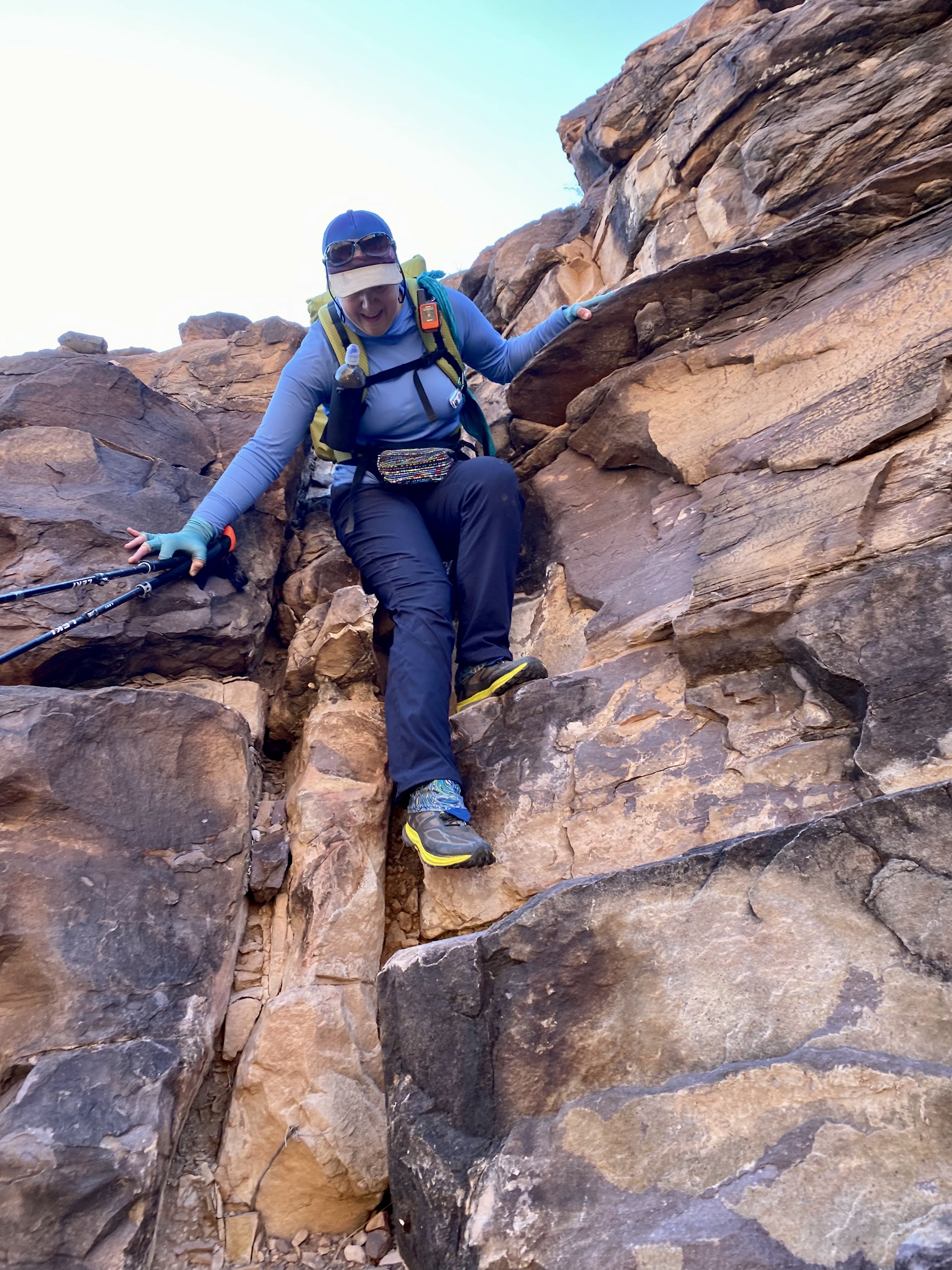
The Chute is the steepest and most technical part of the entire climb, 400 feet below the summit. Trevor showed me that the initial reach to get onto the rock face would be the hardest of the climb, and if I could handle that I’d be fine. We opted not to bother with the rope which would only get in the way and slow us down. Up we went, soon overtaking the party of four. The Chute took us literally only about twenty minutes … and it was SO MUCH FUN!! Yes, there was exposure, but it was all behind me (literally) – I just kept my eyes up and ahead. The actual rock climbing was easy with only a few tricky spots. Then, all of a sudden, we were done!

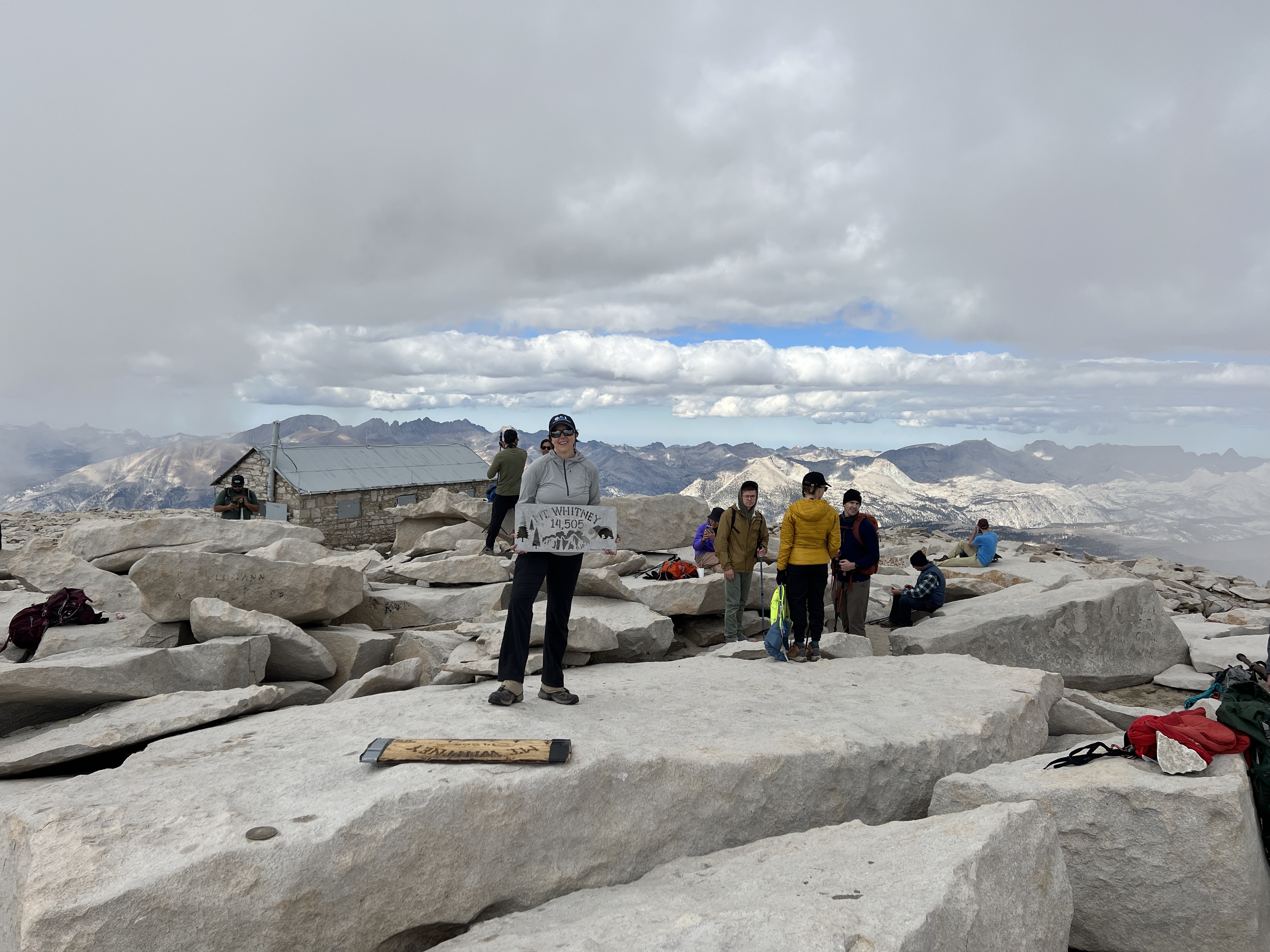
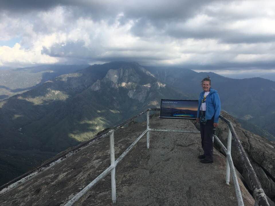
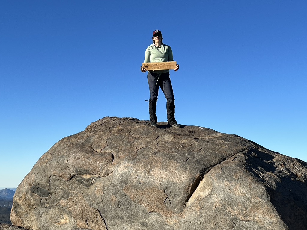
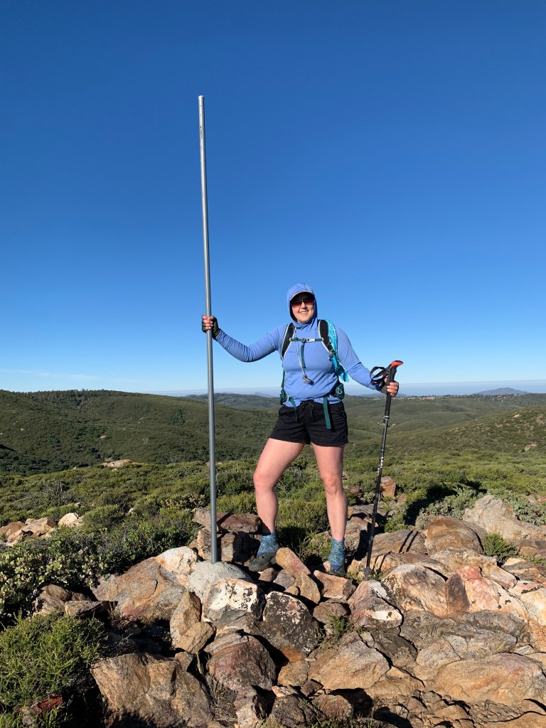
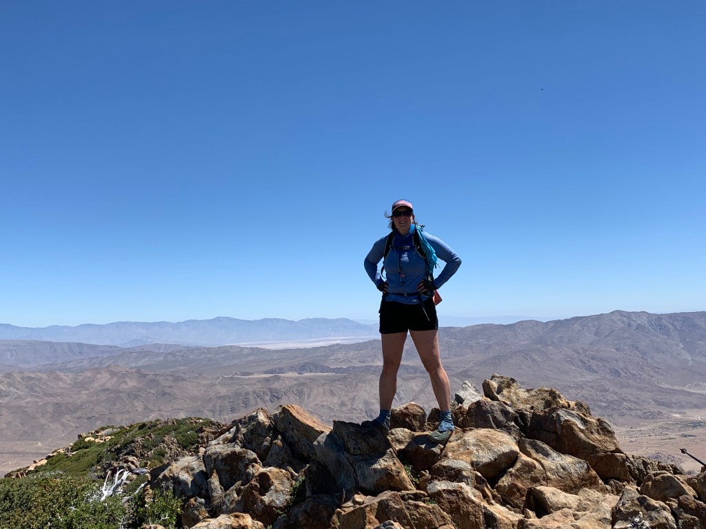
I MADE IT!!! Finally, after seventeen freakin’ years, I had vanquished the Mountaineer’s Route; bucket list checked off; business now finished. The summit itself was almost irrelevant – it was 11am and the crowds had arrived; besides, I’d been there before. This had been all about the journey, not the destination. We lingered a bit, taking photos and exploring the hut*. But as they say: going up is optional; going down is mandatory. It was time to start the slog down. Seems easy, but honestly going downhill on that scree shit can be so much worse than going up!

Trevor took me westward off the summit to “the traverse” because I’d been whining about downclimbing the Chute – climbing up on rocks is fun; climbing down is scary. Of course the traverse was just a longer segment of scree, so I’m not sure if it was really any better. We took a little break at the Notch and then the real work of going down the couloir began. It was fine, just tedious. I tended to slide on my butt a lot more than Trevor did (in fact I did not see him do that even once) which means I was scraping a lot of the rocks off with me – no points for style. 

Finally at Iceberg Lake I felt like I could mentally relax. The hardest of the hard work was done. Descending down the rest of the steep trail would be hard, but only physically. The adrenaline could finally start to dissipate. We stopped for lunch and to hydrate, and then kept moving. We were back at camp by 2:45pm – an eight hour day, exactly.

I guess my story mostly ends here. We lazed away the afternoon, watching the clouds roll in, sometimes raining on us. We snacked and had hot drinks. Trevor spoiled me again with a rich dinner of chicken, tortellini, and pesto sauce. I ate so much I had no room for dessert. Took a lot longer to fall asleep – lingering adrenaline is more powerful than an after-dinner espresso. My air mattress had sprung a slow leak and I had to refill it about every hour – so that was fun. And it was warm! I would have preferred my lighter sleeping bag for sure.

The next day we had a lazy morning and got going around 8:30am. Our neighbors had started about 45 minutes prior, and we easily caught up with them at LBS. For the first time we chatted – turns out it was a 57-year-old badass mom and her two grown sons! Put me in my place about feeling all smug when we’d passed them – good for her! The Ledges presented one final mental challenge. From there we took no more breaks. At the main trail we turned right instead of left – Trevor led me down the “Old Whitney Trail,” dizzy with switchbacks down to the backside of the Portal. An early lunch of a delicious cheeseburger and beer was inhaled. I took my time – I’d hit traffic going home no matter what, so might as well linger. The thing is done.


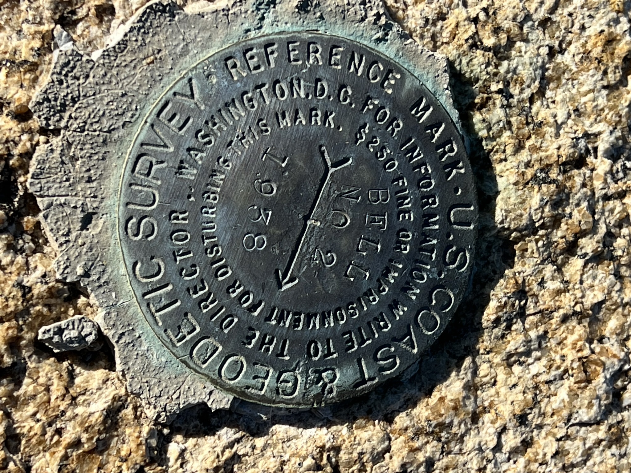
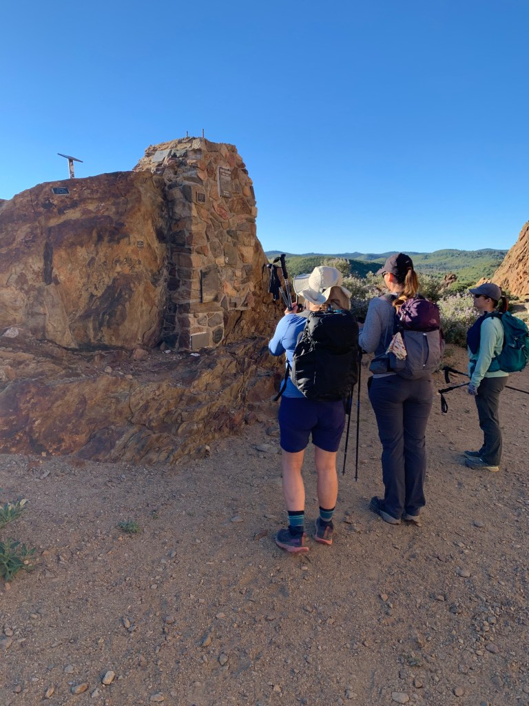
*I said I would answer all of Deirdre’s questions, so, about the hut. No, you cannot legally sleep in it, although I have heard of people who have done so. It is divided in half and one half is locked up. The other half is open and full of Sharpie graffiti. Apparently it is VERY VERY BAD to be there during a lightning storm. More about it here: https://en.wikipedia.org/wiki/Smithsonian_Institution_Shelter. Also, no I did not carry that metal sign. There is currently a (broken) wooden one there too. These signs are made and carried up by other hikers. Many in the hiking community think they are trash and not “LNT.” The NPS apparently will remove them on occasion.


And a coda: While I inhaled my cheeseburger at the Whitney Portal Store, doing my best not to swallow any bees, I got to meet Crazy Jack Northam. Jack, a 75-year-old San Diegan, has climbed Mount Whitney 205 times as of our meeting. He told us with great fanboy excitement the story of the time he was helping another hiker who turned out to have been on three seasons of Survivor.


Posted in Mountains Are Calling | Tagged | 7 Comments

Grand Canyon Escalante Route

March 28 to 31, 2022

This trip, my third to the bottom of the Grand Canyon (second time this year!), was absolutely epic! In fact I would say it was one of my most favorite backpacking trips ever. Fifteen days on the John Muir Trail in 2020 was more significant, for sure; the Sierras are always stunning; and Yosemite is still my “favorite place on earth.” But this trip ranks way up there, simply for bang for the buck – what we crammed in to four days and three nights was amazing!

This trip came about because Kali was able to snag a permit for herself, Tara, and me. Initially we considered doing a rim-to-rim-to-rim hike – which remains near the top of my bucket list – but we realized it was too early in the season and the North Rim Campground would not yet be open. When Kali took the Sierra Club Wilderness Basics Class in 2019, she took a trip with a leader, John P., who first told her about the Escalante Route, and it had been on her radar since then. The route is a “route” because, while there is a trail that is not that hard to follow, it is nothing like the clear and well-marked “corridor” trails in the heart of the Grand Canyon. There are many areas where route-finding and navigation are needed, with lots of rock scrambling and washed-out sections.

And then there is the crux of the route: the Papago Wall and Slide. At the mouth of the dry Papago Creek, the hiker reaches a cliff wall that must be climbed! A bit further west along the route, what goes up must go down, and the hiker now needs to slowly pick her way down a narrow, steep wash back down to the beach. Sounds like fun, yes!?

Day 0: Drive from San Diego to Williams, AZ

Our adventure started with the long drive from San Diego. We decided to stay in Williams – cheaper than staying in the park itself or just outside of it, and our first day’s hike was not super long. We arrived in the early evening and got pizza in town for dinner. Our hotel was the Comfort Inn and I was pleasantly surprised at how nice it was.

Day 1: Tanner Trail from Lippan Point to Tanner Beach
Gaia Track | 7.8 miles | 248 ft ascent | 4,968 ft descent | 5:06 total time

We got up early on our first day and enjoyed the Comfort Inn’s pretty darn good hotel breakfast, then hit the road for the 1.5 hour drive to the park. One of the logistical challenges we needed to work out was how to get to the trailhead, since this is a point-to-point hike and we had only one car. Our initial plan was to take a taxi, as the GC website states this as an option; however the official park cab service is not traveling east of South Kaibab these days. Fortunately there is a Facebook page specifically to help coordinate rides within the park, and we were able to find several options. We lined up a ride with a guy named Matt, a Grand Canyon firefighter, who picked us up right on time at 8am at Grandview Point, our exit point. He was chatty on the 20-minute drive to Lippan Point, telling us all about the many rescues he’s been involved in at the park. Apparently rescues are extremely frequent! Scary!

With the recent warm temperatures we opted not to bring microspikes with us. This turned out to be the right call, at least for the descent – there were a few icy spots within the top 1/4 mile or so, but all of them were rotten, with ground-in dirt providing traction. But even without that hazard, this trail was no joke – as is typical for a south rim descent, the top portion was steeeeeep! And as a non-corridor trail, there were plenty of rocks to hop over. We encountered few people on our way down, including a family of five who had NO WATER near the top; and a pair of European backpackers who gave us a bit of trail beta on water options (nothing we didn’t know already but good to have it confirmed). We stopped for lunch at an amazing viewpoint from which we could see up and downstream along the mighty Colorado River.

We arrived at Tanner Beach at 1:30pm, super early. We explored the beach area, including the pit toilet hiding in the reeds on the east end of the beach. We introduced ourselves to the only other people there – two guys who we would later learn are hiking the Hayduke Trail (envy!). The only problem was that it was super windy, which was nice during the hike to keep us cool, but not so great while camping. We did our best to pitch our trekking-pole tents such that the narrow ends were facing into the wind.

Our first camp chore was to figure out how to filter the silty Colorado River water. We had done a decent amount of online research and had learned that if the water is not allowed to settle, the silt will clog most filters, and the cloudy water will render chemical purification techniques less effective. Not wanting to take the risk with potentially runoff-filled river water, we’d all brought 2.8-oz packable buckets, and a few extra toys to experiment with, including aluminum sulfate, aka “alum,” which is a flocculant. First we filled the bucket with water from the rapids. We mixed about a half teaspoon of the alum with maybe 1/10 liter of clean water that we’d hiked in with, shaking it vigorously to get it to dissolve. Next we poured this mixture into the bucket, stirring the bucket rapidly for a minute or so. After that we let it sit while we performed other camp chores. It seemed to work fairly quickly – within a half hour or so, the water was relatively clear, and the alum powder could be seen at the bottom of the bucket. (To me this means it did not actually dissolve, so pre-mixing it with clean water seems unnecessary; but I did not experiment with putting the powder directly into the bucket.) Everyone seemed to perform the next step differently: what worked for me was having a friend hold open my dirty water bag (I use a C’noc Vecto bag) while I carefully poured the water from the bucket into the bag, which holds 2 liters. I am currently using a Platypus QuickDraw, which is a squeeze filter, and I’m liking it pretty well – it seems faster than my old Sawyer Squeeze. Our last step was to use a chemical purifier, which may have been belt + suspenders, but the GC website recommended doing both a physical and a chemical purification, so why not. I chose to use MSR Aquatabs which I placed directly into the clean water container (I brought a wide-mouth Nalgene bottle for this trip) which took about 40 minutes to do its work. This whole process took about an hour and a half for me, but my water needs are fairly low, and I had not run out of fresh water on the hike down, so it was fine.

As an experiment, after I was done with my primary water needs, I refilled my bucket and let it sit overnight without adding alum. By the next morning it was still fairly cloudy; and within 20 minutes of stirring in the alum it was clear. So my conclusion is that using the alum is worth it!

We are always in our tents early when backpacking, and today more so than usual because of the wind. We hit the sack at 6pm, and I think I was asleep by 8pm!

Day 2: Tanner Rapids to Seventy-Five Mile Rapids
Gaia Track | 9.8 miles | 1,628 ft ascent | 1,554 ft descent | 6:18 total time

We started our first full day within the canyon without rushing, hitting the trail around 8am, after breakfast and some more water filtering. I decided to go ultralight this trip, and, as usual, left my stove and fuel at home. I am an annoyingly un-picky eater and don’t really mind “cold-soaked” food (which is a misnomer: food rehydrating in a jar on the outside of my pack all day will actually be pretty warm). My other sacrifice to the ultralight gods was to bring my 15-oz, 30-degree quilt in lieu of my 29-oz, 0-degree bag. Ideally, something in between would have been great; but in the end I was really glad that I had the 30-degree quilt because otherwise I would have been too warm. Finally, I also had my new favorite pack with me, my MLD Prophet, which clocks in at less than 20 oz. My base weight was between 12-13 lbs, and with an estimated 6lbs of food and 1.7 liters of water (<4lbs) my starting pack weight was about 22-23 lbs. Not bad!

On the other hand, given the weather forecast, I decided to bring my heavier Gore-Tex rain jacket. Today it did indeed rain, but never heavily – I would have been fine in my lighter rain jacket; but better safe than sorry. My other “luxury” item was my cut-down Z-lite closed-cell foam pad. I don’t use it to sleep on, and it’s definitely not a necessity; but every time I backpack without it I regret it.

Today would be our second-easiest day, but it was definitely not easy. The trail made its way along the river westward for a while, until it turned inland (south) and wound around cliff sides and steep slopes. The rain made the boulders more slippery, but the loose dirt grippier – a bit of a trade-off. Early in the day we encountered a rattlesnake, tightly coiled up and completely ignoring us. As we made our way across the hills, we saw a large group ahead of us and figured we’d catch up with them soon. And so we did – after we came up out of the dry Escalante Creek, we encountered them resting. And guess what!? It turned out to be a Sierra Club trip – led by the very John P. who introduced Kali to this route! We stopped to chat with them for a moment, getting some info about the upcoming campsite options.

We decided to proceed past our original planned stop and experience the Seventy-Five Mile Canyon before camping – and we were glad we did! This was certainly the prettiest part of the trip. The trail followed the cliff above the river, then turned in above the 75mi canyon to skirt around the top of it, until it finally descended into the slot canyon itself. We were now enclosed by smooth walls that led us back down to the river – incredible!

At the Seventy-Five Mile beach/rapids, we explored for a bit until we found one of the best campsites of my life – sandy beach, beautiful dune flowers, nearby river, incredible views, perfect weather…! What more could I ask for!? We picked our sites, set up our tents, and began our arduous water purification process. We took walks along the beach, and did our yoga stretches. We watched as a rafting group paddled through – with one kayaker, who capsized! We walked a bit further down the beach and made friends with another rafting group, who shared their cold beverages with us and explained their gear and process with us. We all agreed that we must do a Grand Canyon rafting trip someday!

Back at camp we made dinner, did a little more puttering, and went to bed – we held out until 7pm tonight, yay us! I mentioned earlier that my food weight for four days was about six pounds… well, I was doing ok with my meals, but I definitely was going to be coming out of the canyon with an empty food bag – I certainly would not have minded the weight of a few more calories. So, much to my surprise and pleasure, one of the rafters wandered over in the dark to our little camp to tell us that they were done eating and were about to toss their leftovers, and did we want any? Kali & Tara demurred but I was like, “Um… sure!!!” So I crawled out of my tent in my fleece pajamas and eyeglasses, grabbed a headlamp, and went out to eat some vegan chili and make some friends! Second dinner, yeah! The rafters were all super friendly and it was fun chatting with them. They were mostly from the NorCal area, and it was a private (non-guided) rafting trip. They explained that the way to get a rafting permit was to always have some newbies in the group – folks who have never had a permit before get higher priority. Good to know! With a fuller belly, I made my way in the dark back to my comfy tent.

Day 3: Seventy-Five Mile Rapids to Hance Creek via the Papago Wall & Slide
Gaia Track | 8.8 miles 1,748 ft ascent | 666 ft descent | 7:16 total time

Our third day on trail would be our toughest: today we’d tackle the Papago wall & slide; and also the route would turn in away from the river so there’d be a bit of climbing. It was also going to be a lot warmer today. We hit the trail fairly early, around 7am. The route began by ascending the cliff above our campsite which was kind of cool to look down on. This whole section, for the first several miles before & after the Papago features, was very much a “route,” and we were keeping our eyes peeled for cairns and “choose your own adventure” scrambles across gorges and cliff-sides. In short order we arrived at Papago beach (which would have made a nice campsite) and gazed up at our obstacle. Kali headed up first as our strongest climber; Tara followed; and I brought up the rear. All three of us are decent climbers and were not really worried, but we don’t typically climb with packs. I had brought a spool of strong but thin rope, and a couple of weight-bearing carabiners – not expecting to need them to climb with (although we could have if needed – I’d practiced and taken screen shots of how to tie a Munter hitch), but more likely, to haul up our packs. Fortunately it was unnecessary. The wall itself was indeed a wall – straight up – but it did not have a feeling of exposure, and we made pretty quick work of it. It was actually a lot of fun!

Right after the wall, though, the route – still a route, not really a trail – became confusing with cairns heading in conflicting directions. We became stuck until we figured out that we needed to get on top of the ridge that was to our left. We ended up backtracking – we’d gone too far to the right. The way was clear once we figured that out.

Our next obstacle was the Papago Slide – what goes up must go down! This was a lot less “fun,” but also completely doable; pretty much nothing compared to some of the steep peaks we’d done last year (Indianhead and False Sombrero come to mind…) – not to mention, no pokey plants that were trying to kill us! A walk in the park!

It had been slow going though – the first three miles of the day took us about as many hours. At the bottom of the slide was a lovely beach and camping area where we took a well-deserved rest, dunking our hats in the river to cool down, and saying goodbye to it – we were leaving the river behind for good. The pace picked up a lot after our break, which was good, because we had a long way to go. The trail – now a real trail – wended its way gradually south up and away from the bottom of the canyon.

We arrived at our final night’s campsite a little before 3pm. Our water source was now a small but pretty stream that seemed to flow from an underground spring into a little pool. It was less of a “stream” than we expected, but it met our needs. And since it was not coming from a silty river, we didn’t need to use the alum and the other extra purification steps – which was good, because two of us were nearly out of water; waiting for the silt to settle would have been torturous. I was able to take a nice little bath in the pool right below the spring, once I shooed off the Jesus bugs.

As evening fell, some nearby squawking birds were becoming louder… and louder… and then we realized, they’re not birds, they’re FROGS! Waking up for a little evening romance. Man, were they LOUD!!! Thank goodness for ear plugs.

Day 4: Hance Creek to Grandview Point via Page Spring
Gaia Track | 4.7 miles | 3,684 ft ascent | 9 ft descent | 4:22 total time

For our last day, we had a choice of a longer route encircling Horseshoe Mesa, or a shorter route that took us past Page Spring. Tara & Kali had a long drive ahead of them so we opted for the shorter route. I have heard that Horseshoe Mesa is gorgeous; someday maybe I’ll do it as a dayhike. One thing about shorter routes – they are also steeper! The trail – such as it was – climbed up the side of a cliff and again required a bit of route finding. Soon we came to an old closed-off mine shaft and some abandoned equipment, marveling at the trail building required to haul copper ore out of this rugged landscape.

We took a break when we finally arrived on top of the mesa, and then began the final, brutally steep climb up the Grandview Trail. The trail was well-built, paved with cobblestones in the steepest sections. It was also washed out in a few places, requiring occasional bouldering, apparently from heavy rains last summer. The steep climbing seemed endless. We passed relatively few people. And then we made it to the lip of the canyon and onto the rim … and found all the people! It was a little jarring going from hardly anyone to practically a mob. They were all out to enjoy the stunning Grand Canyon views in their own way.

It was about noon when we popped out of the canyon. We had a change of clothes at Kali’s car waiting for us. We decided to wait until we got to Flagstaff for lunch, despite our post-hike hunger. It was worth the wait though; our burgers at the Lumber Yard were delicious, and I swear those were the best nachos I’ve ever had!

Kali & Tara headed home after that and I checked into a hotel in Flagstaff. Tomorrow I would pick up a rental car and meet up with my family in Las Vegas where we’d proceed to Salt Lake City for a spring break ski trip – but that’s another story.

Posted in Mountains Are Calling | Tagged , , | 1 Comment

The Grand Finale

Whale Peak
December 11, 2021
Miles: 4.4 miles
Elevation Gain: 1,282 feet
Gaia Track

Pinyon Mountain
December 11, 2021
Miles: 1.5 miles
Elevation Gain: 433 feet
Gaia Track

Ghost Mountain
December 12, 2021
Miles: 2.3 miles
Elevation Gain: 599 feet
Gaia Track

WE DID IT! During 2021, Tara, Kali, Casey, and I completed the 100 Peaks Challenge!

Ok, yes, I’m finally getting around to writing this up three months later. Well, life happens. But as you can see from my previous post, I got some motivation as well as some “free time” to write it all up. So, here goes.

We had long ago decided which peaks would make up our finale, deciding on a trio of peaks in the Blair Valley area of Anza Borrego: Whale Peak, Pinyon Mountain, and Ghost Mountain. We have family-camped in this area several times, so we knew it would be a great place for a celebration. We selected a weekend in mid-December and invited all our hiking buddies to join us.

The planned dates rolled around with a weather forecast that was colder than normal. This would be great for our hiking, but challenging for the camping part! My family and I – along with a friend for Paige – headed out after school on Friday. Several of our party had arrived already. We got there after dark and got a fire going to keep us warm.

On Saturday morning we gathered at a reasonable hour and headed for the Whale Peak trailhead. Alejandro joined us which was fun. We have hiked this before – some of us many times – and it’s a favorite, but none of us had ever started from this trailhead. Since we had three peaks to cover this weekend, we made things easier for ourselves by driving the rugged Pinyon Wash Road to a trailhead that saved us several miles. We took Kali’s AWD Explorer, and it almost didn’t make it – Tara’s Jeep would have been better. The trail itself was super fun, with lots of bouldering up a dry stream until we got to the main trail and finally to the summit.

The Pinyon Mountain trail was just across the “street” from Whale, and we got started right away. The trailhead was in a nice dispersed camping area – something to keep in mind for the future. The hike up Pinyon was a steep scramble over typical desert terrain (think cactus & agave). In contrast to its big sister across the street, I personally found it sort of boring – a one-and-done for me, although it did have a nice view.

We headed back to our campsite to more friends who had joined us. Lane had taken off to climb up the ridge forming the northern “wall” of Blair Valley and we watched him as he picked his way along the steep slope. We got various grills and fires going and had a lovely feast as the temps dropped for another cold night.

We had saved Ghost Mountain for our grande finale. The flank of Ghost Mountain is the location of the Marshal South ruins, also known as Yaquitepec. Marshal South, along with his wife and three children, lived in this remote and waterless site for 17 years, from 1930 to 1947. His oldest son, Rider, narrated this video of the family at their home. The ruins that remain include the house foundation, water cisterns, some rusted-out bed springs, and various other artifacts. The neatest thing we saw was the sundial, standing near the trail that continues to the summit.

The hike up Ghost Mountain to the ruins is family-friendly, and we had a good-sized crew joining us. Our whole party made it to the ruins, and then a subset of us proceeded on for the 1-mile round-trip hike to the summit. I had been to the ruins a few times but never the summit. The trail was faint, but the route was easy to follow. It was actually a fun hike. We arrived at the summit to a large boulder atop the highest point. Up we climbed… and with that we completed our 100th peak! Yeaaaahhhh!!!

Susie’s dad had created a 100 Peaks sign for her when she was the first to finish the challenge in 2017, and she’d brought it with her, which was really cool. Chris brought the 100 Peaks flag. We four finishers climbed up the summit block and took lots of photos with our props. After that I pulled out of my pack four medallions I’d had made in honor of the occasion – custom benchmarks modeled after the USGS summit markers, with each of our names. Everyone appreciated their gifts.

Back at the ruins we rejoined everyone else, popped some champagne, and headed back down. We were done! For one final celebration we headed to Wynola Pizza for lunch.

Posted in Mountains Are Calling | Tagged , , , | 2 Comments

Hiking Alongside Me

It’s funny that I stopped blogging right before we finished the 100 Peaks Challenge. You’d think I would have powered through to the end. To be clear, I DID power through to the end of doing the challenge – just not blogging the challenge. I always intended to – and even indicated I would do so on my very brief Facebook post referencing that we’d finished the challenge – but it did not happen. I switched roles at work in December, and things just got crazy.

Fast forward to now. My mom had knee replacement surgery planned, and I had decided to fly back east to help out with the post-op. I arrived in Rhode Island on Wednesday, the day of her surgery. Dad and I went to dinner after my flight landed, drove home, and went to bed. The next day, before we picked Mom up, she reminded Dad that she’d had a gift for me that he was supposed to put on my bed, and had forgotten. So, on the kitchen counter I found a scrapbook she had made for me documenting my 100 Peaks Challenge! How amazing!! The first page of the book is a letter from her to me, explaining that “creating this album helped me become part of your wonderful experience.”

As I paged through the book though, I got to the end and realized she had the last three peaks wrong. She had listed Point Loma correctly, as number 97. But for 98, 99, and 100, she hadn’t known what to do… since I’d never gotten around to blogging those! So she guessed at it and instead included some re-hikes that I’d done and blogged about. I looked back at my blog and my Facebook page and realized that although I did tell the world I’d finished, that was it. I had never actually posted any details or info about our grand finale.

As I type, I am sitting in Foster, RI, at my parents’ house. I’m here to help my mom with her recovery, and so far it’s been really rewarding. My mom is doing absolutely fantastic – recovering well, in great spirits and with a great attitude. Her bum knee had taken her from climbing Moro Rock in 2018 and the Bunker Hill Monument in 2019, to the freakin’ couch. Here we are three days after surgery and she is already hobbling around the house better than she was before surgery, and we have high hopes that this procedure gets her back to her old self. I’m so grateful that despite her pain last year she found a way to connect with me and my challenge. I figure it’s the least I can do to finally write up my last three peaks! Here’s to you, Mom!

In 2018, Mom climbed Moro Rock – no easy feat!
Posted in Mountains Are Calling | Tagged , | Leave a comment

Filling In the Gaps

Bell Bluff
November 7, 2021
Miles: 7.1 miles
Elevation Gain: 1,637 feet
Gaia Track

Sycuan Peak
November 7, 2021
Miles: 2.1 miles
Elevation Gain: 710 feet
Gaia Track

Paradise Mountain
November 14, 2021
Miles: 7.8 miles
Elevation Gain: 1,884 feet
Gaia Track

Grapevine Mountain
November 21, 2021
Miles: 6 miles
Elevation Gain: 1,606 feet
Gaia Track

Sentenac Mountain
November 21, 2021
Miles: 2.2 miles
Elevation Gain: 821 feet
Gaia Track

South & North Fortuna Loop
November 25, 2021 (Thanksgiving Day!)
Miles: 6.7 miles
Elevation Gain: 1,177 feet
Gaia Track

The Point Loma peak was peak #97, which means I have three peaks left to complete the 100 Peaks calendar-year challenge – easy peasy. The remaining three peaks are all in the Blair Valley area of the Anza-Borrego Desert, and we are planning on doing them as an “event” in early December. So for all intents and purposes I am done. There are four of us doing this challenge together, and two of us are at this point. The other two have some gaps to fill, and that’s what we’re focusing on right now.

In early November, we re-hiked Bell Bluff and Sycuan Peak. I had a hard time remembering Bell Bluff. In my head, I had it blurred with Long Valley Peak. They are both just south of the 8, and not far from my house; they are similar distances, and they both start with a relatively flat and quick approach to a steep ascent to the peak. Once on the trail I remembered it – and definitely enjoyed it. It’s probably a hike I’ll keep in my back pocket as a good training hike. This time we did it decently faster – all our hiking this year paying off!

After Bell, we decided to hit Sycuan Peak, thinking it was close. Which I suppose it is, as the crow files; but out in east county San Diego, there was no direct route and after lots of winding country roads we finally arrived at the trail head. This is a quick hike and we got it done in no time. It was my third time on this peak – it’s less than 15 minutes from my doorstep – but this time I could not find the peak register. On the way back down, my bum knee started acting up, which it has not done for a while, so that was annoying.

The following weekend we hit Paradise Mountain. Unlike Bell Bluff, I remembered this one well – it’s memorable since it’s an inverted hike. The first part is actually quite pretty as it descends to the dry riverbed of Hell Creek. But as the trail ascends up the side of the mountain, it’s exposed and scrubby and a bit boring, IMO. The peak itself is probably the most unassuming peak on the list – just a high point along the trail, no benchmark or notable summit block or anything to mark it as a peak. We took the same loop back down as we’d done earlier in the year. There are a couple of viewpoints and side trails, and these do look interesting, but not today. (I think we said that last time too.) This mountain is annoyingly far from my house, off the beaten path in Valley Center, so it’s unlikely I’ll visit again anytime soon.

Last weekend we hit the desert for the first time this season. It was a bit warm for it, but really not too bad, and breezy enough to keep things from getting too hot. Our objective was Grapevine Mountain. When we did this the first time, we took a longer route, up from Grapevine Canyon and through Bitter Creek, as a loop. This time we decided to take the more straightforward – but definitely less interesting – route along the PCT. I do like this mountain; particularly the remoteness of it. Along the PCT you are never far from the cars along San Felipe Road; but once you get away from it there is just peace.

The Sentenac Mountain trail head is just a bit down the 78 from Grapevine, so after a snack and a rest we made our way out there. I really like the Sentenac hike. Half of it is in a dry streambed, replete with gorgeous rock formations to climb over. It is super fun. The second half is a steep scramble to the summit – just long enough to be challenging, but short enough that it is not tiresome.

That brings us to this week. Yesterday – Thanksgiving Day – of course I wanted to get out there and pre-emptively burn some calories. An informal trail run was organized in Mission Trails, heading up the South Fortuna stairs, over to North Fortuna, and then looping back down again to the cul-de-sac where we all parked. After the run there was a ton of snacks and some morning beers (it’s 5 o’clock somewhere, right?). It was a great way to get into the festive spirit.

Bell Bluff
View from Bell Bluff
Sycuan Peak (I changed into shorts…)
Evil Cholla
View from Grapevine
So peaceful…
Climbing up toward Grapevine
On top of Grapevine
Super cool wood-like rock formations heading up Sentenac – I wish I’d taken more pics!
Posted in Mountains Are Calling | Tagged , , , , , , , | Leave a comment

To The Lighthouse

Point Loma
November 6, 2021
100 Peaks Challenge #97

Early in the 100 Peaks Challenge, there were a few peaks that we had decided we’d do on our own. The easiest of them, in every sense of the word, was Point Loma.

Point Loma, you ask? That’s a peak? Well, yes – what makes a high point a “peak” is its prominence. Point Loma may be in an urban location that we can simply drive up to; but it’s 402 feet above sea level, and it’s practically surrounded by the sea – so yeah, it’s a peak!

The others in my peakbagging crew did this peak months ago, so it was about time I got it done. This is my last peak until our planned three-peak finale in December. It was a pretty fun day. The five of us – Tad, the kids, Mackie, and I – left around noon and went to Liberty Station for lunch. I got a California lobster roll which is like a Maine lobster roll except with lettuce and avocado. Yum.

After wandering around the shops a bit we got back in the car and headed to Cabrillo National Monument. We’ve been there many times before, but it’s been a long time – certainly the kids barely remembered it from past visits. The first thing we did after parking was go to the lighthouse and bag my peak, yeah! That was easy. We explored the lighthouse exhibits and ocean viewpoints, then headed down the nearby Bayside Trail a ways to see the WWII relics. I have hiked this trail once before a verrrrry long time ago. When I first moved to San Diego in 1995 I lived in Ocean Beach, so this was one of the first areas I explored. I have not hiked it since. We hiked less than half of it, so maybe sometime I’ll come back on my own.

Posted in Mountains Are Calling | Tagged , , | Leave a comment

Wrapping it up

Sheephead Mountain
October 30, 2021
Miles: 3.3mi
Elevation Gain: 790ft
Gaia Track
100 Peaks Challenge #96

It’s funny that I’m reviving the blog with this hike, since it was so unremarkable. We haven’t been intentionally procrastinating on this hike; we just have not quite gotten around to it. Finally here we are – it’s the last real hike for Tara and me (I need to do Point Loma, which is a drive-up peak; and the remaining 3 hikes we have planned as our big finale event). Otherwise our focus is to get Kali and Casey caught up. So, this was it!

Sheephead is tricky because there is a short but critical section along a “private” road. The whole area is within National Forest, which got me thinking about the private land question. I don’t know this for sure, but I THINK the private land is a holding within the national forest; and the road to access the private land is an easement – so we can walk within 50ft of the road. I also looked at a map of the private land parcel ownership, and to me it looks like the gate marking the private land is not in the right location. In other words, the “private property”sign is placed too soon on the access road.

Who knows. What we ended up doing is hiking (bushwhacking) alongside the road on the way out, until we took a right turn (southwest) steeply up the mountain. The climb was short mileage-wise, but was straight up. Finally we arrived at some boulders with the benchmark and the peak register – but it was obviously not the highest point on the summit. So we continued a dozen or so more yards to the boulders that were clearly the highest point. Climbing up was a bit tricky but doable, and after some trial and error we managed to get to the top of the highest boulder. There was a laser-cut “Sheephead Mountain” sign which was neat, so we took our pics with that.

From there we plowed back down the peak. It was a short hike in the end, but was warmer than we expected, so we all appreciated being done well before noon. Also the fall colors were gorgeous, so it was nice to get into the mountains.

Posted in Mountains Are Calling | Tagged , | Leave a comment

Are you with me so far?

You’re right, I have not blogged in a while! I don’t care, I love it! I blog because I like to write and I like to look back on my blog posts. Work has been super busy the last few months and so the blog didn’t happen, and that’s all there is to it.

Lots has happened since my last post – specifically, 16 more peaks, plus the northernmost 60+ miles of the JMT and then some, yeah baby! So here’s what I’m gonna do. This blog post will be a round up of the last 15 peaks, through peak #95. I’ll do a separate post for peak #96, which we did last weekend. I’ll also do a separate post for our JMT-North hike, but not right now. We’re on the home stretch!!!!

Ok here’s the roundup!

July 10: Peaks #81 & 82
Manza Benchmark: 4 miles | 775 feet
Monument Peak: 2.9 miles | 516 feet

Two days prior to this hike, Tad, Lane, and I were downtown having an amazing steak dinner at Cowboy Star (Paige was in Rhode Island, enjoying “Camp Grandma”). There had been no parking so we had a long walk to the restaurant. After dinner we decided to take scooters back to the car – and I immediately fell off mine. Yes I may have had a few glasses of wine during dinner… I bruised my knee and hurt my toe. I would learn over a week later that yes, I’d broken the pinkie toe, just slightly. (It’s now November as I type this, and I would say the toe is 90% better, but still hurts if I bend it too far.) Did I hike two days later anyway?? YOU BETCHA! Manza Benchmark was a bushwhack that I’m unlikely to do again. We did see a hunter’s blind (hiding spot) in a tree which was kinda neat, but it was otherwise unremarkable. Monument is a nice hike that I’d done before – the peak has lots of antennas and whatnot on it. It’s a popular short hike in the Lagunas.

July 24 & 25: Peaks #83 & 84
Eagle Rock: 9.9 miles | 706 feet
Combs Peak: 4.3 miles | 1061 feet

This was a super fun backpack, just for the heck of it! By no means does it need to be done as a backpack, but we figured, why not. We headed up to the Barrel Springs trailhead for Eagle Rock late afternoon on Saturday and hiked along the PCT to the San Ysidro Creek – dry, of course; but with room to camp. We set up our shelters (I’d decided to tarp it) and then did a night hike to the famous Eagle Rock. When we arrived, just as the setting sun was lighting up the sky, a huge group of people (like, 50??) showed up! Turned out they were the Triton Ruck Club. Super friendly and with a party atmosphere! So that was fun. The next morning we hiked back to the road and drove deeper into the backcountry to get to the trail head for Combs Peak. This hike was also along the PCT, further north – the stretch between the two is supposed to be lovely, and I did have a passing thought to hike it, but maybe some other time. The hike was unremarkable – easy going until we turned off the PCT to climb straight up to the peak, getting ‘er done.

September 5: Peaks #85 & 86
Stonewall Peak: 3.7 miles | 768 feet
Middle Peak: 5.1 miles | 1187 feet

Yes, we really went the entire month of August without bagging any peaks!! August is when we hit the JMT and did the northernmost 60 (plus) miles. We prepped for this – and avoided the summer heat – by hiking Taquitz Peak and Mt. San Jacinto (hey, those are peaks, right?). Fast forward to this first weekend in September, and we got back at it by tackling a few peaks in the local mountains. Stonewall is a local favorite and never disappoints; we got it done and out of the way. We then tackled Middle Peak. We opted for the shortest route, which was fine but a bit rutted in places. The summit itself is off-trail and a serious bushwhack. This was different from the norm in that the bushes were very high – more likely to poke you in the eye than scrape your shins. Even the summit was bushed in – views were very limited and we had trouble getting a good photo angle. Everyone agreed that this was pretty much our least favorite hike out of all of them so far. One and done.

September 18 & 19: Peaks #87 & 88
East Mesa – Peak 5178: 4 miles | 1123 feet
Sugg Peak: 7.5 miles | 574 feet

We decided to do these two peaks in Cuyamaca Rancho State Park as another quick & easy backpack. On Saturday afternoon we hiked in to Peak 5178 – another unremarkable bushwhack, although the main trail leading to it was nice – and then hiked down to the Granite Springs primitive campground. I’ve stayed there a couple of times before and I just can’t get over this campground. Here we are in mid-September of a drought year, and the pump was flowing! It’s a gorgeous backcountry campground, with water and pit toilets, and an easy hike to get to it … and we had it all to ourselves! We saw a deer, a flock of turkeys, and we even heard mountain lions calling to each other in the night. I just love this place, such a hidden gem! The next morning we arose early and made a brisk pace with a sunrise view over the Lagunas. We took a “shortcut” that was more of a bushwhack than expected; and then the bushwhack started in earnest as we hacked our way toward Sugg Peak. The peak itself was lovely – wide open spaces with fun-to-climb boulders; almost (but not quite) making up for the bushwhack.

September 25: Peaks #89, 90, & 91
Cuyamaca Peak, Japacha Peak, and Airplane Ridge: 10 miles | 1665 feet

Oh my, this was a lovely hike! We did this one as a point-to-point with a car shuttle: we dropped one car at Green Valley Campground and then drove the other up to Paso Picacho. We opted for the fire road up to Cuyamaca Peak (the 2nd highest peak in San Diego County!) and made good time. From there we took the Burnt Pine trail down to the short and not-too-bad bushwhack to Japacha Peak – this section was absolutely gorgeous hiking that I’d love to do again. Next we descended the switchbacks down to the West Mesa Trail and over to Airplane Ridge – the peak itself being one of the more unremarkable peaks on our list. A couple of us took a quick detour to the Airplane Monument, commemorating an airplane that crashed here in 1922. Finally, we ended at Green Valley.

October 11: Peak #92
Morena Butte: 7.3 miles | 2067 feet

Morena Butte is right off the PCT, so Kali & I decided to do it as a quick backpack. Saturday we car shuttled down to the border and started from PCT mile 0. We got to mile 15 – Hauser Canyon – earlier than expected and spent the rest of the afternoon relaxing in the lovely campsite. The next morning we continued northbound until we got to the turnoff for the main event and waited for Tara & Casey to arrive. While we waited, a PCT SOBO (southbound) hiker stopped by. His trail name was Ghost (real name: Casper!) and he was from the Netherlands. He was super speedy and was finishing in 3 months, wow! But half his face was swollen – he’d been suffering from an abscessed tooth for three days! Soon our friends arrived, and headed off to bag this peak – one of our favorites in the county, for sure. This hike can be done as a loop and that’s what we opted to do. On the back side of the loop we decided to extend it a bit and cut across a meadow – a route none of us had taken, and it was very pleasant. Back at the trailhead, Kali & I shuttled to the border to pick up my minivan. Casper the friendly Ghost had just arrived. We gave him time to reflect on finishing such an epic journey … and then I brought him to the hospital!

October 24: Peaks #93, 94, & 95
Peak 1546: 3.6 miles | 848 feet
Cemetery Hill: 3.6 miles | 685 feet
Oak Benchmark: .7 mile | 320 feet

We’ve been putting off these three hikes for a few reasons. The main reason is that Peak 1546 is the peak right above Cedar Creek Falls, which is one of the most popular hikes in the county. A permit is required, and they can be hard to get in the spring. You don’t want to do this hike in the summer as it’s insanely hot. So, here we are in the fall – and the third problem with these hikes is that they are fucking far away. I mean, on the map they don’t look that far, but they’re just hard to get to. We made things even harder for ourselves unwittingly – Google Maps was horribly wrong, and routed us along a road that was (a.) very rugged (thank goodness for Tara’s trusty Jeep); (b.) had a closed gate; and (c.) if the gate had been open, it would have led to the trail itself, which apparently was a road once, but not for about the last four decades (before Google Maps even existed!). This cost us an hour – we now had to drive all the way through Ramona and Julian to get there. Oops. Anywhooo… we finally arrived and started our hike. The hike itself was fine, nothing special. This turned out to be opening weekend for hunting season, and friendly hunters were everywhere. We tried to make a lot of noise to avoid being mistaken for a deer, but no one seemed to be bagging any game and we were pretty safe. Our next peak was Cemetery Hill. This hike was actually gorgeous – descending to a (dry) river crossing, then up across meadows with beautiful oak and cottonwood trees in vibrant fall colors. Beautiful, but still not worth the stupid drive – especially for such a short hike. Finally, back at the road, we crossed the street and climbed straight uphill to Oak Benchmark. It was also a very pretty hike but not worth the trail-less and very steep climb.

Posted in Mountains Are Calling | Tagged , , , , , , , , , , , , , , , | Leave a comment

Why walk when you can drive?

Otay Mountain & Tecate Peak
June 20, 2021
100 Peaks Challenge #s 79 & 80

When I first decided to attempt this challenge, I knew that there were a few peaks that could be driven. I had decided that I would hike at least a little bit, to be true to the “spirit” of the challenge. So far the only peak that I have not walked even a little bit of is Boucher Hill, which I justified by (a.) having done a longish hike already that day; and (b.) the fact that I have hiked it in the past.

Well, today that commitment pretty much went out the window. Today’s two peaks – Otay Mountain and Tecate – like Big Black last weekend, are peaks that I really don’t ever want to hike. (Although I would like to hike all the hikes in Afoot & Afield, as a lifetime challenge – and if I pull that off I’m gonna have to…)

The weather this weekend was unusual in that the higher we drove, the hotter it got. The low valleys were kept cool by our June gloom fog layer, which we punched through as we ascended the winding dirt road in Tara’s Jeep. After passing some Border Patrol eye candy we arrived at the top of Otay Mountain. Getting out of the Jeep took our breath away with the significantly warmer air than down below. I suppose we did hike a bit atop Otay – maybe 100 yards or so, over to the boulder pile that made up the highest point on the broad summit. It was tricky getting summit photos that avoided antenna, fence, or electrical wires photo bombs, but we managed.

We took a chance and headed down the mountain via the road that heads eastward from Doghouse Junction. It was long and rugged, but totally doable, and dumped us onto the 94 much closer to our next destination.

Tecate Peak is along the Mexican border just west of the border crossing. On the US side, the “town” of Tecate is basically just one huge parking lot with cars parked literally everywhere – some obviously untouched for weeks or months, maybe even years. We headed west alongside the border wall, avoiding the parked cars jutting into the roadway, until the road eventually became more rugged and headed up the side of the mountain to the peak. This time there was even less “hiking” – simply a paved walkway to the summit. It was an interesting view, looking down on the border wall as it petered out along the mountainside, and to see the stark differences between the rural landscape on the US side and the vibrant town of over 100,000 residents on the Mexican side.

We had discussed walking across the border for some tacos – there are no restaurants of any kind on the US side – but not all of us had passports, and despite the lack of effort today, we were pretty much done.

Posted in Mountains Are Calling | Tagged , | Leave a comment

Another Six-Peak Weekend

Garnet Mountain
June 12, 2021
Miles: 0.79
Elevation Gain: 223ft
Gaia Track
100 Peaks Challenge #73

Pine Mountain
June 12, 2021
Miles: 4.1
Elevation Gain: 489ft
Gaia Track
100 Peaks Challenge #74

Garnet Peak
June 12, 2021
Miles: 2.3
Elevation Gain: 450ft
Gaia Track
100 Peaks Challenge #75
Afoot & Afield 5th ed. Trip #174

Wooded Hill
June 12, 2021
Miles: 1.5
Elevation Gain: 185ft
Gaia Track
100 Peaks Challenge #76
Afoot & Afield 5th ed. Trip #186

Peak 1820 and the North Clevenger Canyon Trail
June 13, 2021
Miles: 5
Elevation Gain: 1406ft
Gaia Track
100 Peaks Challenge #77
Afoot & Afield 5th ed. Trip #51

“Big” Black Mountain
June 13, 2021
Miles: 0.45
Elevation Gain: 90ft
Gaia Track
100 Peaks Challenge #78

I’m way behind in writing up these hikes so let’s see what I can remember! This was our third six-peak weekend so far in this challenge. The first was our four-peak Saturday out in the desert followed by two peaks up in north county; and the second was our epic desert weekend out in Ranchita – much more challenging than this one, that’s for sure! For the most part these peaks were all pretty easy, but one of them gave us a run for the money with the navigation, resulting in more bushwhacking than I was expecting – hence the shorts!

We have been holding off on hiking in the Laguna and Cuyamaca mountains until it got too hot to hike anywhere else, and now seemed to be the time. We started with Mount Laguna. All of the hikes in this challenge in Mount Laguna are standalone hikes in that they are not close enough to each other to do two at once, which has actually been pretty common on this challenge. However, some of the hikes are super short. So we went through and figured out some grouping that made sense. Our original plan was Garnet + Pine + Garnet + Monument, but by the end we were worn out from our unexpected bushwhack on Pine, and the rising temperatures. So we swapped it out for Wooded Hill.

We started in the north of the recreation area and worked our way south, beginning with Garnet Mountain. This is an obscure peak off a gated Jeep road next to Kwaaymii Point, not to be confused with the much much more well-known Garnet Peak, which we would bag later in the day. It was an unremarkable hike, mostly up a the Jeep road with a bit of off-trail bushwhacking to the summit. We debated whether the purple flowers on the hillside were Poodle Dog Bush and concluded later that they were not – wooly blue curls and yerba santa was our conclusion later.

Next up was Pine Mountain. I’ve hiked along the Pine Mountain trail a couple of times, but never attempted the peak. I knew that there is no trail to the peak so I downloaded a few different options. The first option took us briefly along a road (which was actually lovely – shady and with a meadow-full of lupines) and then headed into the thick brush. Nope. Backtracking along the road we attempted the other route I’d downloaded. The scrub brush was below chin-level but still quickly became too thick to penetrate. Fortunately we had a signal and Kali was able to find another route that approached from the southeast. This route was perfect – still no trail, but no bushwhacking either and it was straightforward to the top. We learned later that another workable option would have been to continue across the north of the mountain along the Jeep road.

At the flat, broad summit of Pine Mountain we were attacked by flies. The summit itself was pretty with its eponymous trees, but because of said trees there was absolutely no view. We found a good enough spot to take our obligatory photos and got the flock out of there.

The rest of the day was relatively uneventful. We had all climbed Garnet Peak multiple times before, and we made quick work to the summit and enjoyed the views. We made the decision to save Monument Peak for another day and instead do a quick run up Wooded Hill. And it’s good that we did, too, as the flowers were glorious, and if we had waited for later in the summer we surely would have missed the show.

Sunday was to be a bit cooler and we decided to see if we could squeeze in Peak 1820 along the North Clevenger Trail early enough in the day that it would not be too hot. None of us had ever hiked this trail but we knew it would be less showy than it’s sister trail to the south – that trail heads south out of Clevenger Canyon, and hence is on a north-facing slope, blanketed with flowers. Today’s hike to the north was in the blazing sun always. But it was pretty in its own way with typical chaparral shrubs and meadows. The boulders at the beginning of the trail are covered with decades of graffiti – according to Casey, who grew up nearby, it’s a ritual for the seniors at the local high schools to make their marks.

We decided to explore the trail a bit and continued past the turnoff for the peak to see where the trail would go. There is another peak that some hike to in that area. We took a look but opted not to climb it, and returned to our objective – peak 1820 – a minor bushwhack off the main trail.

With that done, our last peak of the weekend would be a driving peak. “Big” Black Mountain in Ramona can only be hiked by trudging up a long and hot Jeep road – no thank you. As luck would have it, we have access to a Jeep! Tara’s trusty steed got us up to a large parking area near the top in no time, and we hiked the last half mile to get to the antenna-covered summit. Totally the way to go, I would not want to walk that road!

Posted in Mountains Are Calling | Tagged , , , , , | Leave a comment