
March 28 to 31, 2022
This trip, my third to the bottom of the Grand Canyon (second time this year!), was absolutely epic! In fact I would say it was one of my most favorite backpacking trips ever. Fifteen days on the John Muir Trail in 2020 was more significant, for sure; the Sierras are always stunning; and Yosemite is still my “favorite place on earth.” But this trip ranks way up there, simply for bang for the buck – what we crammed in to four days and three nights was amazing!
This trip came about because Kali was able to snag a permit for herself, Tara, and me. Initially we considered doing a rim-to-rim-to-rim hike – which remains near the top of my bucket list – but we realized it was too early in the season and the North Rim Campground would not yet be open. When Kali took the Sierra Club Wilderness Basics Class in 2019, she took a trip with a leader, John P., who first told her about the Escalante Route, and it had been on her radar since then. The route is a “route” because, while there is a trail that is not that hard to follow, it is nothing like the clear and well-marked “corridor” trails in the heart of the Grand Canyon. There are many areas where route-finding and navigation are needed, with lots of rock scrambling and washed-out sections.
And then there is the crux of the route: the Papago Wall and Slide. At the mouth of the dry Papago Creek, the hiker reaches a cliff wall that must be climbed! A bit further west along the route, what goes up must go down, and the hiker now needs to slowly pick her way down a narrow, steep wash back down to the beach. Sounds like fun, yes!?
Day 0: Drive from San Diego to Williams, AZ
Our adventure started with the long drive from San Diego. We decided to stay in Williams – cheaper than staying in the park itself or just outside of it, and our first day’s hike was not super long. We arrived in the early evening and got pizza in town for dinner. Our hotel was the Comfort Inn and I was pleasantly surprised at how nice it was.
Day 1: Tanner Trail from Lippan Point to Tanner Beach
Gaia Track | 7.8 miles | 248 ft ascent | 4,968 ft descent | 5:06 total time
We got up early on our first day and enjoyed the Comfort Inn’s pretty darn good hotel breakfast, then hit the road for the 1.5 hour drive to the park. One of the logistical challenges we needed to work out was how to get to the trailhead, since this is a point-to-point hike and we had only one car. Our initial plan was to take a taxi, as the GC website states this as an option; however the official park cab service is not traveling east of South Kaibab these days. Fortunately there is a Facebook page specifically to help coordinate rides within the park, and we were able to find several options. We lined up a ride with a guy named Matt, a Grand Canyon firefighter, who picked us up right on time at 8am at Grandview Point, our exit point. He was chatty on the 20-minute drive to Lippan Point, telling us all about the many rescues he’s been involved in at the park. Apparently rescues are extremely frequent! Scary!
With the recent warm temperatures we opted not to bring microspikes with us. This turned out to be the right call, at least for the descent – there were a few icy spots within the top 1/4 mile or so, but all of them were rotten, with ground-in dirt providing traction. But even without that hazard, this trail was no joke – as is typical for a south rim descent, the top portion was steeeeeep! And as a non-corridor trail, there were plenty of rocks to hop over. We encountered few people on our way down, including a family of five who had NO WATER near the top; and a pair of European backpackers who gave us a bit of trail beta on water options (nothing we didn’t know already but good to have it confirmed). We stopped for lunch at an amazing viewpoint from which we could see up and downstream along the mighty Colorado River.
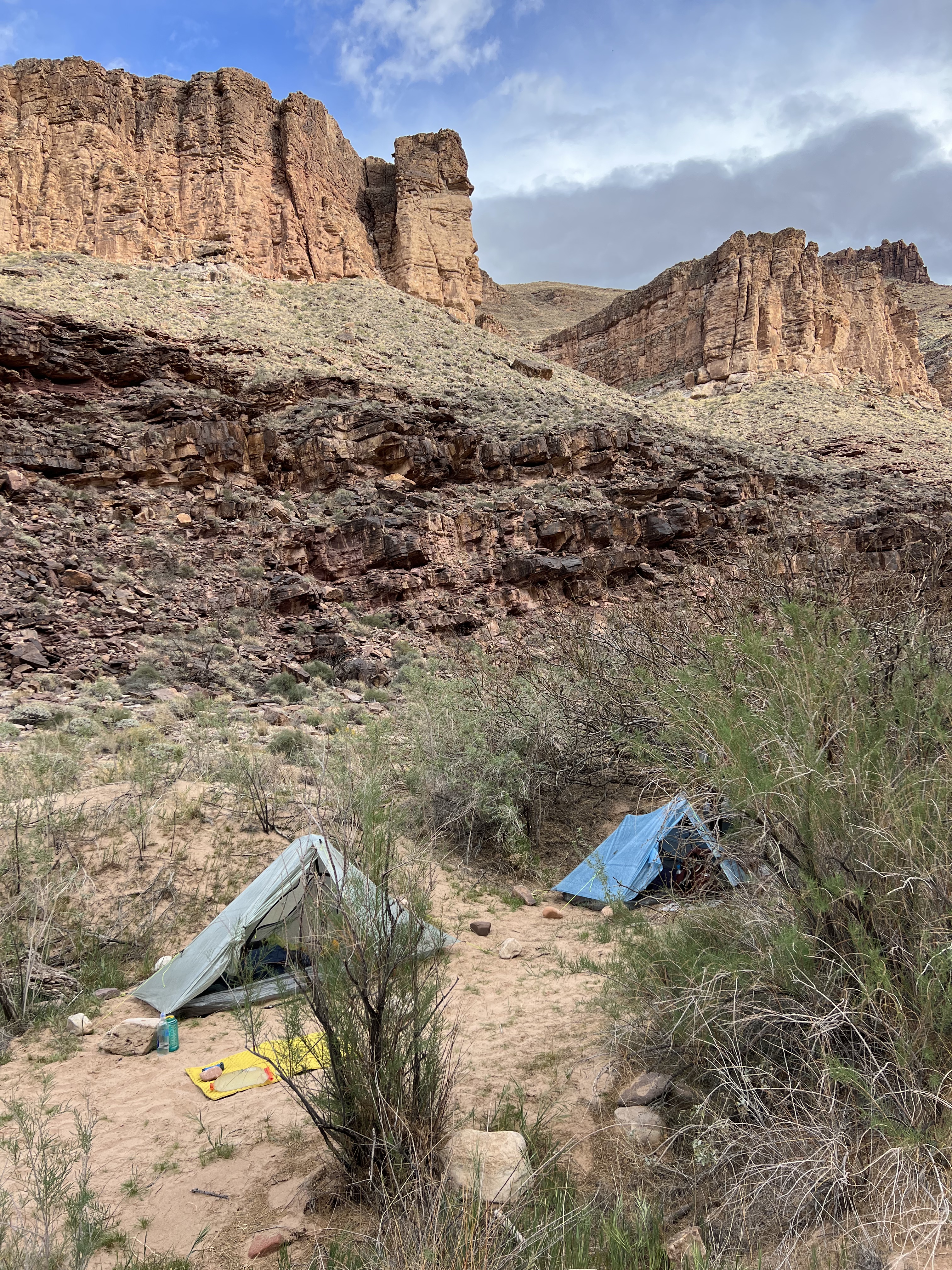
We arrived at Tanner Beach at 1:30pm, super early. We explored the beach area, including the pit toilet hiding in the reeds on the east end of the beach. We introduced ourselves to the only other people there – two guys who we would later learn are hiking the Hayduke Trail (envy!). The only problem was that it was super windy, which was nice during the hike to keep us cool, but not so great while camping. We did our best to pitch our trekking-pole tents such that the narrow ends were facing into the wind.
Our first camp chore was to figure out how to filter the silty Colorado River water. We had done a decent amount of online research and had learned that if the water is not allowed to settle, the silt will clog most filters, and the cloudy water will render chemical purification techniques less effective. Not wanting to take the risk with potentially runoff-filled river water, we’d all brought 2.8-oz packable buckets, and a few extra toys to experiment with, including aluminum sulfate, aka “alum,” which is a flocculant. First we filled the bucket with water from the rapids. We mixed about a half teaspoon of the alum with maybe 1/10 liter of clean water that we’d hiked in with, shaking it vigorously to get it to dissolve. Next we poured this mixture into the bucket, stirring the bucket rapidly for a minute or so. After that we let it sit while we performed other camp chores. It seemed to work fairly quickly – within a half hour or so, the water was relatively clear, and the alum powder could be seen at the bottom of the bucket. (To me this means it did not actually dissolve, so pre-mixing it with clean water seems unnecessary; but I did not experiment with putting the powder directly into the bucket.) Everyone seemed to perform the next step differently: what worked for me was having a friend hold open my dirty water bag (I use a C’noc Vecto bag) while I carefully poured the water from the bucket into the bag, which holds 2 liters. I am currently using a Platypus QuickDraw, which is a squeeze filter, and I’m liking it pretty well – it seems faster than my old Sawyer Squeeze. Our last step was to use a chemical purifier, which may have been belt + suspenders, but the GC website recommended doing both a physical and a chemical purification, so why not. I chose to use MSR Aquatabs which I placed directly into the clean water container (I brought a wide-mouth Nalgene bottle for this trip) which took about 40 minutes to do its work. This whole process took about an hour and a half for me, but my water needs are fairly low, and I had not run out of fresh water on the hike down, so it was fine.
As an experiment, after I was done with my primary water needs, I refilled my bucket and let it sit overnight without adding alum. By the next morning it was still fairly cloudy; and within 20 minutes of stirring in the alum it was clear. So my conclusion is that using the alum is worth it!
We are always in our tents early when backpacking, and today more so than usual because of the wind. We hit the sack at 6pm, and I think I was asleep by 8pm!
Day 2: Tanner Rapids to Seventy-Five Mile Rapids
Gaia Track | 9.8 miles | 1,628 ft ascent | 1,554 ft descent | 6:18 total time
We started our first full day within the canyon without rushing, hitting the trail around 8am, after breakfast and some more water filtering. I decided to go ultralight this trip, and, as usual, left my stove and fuel at home. I am an annoyingly un-picky eater and don’t really mind “cold-soaked” food (which is a misnomer: food rehydrating in a jar on the outside of my pack all day will actually be pretty warm). My other sacrifice to the ultralight gods was to bring my 15-oz, 30-degree quilt in lieu of my 29-oz, 0-degree bag. Ideally, something in between would have been great; but in the end I was really glad that I had the 30-degree quilt because otherwise I would have been too warm. Finally, I also had my new favorite pack with me, my MLD Prophet, which clocks in at less than 20 oz. My base weight was between 12-13 lbs, and with an estimated 6lbs of food and 1.7 liters of water (<4lbs) my starting pack weight was about 22-23 lbs. Not bad!
On the other hand, given the weather forecast, I decided to bring my heavier Gore-Tex rain jacket. Today it did indeed rain, but never heavily – I would have been fine in my lighter rain jacket; but better safe than sorry. My other “luxury” item was my cut-down Z-lite closed-cell foam pad. I don’t use it to sleep on, and it’s definitely not a necessity; but every time I backpack without it I regret it.
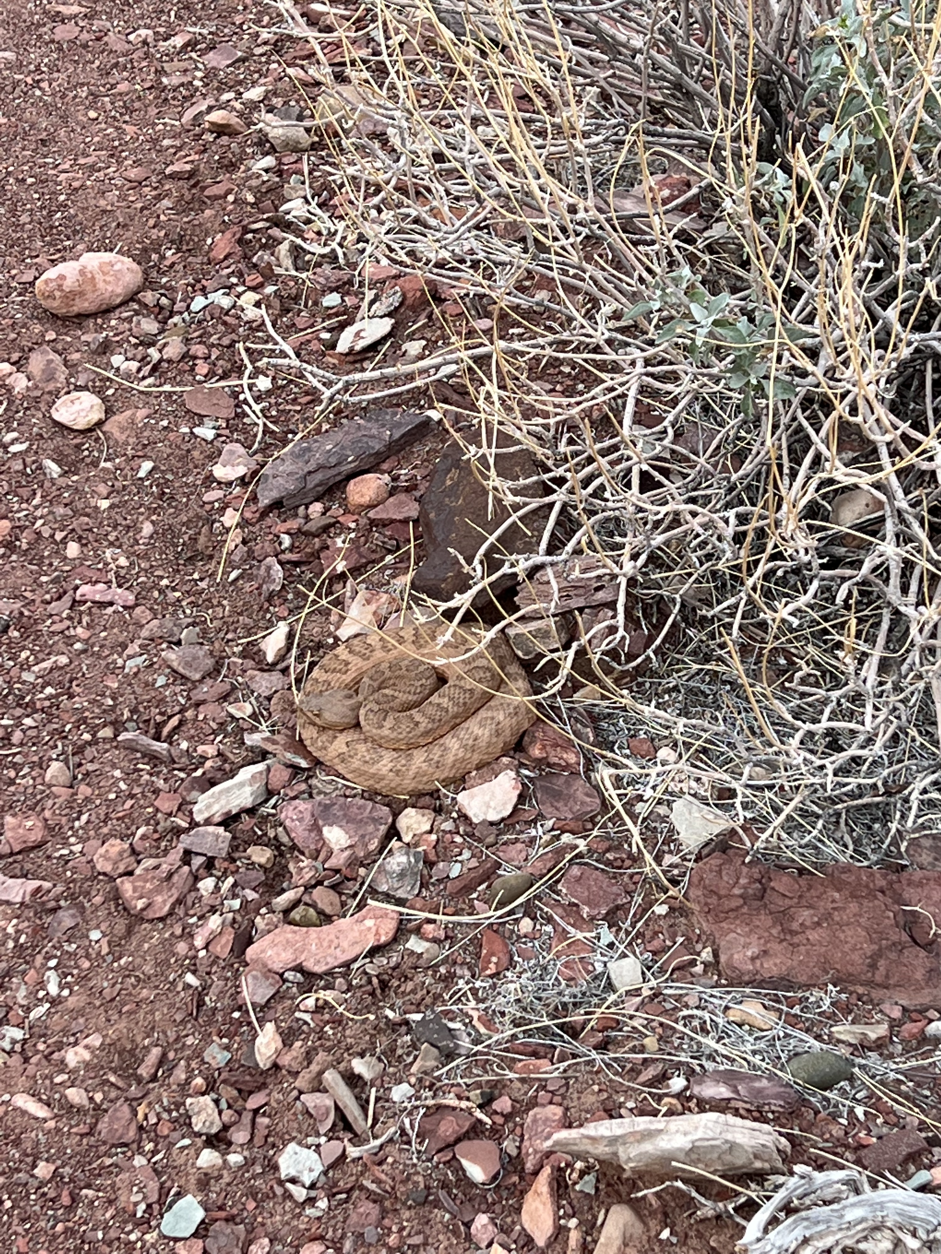
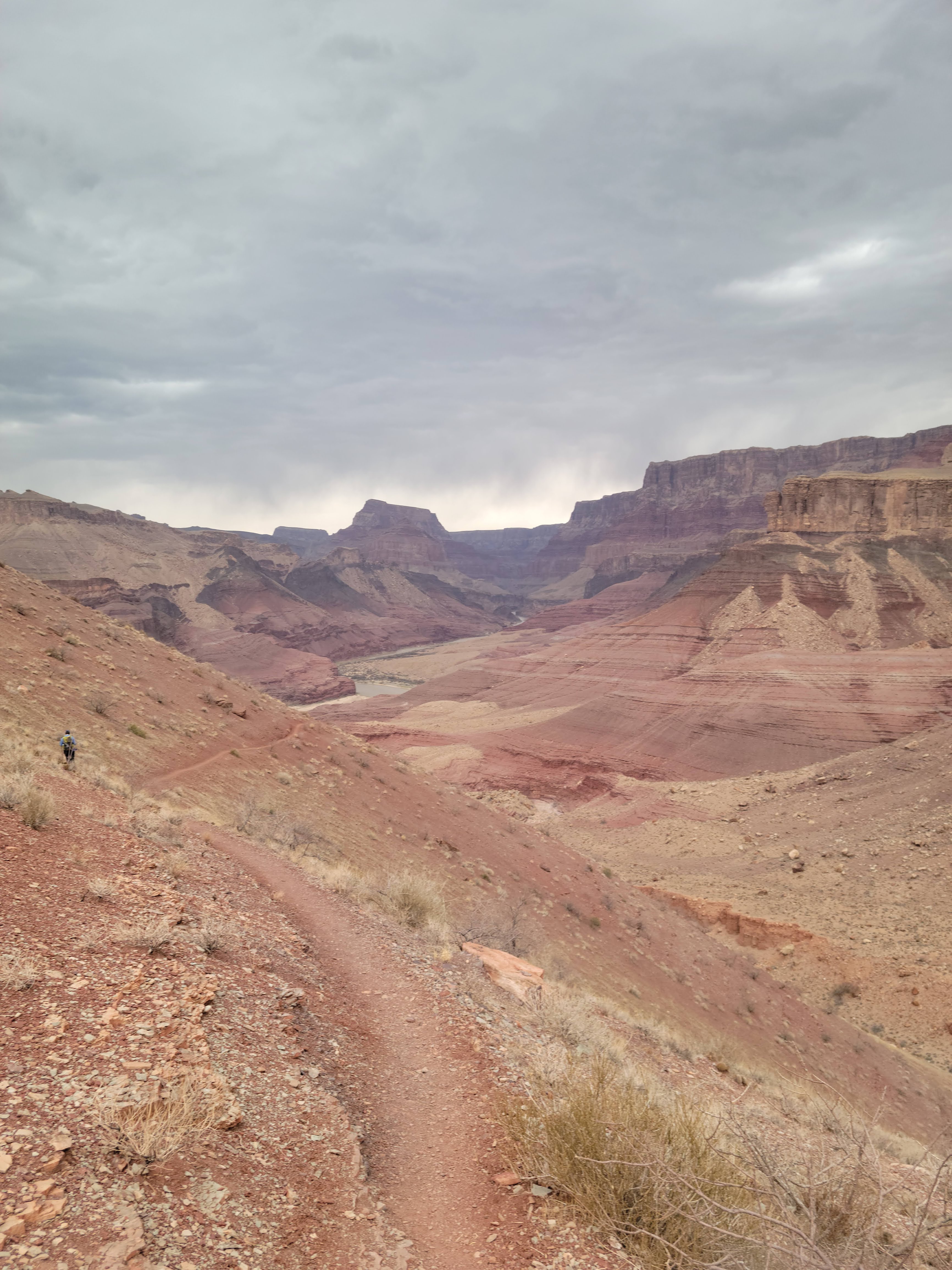
Today would be our second-easiest day, but it was definitely not easy. The trail made its way along the river westward for a while, until it turned inland (south) and wound around cliff sides and steep slopes. The rain made the boulders more slippery, but the loose dirt grippier – a bit of a trade-off. Early in the day we encountered a rattlesnake, tightly coiled up and completely ignoring us. As we made our way across the hills, we saw a large group ahead of us and figured we’d catch up with them soon. And so we did – after we came up out of the dry Escalante Creek, we encountered them resting. And guess what!? It turned out to be a Sierra Club trip – led by the very John P. who introduced Kali to this route! We stopped to chat with them for a moment, getting some info about the upcoming campsite options.
We decided to proceed past our original planned stop and experience the Seventy-Five Mile Canyon before camping – and we were glad we did! This was certainly the prettiest part of the trip. The trail followed the cliff above the river, then turned in above the 75mi canyon to skirt around the top of it, until it finally descended into the slot canyon itself. We were now enclosed by smooth walls that led us back down to the river – incredible!
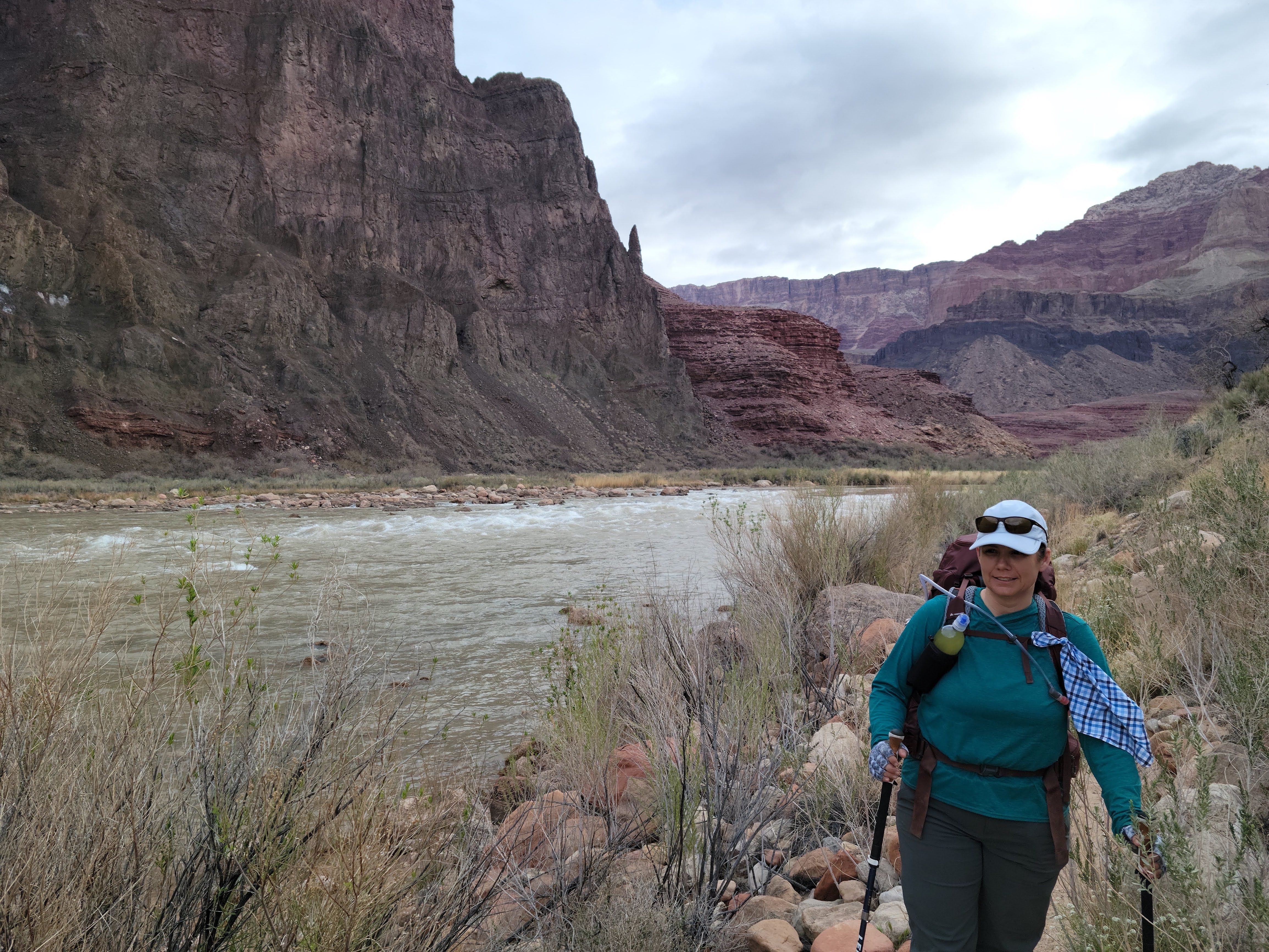
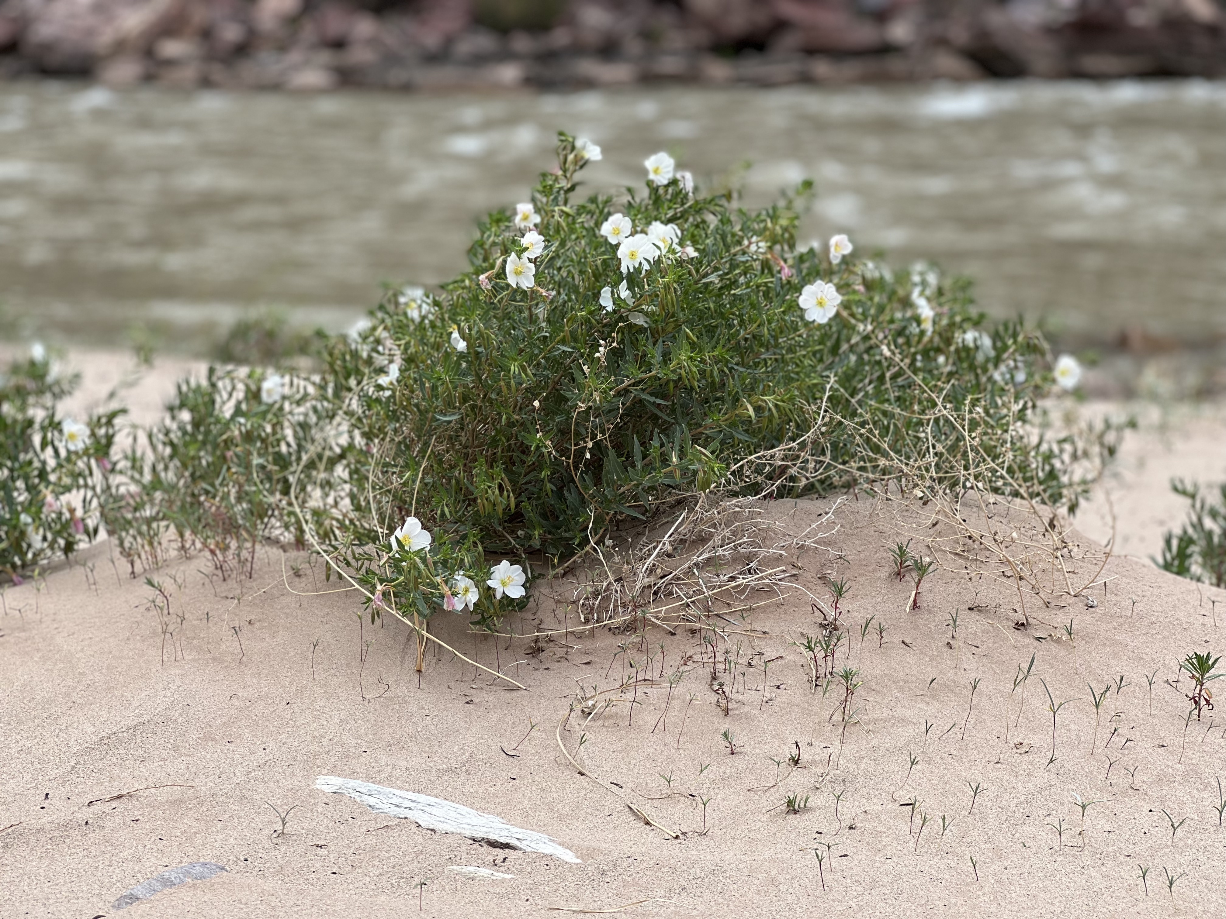
At the Seventy-Five Mile beach/rapids, we explored for a bit until we found one of the best campsites of my life – sandy beach, beautiful dune flowers, nearby river, incredible views, perfect weather…! What more could I ask for!? We picked our sites, set up our tents, and began our arduous water purification process. We took walks along the beach, and did our yoga stretches. We watched as a rafting group paddled through – with one kayaker, who capsized! We walked a bit further down the beach and made friends with another rafting group, who shared their cold beverages with us and explained their gear and process with us. We all agreed that we must do a Grand Canyon rafting trip someday!
Back at camp we made dinner, did a little more puttering, and went to bed – we held out until 7pm tonight, yay us! I mentioned earlier that my food weight for four days was about six pounds… well, I was doing ok with my meals, but I definitely was going to be coming out of the canyon with an empty food bag – I certainly would not have minded the weight of a few more calories. So, much to my surprise and pleasure, one of the rafters wandered over in the dark to our little camp to tell us that they were done eating and were about to toss their leftovers, and did we want any? Kali & Tara demurred but I was like, “Um… sure!!!” So I crawled out of my tent in my fleece pajamas and eyeglasses, grabbed a headlamp, and went out to eat some vegan chili and make some friends! Second dinner, yeah! The rafters were all super friendly and it was fun chatting with them. They were mostly from the NorCal area, and it was a private (non-guided) rafting trip. They explained that the way to get a rafting permit was to always have some newbies in the group – folks who have never had a permit before get higher priority. Good to know! With a fuller belly, I made my way in the dark back to my comfy tent.
Day 3: Seventy-Five Mile Rapids to Hance Creek via the Papago Wall & Slide
Gaia Track | 8.8 miles 1,748 ft ascent | 666 ft descent | 7:16 total time
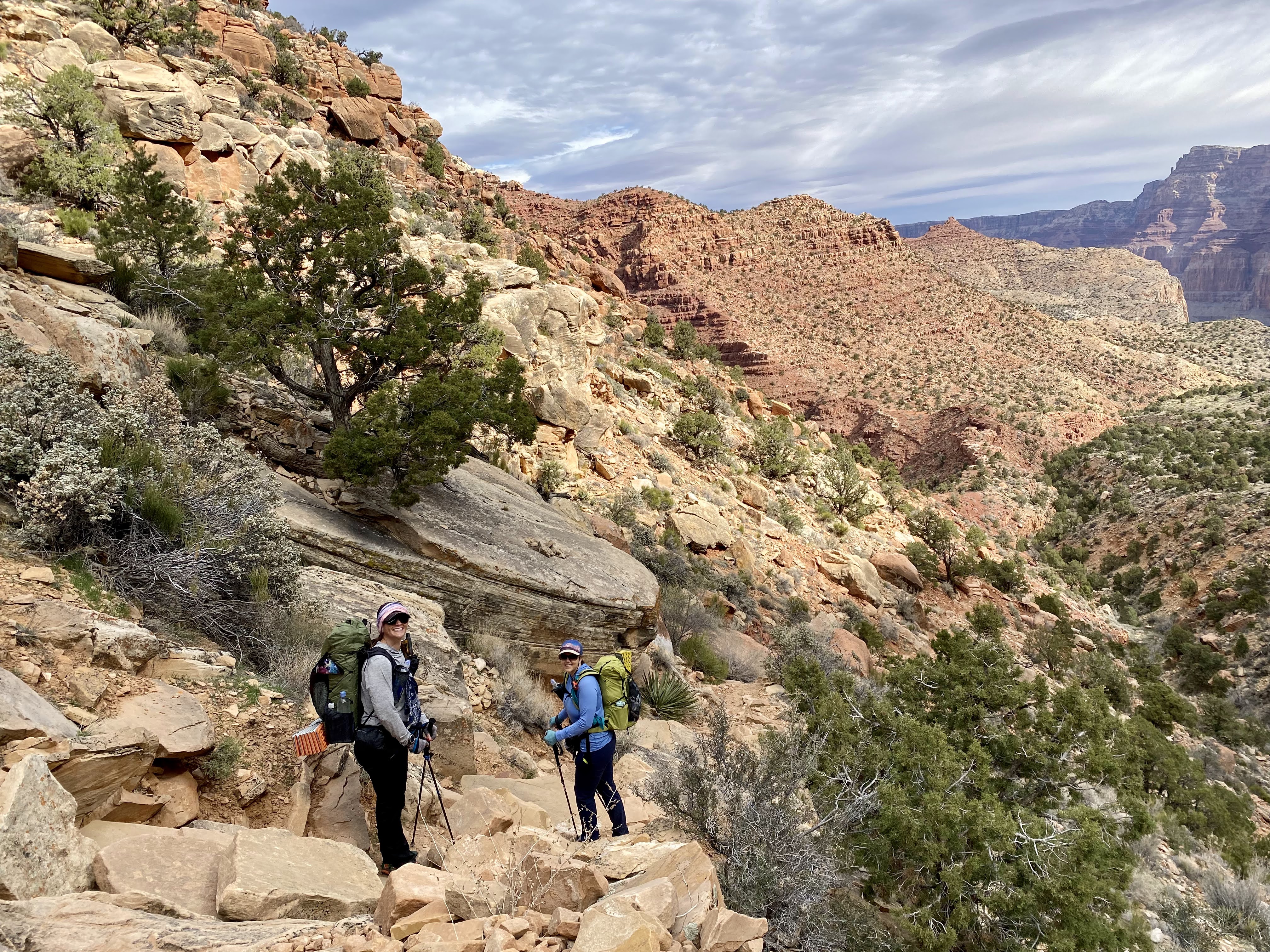
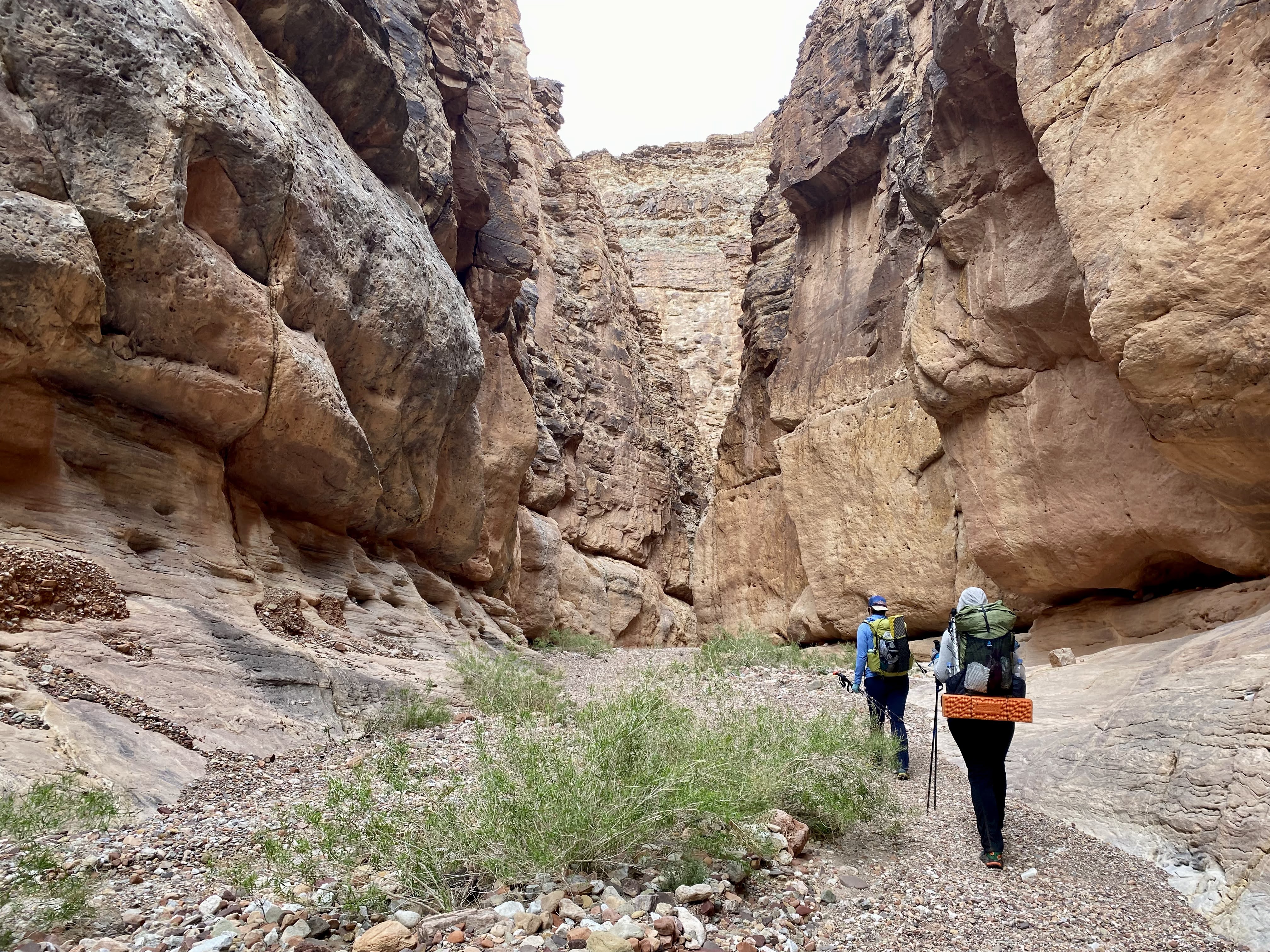
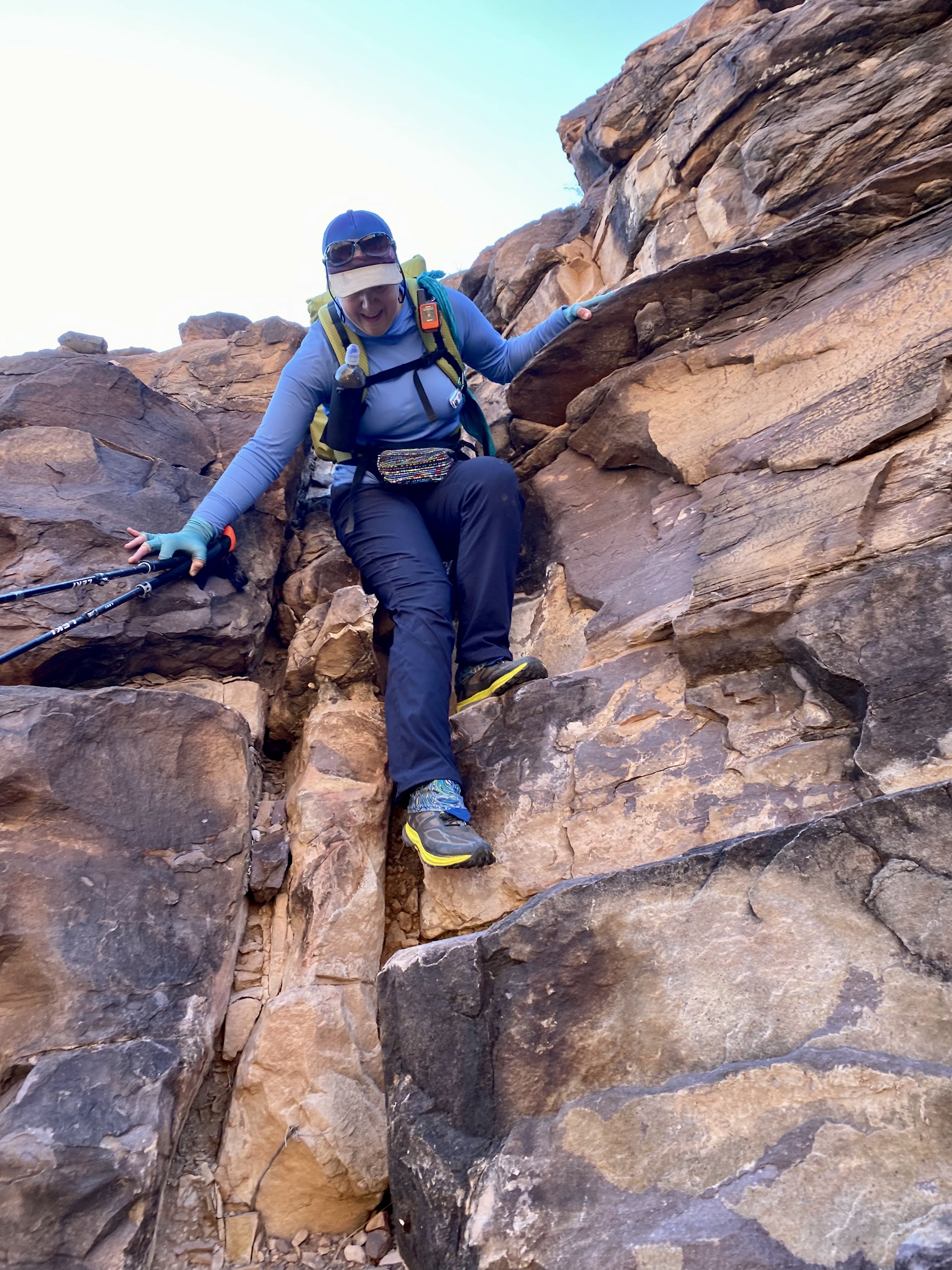
Our third day on trail would be our toughest: today we’d tackle the Papago wall & slide; and also the route would turn in away from the river so there’d be a bit of climbing. It was also going to be a lot warmer today. We hit the trail fairly early, around 7am. The route began by ascending the cliff above our campsite which was kind of cool to look down on. This whole section, for the first several miles before & after the Papago features, was very much a “route,” and we were keeping our eyes peeled for cairns and “choose your own adventure” scrambles across gorges and cliff-sides. In short order we arrived at Papago beach (which would have made a nice campsite) and gazed up at our obstacle. Kali headed up first as our strongest climber; Tara followed; and I brought up the rear. All three of us are decent climbers and were not really worried, but we don’t typically climb with packs. I had brought a spool of strong but thin rope, and a couple of weight-bearing carabiners – not expecting to need them to climb with (although we could have if needed – I’d practiced and taken screen shots of how to tie a Munter hitch), but more likely, to haul up our packs. Fortunately it was unnecessary. The wall itself was indeed a wall – straight up – but it did not have a feeling of exposure, and we made pretty quick work of it. It was actually a lot of fun!
Right after the wall, though, the route – still a route, not really a trail – became confusing with cairns heading in conflicting directions. We became stuck until we figured out that we needed to get on top of the ridge that was to our left. We ended up backtracking – we’d gone too far to the right. The way was clear once we figured that out.
Our next obstacle was the Papago Slide – what goes up must go down! This was a lot less “fun,” but also completely doable; pretty much nothing compared to some of the steep peaks we’d done last year (Indianhead and False Sombrero come to mind…) – not to mention, no pokey plants that were trying to kill us! A walk in the park!
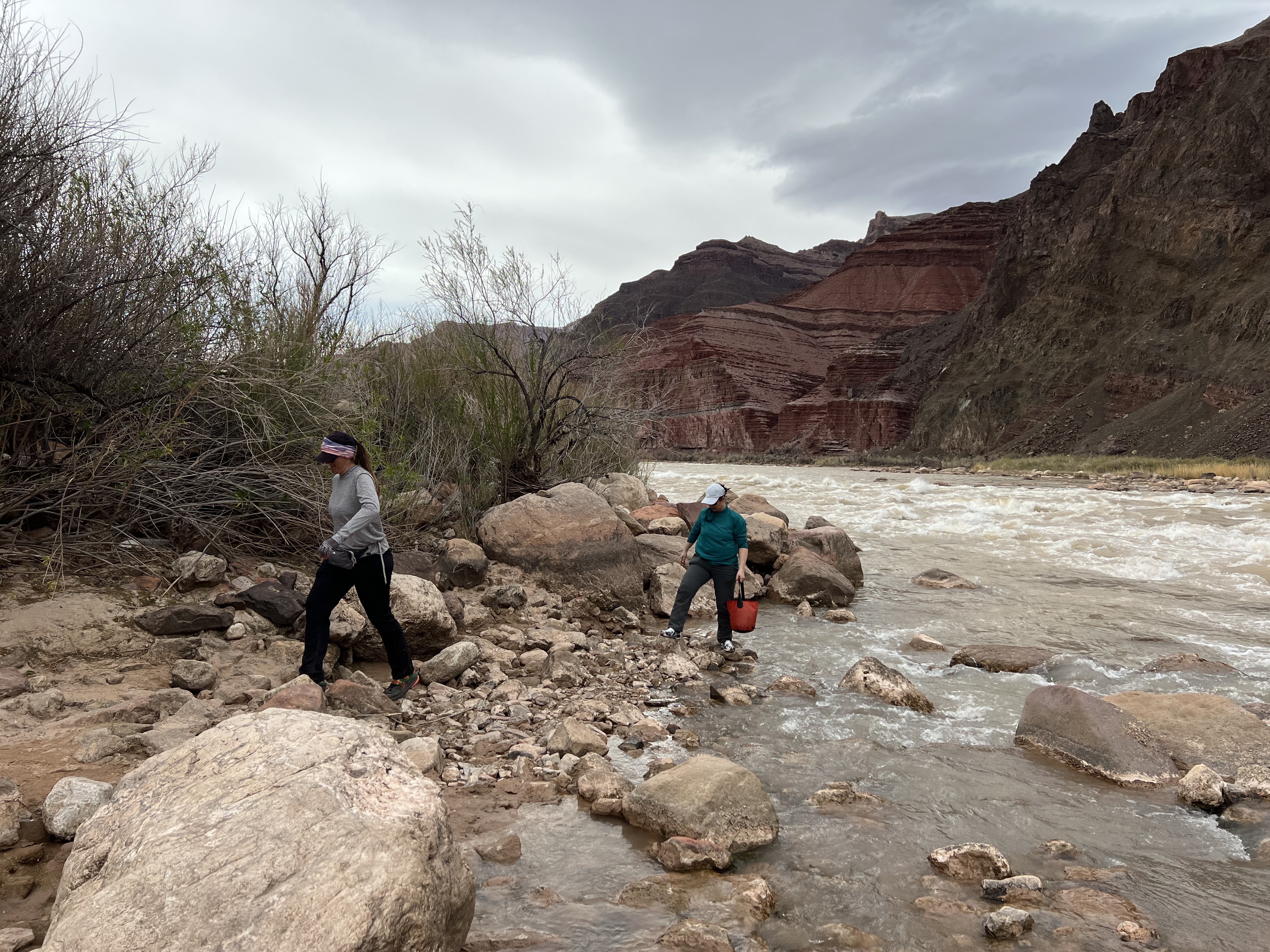
It had been slow going though – the first three miles of the day took us about as many hours. At the bottom of the slide was a lovely beach and camping area where we took a well-deserved rest, dunking our hats in the river to cool down, and saying goodbye to it – we were leaving the river behind for good. The pace picked up a lot after our break, which was good, because we had a long way to go. The trail – now a real trail – wended its way gradually south up and away from the bottom of the canyon.
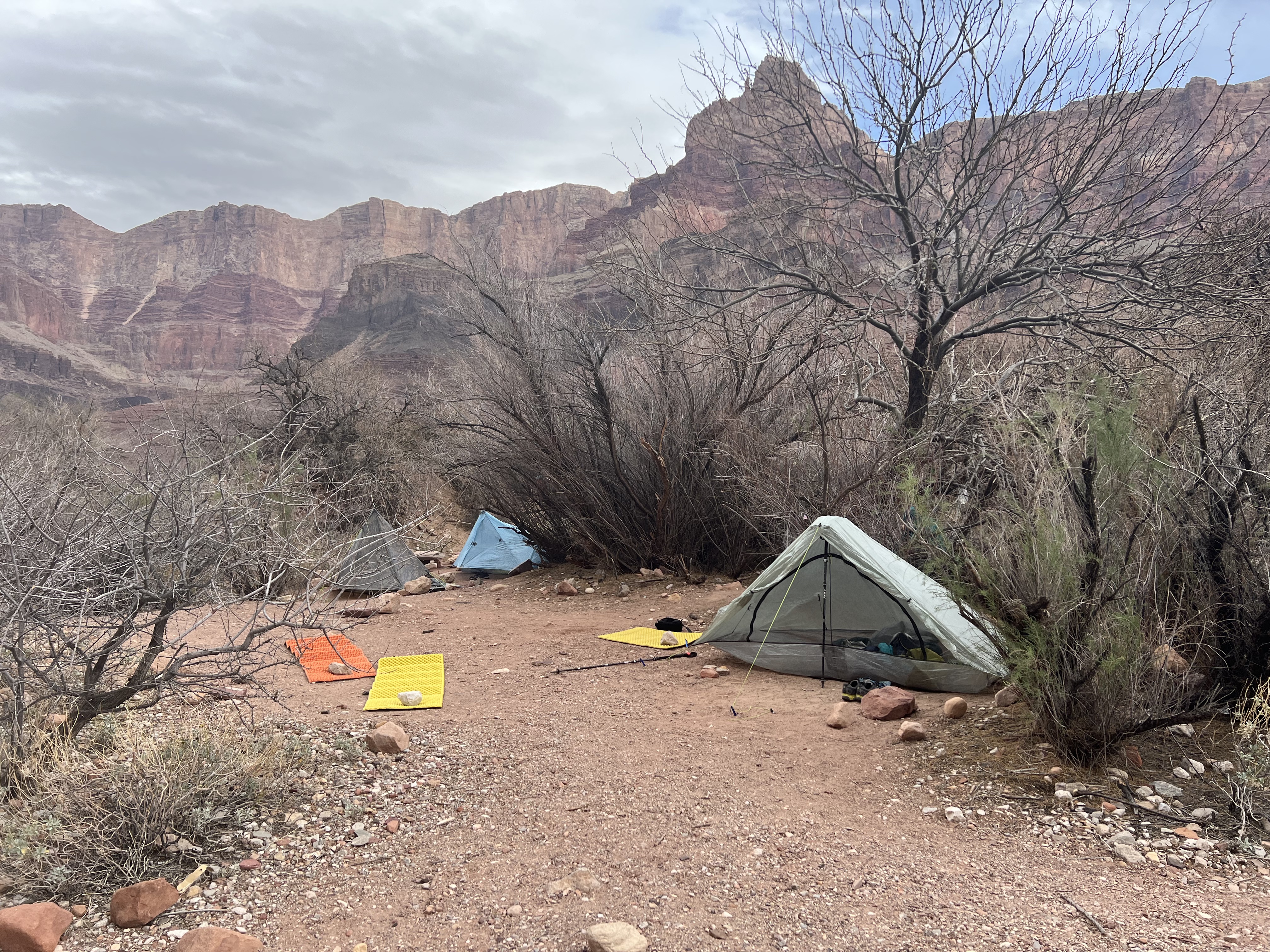
We arrived at our final night’s campsite a little before 3pm. Our water source was now a small but pretty stream that seemed to flow from an underground spring into a little pool. It was less of a “stream” than we expected, but it met our needs. And since it was not coming from a silty river, we didn’t need to use the alum and the other extra purification steps – which was good, because two of us were nearly out of water; waiting for the silt to settle would have been torturous. I was able to take a nice little bath in the pool right below the spring, once I shooed off the Jesus bugs.
As evening fell, some nearby squawking birds were becoming louder… and louder… and then we realized, they’re not birds, they’re FROGS! Waking up for a little evening romance. Man, were they LOUD!!! Thank goodness for ear plugs.
Day 4: Hance Creek to Grandview Point via Page Spring
Gaia Track | 4.7 miles | 3,684 ft ascent | 9 ft descent | 4:22 total time
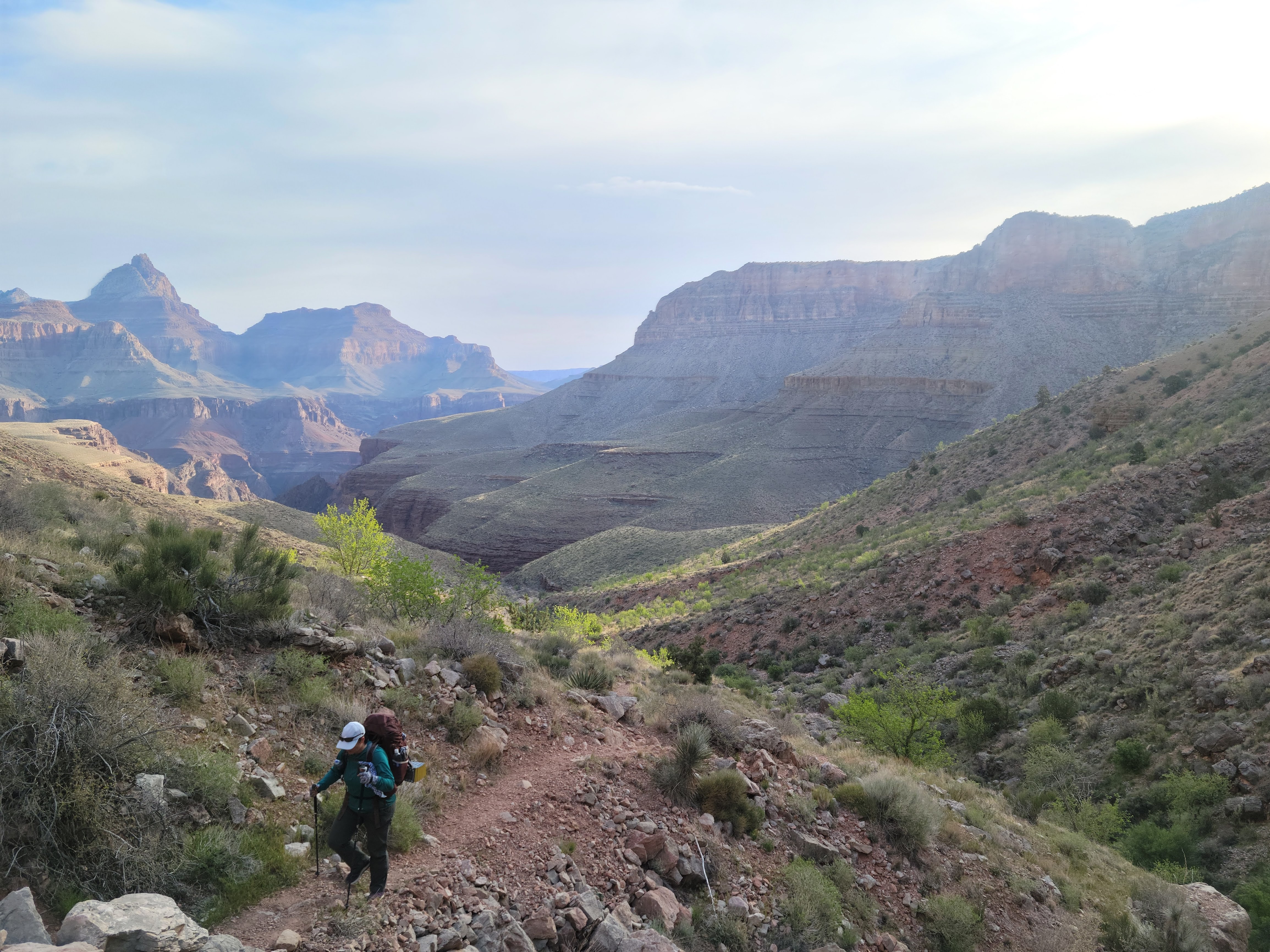
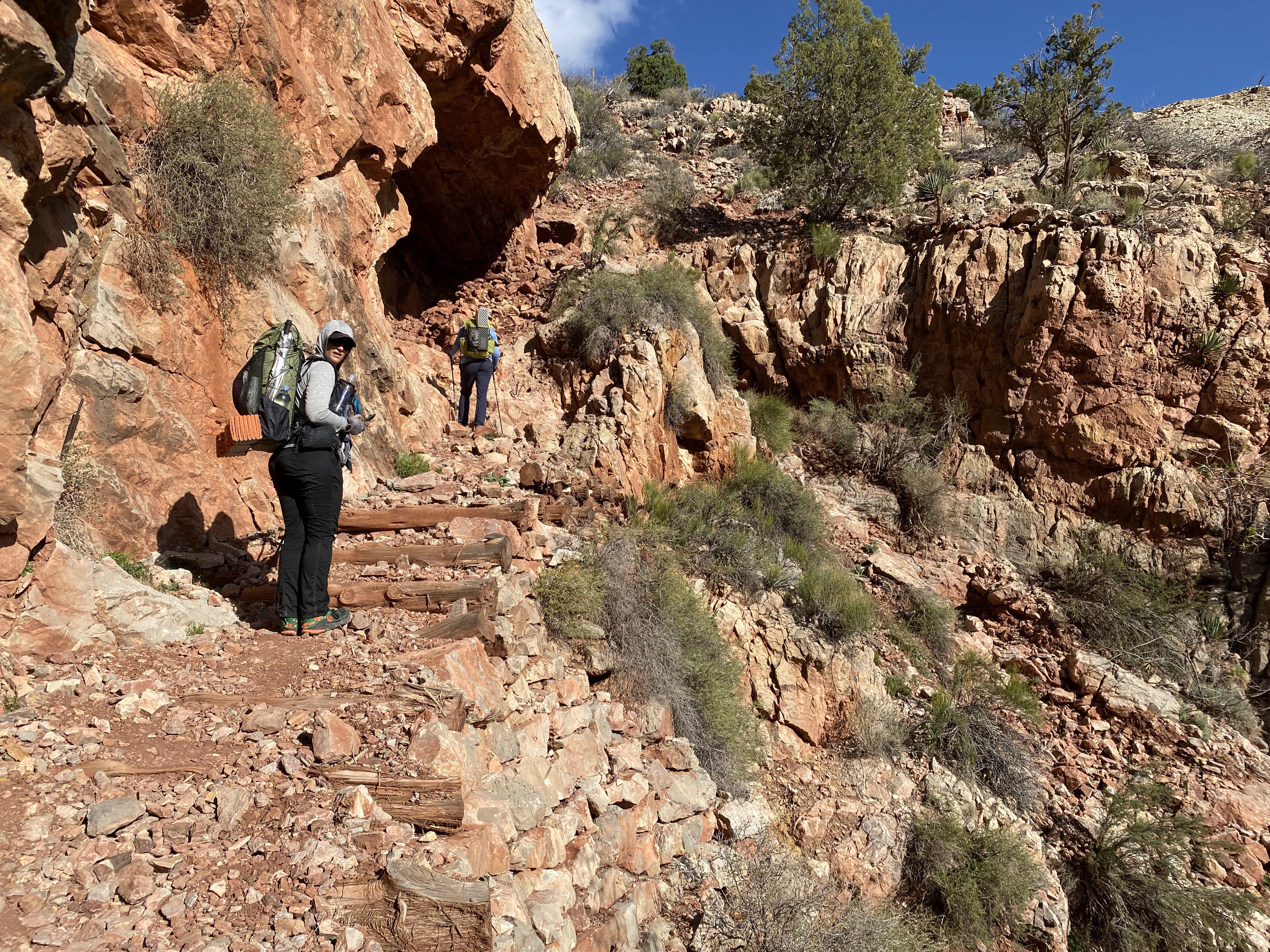
For our last day, we had a choice of a longer route encircling Horseshoe Mesa, or a shorter route that took us past Page Spring. Tara & Kali had a long drive ahead of them so we opted for the shorter route. I have heard that Horseshoe Mesa is gorgeous; someday maybe I’ll do it as a dayhike. One thing about shorter routes – they are also steeper! The trail – such as it was – climbed up the side of a cliff and again required a bit of route finding. Soon we came to an old closed-off mine shaft and some abandoned equipment, marveling at the trail building required to haul copper ore out of this rugged landscape.
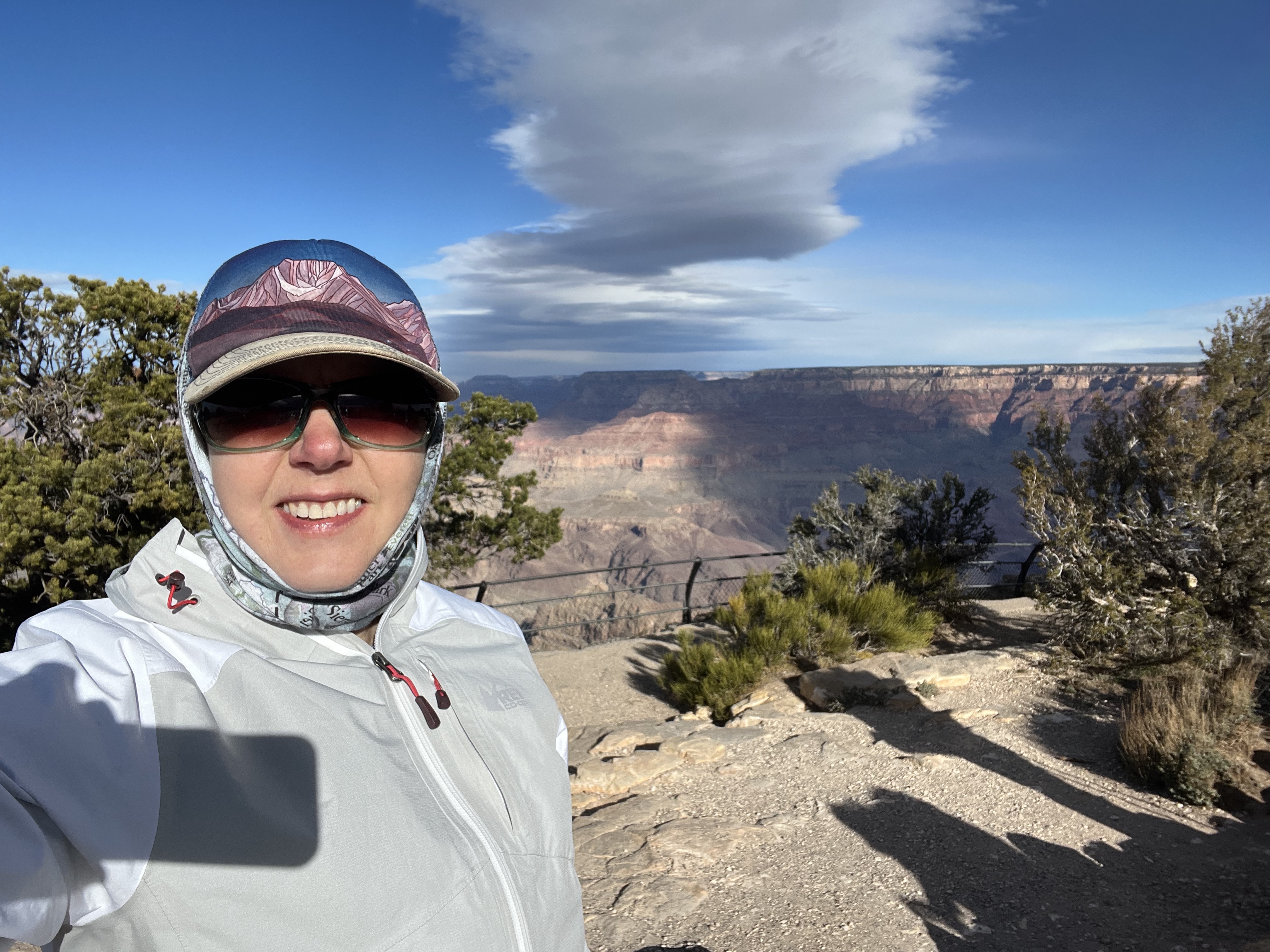
We took a break when we finally arrived on top of the mesa, and then began the final, brutally steep climb up the Grandview Trail. The trail was well-built, paved with cobblestones in the steepest sections. It was also washed out in a few places, requiring occasional bouldering, apparently from heavy rains last summer. The steep climbing seemed endless. We passed relatively few people. And then we made it to the lip of the canyon and onto the rim … and found all the people! It was a little jarring going from hardly anyone to practically a mob. They were all out to enjoy the stunning Grand Canyon views in their own way.
It was about noon when we popped out of the canyon. We had a change of clothes at Kali’s car waiting for us. We decided to wait until we got to Flagstaff for lunch, despite our post-hike hunger. It was worth the wait though; our burgers at the Lumber Yard were delicious, and I swear those were the best nachos I’ve ever had!
Kali & Tara headed home after that and I checked into a hotel in Flagstaff. Tomorrow I would pick up a rental car and meet up with my family in Las Vegas where we’d proceed to Salt Lake City for a spring break ski trip – but that’s another story.


Wow!! What a hike!! Sounds like you had a challenging fun time. Great pictures! Thanks for sharing.