
Saturday, January 30, 2021
Sombrero Peak
100 Peaks Challenge #17
Afoot & Afield Trip #264
False Sombrero Peak
100 Peaks Challenge #18
Totals for the full hike:
Miles: 5.2
Elevation Gain: 1988ft
Gaia Track (it’s not perfect – follow at your own risk!)
We are on a total roll with this challenge in terms of weather! Originally pencilled in for last weekend, we delayed hiking Sombrero & False Sombrero Peaks to this weekend because, at over 4000ft in elevation, these peaks were more likely to have snow or rain issues. We were still a bit concerned that it might be muddy or slippery after Friday’s drenching – I clipped Yaktrax to my pack just in case – but it ended up being absolutely perfect. A gorgeous, clear, and sunny day, but not too hot.
The Sombreros are deceptive. The mileage for hiking these peaks individually is low – 1.5mi (one way) for Sombrero, and less than a mile for False – but they are insanely steep and rugged, with constant navigation required. These are not beginner hikes.
As usual, I keep trying to find ways to combine hikes to save on driving time, and to get multiple peaks done in one day. As I looked at the topo map for these two neighboring peaks, it seemed entirely possible to traverse between them, avoiding climbing the steep western slope twice. This does not seem to be commonly done, and I was only able to find one GPX track to reference, created by a hiker I did not know. I studied his track, and it looked pretty good. The east side of both peaks was on a plateau, and the terrain between them looked reasonable, with False almost due north of Sombrero. We made a plan to hike up Sombrero, traverse north, climb up to the summit of False, and then straight down from there. We were a bit apprehensive because of the lack of trip reports following this route, but the map looked promising.
Early Saturday morning the four of us took two 4wd vehicles – Tara’s Jeep and my Sportsmobile – to the FS trailhead. Chris joined us as well, in his Subaru. Indian Gorge Road, off the S2, was rocky and a bit sandy, but not too bad. We left the Jeep and the Subaru there, and drove the Sportsmobile back up the wash and then down the southern fork to the Sombrero trailhead. We started hiking at 8:30am.
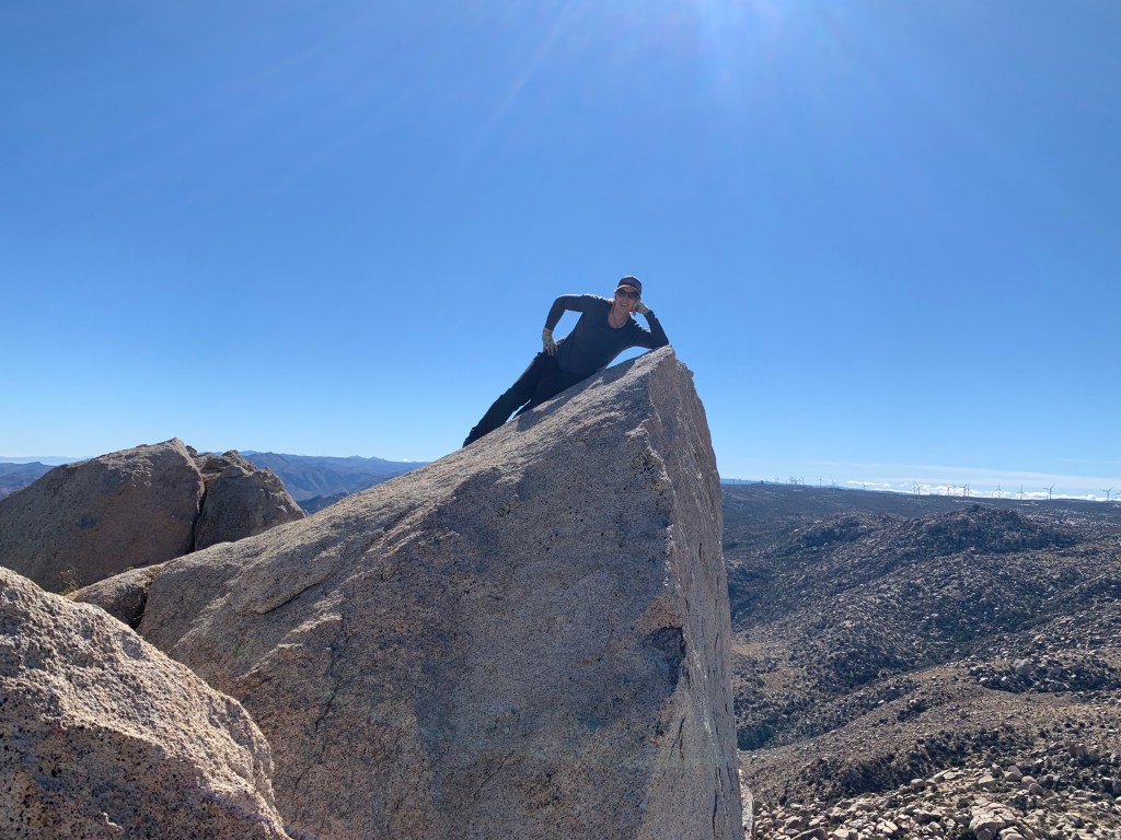
The climb up Sombrero was no joke. It began by following a steep wash up to a low saddle. We angled our way up the steep slope until we attained a ridge northeast of the peak. The peak itself required some minor class 3 scrambles, scouting around to find the best route. Finally we arrived at the summit boulders. Peak #17, yeah!
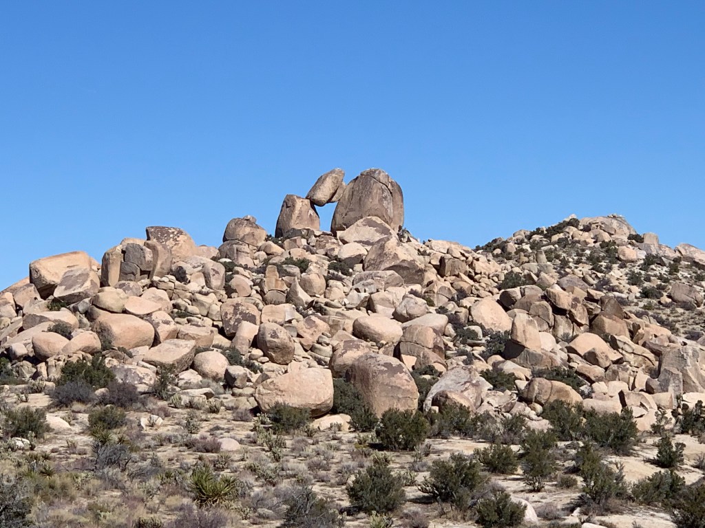
From the top we could see False Sombrero Peak, and it sure did look far away. After a rest, snacks, and photos, we climbed back down the opposite side of the peak, initially following the other main route up this peak via McCain Valley. In a short while, after passing some boulder piles, we diverged northward. The three-mile traverse between the two peaks was indeed relatively flat. We had a lot of route finding to do, mostly to get around brushy areas (bushwhacking through cactus and catclaw is NOT fun), but for much of the hike we could see our destination, and the GPX track we’d found was reliable.
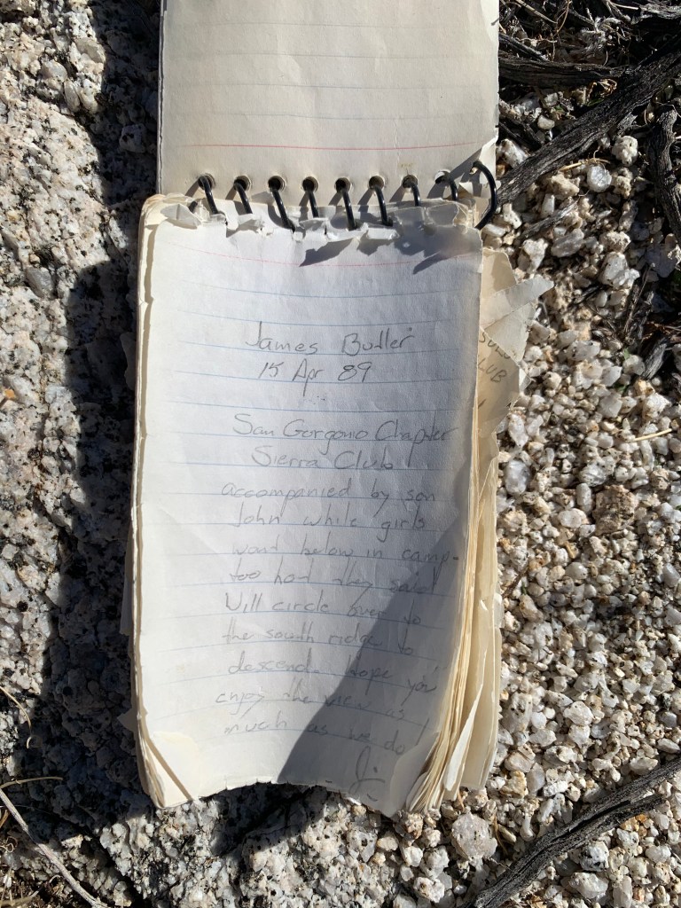
Soon we arrived at the quick boulder scramble up to the triangular summit, and voila! Peak #18! Paging through the register for this less well-known peak was fun – the oldest note we saw, waxing poetic, was from 1989. We also saw page after page of familiar names, from other peak bagging forums, the Sierra Club, and others in the San Diego hiking community.
Finally we headed down. The route down from False requires no navigation… because it’s straight down. For about a third of the descent, we skidded on loose gravelly sand, which was fun – sand glissading? The rest of the descent involved making our way around and over boulders while avoiding getting stabbed by pokey plants. Our knees were not happy with us, but soon the cars came into view and we got to the bottom in one piece.
The hike was a success, and the risky traverse paid off. In fact it was a lot of fun to study the map and find the best route between the two peaks – makes up a bit for the absence of orienteering events since Covid disrupted all of our lives. Traverse FTW!
There were some interesting moments on this hike too – I found a deflated weather balloon (not a roadside bomb!). Driving Indian Gorge Road was an exercise in avoiding turning big wild jackrabbits into roadkill. I saw a desert-colored hummingbird flitting among the ocotillo. And most excitingly, we saw a herd of bighorn sheep as we were driving out – so cool!


Pingback: Grand Canyon Escalante Route | laughter & sleep