
Borrego Mountain – West Butte (via Hawk Canyon)
February 13, 2021
Miles: 2.0
Elevation Gain: 544ft
Gaia Track
100 Peaks Challenge #23
Borrego Mountain – East Butte (via west approach)
February 13, 2021
Miles: 1.2
Elevation Gain: 390ft
Gaia Track*
100 Peaks Challenge #24
*If you copy my track, I recommend taking the northernmost track (that we took downhill) both ways.
Coyote Mountain
February 14, 2021
Miles: 5.1
Elevation Gain: 2603ft
Gaia Track
100 Peaks Challenge #25
Afoot & Afield 5th ed. Trip #215
This weekend’s main event was Coyote Mountain. It is just west of the Santa Rosa range, where next weekend we will tackle Villager Peak, and Mile High Peak the weekend after that, continuing our FEBRUARY OF PAIN. Coyote’s terrain is similar to Villager’s – both are a ridge walk – so it should be a good warm-up to the much longer Villager.
Compared to last weekend at Indianhead, and our plans for the next two weekends, though, Coyote is relatively tame. So we wanted to combine this hike with something else – gluttons for punishment, obviously. We decided to start our weekend with The Buttes, a pair of short hikes that are sort of in the middle of nowhere – hard to justify the two-hour drive to get there just to do them. This worked out perfectly.
On Saturday at 1pm the four of us met at the turnoff to Buttes Pass. The normal route up to West Butte (aka Borrego Mountain West) starts at “The Slot.” Recently The Slot has become so popular that they’ve installed a bathroom, and have started charging $10 to park there. We decided to avoid all that and drive around further east to Hawk Canyon. We piled into Tara’s capable Jeep and drove down the sandy road to the somewhat crowded canyon, and parked for our hike. We started up via the canyon bottom, clamoring over up dry waterfalls and ascending one steep-ish slope to eventually merge with the main trail. The rest of the hike to West Butte was straightforward, with some attention needed to stay on the right track and not accidentally wander onto one of many viewpoint side trails here and there.
The summit was windy, and had no trail register that we could find. To the northwest we could see tomorrow’s goal, Coyote Mountain, and looking eastward, we could see our next stop: East Butte.
We began the hike back down toward Hawk Canyon. On the way down we avoided the steep portion and instead found a use trail that stayed high on the northeast side of the canyon. This turned it into a loop hike of sorts with different terrain from the way up – fun! We soon were back at the bottom of the canyon, and piled into the Jeep to head out.
We drove back up the canyon and over Butte’s Pass proper, toward the East Butte of Borrego Mountain. We parked on the side of the road, avoiding the soft sand, and headed up the ridge. Arriving at a crux we studied the terrain: to the left, the path looked easier on the map (a more gradual ascent up the ridge). But to the right, the path looked easier in real life. We chose the path to the right. Wrong choice! We soon arrived at a rock climb that was not too difficult on its own, but it was exposed, steep, and nerve-wracking. We slowly maneuvered our way up, finally arriving, relieved, at the flat ridge. From there it was smooth sailing to the summit. And sailing is right – by now the wind was really howling, adding to the tension of the climb. There was a peak register that we hastily signed, took our summit snapshots, and started back down. This time we decided to try the northern route, which was absolutely the way to go. It’s subtle on the GPX track, but if anyone decides to copy our path, be sure to take that more northerly variation!

Our day’s work was done and it was taco time. We drove the twenty minutes to Borrego Springs and stopped at Los Jilbertos (cash only!), got our dinner, and headed to Palm Canyon Campground where friends in high places managed to snag us a last-minute site. It was still blowing hard, so dinner at the picnic table was an exercise in preventing our dinner from blowing away. This weekend I brought a proper tent, knowing that we’d have some weather tonight. Unlike last weekend, instead of simply plopping down in my bug bivy and gazing up at the stars, I tucked my four-season tent up against the concrete bathroom wall to protect myself from the wind (no, it did not smell bad). We went to bed very early mostly due to lack of anything else to do – sitting outside in the wind was no fun.
A few minutes after taking shelter, Kali sent out a text message – a scorpion had invaded her duffel bag in her tent’s vestibule! Excitement! We scrambled out to come and look. It was a little baby that had tucked itself into one of the zippered pockets. We helped Kali convince it to move along and find someplace else to spend the night.
The wind howled for a few more hours but eventually died down. The sky was clear and starry when we woke up early. Tara said to me, “Erika, look up.” I glanced up and said, yes, the stars are lovely… and she said, “No, really, look up!!!” I stopped what I was doing and allowed my eyes to adjust on the sky. We were being attacked by aliens!!!! Really, that’s what it looked like!! There was a line of stars marching single-file across the middle of the sky! It was surreal. We had no idea what it was and watched it for several minutes. We learned later that it was Elon Musk’s STARLINK satellite train. Our iPhone cameras could not capture it, but here is a random YouTube video I found. We did not know that then, though, and just hoped that if we were being attacked it would be over quickly!
Ok back to the task at hand … we were off to our hike. Coyote Mountain’s trailhead is off Rockhouse Canyon Road, west of the dry Clark Lake bed. Again Tara’s Jeep got us there with no trouble, and we began by making our way across the desert floor toward the base of the ridge. Once we got on the ridge we found a use trail that generally made its way all along the ridge toward the summit. The hike was steep in places, but was otherwise a cruiser of a hike with sure footing and easy navigation. Hardly any of the plants tried to kill us, and the rocks underfoot generally stayed put. Unlike last weekend’s sufferfest, we all said we’d do this one again.
At the summit we had amazing views of our recent and future exploits – the Buttes to the southeast, jutting up alone from the desert floor; the hulking and imposing Indianhead looming over our southwestern shoulder; and the Santa Rosa crest, with Villager and Mile High peaks beckoning, due east. The wide open summit area had three benchmarks, a register (that I added a new notebook to), and a marker in a rock pile. Very satisfying. We lingered a bit and then headed down, well ahead of our self-imposed schedule.
Near the bottom we encountered a solo hiker on her way up, and shortly behind her, another solo hiker – this time someone we knew from our various hiking Facebook groups. That was neat, to meet him in person. We got back to our cars and headed home unexpectedly early – which is nice, since it was, after all, Valentine’s Day. ❤️
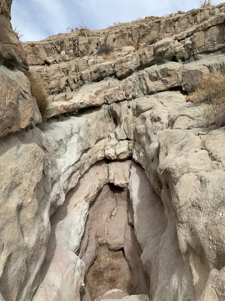
Dry waterfall in Hawk Canyon 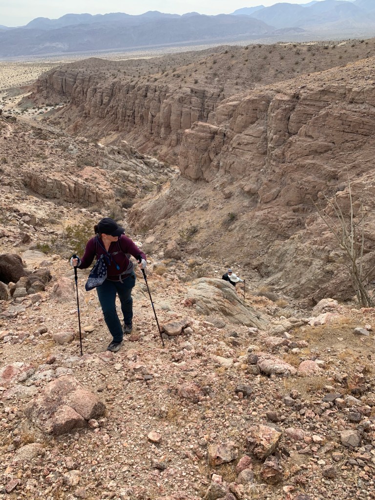
Climbing up out of Hawk Canyon 
Atop West Butte, #23 
Looking toward East Butte – our next stop 
Looking toward Coyote Mountain – tomorrow’s project 
It was windy on East Butte! #24 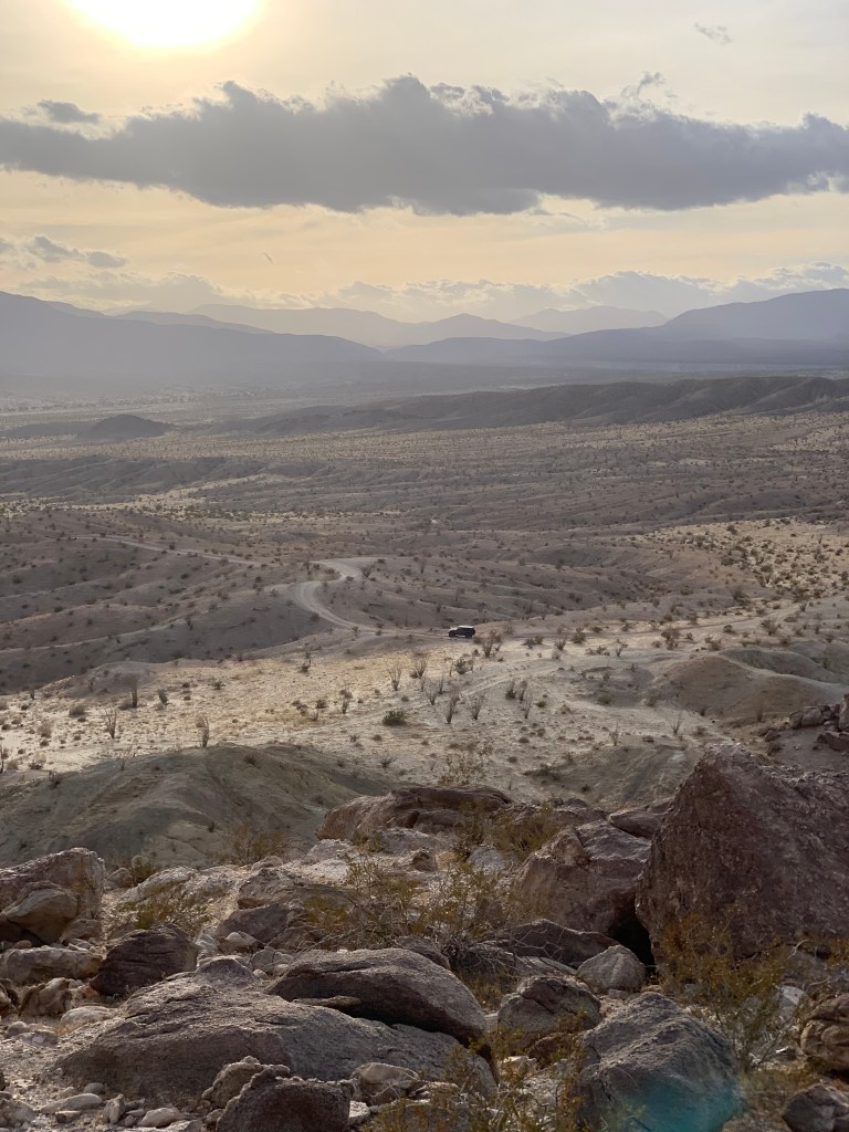
Tara’s trusty Jeep 
My unromantic but comfortably sheltered setup for Saturday night 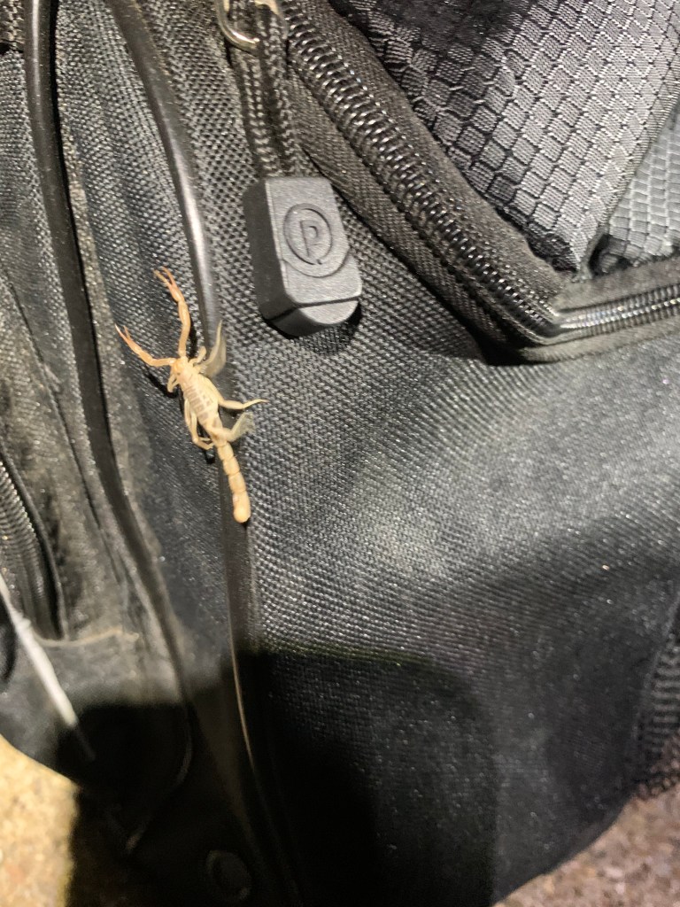
Kali’s new pet 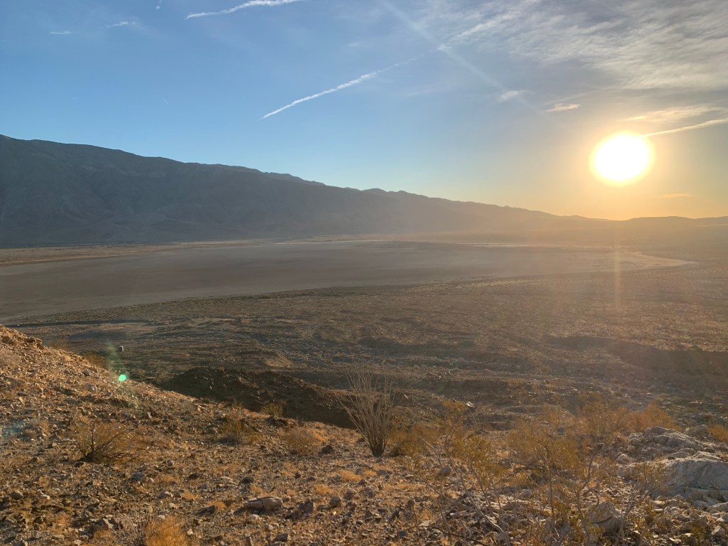
Clark dry lakebed 
Casey enjoying the view from the ridge leading to Coyote Mountain 
Coyote Mountain benchmark 
Santa Rosa Mountains – I was going to annotate this to mark Toro, Dawn’s, Rabbit, and Villager Peaks but I don’t know how to do that, LOL. 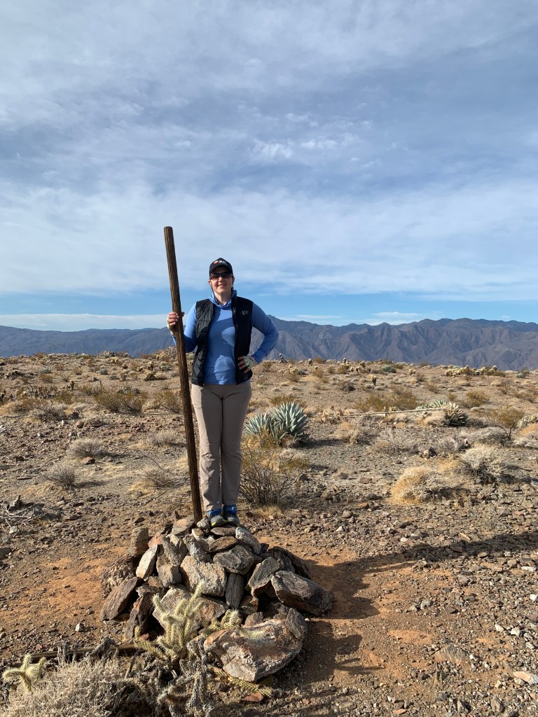
Coyote Mountain, #25 
Photo shoot! 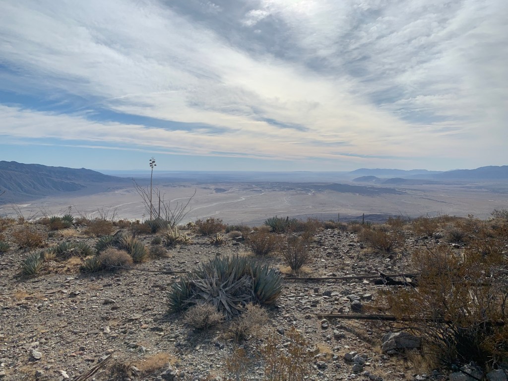
Looking generally east, maybe a bit south 
There we are! Kinda blurry.

Pingback: Road Trip to the Kern Plateau | laughter & sleep