Granite Mountain
Miles: 7.8
Elevation Gain: 2941ft
Gaia Track (thanks Tara!)
Today Tara & I hiked Granite Mountain via the south approach. En route to the trailhead we stopped at the Blair Valley bathrooms. I mentioned in yesterday’s post that my original plan for the first weekend in 2021 was to camp in Blair Valley to bag three peaks on Jan. 1, and one peak on Jan. 2 – today. One of the reasons I ditched this plan was because technically camping in Anza Borrego is not allowed due to Covid. Given that Blair Valley is a super popular place to camp, and that it is a holiday weekend, I thought that getting a ticket would be kinda likely.
Welp, Blair Valley was packed. I guess it’s possible that a ranger (we did see one, but as far as I can tell all they did was clean the bathroom – thank you!) drove through and wrote down everyone’s license plates, but that seems highly unlikely. People were everywhere! Oh well.
We continued along the S2 and turned off onto the Mason Valley Truck Trail, turning right down the Vallecito Wash Road due to a gate blocking a slightly more direct route, until we arrived at the Rodriguez Spur Truck Trail. To the left (southwest) was Oriflamme Canyon, another popular camping spot – it too had several vehicles but was not nearly the madhouse that Blair Valley was. The road was actually fine – sandy in spots, but doable in a regular car – until Rodriguez when it got a bit rougher. Still ok for high-clearance.
I chose to do the south approach for this climb as I had read that it was less arduous than the more common east approach. I think the main reason it’s less common is simply because the route does not appear in AllTrails. Additionally, it’s a bit harder to get to the trailhead. I’m very glad we chose to go this route. It was still a hard hike but nothing like the stories I’ve heard of the other route.
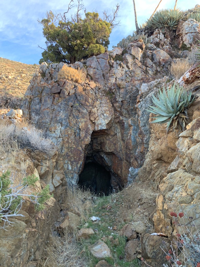
The hike starts by crossing the wash where we parked up to a fairly clear trail that cuts up the side of the slope. The trail continues for about 1.5 miles until it arrives at the remains of the Republic Mine. Above this point the clear trail is no more, and we followed a faint occasional use trail. I had found a public GPX track that was actually very helpful as well. Even without those aids the route was fairly obvious, as we were following a ridge line the entire way.
Navigation was not challenging but I do enjoy the meditative nature of following a more clear trail. The first part of the trail above the mine was fairly steep, with tricky footing. As we ascended, the cacti started to become just a little bit insane. At times it felt like we’d been taken prisoner by the prickly pear and cholla. Fucking cactus were everywhere! I wish I’d taken a photo of that section of the hike – it was ridiculous.
Eventually we got to the ridge and the hike became a bit easier. There were a few small rock scrambles here and there, but all minor except for one bit near the “shoulder” of the ridge that required some climbing (but on the way down we got past this section without even realizing it, so there were probably easier ways up that we’d missed).
From there we were at the true ridge and made our way toward the summit. There was significant snow up there, which took us entirely by surprise! Thank goodness for our trekking poles. We also contended with some false summits – we’d navigate around some boulders thinking we were near the top and, surprise! Another rock pile awaited. The summit itself turned out to be a big rock scramble that was sketchy in places – I would not have liked to do this solo, that’s for sure. Finally on the top, we took some obligatory photos and quickly descended back to terra firma for our lunch.
The hike back down was pretty quick. In the snow near the top on the way down we crossed paths with some paw prints that I’m pretty sure were mountain lion (no claw marks, and big) – very cool. More encounters with cacti on the way down, probably because we were more tired and also moving more quickly. We were back at the car at 3pm, making for a 7hr hike including a ~30min break at the top.
We both agreed that we enjoyed this hike more than we thought we would, and we’d be willing to go back and do it again!