
Miles: 5.8
Elevation Gain: 1394ft
Gaia Track
100 Peaks Challenge 2021 peak #3
Yesterday was a long day, but today is still a weekend, and I wanted to get in a decent hike that I was comfortable doing solo but not one that I could do on a weekday. Also one that did not require tons of planning. Since I’d hiked Guatay before, I decided it would be a good choice.
I hiked Guatay the first time in January 2019. I remember the bathrooms at the trailhead being locked because of the government shutdown – remember that?? It was a Sierra Club hike, and I was the slowest in the group – this was before I’d discovered OrangeTheory, and was not as fit as I am now. Still, usually the Sierra Club hikes are not super fast, so I remember being frustrated at my comparatively slow pace. I sort of thought today I’d blow it out of the water, and I was definitely faster by about 20 minutes, but would have been even faster if not for a few diversions that I’ll describe below.

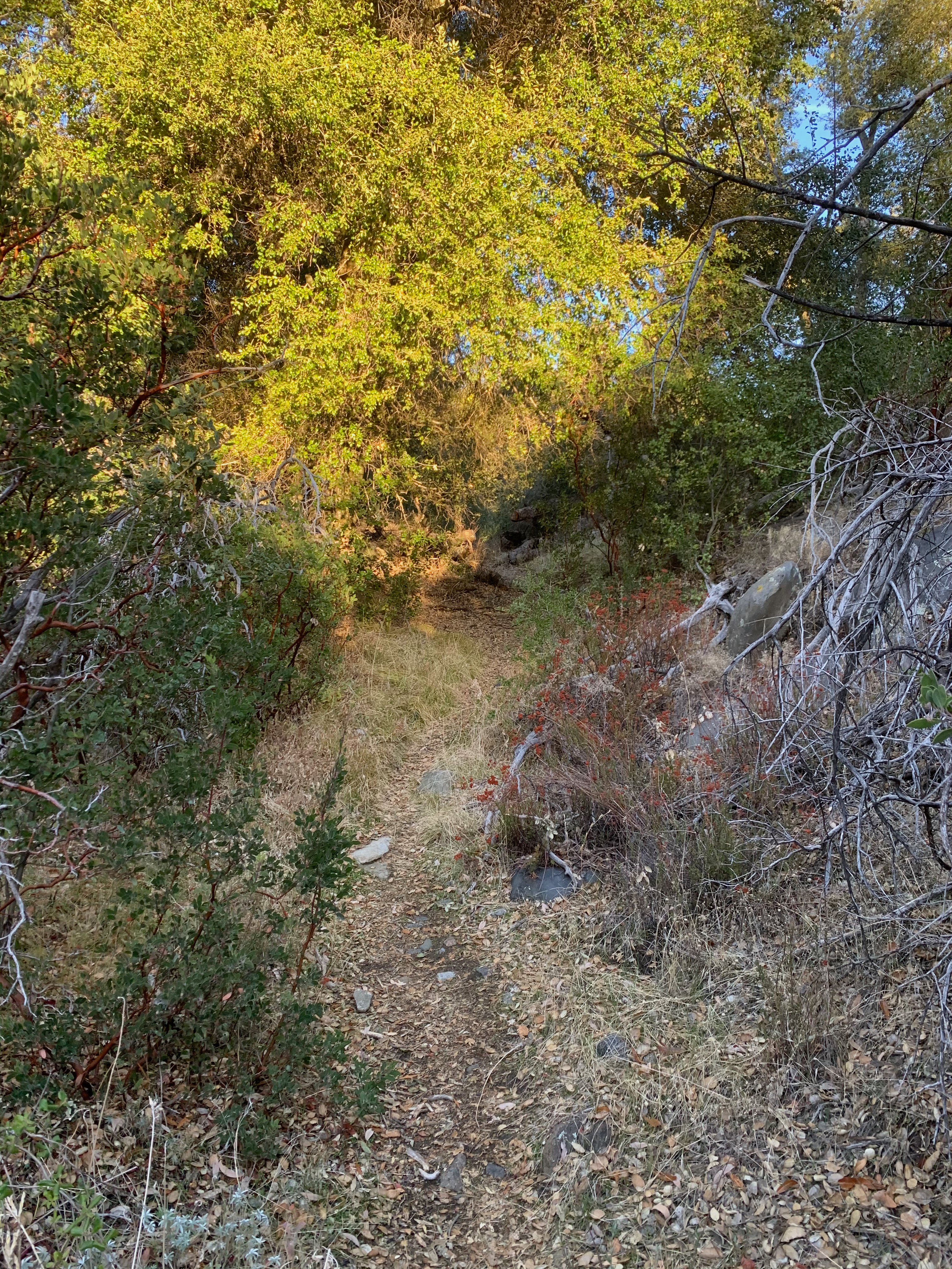
I got to the trailhead a little after 7am and it was pretty cold – below freezing. After yesterday’s surprise snow on Granite Mountain, I clipped some Yaktrax to my pack and headed up. The trailhead is actually a bit hard to find – you have to backtrack down the road from the parking area and pass through a cattle gate that you actually can’t really see from the road. My track from January 2019 came in handy as a refresher. The trail begins by paralleling the road alongside a gully for nearly a mile. It’s a pretty walk, with riparian flora all around. Just before one mile the trail turns left (it’s well-marked) and begins an extremely rutted climb. At the turnoff I took off a layer, and also noticed some cat prints in the mud. They were smaller than the ones we saw yesterday, so I figured they were those of a bobcat – but all the same, whenever I went through thicker brush, I was loudly serenading the forests with whatever song came into my head!
Eventually the trail smooths out and opens up and the views begin. In my head I nicknamed this trail “the Falsies” – it is riddled with false summit after false summit. The early ones are obviously not the summit – too soon – but I think the damn mountain fooled me three times as I approached the true summit. In Appalachian Trail culture they call these “PUDs” – pointless ups & downs. But I suppose it’s a good workout, right?
Finally at the summit I was surprised to see a couple already atop. They were very friendly, I think a dad and daughter (her name was Erica and she was 19). We chatted for a bit and Erica took my photo. As they started down, I started looking through the trail register ammo boxes. There were two, both inside of a larger case. One had a full notebook. The other had a messy crumple of papers. I had brought a new logbook with me so I wrote my name in it and placed it in the neater of the two boxes. I still wonder what to do with these messy caches. Erica said she looked through the mess and saw logs from 2006! My inclination is to clean out the box and bring the log papers home … but then what? I sure as hell don’t want to hang on to them, and certainly they should not be thrown away. I guess just taking the time to tidy up the box would have been good but it was cold up there and I did not want to take that on.
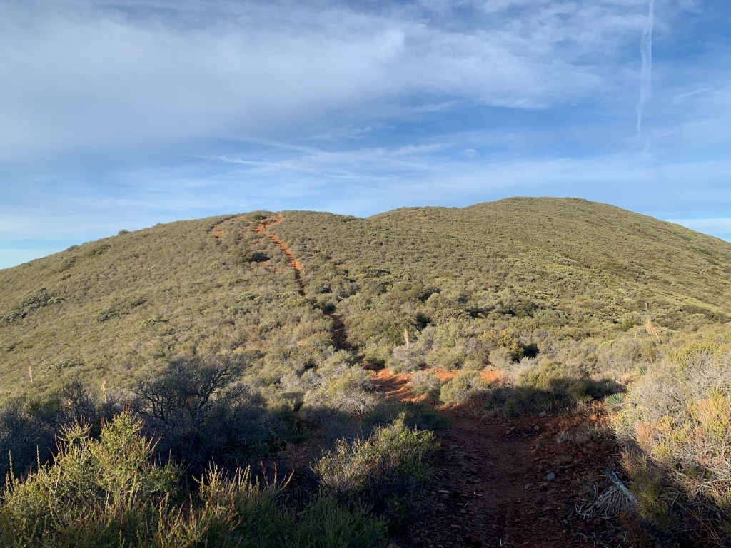
You can see all the “falsies,” one after the other! 
Me at the top! 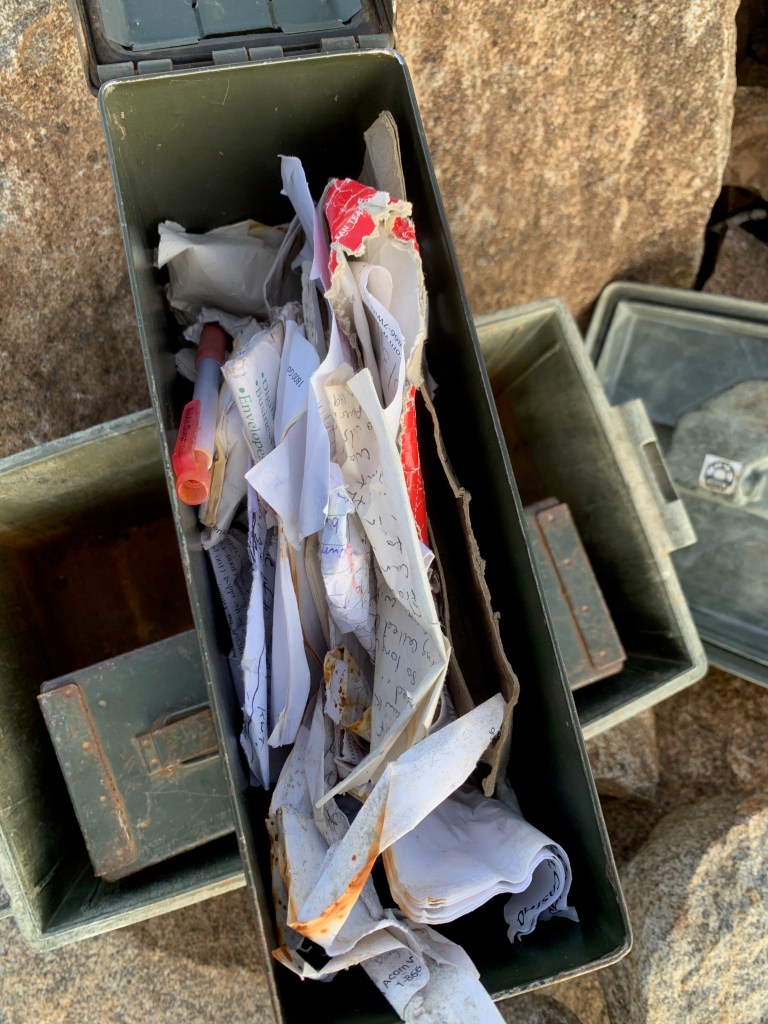
What a mess. 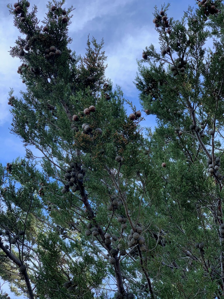
The rare Tecate Cypress 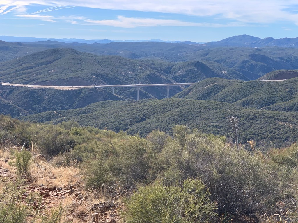
Great views of the Pine Valley bridge, one of the highest bridges in the country.
I had considered doing a second peak today – Long Valley Peak, just across the 8 and only a 4mi round-trip. But I decided I was pushing my luck with the family and should get home at a decent hour. But that meant that I could take my time with the current hike, so I decided to take the side trail down that goes by the groves of Tecate cypress. These are rare trees that are only found in a few places, including here. The side trail is steep, and is where I almost needed my Yaktrax, as it was snowy in places. However the snow was crunchy, not slippery; and it was easy to find dirt footholds around it. The unmarked use trail cuts steeply down around one of the Falsies, and then abruptly cuts to the right (south) back toward the main trail. It passes two larger groves of the trees but not close enough to observe, until it eventually comes right up to a few lovely specimens. I paused at one to take some photos and appreciate the tree … when I noticed several empty plastic water bottles of various types under the tree. WTF? Is this the “empty bottle” tree or something? As a hiker I passed later commented, how hard is it to hike your fucking empty water bottle out?? I usually hike with a trash bag but had forgotten to replace it recently so I was only able to carry out a few of them. So weird. (Messing around like this is why my time was not that much better than the first time I did this hike, following the same route.)
From there it was pretty much a straight shot back to the parking lot. I saw four more friendly hikers going up as I was going down, but otherwise I had the mountain to myself. Then I went to Starbucks. Peak #3 in the bag!
