
Grapevine Mountain & Bitter Creek
Miles: 6.6
Elevation Gain: 2,081 ft
Gaia Track
100 Peaks Challenge 2021 peak #5
Afoot & Afield #235
Sentenac Mountain
Miles: 2.2
Elevation Gain: 804 ft
Gaia Track
100 Peaks Challenge 2021 peak #6
Eagle Peak
Miles: 4.85 (including bushwhack)
Elevation Gain: 1,007 ft
Gaia Track
100 Peaks Challenge 2021 peak #7
Afoot & Afield #151
Lots has happened in the last three days to talk about! I thought about breaking this into two posts but decided not to – sorry if it’s TL;DR!
Friday
Last Tuesday I took my lunch break up on Sycuan Peak for Peak #4 – and on the way down this very short climb, my troublesome knee started complaining. That was all I needed mere days before our planned upcoming big hiking weekend! On Friday I was supposed to do a follow-up to my running gait analysis (which I did not blog about yet but probably should – it was pretty cool). So, I contacted the PT to cancel – running on a treadmill was clearly not a good idea right now – but instead he suggested I come in anyway and we can focus on getting the knee ready for the weekend. Duh, of course that’s what we should do. And OMG was that the right call!
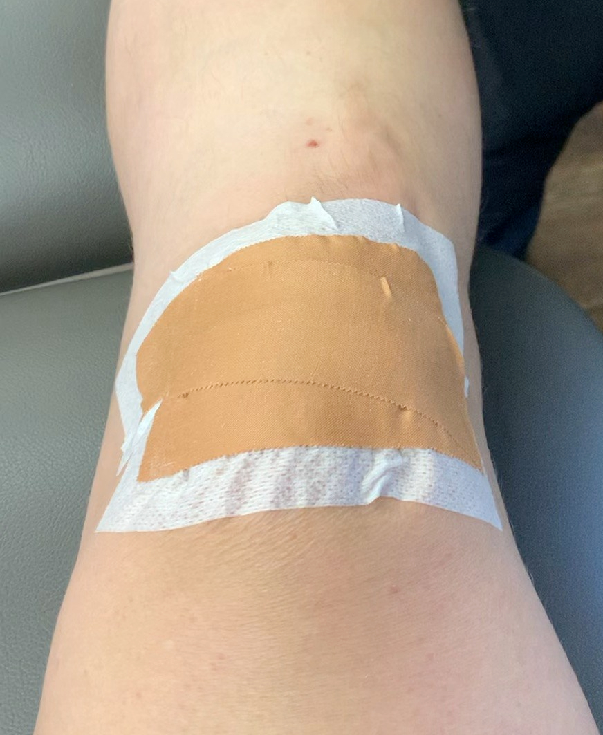
The PT (Dr. Arsen from Prehab) first assessed the problem (simple – kneecap not tracking straight). He then deeply massaged the area, applied cups, and orchestrated various other torture techniques I mean therapies. I’m sure all this helped but what I think helped the most was that once he was done he taped the shit out of it – in fact he did both knees, why not. My knees look like they’ve been through some kind of weird Battle Of The Knees. Thank goodness I don’t wear shorts when I hike.
Saturday
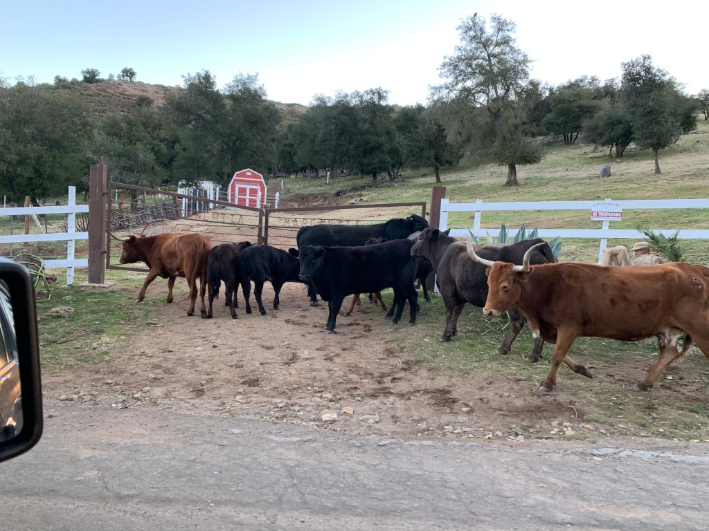
Yesterday was the test of the tape. My plan for January in general is to hit the desert one day of the weekend, and then a “non-weekday,” non-desert hike on the other day. Saturday was desert day, and I’d penciled in Grapevine and Sentenac Mountains. So, early on Saturday, four of us badass gals headed out to Scissors Crossing to get started.
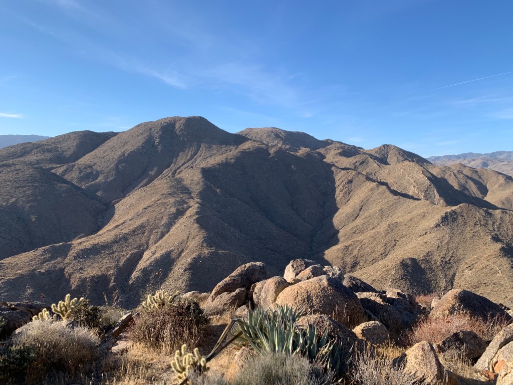
Grapevine Mountain has two main options for getting to the top. Both are about six miles, give or take. The more common route follows the Pacific Crest Trail for two-ish miles, then heads uphill cross country to tag the peak. There is another route described in Afoot & Afield (trip #235) that is a bit longer and with an extra ~500 feet of elevation gain, but quite honestly it looked more interesting: it did not use the PCT (which I’ve hiked already); it’s a loop (always better!); and it included more varied terrain (the dry wash of Bitter Creek). All of this sounded more interesting, and possibly more challenging, to me. And, in the first of many “I have the BEST hiking buddies ever!” moments this weekend, of course all four of us were like, yeah, let’s do the harder route!
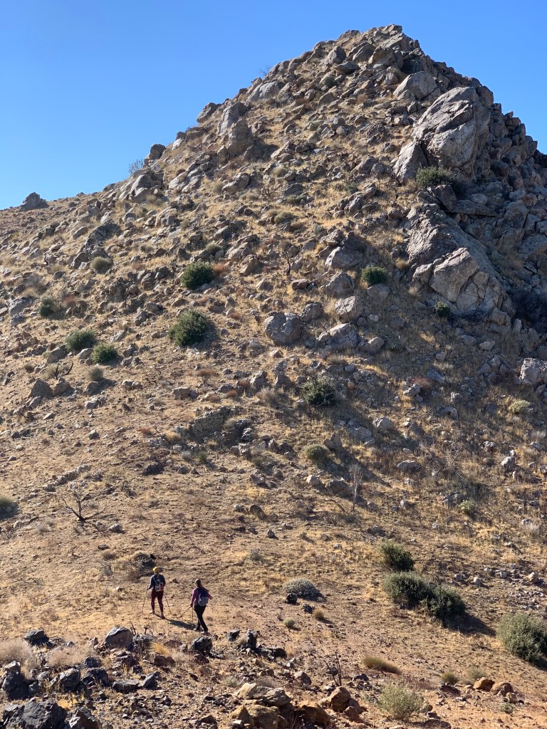
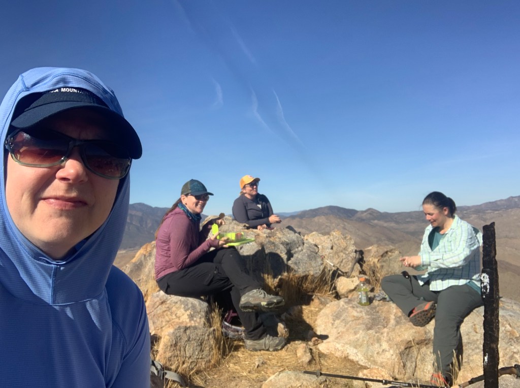
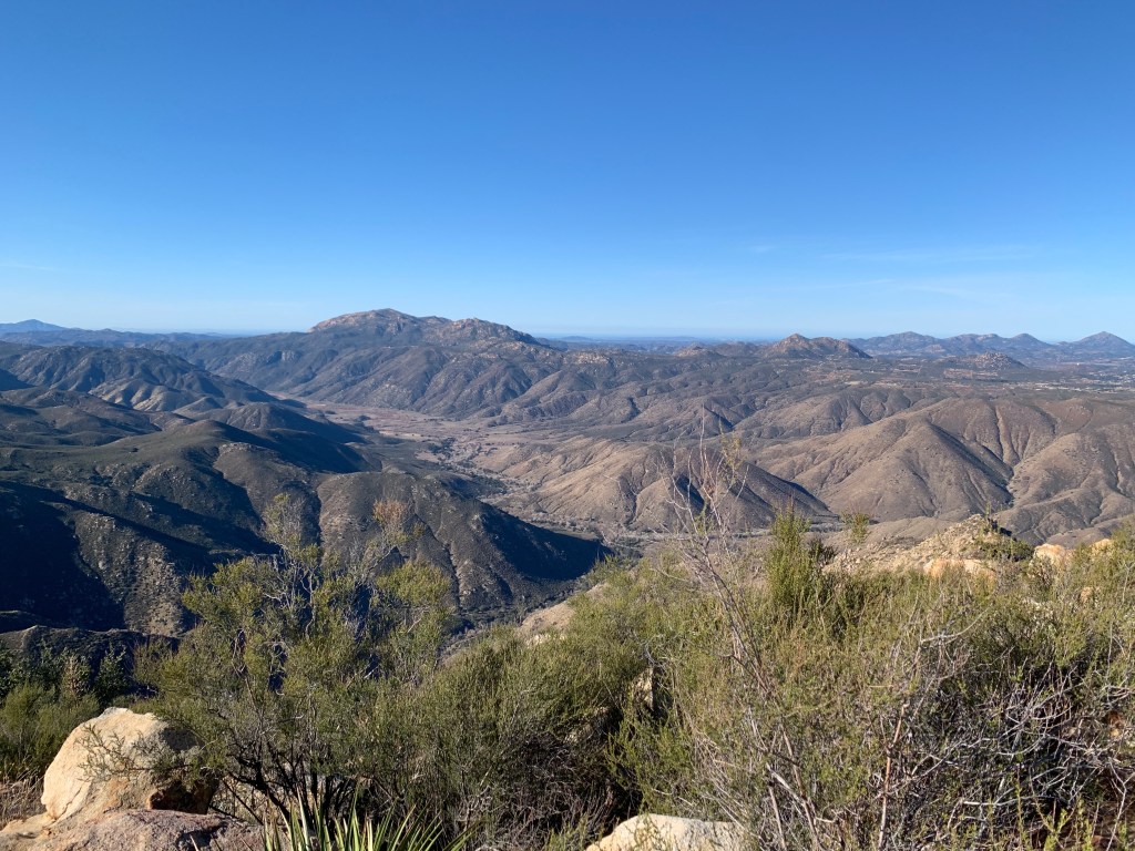
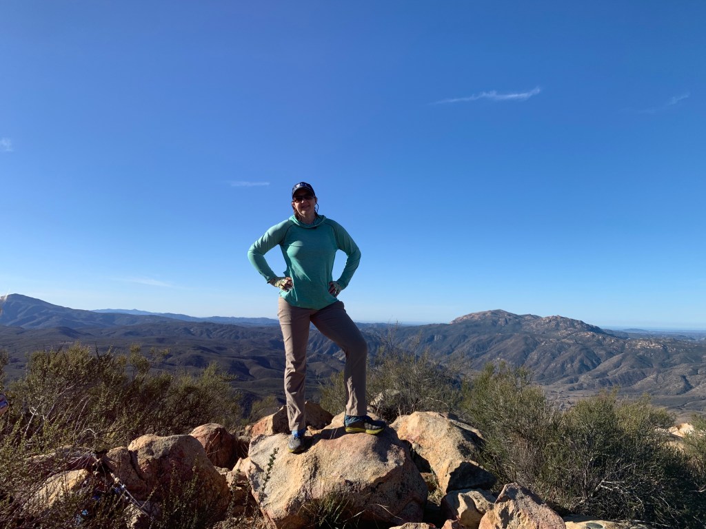
So we piled into Tara’s Jeep and headed up Grapevine Canyon – which only has one tricky bit requiring high clearance, where the road crosses San Felipe Creek shortly after leaving the S2. The loop hike started at a parking area a little over a mile up the road, and heads up into the hills to the west. The route wasted no time in climbing – we covered the first 2000 feet of elevation gain in the first ~2.5 miles! It was mostly steep climbing on slopes and along ridges with relatively little bouldering. The terrain was not hard except that many of the rocks were loose, requiring a bit of caution before using them as footholds. After a false summit or two (the new bane of my existence, apparently) we finally arrived at the wide top of Grapevine Mountain where we enjoyed the view, had a snack, and took the obligatory photos.
Now for the downhill, the test of the tape – and it was fine! A few twinges, but the knee held up, thank goodness. Buy stock in Rock Tape now! The descent began by continuing down the west side of Grapevine for a bit until it reached a saddle, then headed north/northwest down a steep ridge until we finally arrived at the sandy floor of Bitter Creek. The map shows a dotted line trail that heads slightly more northerly, and I’d marked this on my map as a possible track, but we opted to follow a slightly longer and less steep route that another peakbagger had recorded. Once on the floor of the wash we made good time. The only remaining obstacles were thick thorny brush as we neared the spring itself. At the spring an animal had overturned a rock to reveal some greasy (bitter?) water beneath.
We arrived back at the Jeep around 2pm. It was getting late, but Sentenac Mountain was tantalizingly close – just across the S2! Could we safely squeeze it in before it got too late? The Best Hiking Buddies Ever kicked in again and we all agreed – let’s go for it! The Jeep whisked us quickly up Plum Canyon to the California Riding & Hiking Trail trailhead. We wasted no time in getting started.
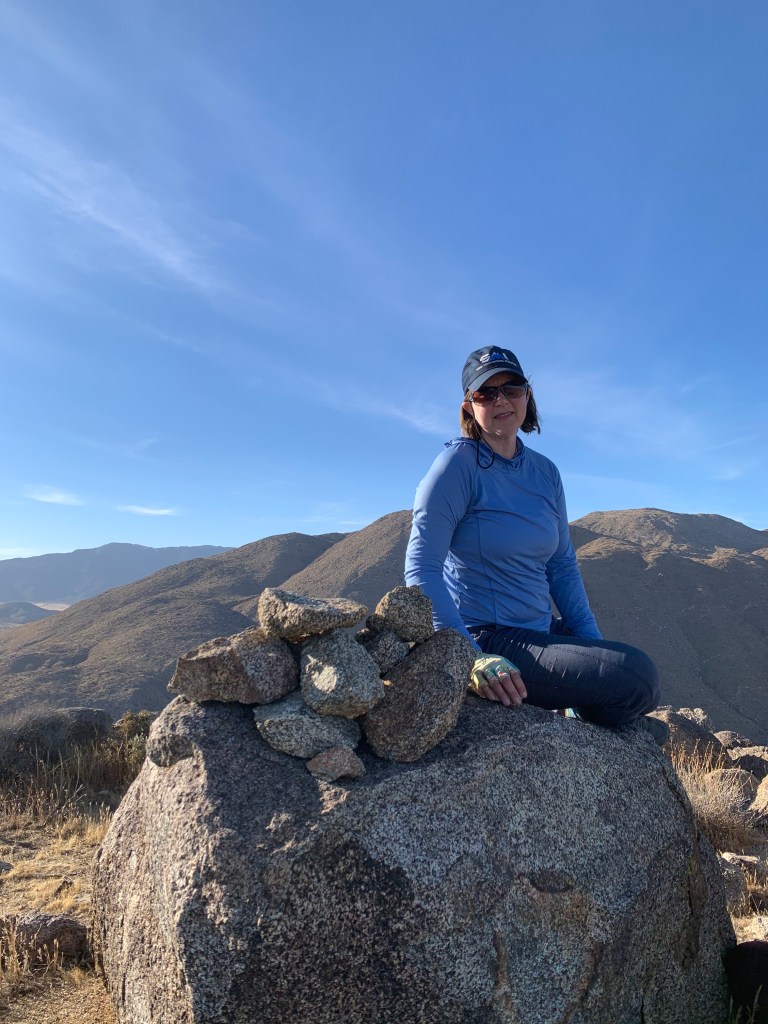
Sentenac Mountain is a straightforward hike that begins at the CRHT, following that lovely trail for about a quarter mile, before the route turns offtrail up a wash. The bouldering up the wash was lots of fun and we made quick work of it, until it was time to abandon the wash and head up the steep hillside. It was hard but short, and we soon arrived at the summit. Logged our names in the register and took some photos, but we did not linger. We headed down via a steeper and more direct route back to the wash, and got to the car before 4pm. Just as we were arriving at the car I sucked the last of my water out of my 3L bladder – I have literally never done that before on a hike! (Have no fear: I do carry extra emergency water in my pack.) It was a GREAT day and we felt very accomplished.


Sunday
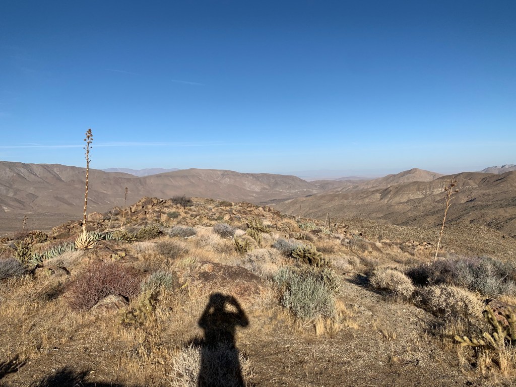
The plan for today was to hit three peaks near the Three Sisters trail: Eagle Peak, Sunshine Mountain, and Ant Benchmark. Welp, we only managed one of them, Eagle Peak. The reason I was hoping to bag all three of them in one go was that the trailhead is a bitch to get to – it’s a 1:10 drive on a windy road through San Diego’s backcountry. It is an area that cannot be hiked in the summer because it gets way too hot. Finally, this is an annoying area to hike because of the ridiculous popularity of the Three Sisters Waterfall trail – the place is always packed, even on a day like today when the waterfalls are not flowing. (People are dumb.)
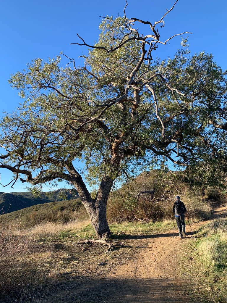
The hike started out fine. The Eagle Peak trail initially follows the Three Sisters trail but keeps going straight, instead of turning down the hillside to get to the falls. The trail was clear and navigation was not an issue. We neared the summit and guess what? You guessed it; plenty of false summits to mess with your head! We overcame the psychological damage and finally arrived at the real thing. It was actually a beautiful hike, with lovely oak trees and plenty of views, with some challenging bits to keep it interesting. We even took a wrong turn on the way down that helped to keep it sporty.
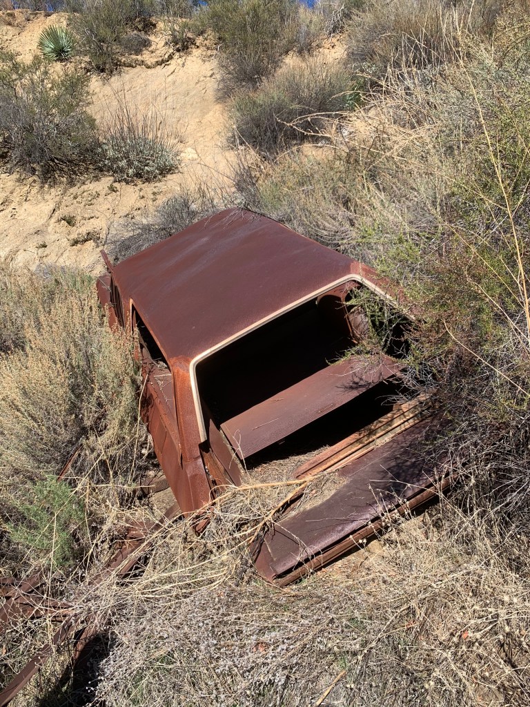
Here’s where things went awry. In an effort to avoid excess miles by going all the way back to the trail head, I planned for us to follow a trail that was on the map, and appeared to go through, but would cut off those extra miles. We started down the faint trail, which required some bushwhacking, but was not awful. Down the slope we could see a rusted out wrecked car ahead, at the base of a cliff. It looked like the route would take us right by it, so that was neat. Soon enough we arrived at the car … but that meant we also arrived at the darn cliff! So much for cutting off some miles. This was going to be brutal. Going back up the slope we’d just bushwhacked down was not appealing; but going up the soft sand cliff would be dangerous. We scouted around for a while (and checked out the car – it had no engine, and there were a few other household items, so we concluded it was dumped there) until Scott managed to find a possible route up the cliff. Our party of five slowly started up, digging our trekking poles deeply into the soft sand, and pulling carefully on shallow-rooted shrubs that could barely hold us. With only one casualty of a single trekking pole, we finally got to the top and emerged onto Cedar Creek Road.
It was this moment when I felt the most gratitude for my amazing hiking companions. I know that this 100 Peaks Challenge is going to come with ups and downs, literally and figuratively. I am going to make some mistakes. Today was a big mistake. We were clearly done for the day – no one (myself included) wanted to keep trudging through the now-warm sunny day for any more peaks, especially after yesterday’s long day. But instead of being grumpy and irritated at me for leading us through a poorly-planned bushwhack, everyone was excited to have conquered the cliff, and gotten in a bit of bushwhacking – only a little blood here and there! Yay adrenaline! You guys are the best. Sunshine Mountain and Ant Benchmark can wait for another day. Three peaks (including one hard one) in a weekend is good enough for me!

Sounds like quite a collection of adventures! I am trying to figure out what part of the Eagle Peak Trail you were trying to shorten. It’s almost a straight light from the trailhead to the peak. I’ve spent many trips out to the area, even backpacking overnight nearby with my daughter, but I’ve never seen that car. Could you give me a hint of where it is?
Pingback: Top Ten! Maybe Top 5! | laughter & sleep
The description of your hike sounds very appealing.