
Ant Benchmark
March 20, 2021
Miles: 1.6
Elevation Gain: 328 ft
Gaia Track
100 Peaks Challenge #39
Sunshine Mountain
March 20, 2021
Miles: 3.5
Elevation Gain: 828 ft
Gaia Track
100 Peaks Challenge #40
Mount Gower
March 21, 2021
Miles: 7.2
Elevation Gain: 1691 ft
Gaia Track
100 Peaks Challenge #41
This weekend we were planning on heading up to Mammoth, but that didn’t happen due to work conflicts. So we put together a last-minute plan to knock out Ant Benchmark and Sunshine Mountain on Saturday, two peaks we had intended to do after Eagle Peak, but didn’t due to my bad decisions on navigation. It was good to get these two peaks out of the way as this area can get hot. Also it’s weirdly annoying to drive up there (the long and winding road…).
We had some mini-hikers with us on this day. Tara had Madelyn with her and I brought Paige along. My husband & son had plans that day (which is a whole ‘nother story) and I couldn’t leave Paige home for that long alone. She could have gone to her grandmother’s house, but I enticed her with promises of bushwhacking and bouldering. She later said, “Mom, you said we were going on a hike. You didn’t say we were going on TWO hikes!”
We were doing these hikes in the afternoon, which is unusual for us, due to Kali’s work commitment. We decided to do Ant first and drove up through Cuyamaca and along the winding Engineer’s Road (yay! A road I’ve never been on!) to Boulder Creek Road, where we parked at a turnout after getting a bit distracted by cows (there always seem to be cows in this area!). The others arrived, and we suited up – Tara had some boots for Paige, which was nice – and headed out. Ant Benchmark is a short, trail-less hike. We walked down the road a bit before turning up a use trail through oak and manzanita groves – in fact some of the biggest manzanita trees I’ve ever seen! Soon the route cuts across a field to the base of the mountain, and the climbing starts. There was some bushwhacking but not too bad. Lots of fun bouldering, and we soon arrived at the summit.
The summit had an informal register but with no pages left, so we did not sign in. We found two survey markers, but they were blank! I don’t know what that means – Tad thinks maybe they were installed unofficially for some local surveying.
We headed back to the cars at a slower pace than usual due to our additional companions. Back in the cars we headed over to the Three Sisters trailhead. Our plan had been to drive along the dirt Cedar Creek Road to the Sunshine Mountain trailhead, and shave a mile round trip off the hike … but alas, the gate was closed. Every time I’ve been up here, and in every trip report of this hike I’ve read, the gate has been open. Why today, of all days, when we had grumpy tweenagers in the backseat, was it closed!? Sigh. We guessed that it was due to the recent rains.
Well we were there, so we were going to hike. We parked in the Three Sisters lot (which was half empty due to the late hour) and began our trek down the dirt road. We turned north where we would have parked, and followed a relatively clear use trail past the dry pond and up the slope. Eventually we had to depart from the use trail and bushwhack in earnest. We did not have to bushwhack far, and in fact there were lots of little clearings amidst the shrubs, so it was kind of fun – like following a corn maze. Finally we arrived at the base of the rocky mountain.
By this point, the girls were done. We coaxed them up to a rocky outcrop and got them settled with candy and promises not to climb around too much while we were gone. I gave Paige my InReach satellite messaging device, with tracking enabled. I showed her the SOS button but cautioned her not to press it unless it was a TRUE DEADLY EMERGENCY – like one of their heads falling off! And with that, off the grown-ups went to bag the summit. From there we were able to follow a cairned route most of the way up the rocks until we arrived at the top. Took our pics, signed the log, and hustled back down to the young ladies in waiting.
The rest of the hike back was fairly uneventful – the girls got a second wind from their rest, and downhill is easier, so Paige was chatty on the way, and we enjoyed the early evening scenery. By the time we were back at the cars and headed home, the sun was setting over the canyon. It was a harder day than Paige expected but we both enjoyed the mother-daughter time together.
And now on to Sunday. I probably should make these into two blog posts but this is easier. For Sunday we decided to make an attempt on Mount Gower. My first hike on this challenge was a “failed” attempt on Mount Gower – I prefer to think of it as “practice” though. There are three summits in (or just beyond) the Mount Gower County Preserve, and the peak that most people think of as “Mount Gower” is actually False Gower. The next one on the ridge is Middle Gower, and then finally the actual Mount Gower. I hiked False Gower back in December when I had decided to do the challenge, and scouted the beginning of the bushwhack across the saddle to the other two summits. It looked doable, and with the hike so fresh in my mind I decided to do it as my first summit of the challenge. As you can read in that post, the bushwhacking defeated me.
After that experience I did more research and learned about a route that skirts False Gower entirely and wends around to the other side of the peak. The review I read said there was no bushwhacking and that it was a cairned route. We also decided to shorten the mileage a bit by taking the shortcut by the water tower.
On Sunday morning our crew met up on the side street in the San Diego County Estates neighborhood and headed up the paved pathway. We skirted around the barbed wire fence enclosing the water tank and joined the main trail. Gower is a tough hike, and the steep ups & downs took work. Finally we arrived at the “dragon’s teeth,” which is where we’d normally turn off for False Gower, but we continued straight along the main path. Here the trail descends a bit and curves around to the east. Soon we departed from the main trail – an easy point to miss – to head cross-country nearly due west toward the peak.
As we crossed the flat open space we marveled at the ground cover – red-hued grasses and yellow flowers were abundant. The rocks were covered with multi-colored bunches of moss and lichen. As we ascended we passed lush rock gardens with streamlets trickling across the granite. Dudleya were peeking up between cracks in the rocks, and yucca blooms were emerging from their spiky leaves. Cairns were well-spaced and very clear. Where the brushes became thick, someone had recently trimmed them back! This was turning out to be one of the loveliest trails I’ve hiked during this challenge, maybe in all of San Diego! We were astonished.
There were some rocky bits to climb over, and some care with footing, but in general it was a straightforward climb to the summit. The top of True Gower turned out to be broad and wide, with amazing views and a flat granite slab on which to have our snacks. We could have stayed up there for lots more time, but we’d promised our families we wouldn’t be out all day. Reluctantly we packed up and headed back down. We all agreed that this hike is in our top ten, maybe even top five, for San Diego County.
One note: Yes, we took the possibly-not-quite-legal shortcut up past the water tower. If you have more time and are up for the challenge, doing the whole hike from the preserve’s trailhead (with it’s surprisingly clean bathroom, according to Tara!), it is much more challenging (probably over 10 miles), but the little canyon it drops into is also lovely. So definitely do it at least once.
Ant Benchmark
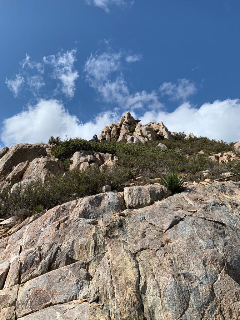
That’s where we’re headed! 
I’ve never seen a “blank” survey marker before. 
Ant Benchmark, Summit #39 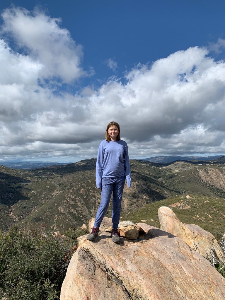
Ant Benchmark, Summit #1! 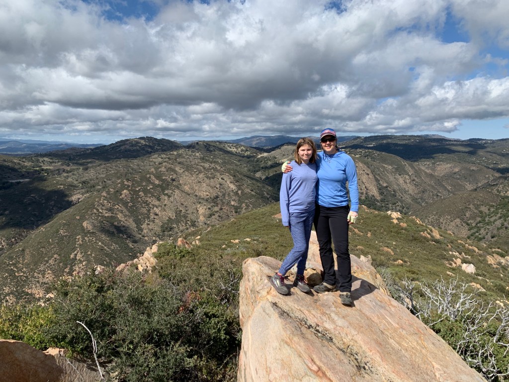
Mother-daughter outing 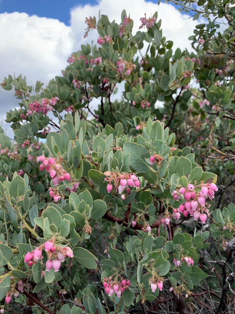
And as if the manzanita weren’t pretty enough, here they are blooming!! 
Paige let me put a ponytail into her hair at this point, LOL. 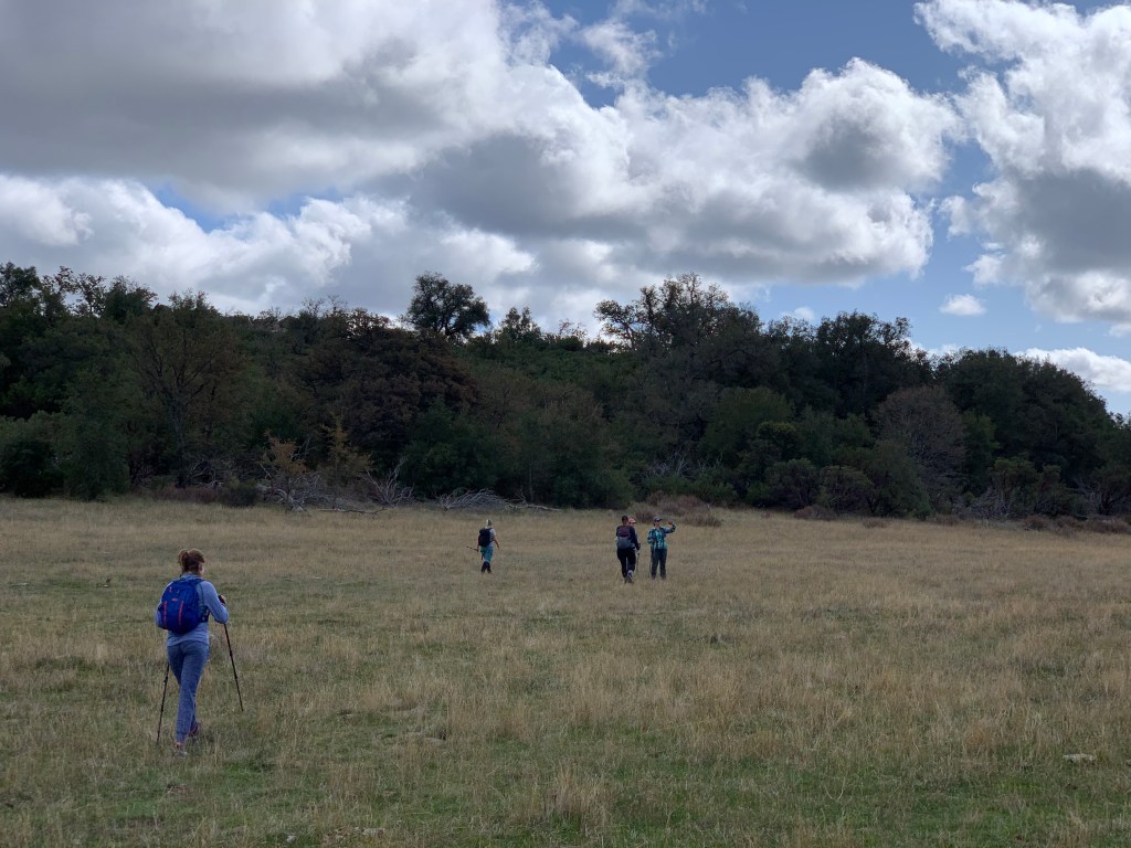
Crossing the meadow 
Through the groves of trees
Sunshine Mountain

Sunshine Mountain: Summit #40 
She did not hit the SOS button but she did figure out how to send messages! 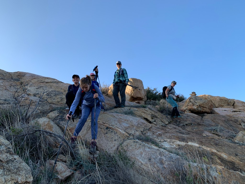
A steep bit 
Lovely canyon 
Sunset on the drive home
Mount Gower

It’s a henge! 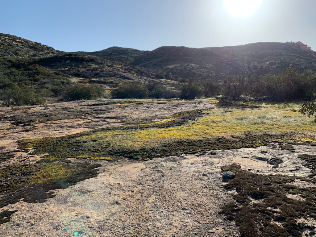
So pretty! 
Cairns just when you need them 
Mount Gower: Peak #41 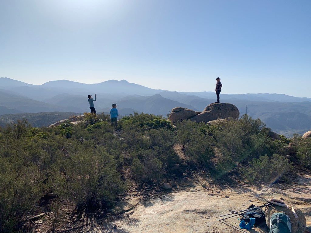
Photo shoot 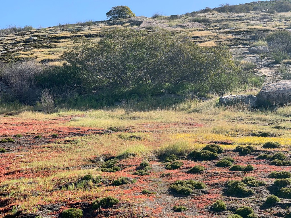
None of my photos do this justice! 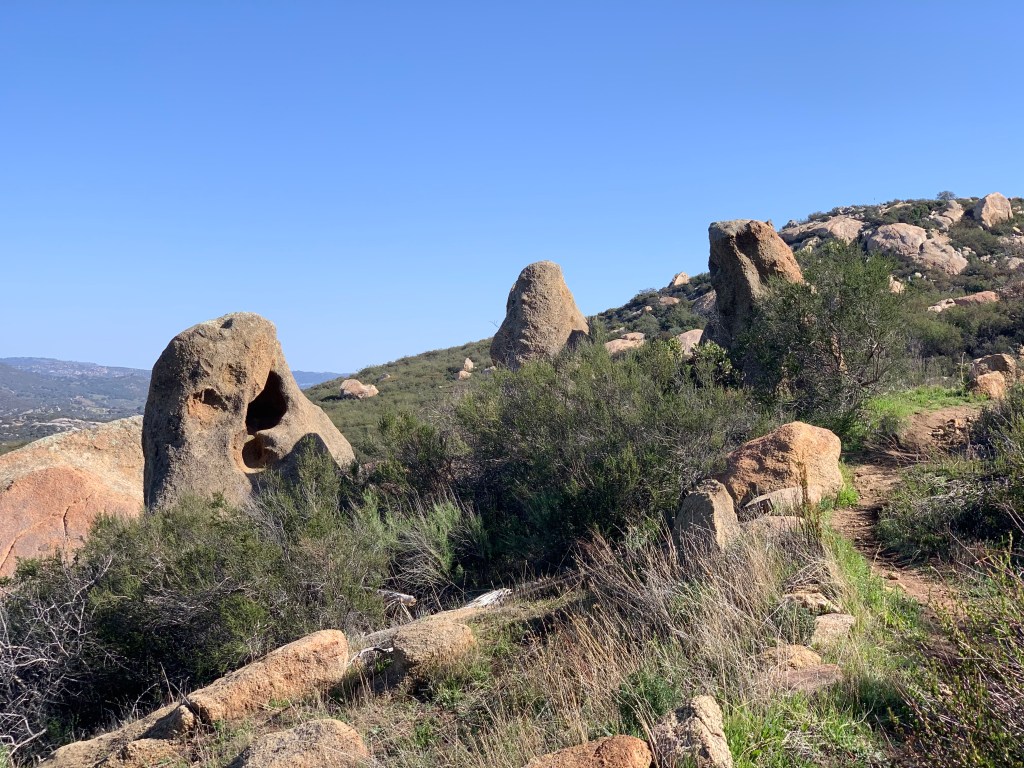
Dragon’s teeth
