
El Cajon Mountain
February 20, 2021
Miles: 11.1
Elevation Gain: 3210ft
Gaia Track
100 Peaks Challenge #28
Afoot & Afield 5th ed. Trip #102
Peak 3339
February 21, 2021
Miles: 5.8
Elevation Gain: 1083ft
Gaia Track
100 Peaks Challenge #29
Saturday
I’m sorry to report that we only completed two peaks this weekend (she says, hanging her head in shame…). This was an inverted weekend – usually the “hard” hike is in the desert, but this weekend the harder hike was in-town. We kicked things off with my first ascent (believe it or not) of infamous El Cajon Mountain. It is often referred to as the “hardest hike in San Diego County.” That is simply not true, if you consider the many challenging hikes in San Diego’s desert. In fact I don’t even think it’s the hardest non-desert hike on the 100 Peaks Challenge list – we have not done them yet, but I am expecting Agua Tibia and/or Eagle Crag to claim those titles when the time comes.
All that said, it’s still pretty damn hard. The hike begins along a driveway heading up from Wildcat Canyon Road, passing some private properties, until the “official” trail starting point. From there until the “saddle” I found it to be a very long version of Sycuan or McGinty Mountain – steep in sections, occasionally rutted and rocky. However it also had some tree-lined sections, and there was even water trickling across the trail in places. Beautiful views at every turn.
The trail reached the saddle, with El Capitan to the right, an overlook (now closed, due to nesting Eagles) straight ahead, and a well-marked (some might say excessively so…) but steep rock scramble to the left heading to the El Cajon peak. We turned left and made our way up through the rocks to the summit. Took our photos, found the three benchmarks, chatted with others up there already, snacked… the usual summit activities. Then we headed back down.
It had been relatively quiet on the way up, since we started at 6am; but on the way down we passed lots of people making their way up – this trail has become ever-popular since it was included on the San Diego Six-Pack of Peaks Challenge. We even encountered some friends making their way up, including our friend David hitting the peak for his 110th time!!! (That is NOT a typo!)
I had some issues heading down. I have a knee problem that flares up every once in a while that is probably a bone rub of some kind, as it is a sudden sharp pain that responds extremely well to sports tape… which I had not applied, and did not have with me. This caused me to slow down significantly. Every steep section I descended by hunching forward and limiting the range of motion my knee had to go through. Finally we got to the bottom and to our cars. It was noontime, so I swung by Panchos to pick up some Mexican for lunch. At home I was much more sore than I should have been – hunching forward to descend had taken its toll.
Sunday
During this challenge, our Sunday hikes have normally been more mellow, in-town hikes. Following our backwards theme for this weekend we instead went out to the desert today, for a hike that was just a wee bit too long to combine it with others in the area, but perfect for a less-strenuous day. What really made this a backwards hike, though, was the fact that it is “inverted” – the downhill portion is at the beginning of the hike, with only a modest ascent to the summit. As far as I know it’s the only inverted hike on the list.
The trail started in McCain Valley, at the Carrizo overlook. We arrived after an hour drive at about 7:30am. It was windy! But that was not a bad thing – it was chilly to start but we warmed up, and the breeze kept us nice and cool. Most of the hike – unlike nearly all our desert hikes so far – started on a clear and well-defined trail. In this case the trail is used by dirt bikers, and had lots of bumps – are these just natural features enhanced by the dirt bikes? I don’t know, but for a hiker, they are pretty annoying. We undulated our way across the desert, enjoying the peacefulness provided by the steady breeze, and – unlike yesterday – the lack of literally anyone else out there. All day we saw not a single soul besides us four. Finally the route departed from the dirt bike trail and we began bouldering our way to the summit.
There are a few rock piles in this area, and we had to keep an eye on the GPX tracks we’d downloaded to figure out exactly which one was Peak 3339. To get near the summit, we crawled through a rock tunnel. Locating the highest point on the summit – a large boulder with some small rocks placed on top – we decided this would be good enough. We probably could rock climb up it, but it was exposed and windy. Not worth the risk! We found the register (two, actually) and selected our photo shoot spots. Back below the windy summit we enjoyed the view and a snack, then headed back … UP! … to Tara’s waiting Jeep.
We arrived back at the Carrizo overlook around 11:30am, and I had a hankerin’ for a cheeseburger – and no one argued with me. We were really in the middle of nowhere, so hopes were not high; but on Google maps, in the town of Boulevard, I found a place called Matthew’s Live Oaks Restaurant. It turned out to be a fully-stocked convenience store with a built-in restaurant. We ordered from the cashier, and his wife cooked our food. They had a small, empty seating area that they let us use. It took awhile but the food was good, and the service was friendly. It hit the spot.

Produce stand at Blue Sky Ranch 
Sunrise on the El Cajon Mountain trail 
El Cajon Mountain stop sign 
Jeep! 
At the sign 
Summit rock 
Benchmark 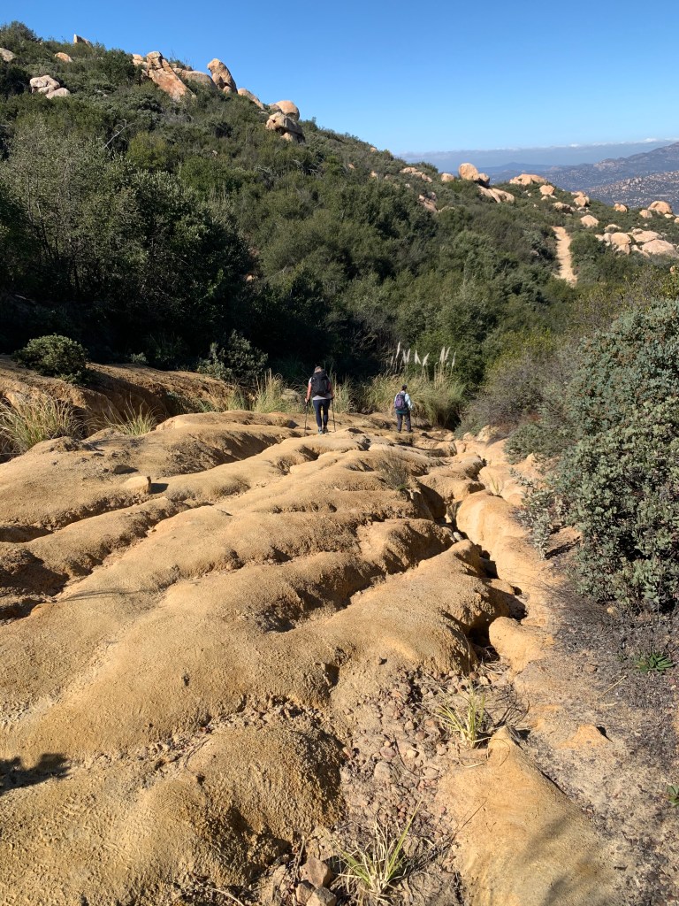
Rutted trail on the way down
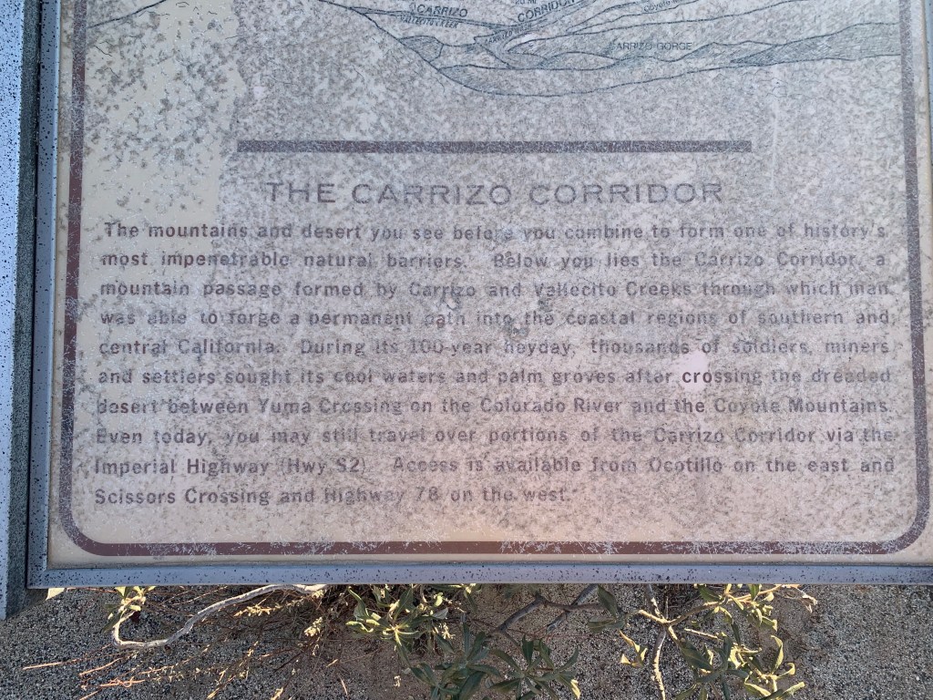
Carrizo Corridor 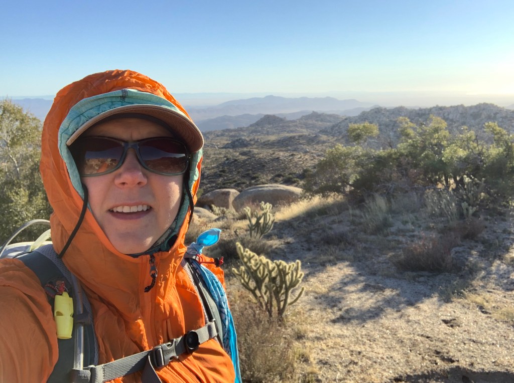
The hike started chilly and windy! 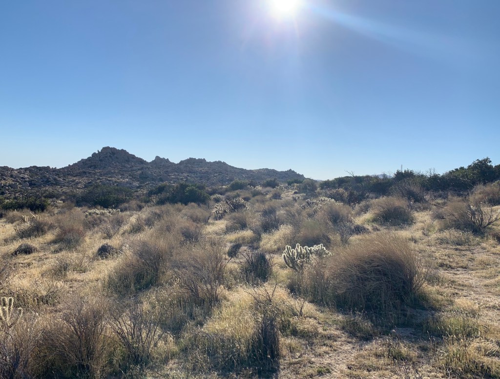
View toward where we were headed 
At the summit 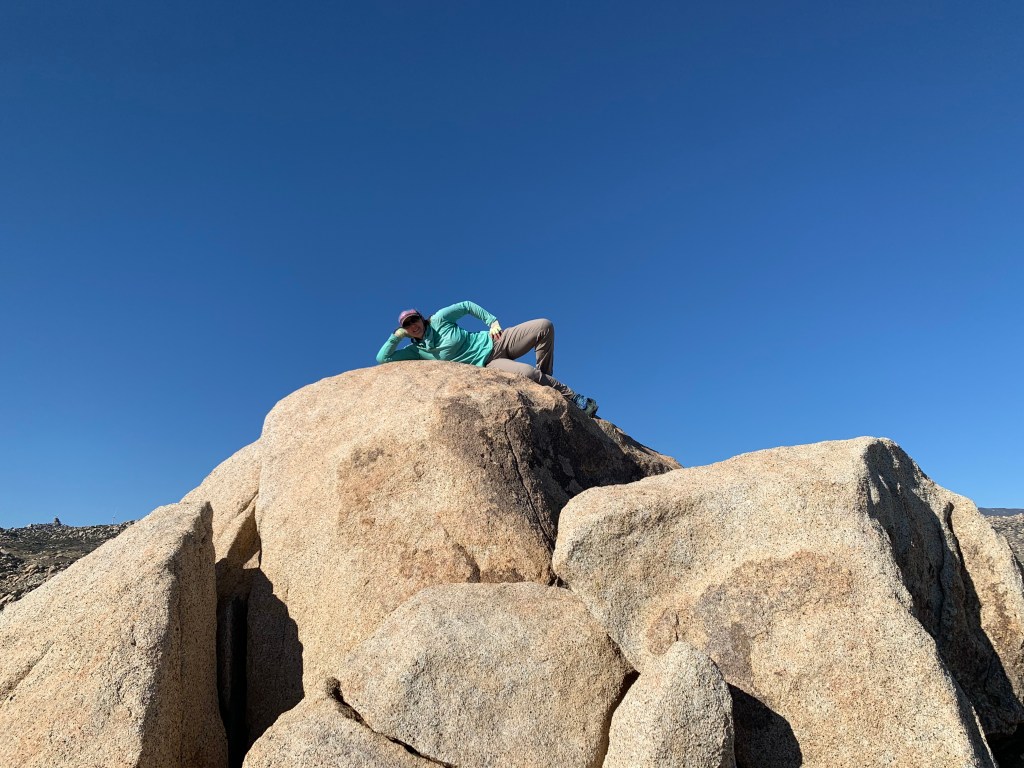
Summit-adjacent (close enough!) 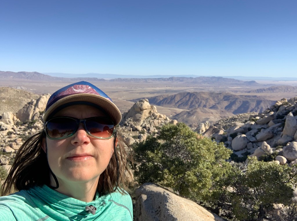
View to the north 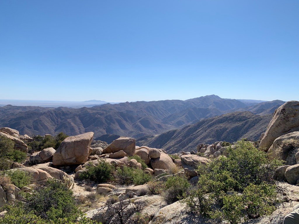
View to the southeast 
Windmills 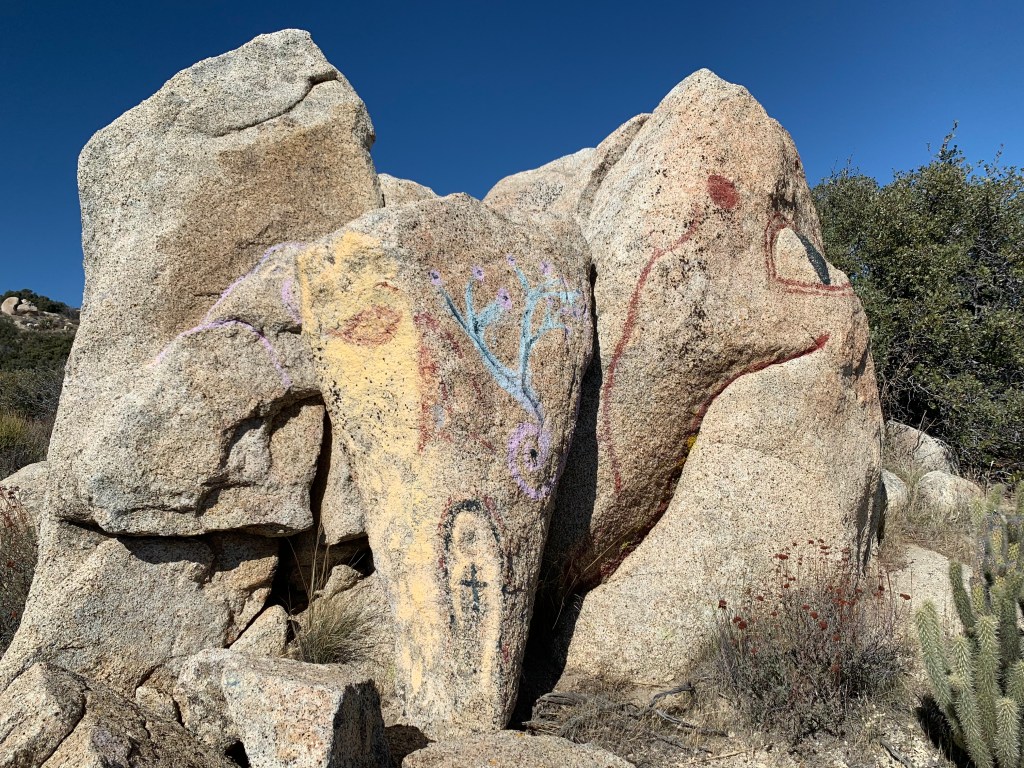
Graffiti
