
Palomar High Point
April 17, 2021
Miles: 0.6
Elevation Gain: 180ft
Gaia route (I did not record the track)
100 Peaks Challenge #54
Eagle Crag & Agua Tibia
April 17 & 18, 2021
Miles: 21.6
Elevation Gain: 3219ft
Gaia track day #1 (Eagle Crag)
Gaia track day #2 (Agua Tibia)
100 Peaks Challenge #s 55 & 56
Afoot & Afield 5th ed. Trip #123
I like hiking, and I really like peak bagging. But you know what I love? I love backpacking!! Eagle Crag and Agua Tibia peaks, north of Palomar, are remote enough that we decided an overnight trip was called for. They can be done as day hikes – two looong day hikes – but that just sounded hard. And you don’t really need to twist my arm to convince me to go backpacking. Yes, it would be a dry camp (i.e., we’d have to carry all our water), but I’ve done plenty of those (I live in San Diego, after all) – and honestly, we’d need nearly as much water on a super long day hike too. These are the only peaks on our 100 Peaks Challenge list that would be a backpack trip, and I was excited.
We decided to do this as a point-to-point hike, from the Cutca Trailhead to Dripping Springs. We got an early start, dropping one car at our end point, and carpooling over to our start. The Cutca Trailhead is en route to a third peak: Palomar High Point. We were considering doing that one on Sunday afternoon, but we made a last minute decision to do it right off. We drove the windy dirt road all the way up the north side of Palomar Mountain, and parked at the gate leading up to the high point itself. It was a short road walk to get to the top. Atop Palomar High Point is a fire lookout tower – one of three in San Diego county. Visitors cannot climb the stairs but there is a nice open area around the base. We took our pics and looked around for a bit, then headed back down. Peak #54!
We started our big hike around 9am. One of the reasons I was glad we were doing this as a point-to-point hike is that it allowed us to include the Cutca Trail, which is remote and hard to get to, and has been on my to-do list for a while. Afoot & Afield considers this hike to be one of the “best backpacking routes” in the book. The trail starts out inauspiciously – descending steeply and overgrown for the first mile, to a dry stream.
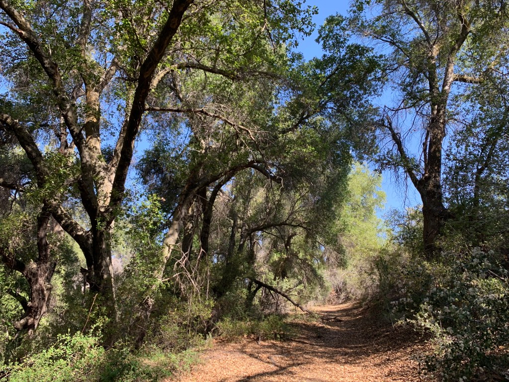
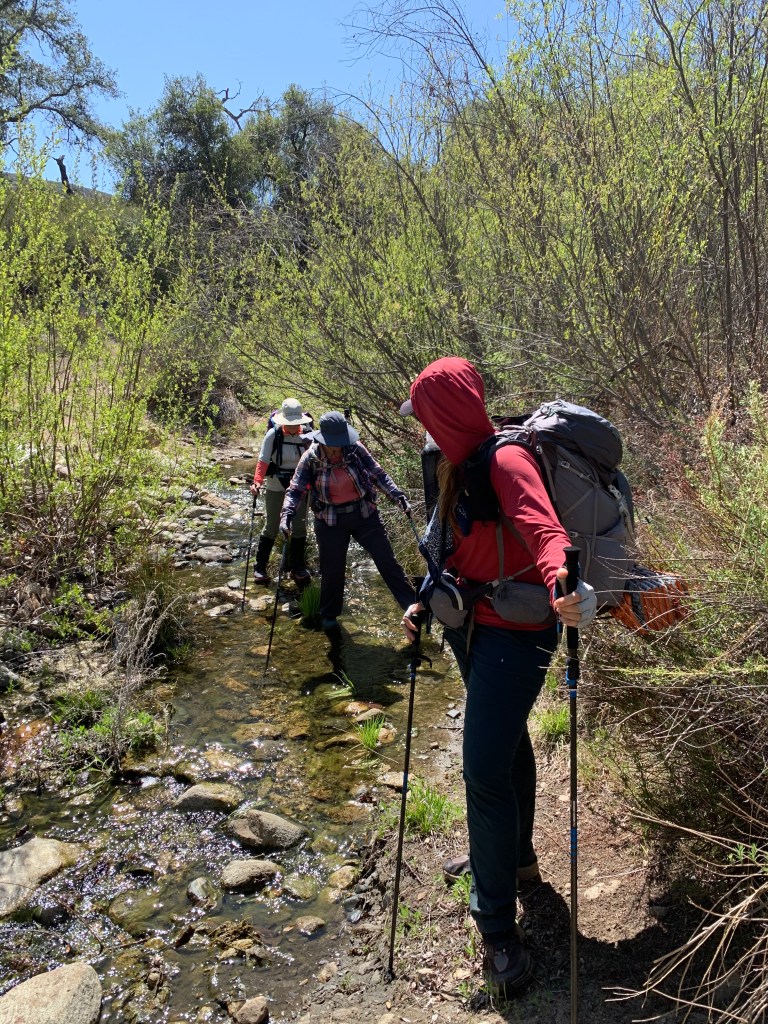
This trail really did have everything – good, bad, and beautiful. It was a long hike that meandered through beautiful lush oak groves; ceanothus tunnels; desert-like chapparal shrubs and manzanita; and open meadows. Spring flower blooms were stunning, and the smell of the lilacs perfumed the air. The first few streams were dry, but as we continued we found water in pools and some even flowing (albeit a bit green). We literally saw no other hikers all day and in this remote part of San Diego county it felt like another world, and like a true adventure.
As for the “bad,” well, there was poison oak everywhere, and ugh, the bugs!! I inhaled at least four of them. We all had bug nets and made good use of them, but they are hot and impair visibility so all day I was pulling mine on and off. But the worst part was that the portion of the trail along the stream just below the switchbacks was completely washed out. It seemed to have suffered a flash flood sometime within the last several months. For about three quarters of a mile we were climbing over ripped-out trees and boulders, and scrambling up the sheer sides of the drainage to get past obstacles – at least once requiring descending a sandy cliff back to the streambed. It was exhausting, and a little after noon we stopped for a nice long lunch break (I took a nap).
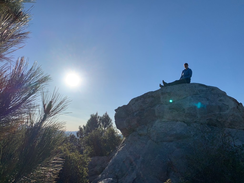
We got started again and ascended up the switchbacks until we arrived at the intersection with Palomar Divide Road. Our first possible campsite was here, but we wanted to get further first – and it was still early afternoon. We continued on to the base of Eagle Crag, dropped our packs, and “cameled up” – gulping down some water so that we did not need to bring any with us. The off-trail route to the peak began extremely steep but with a fairly clear use trail. Eventually the route leveled out and the bushwhacking began. We arrived at the rocky outcrop that was our destination. Peak #55!
Back on the main trail we continued northwest, descending now. The ceanothus were really encroaching on the trail here but I had no more shits to give – I was just plowing through them. It’s a miracle I never drew blood. Finally we arrived at Crosley Saddle, and right at the intersection with the Wild Horse Peak Trail, several camping sites appeared, and we stopped for the day.
It was only 4:30pm but it had been a long, hard day. I’d gotten my pack base weight down to 10 pounds, plus 17 pounds of water and 3 pounds of food for an even 30. I decided that with this glorious weather I’d skip the tent and bring only my bug bivy, and my warm weather quilt. It was the right call. Our campsite was lovely, with a bit of shade and a view of Pauma Valley to the south.
We got started early on Sunday morning. We knew from trip reports that our hike from here to Agua Tibia Mountain would involve a notorious blow-down section with several downed trees to navigate, as well as about 800 feet of climbing. We soon reached the blow-down area and worked our way over and under the limbs and branches … and then we were through. I think we were past the downed trees in about twenty minutes. Well that was nothing! Compared to our obstacle course yesterday this was a piece of cake.
Sooner than expected we arrived at Agua Tibia. The off-trail jog to the peak was a simple walk-up, and soon we were at the summit block. All four of us were able to do the quick climb to the top for our photo shoot. We admired the view and signed the register and then kept going. #56!
The rest of the hike, descending the Dripping Springs Trail, was easy but long. Finally around 8am we encountered our first other human on the trail – a super fast trail runner who had started his run only an hour earlier. We encountered a few more folks on this steady and well-maintained downhill – it was a lovely trail, but downright boring compared to yesterday’s adventure. A few miles from the bottom we even bumped into someone we knew (this actually happens fairly often – it’s such a cool hiking community here in San Diego).
Finally we got to the bottom, arriving at the Dripping Springs Campground, and began the drive to retrieve the car we’d left at our starting point. Doing this as a point-to-point hike took some time to deal with the car shuttles but in hindsight it was a fantastic way to tackle these peaks.
Day 1 Photos
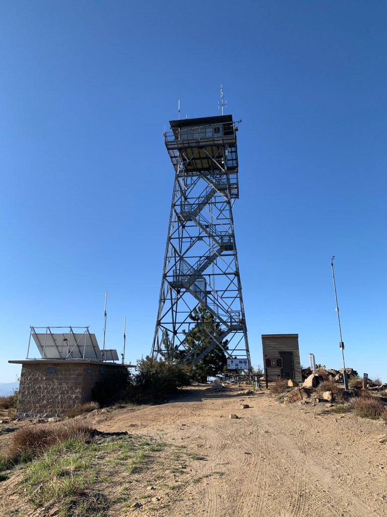
Palomar Fire Tower 
Palomar High Point, Peak #54 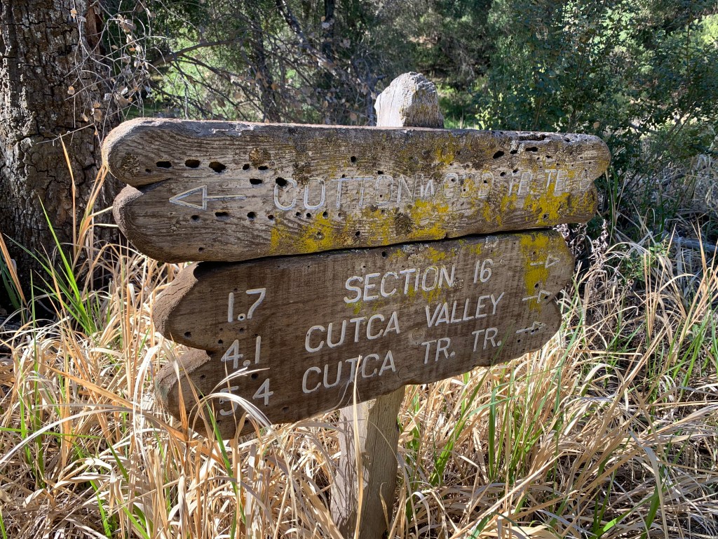

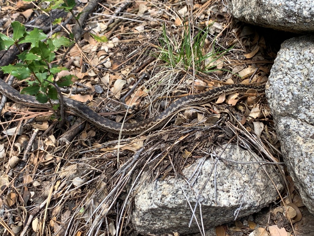
It’s a gopher snake! I also saw a garter snake. 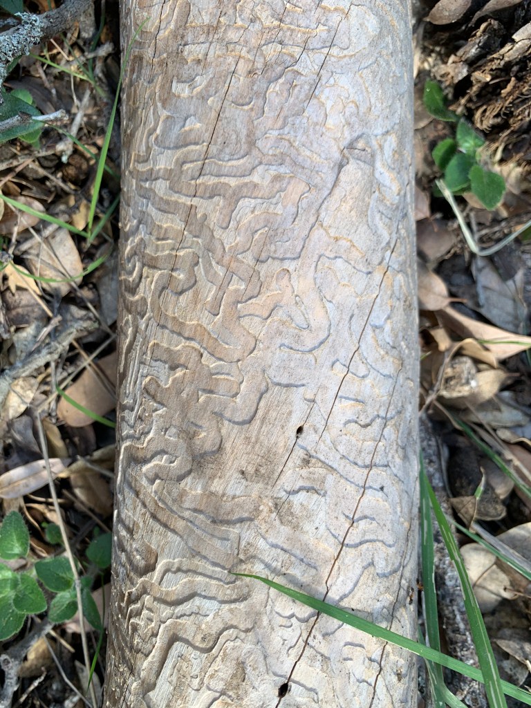

Eagle Crag, Peak #55. Notice the fly photobomb, LOL! 
Our campsite 
My bug bivy
Day 2 Photos

Good morning! 
Agua Tibia Mountain, Peak #56 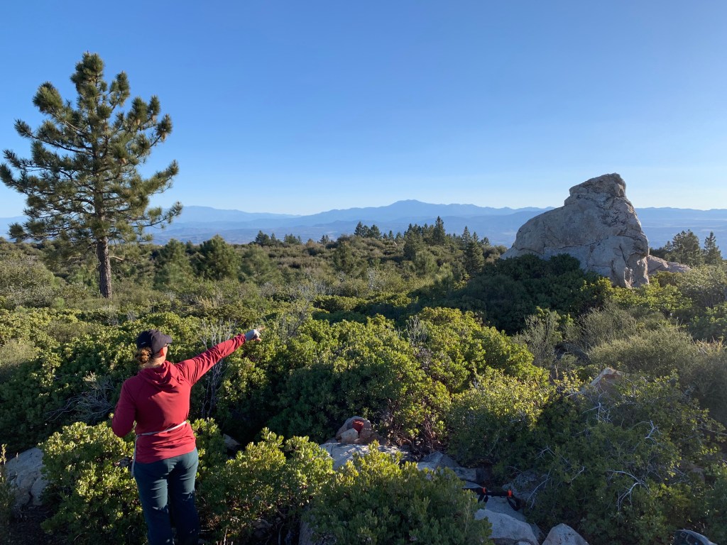
It’s that way! 
Look who we bumped into! 

Campsite post lizard
