
Mile High Mountain
March 6, 2021
Miles: 14.5
Elevation Gain: 4365ft
Gaia Track
100 Peaks Challenge #32
And here it is, the peak we’ve been building up to. I don’t want to take anything for granted, and you never know what challenges lie ahead, but at least based on statistics we have now completed the hardest of the desert hikes on the 100 Peaks Challenge list: Indianhead, Villager, and now this one, Mile High Mountain. This is a huge relief as it’s already starting to get too warm to hike out there. This also completes the hikes in the immediate Borrego Springs area, although there are still several elsewhere in the desert, and plenty others that are a long drive away.
This hike was tricky to plan. No matter what, it’s a long, hard hike. There are four routes to choose among and they all have significant challenges. My initial inclination was to take the most direct ridge route. This is the route described in Afoot & Afield (5th ed., trip 223). In fact, I have heard that there is discussion of renaming this peak – at least colloquially – to “Jerry Schad Mountain,” after the original author of this book, as this was one of his favorite peaks. This route takes Palo Verde Wash up the first few miles, then ascends the ridge above the wash, which it traverses all the way up to the summit. It seemed to me to be the most direct and least technical route.
The biggest problem with this route is that … no one seems to go this way. We typically research these hikes by checking Peakbagger.com, public tracks on Gaia and AllTrails, and other sources. We found almost no tracks taking this seemingly direct route. My theory as to why that is is that most hikers want to bag an additional peak – Rosa Point. This requires taking a different ridge up, and adds a bit to the mileage and elevation. In the interest of staying focused, we did not want to add in Rosa Point. In addition to being longer, this route still includes some steep scree-filled sections, according to reports.
The third route used the Villager ridge, which we’d hiked last weekend, and knew to be fairly easy. The problem with this route is that the saddle between the Villager and Mile High ridges is infamously brutal.
Finally, there is the route we ended up taking: up Rattlesnake Canyon. We enlisted a guide on this hike – Susie’s friend Matt graciously offered to take us up this route, which is his favorite of the options. The advantage of this route is that the majority of the hike is relatively easy as it follows a narrow wash up between the two ridges, passing Rattlesnake Spring. The elevation gain is gradual and steady, and the footing is solid. The challenges with this route are three (3!) dry waterfalls (aka exposed rock climbs), and then, well, at some point you need to get up off the canyon floor. So 7 miles of easy wash hiking followed by 1.5 miles of straight up.
We camped out Friday night and met up at the trailhead at 6am on Saturday. I knew immediately it was going to be a tough day. First of all, I am a dumbdumb, and I did something to my hamstrings at my normal weekly workout on Thursday. I did not think it was a very intense workout at the time, but two days later and my hammies were still sore. That is not good when you’re about to climb 4000+ feet. The second huge challenge of the day was that it was HOT. The weather forecast was originally low-70s, which would have been bad enough; but now the updated forecast was for over 80 degrees. And not a breath of wind until we were much higher up. In hindsight we should have rescheduled but with nine people on the trip that would have been annoying. Also, summit fever – wanna get this done!!
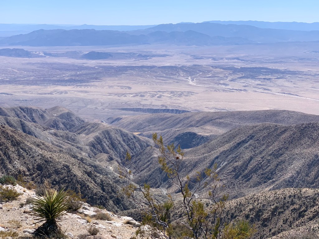
All this challenge added up. It was a looooong day. I’m sure if my hamstrings were less angry, and it was cooler, this hike would not have taken so long. The hike up, for me, was miserable. The rock climbs and boulder scrambles were super fun, but otherwise trudging uphill in the heat with angry legs was an additional challenge I did not need. We began the brutal climb out of the canyon at midday, and the heat really started getting to a couple of us. It was insanely slow-going. There was a false peak that at least I did not realize and it almost killed me with demoralization. Tara & I were both near heat exhaustion, but we both recognized this and kept a close eye on each other, and moved very slowly. At long last the summit was underfoot, and the Salton Sea – previously hidden behind the peak – came into full, unobstructed view. It was glorious, and we were relieved to summit… but it was also 1pm. Way too late to be up there.
We rested a bit and had some snacks, did our usual summit chores. While we ate, Susie read to us the many repeated entries of the infamous Sierra Club climber Steve Fausset – sounds like he comes up here every Tuesday! I guess it’s one of his favorite peaks too. We debated our options for descending. Our original plan was to split into two groups, with my group heading back the same way, and the other group proceeding toward Rosa Point & Pyramid Peak. But it was getting too late to bag additional peaks, and quite honestly we needed the help getting down. I can’t articulate how grateful we are that the others abandoned their plans to stay with us.
We descended a ridge slightly further south from the one we came up, which most of us found slightly easier (although at the bottom it was harder to get back to the main canyon). We were now chasing daylight. The upper waterfall cannot be avoided and fortunately was the least technical of the three. At the middle fall, the group split, with folks not comfortable with down-climbing hitching up and over. Those of us who decided to down-climb realized that we needed a spotter … but none of us were capable of getting down without one, so we were stuck. We were about to backtrack and join the others, when they appeared over the ridge. A few minutes later, the incredible Matt arrived, and, scampering over the waterfall like Spiderman, he helped the four of us find our footing. It was not difficult with the help, but impossible without it. At the last fall we split again, and this time Matt spotted us before helping the others. Again his help was essential. Again his agility and willingness to go back & forth was inspiring.
For me, heading back down the wash was truly fun and I was able to enjoy myself – by now it had cooled off, and my leg issue appeared to be isolated to my climbing muscles; my descending muscles (quads) were fine, and hopping down the rocks was super fun. That said, all the bypassing and one-at-a-time guiding down the waterfalls took a very long time. Fortunately we’d gotten past all the tricky spot before it got dark, but we still had several miles to go. Out came the headlamps as we rushed down the canyon. At the canyon’s exit, we were a bit spread out, and Kali & I zoomed right past the cairned turn to the south toward the cars. We realized it pretty quickly and backtracked. Another mile and a half and we were at the cars.
Normally after these hikes we rush home for a late dinner with our families, but at this point we were clearly not going to be home until 10pm – so no need to rush. Instead, we made one last stop at Los Jilbertos in Borrego Springs where we are practically regulars at this point. Since with this hike we are done with the hikes in the immediate BS area, it was like a goodbye dinner.

Let’s go! 
I’m thinking Silver Cholla 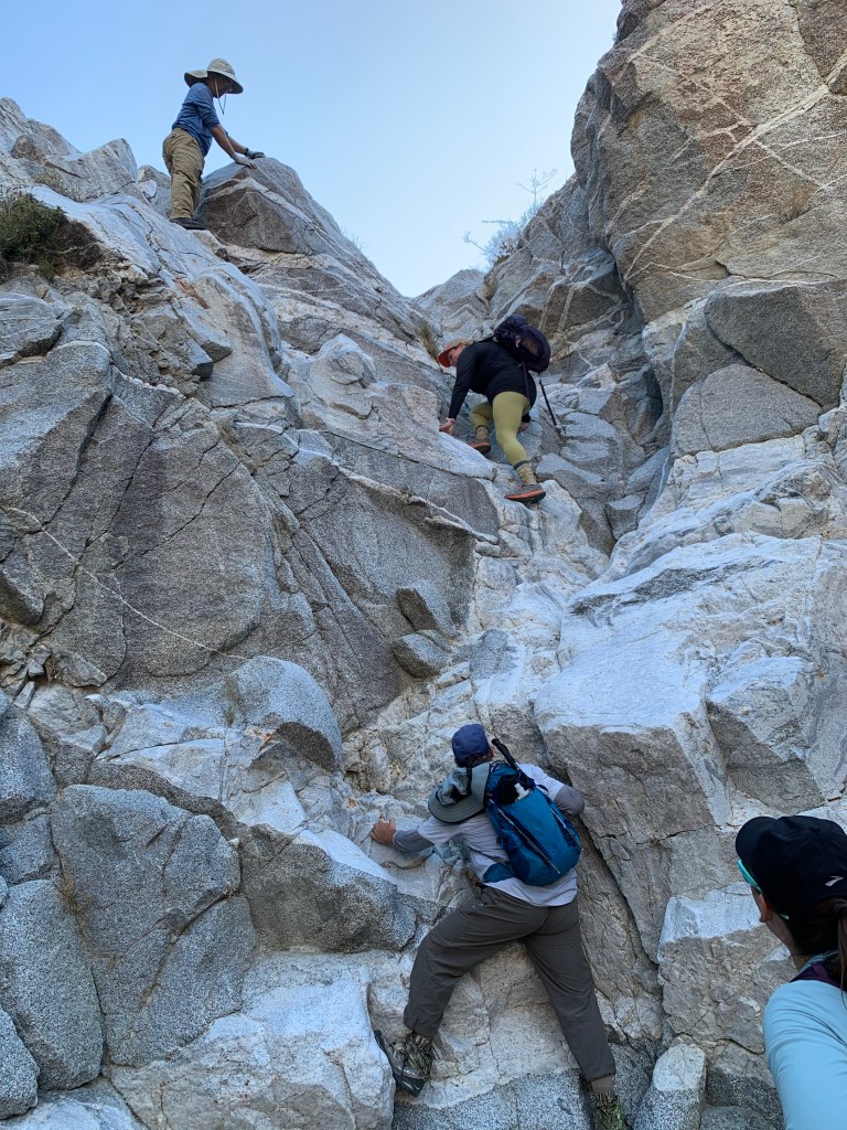
First waterfall 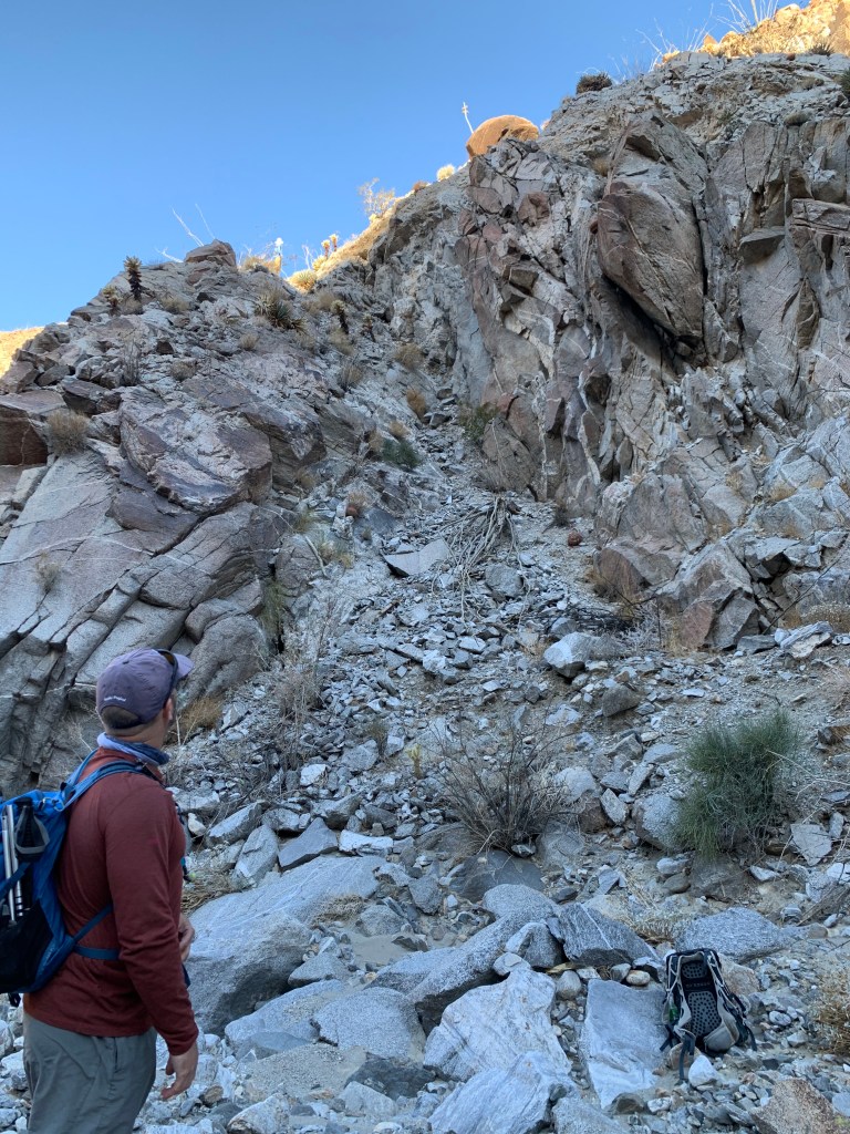
The bypass of the first waterfall is not much better… 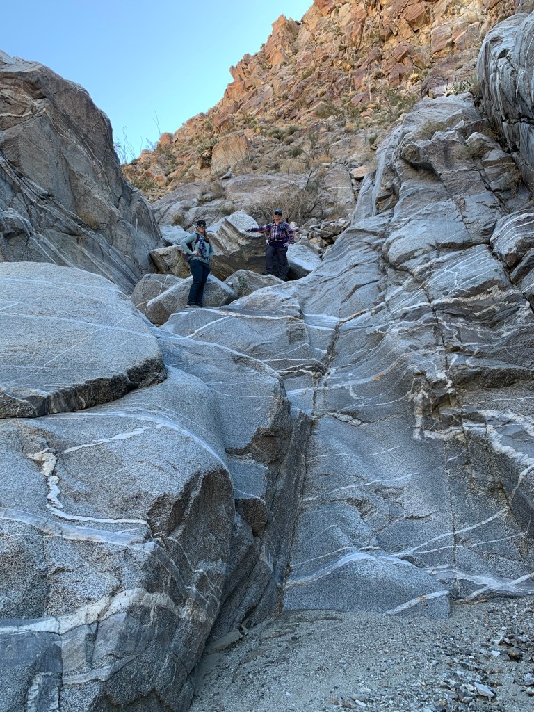
There was super fun bouldering along this whole route! I would go back again for a shorter hike. 
We found weird things on this hike. There must have been a flash flood recently. Here is a critter cam. We also saw an uneaten MRE, and clothes. The weirdest thing was a full-sized wooden baseball bat! 
Matt demonstrating the way up the second waterfall 
Just to the left of the second waterfall 
The third fall was the easiest 
From the top – unobstructed view of the Salton Sea! 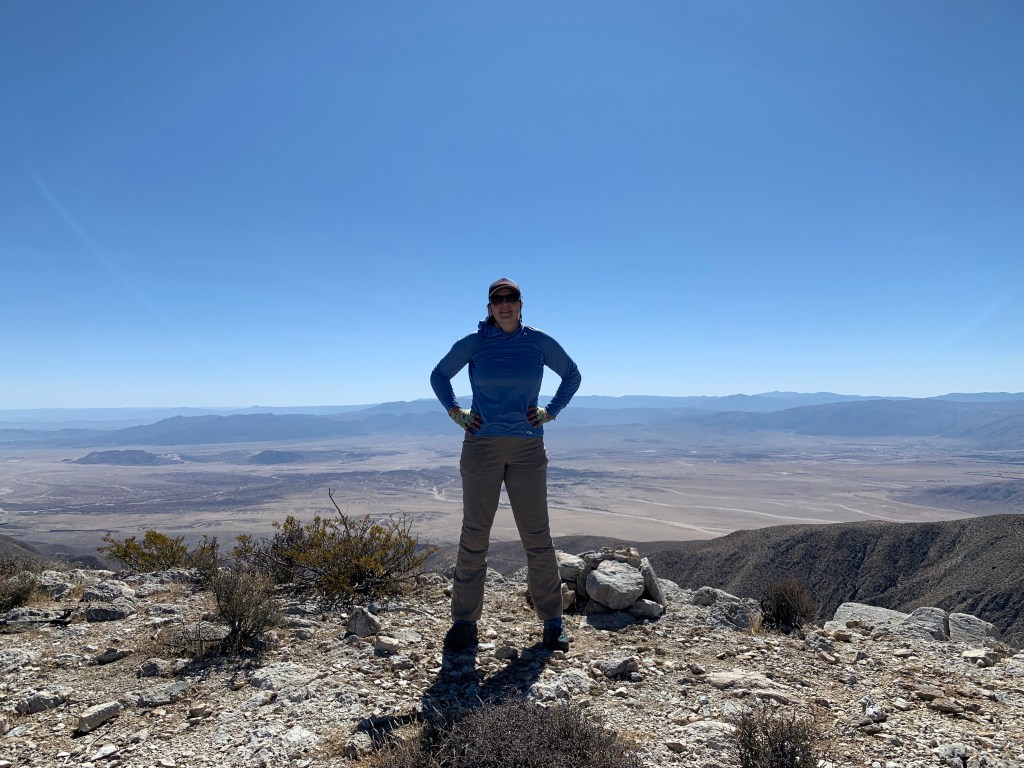
OMFG I made it!!!! 
If you look closely, you can see our cars from the top. 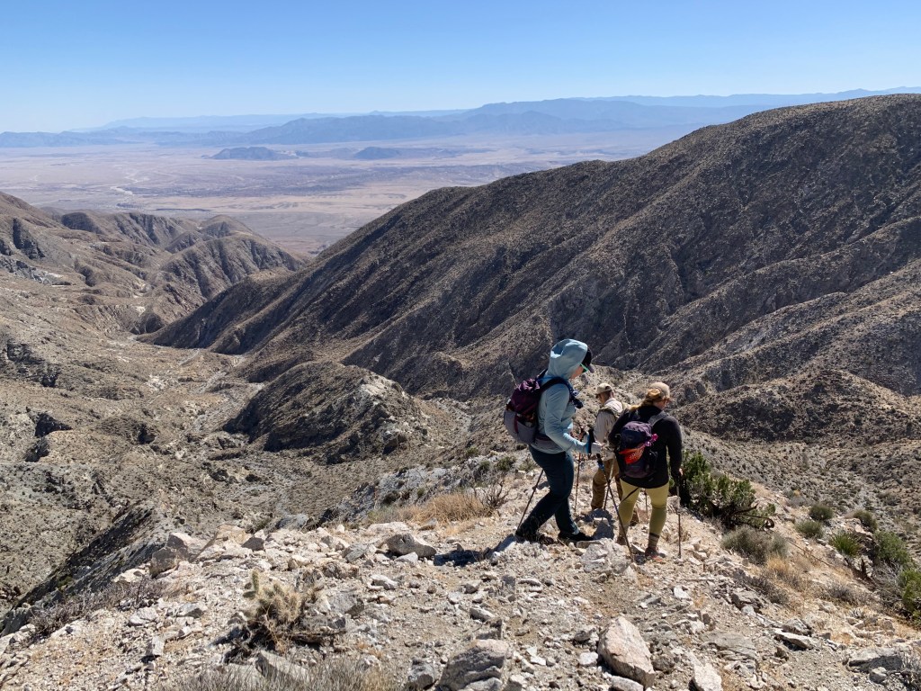
Time to head back down… 
The wash had some very cool geology throughout

Pingback: Mountain Monday | laughter & sleep
Pingback: Epic final desert weekend | laughter & sleep
Pingback: Summiting Mount Whitney via the Mountaineer’s Route | laughter & sleep