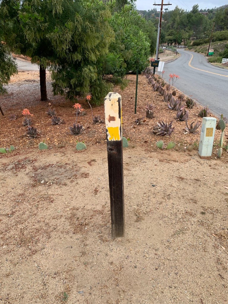
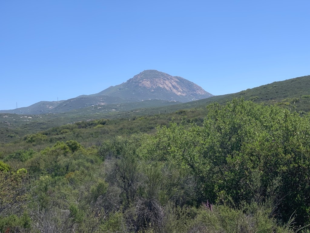
Mother Miguel June 5, 2021 Miles: 3.86 Elevation Gain: 822ft Gaia Track 100 Peaks Challenge #70 Afoot & Afield, 5th ed., Trip #118
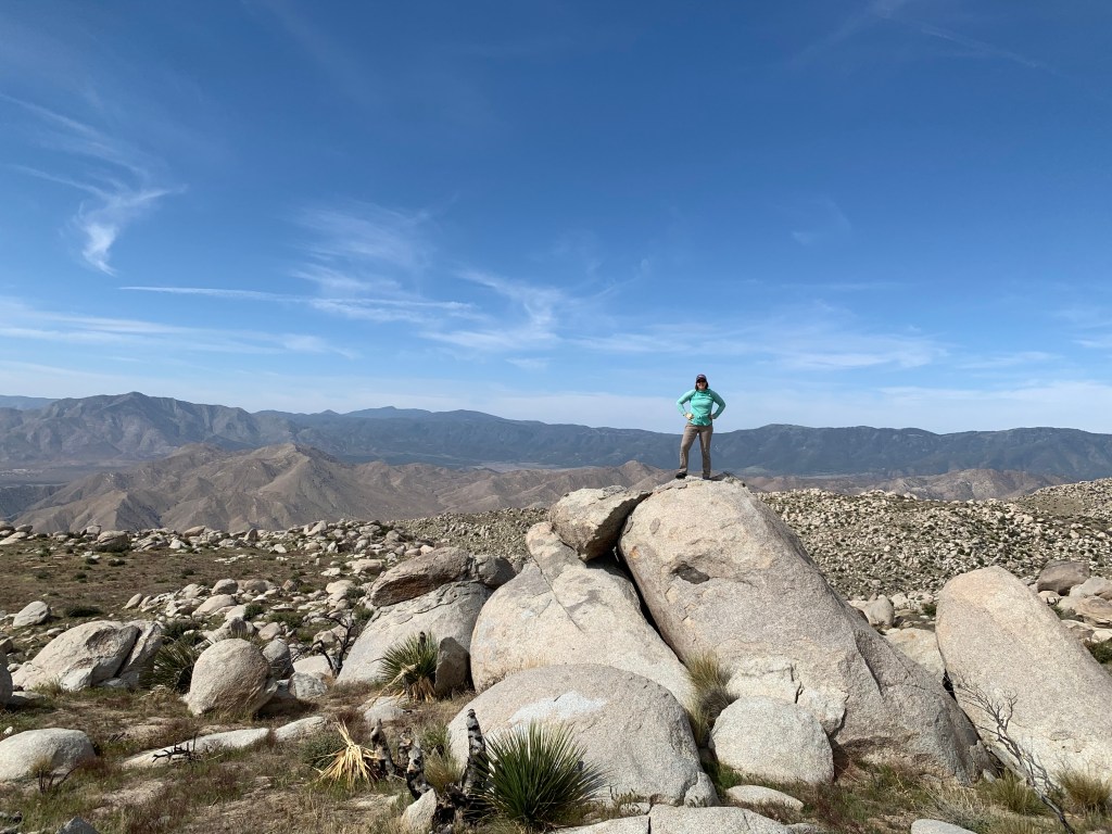
Corte Madera & Los Pinos June 6, 2021 Miles: 10.8 Elevation Gain: 2,205ft Gaia Track 100 Peaks Challenge #71 & 72 Afoot & Afield, 5th ed., Trip #196 (plus!)
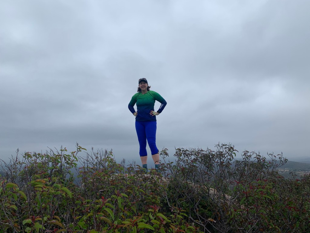
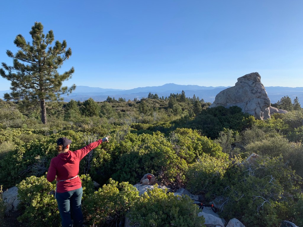
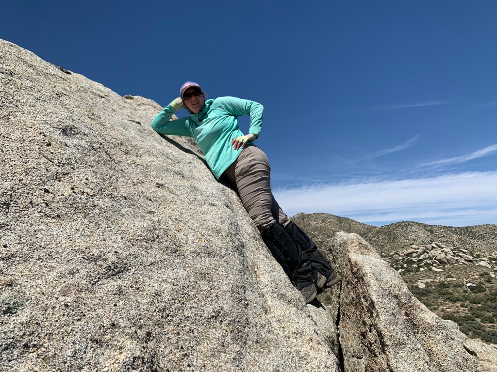
Our first hike of last weekend was Mother Miguel – it’s short and easy, and since not all of our crew could join it made sense – easy for the others to make it up later. Also it was a bit warm on Saturday so getting something done early was in order. It was my third time hiking this peak, and definitely my fastest. Andrew was in the lead, and he was on fire! He set a crazy pace, and we were at the summit in less than 45 minutes – go Andrew!!! I was home from this short and nearby hike by 9am. #70, yeah!
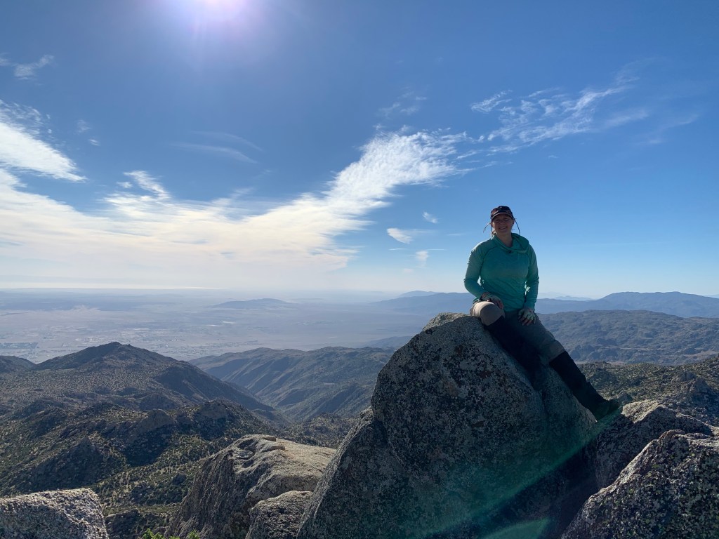
The next day was the big hike of the weekend, with a bigger group, including our whole peak bagging crew plus a few regular extras. Corte Madera is a popular hike that I have never done. I first heard of it when I took the WBC in 2016, and signed up to hike it as a backpacking trip. Turned out I was the only one who signed up! The trip was cancelled and instead I joined Rachel Rench in Sheep Canyon… which was an amazing trip and I’m very glad it worked out that way. But until now, I still had not gotten around to hiking it.
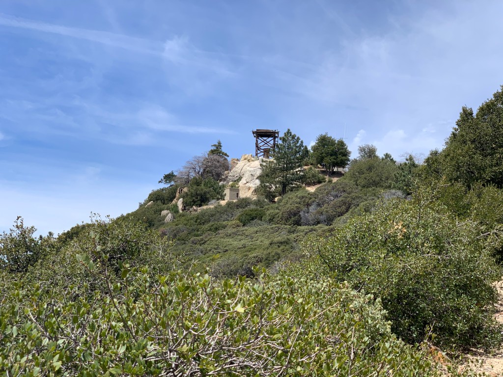
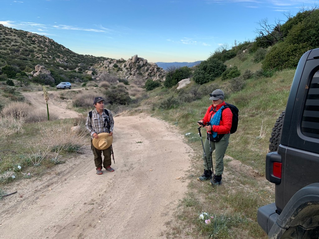
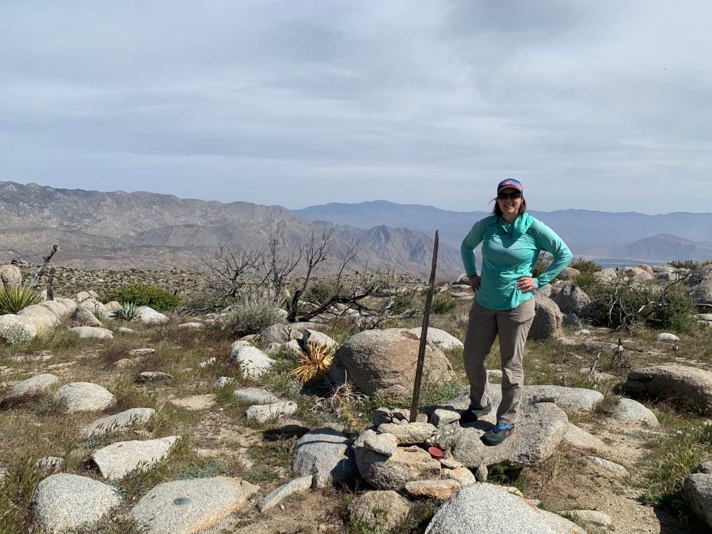
Its neighboring peak, Los Pinos, is also on the 100 Peaks Challenge list. This peak is accessible via a fire road and is not as popular of a hike. Atop Los Pinos is an active fire tower, one of three in San Diego County – the others being Boucher Hill and High Point (Palomar). We had heard that the road leading to the peak was been closed to vehicles due to last year’s Valley Fire. On Sunday, we headed out in Tara’s Jeep just to check. And, yup, it is still closed. We’d have to hike it.
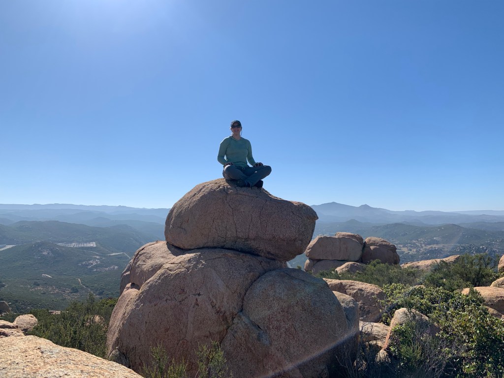
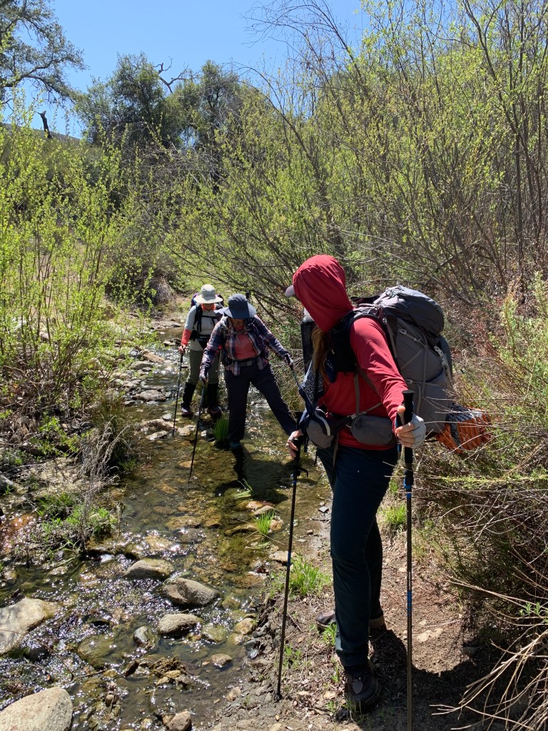
We drove back to the Corte Madera trailhead and parked. It was a good day for wildlife – we passed a juvenile wild turkey on the drive in, and now at the beginning of the trail we paused to let a skunk clear out of the way. The trail was shady in parts, with some steep and sandy sections. It was a lovely hike. We arrived at the summit and had some snacks, did a bit of bouldering to get to the photo op, and headed back down. Peak #71!
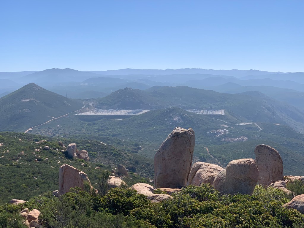
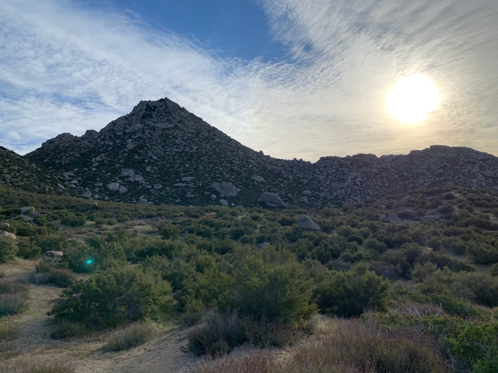
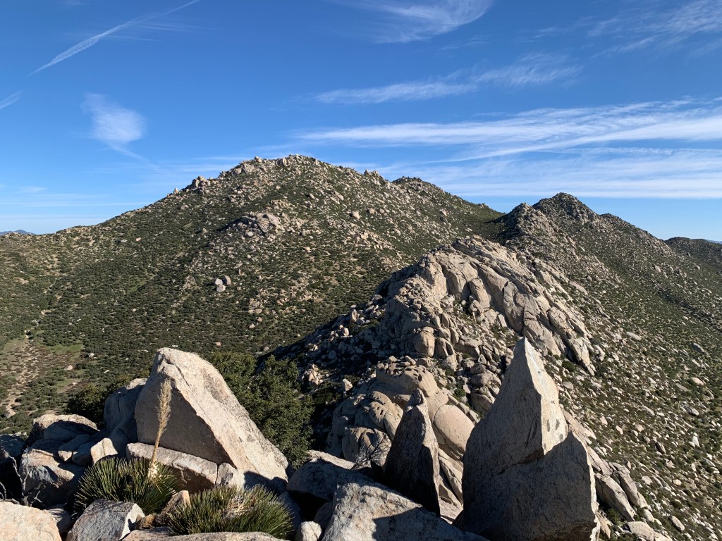
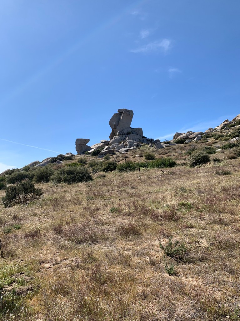
Back at the saddle, we turned right and headed up the road toward Los Pinos. Many consider this road walk to be boring, but I kind of liked it. It was not too steep, and it was easy to get into a meditative state. It was definitely in the blazing sun, but I had my hiking umbrella out. True to its name, it was flanked with pine trees – los pinos – unexpected in this part of San Diego, and actually quite lovely.
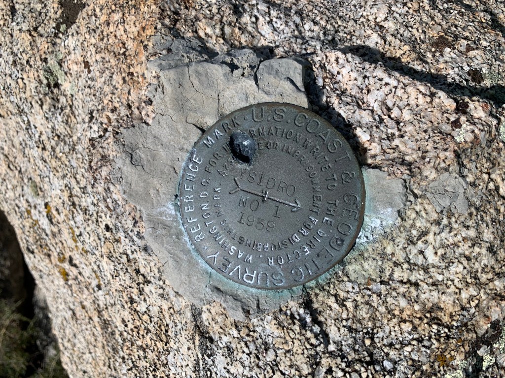
We arrived at the summit, came up to the base of the fire tower – and were greeted enthusiastically by the tower keeper. He invited us up, and we happily ascended to tour his domain. His name was Dave, and we spent the next hour immersed in his world. He showed us his hummingbird feeders – one on each side, and when a male hummingbird gets too territorial, he swaps out the sugar for plain water. All the other birds flock to the opposite side, and eventually the aggressive male figures it out and everyone gets along again. Inside the 12 x 12 foot interior, Dave’s explanations were interrupted – he was called over his radio by a fire crew somewhere off to the east, asking him to give the coordinates for the signal mirror they were flashing at him. We became quiet as he spoke to the fire crew – they were on a training exercise, and we got to see it first hand! Dave then explained his Osborne device to us, showed us his maps and tools, and explained his various responsibilities. He showed us photos of ringtail cats, rattlesnakes, birds of prey, and other regular visitors to his domain. It was an amazing experience and we learned so much. Peak #72!
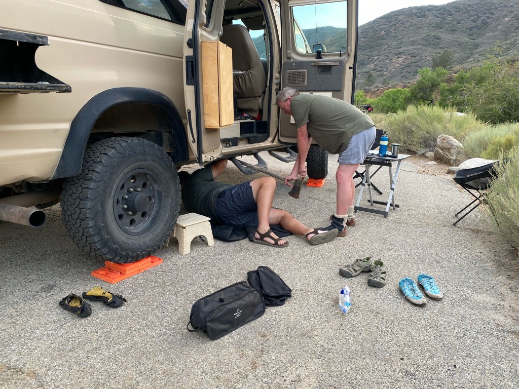
OMG I’m writing about something other than peak bagging! I never meant for this blog to be solely about that, so I thought I’d do a write-up of our fantastic Memorial Day camping trip over Sherman Pass to the Kern Plateau.
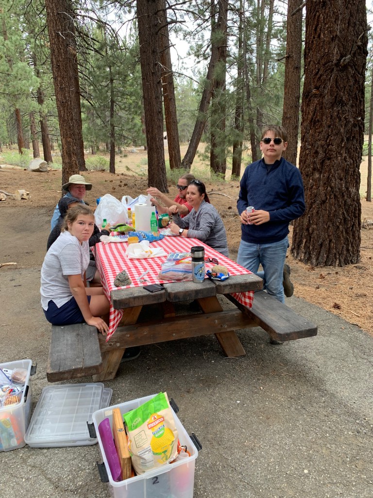
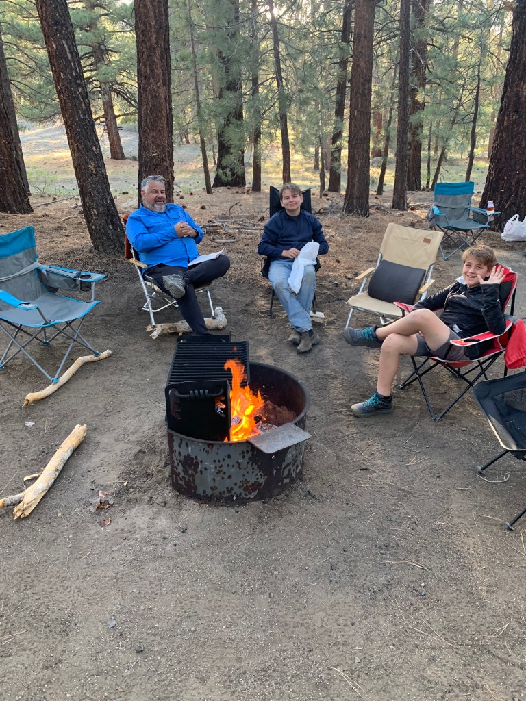
The trip was a bit last minute – I’d been talking about it for a while but did not get around to actually figuring out the details until the week before. I was able to get campground reservations for Friday night only. We’d have to wing it on Saturday and Sunday. The Kizers joined us, along with Scott M.
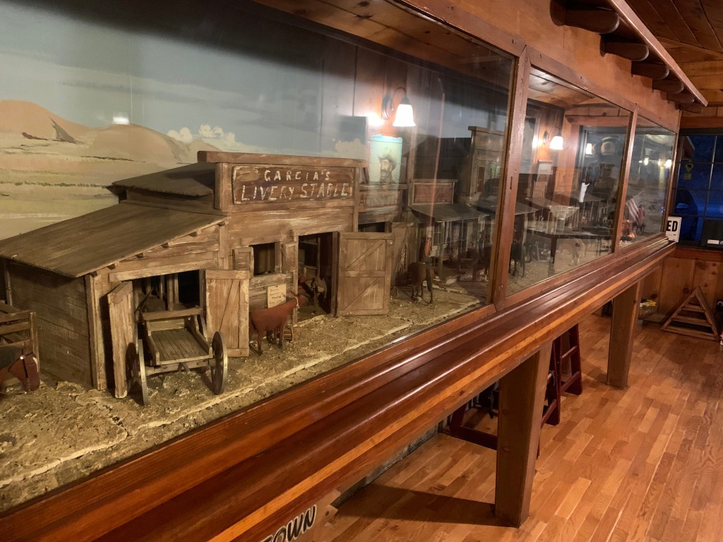
Friday we left San Diego around 1pm and headed up, over Walker Pass (the PCT groupie that I am), to the Fairview Campground along the Kern River just north of Kernville, arriving around 8pm. I’d made dinner reservations at Johnny McNally’s, and that was totally worth it – low-key steak house with a huge patio overlooking the river. Perfect! The Kizers & Scott arrived shortly afterwards. One more drink and we hit the sack.
Our plans for Saturday depended on where we’d be able to camp, since the many dispersed campgrounds along the river were completely packed. I wandered over to the campground host (Amber) and made friends with her – she confided to me that she’d had one cancellation that she had not released yet. Long story short and we secured a site for Saturday, yeah!
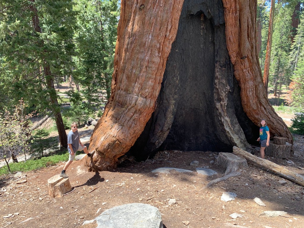
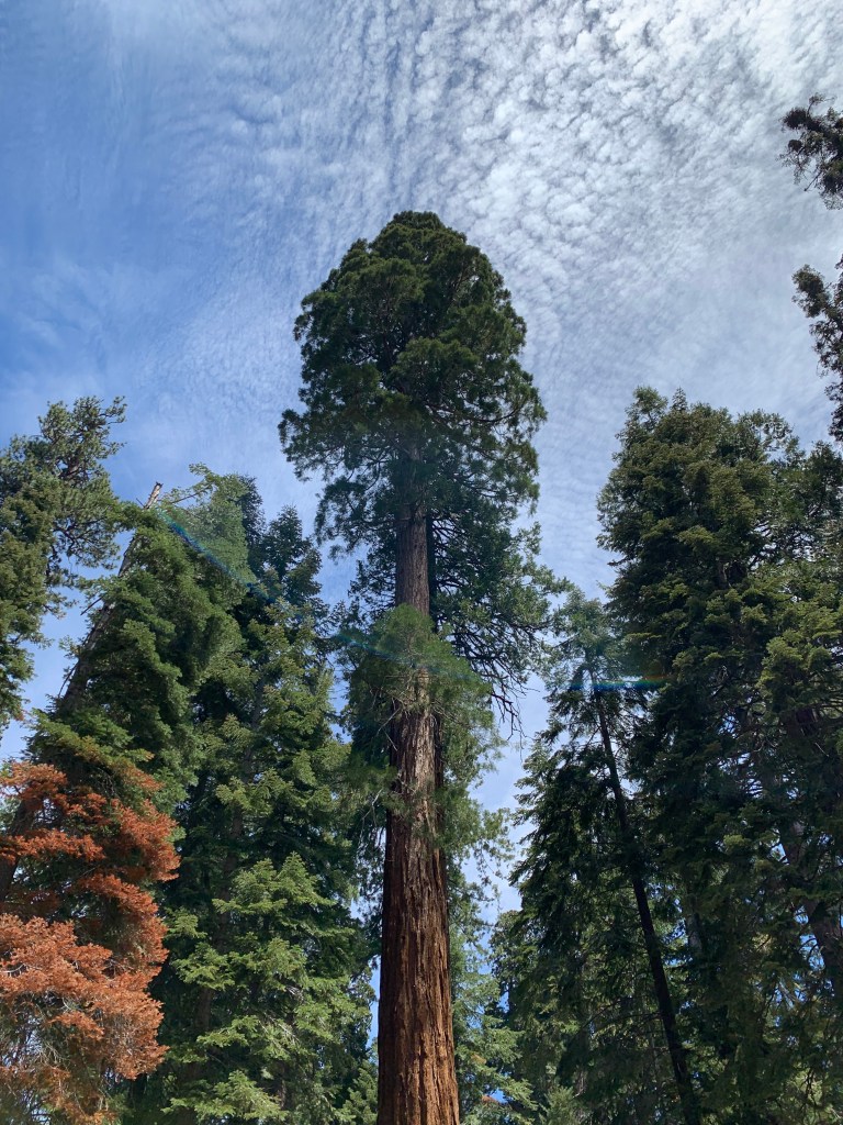
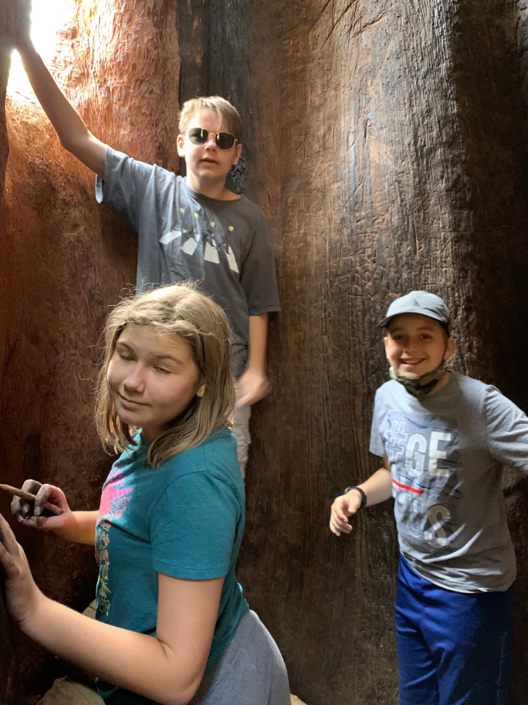
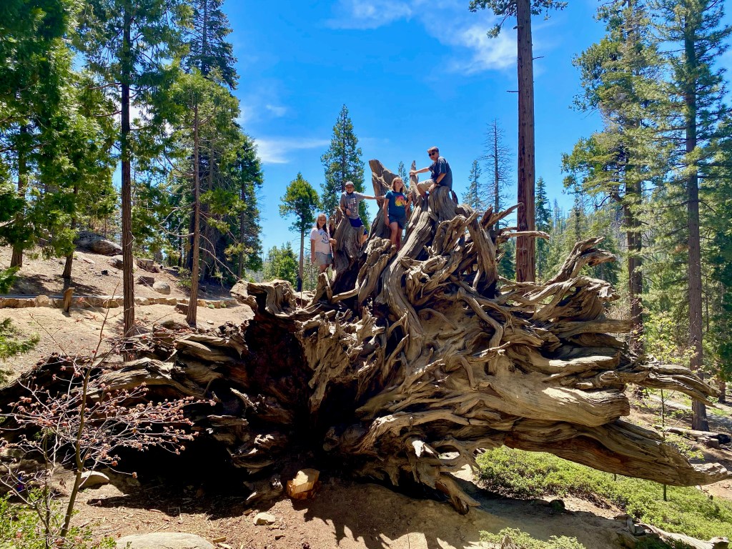
With no more concerns about where we were sleeping, we hit the road in all three vehicles. We headed north on Highway 99 to the Great Western Divide Highway to visit the Trail of 100 Giants – home of the Long Meadow Grove of giant sequoia trees. The campground parking area was crowded and we arrived just in time, before they started turning cars away. We walked along the nature trail checking out and climbing on (and in!) the big trees.
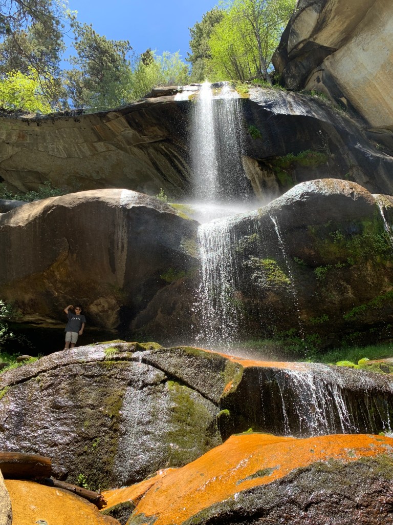
After lunch in the campground, we headed up a bit further to the Nobe Young Waterfall. The campground host told me about these falls confidentially – we’d hoped to visit a different waterfall that formed a “natural water slide,” but the area was closed to cars due to last year’s fire, and he suggested this as an alternative; but “shh, don’t tell anyone.” The trail to the falls was short but very steep. The falls were tall and impressive, but the pools at its base were occupied by a group of chillin’ and loungin’ 20-something stoners. Not much of a secret, apparently. We climbed around for a bit and took some photos, and then headed back up.
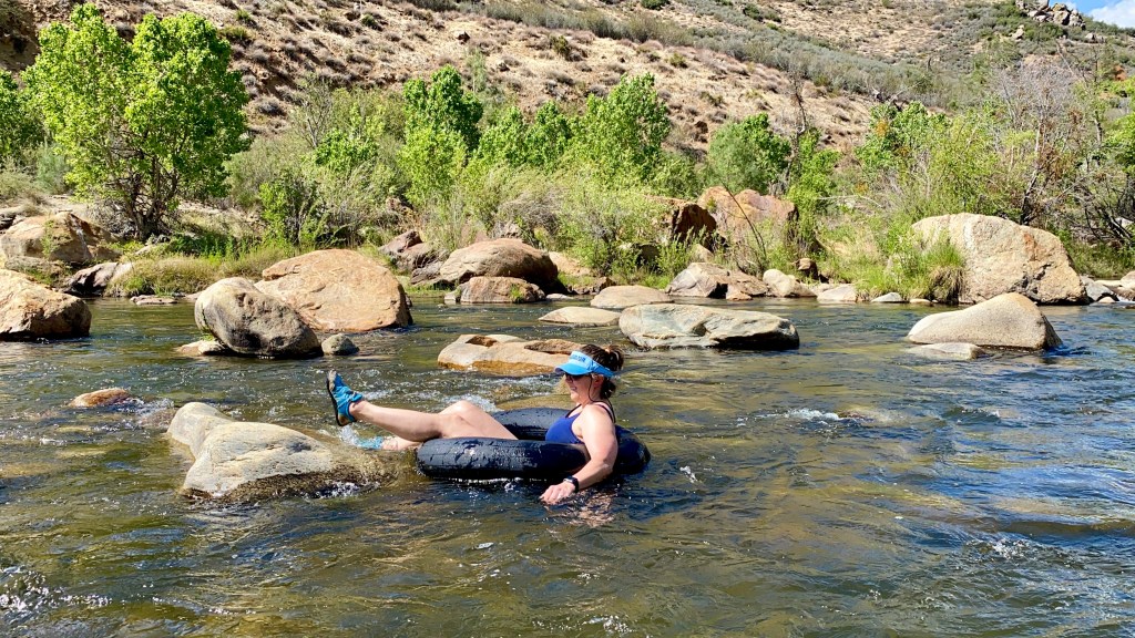
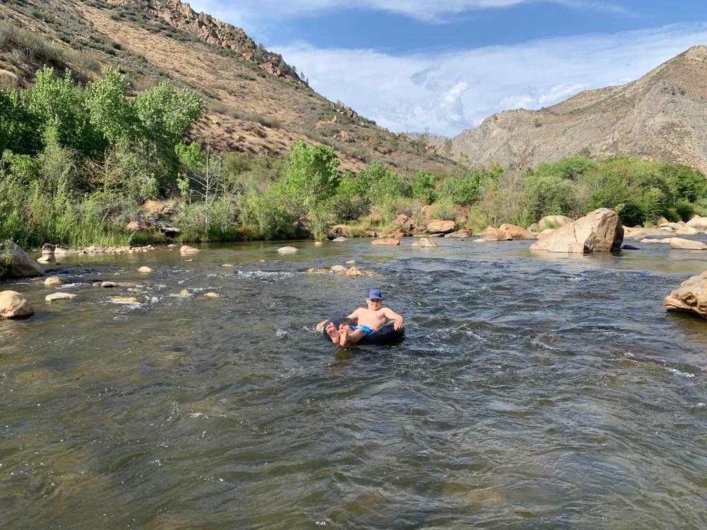
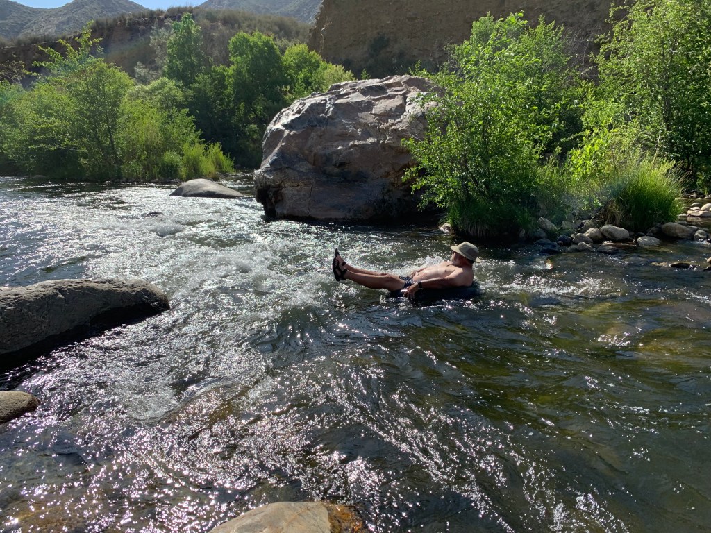
We took a dirt road shortcut (Last Chance Meadow Road, 22S02, to Lloyd Meadow Road, 22S82) back to our beautiful riverfront campsite – and the fun began! We had bought inner tubes for the kids (big and small) and we hit the river. Normally at this time of year the Kern River is raging – floating down the river in inner tubes is something that normally has to wait until much later in the summer, if ever. Well, California is in a drought, and this past winter was drier than ever. This is not good; but the upside was that inner tubing in late May was possible. We spent the sunny afternoon splashing in the river. Later in the evening, gazing up at the star-filled sky, we saw a StarLink launch! It was the second one that Tara & I have seen!
Sunday morning we packed up and hit the road, but this time we headed east toward Sherman Pass. This 9200-foot pass had only just opened for vehicles for the season. The road crosses from the west to the east side of the southernmost Sierra Nevada mountain range – the last chance to do so until Tioga Pass Road, over 150 miles to the north (as the crow flies) in Yosemite National Park. Despite being recently opened there was not a trace of snow anywhere along the pass.
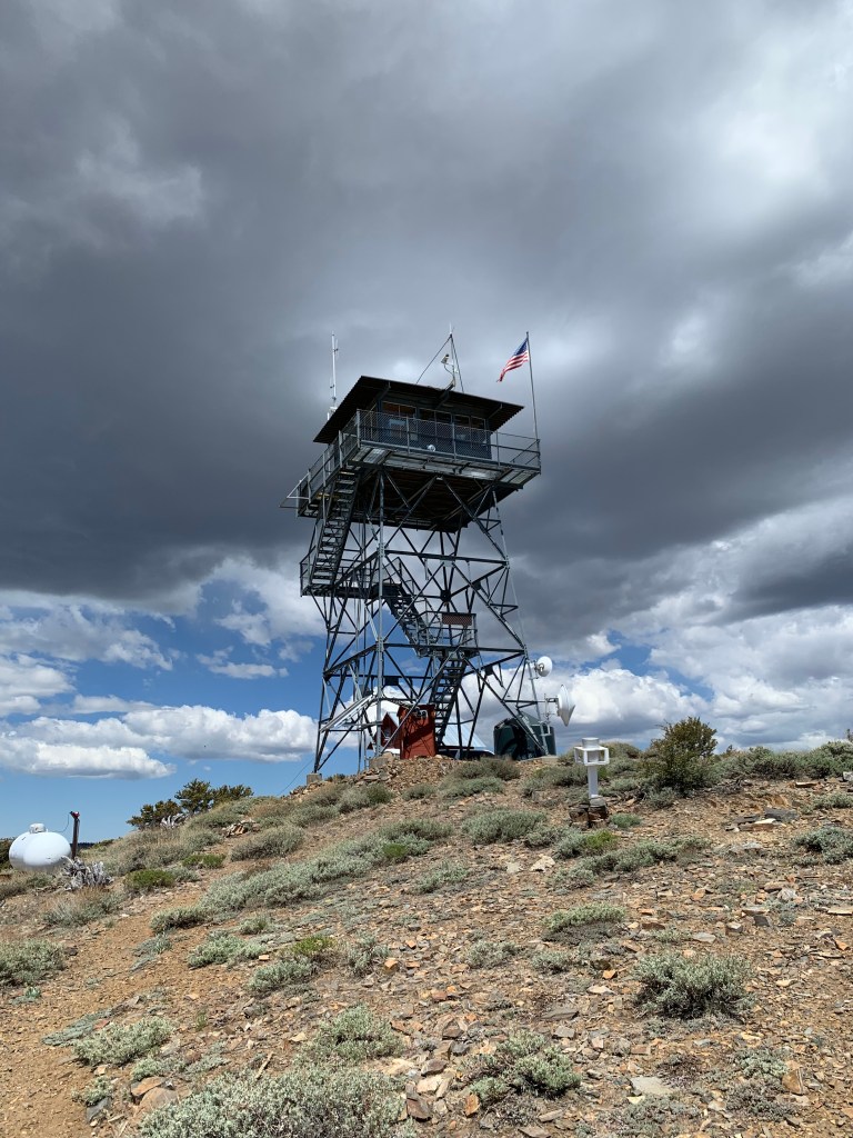
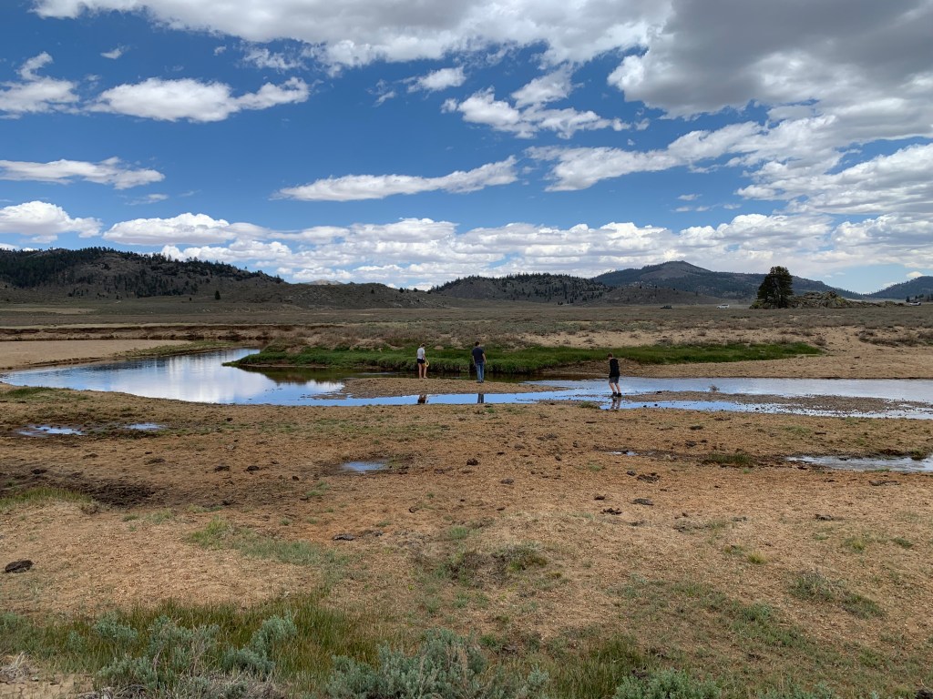
Once over the pass, we drove most of the way up to the Bald Mountain fire lookout tower, and walked the last bit. Chatted a bit with the keeper and admired the amazing view. Our next adventure was to go offroad further north along the Monache Meadow 4×4 trail to the South Fork of the Kern River. The rugged and mostly downhill road took a couple of hours to navigate – and was surprisingly busy! We had considered camping back there, waaaay off the beaten path, along the South Fork… but it was packed! After exploring a bit we headed back up to the paved road.
Tonight’s camp was at Troy Meadows. It’s a first-come, first-served campground, at nearly 8000 feet, with lovely ponderosa pines and roomy campsites. When we drove through in the late morning to claim our spot, only the areas near the stream were busy. The site we selected had a wide meadow on one side, an appropriately-distanced pit toilet on the other… and no one within sight! We lit a campfire, tossed frisbees in our private meadow, and enjoyed the stars. Oh, and guess what!? We saw ANOTHER StarLink launch! Third one FTW!!
Monday morning we hit the road and continued further east to the tiny town of Kennedy Meadows. The General Store was closed (with a few PCT hikers cooking their breakfast on the deck – and a huge selection of worn-out shoes in the discarded hiker’s box), but the infamous Grumpy Bear’s Retreatwas open – and absolutely packed with hiker trash! The line to place our breakfast order was not very long, so we did. What we did not know was that ordering was the easy part. It took over an hour for them to actually bring us our food (after we’d paid for it – so we couldn’t bail). It put a bit of a damper on the weekend, but at least the food was pretty good. And with that we headed home!
Walker Pass
Johnny McNally’s restaurant has dioramas with hand-carved wooden figures!
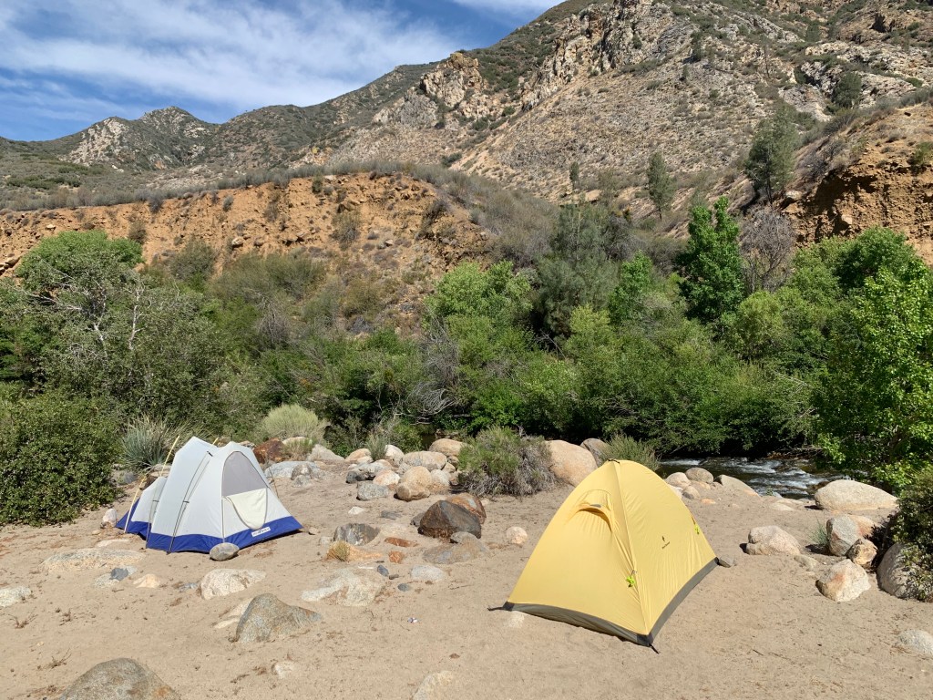
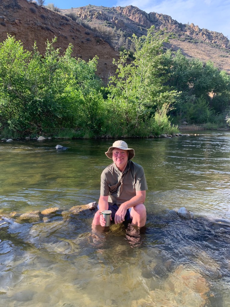
Our Kern River campsite
Hi!
Nobe Young Falls – can you see Lane?
Um…
Near Sherman Pass
Bald Mountain lookout tower
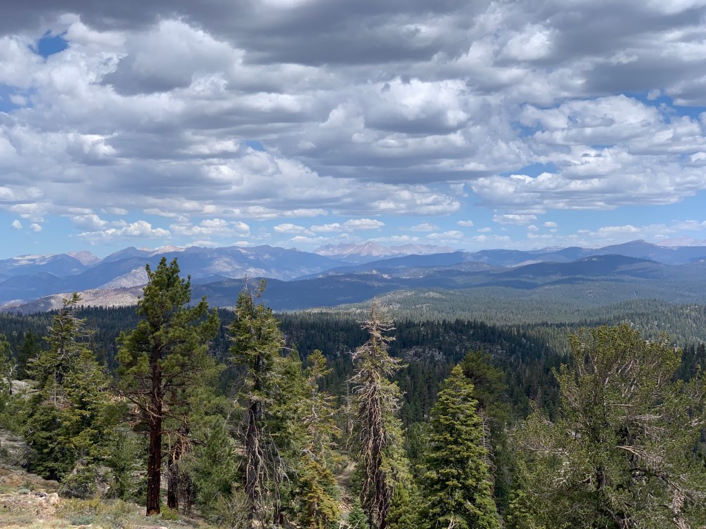
View toward Mt. Whitney and the Sierra Nevada
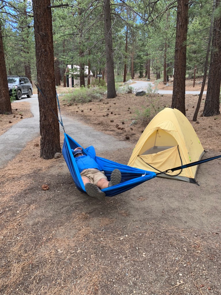
Hammock … so … comfortable …
South Fork of the Kern River, by Monache Meadows
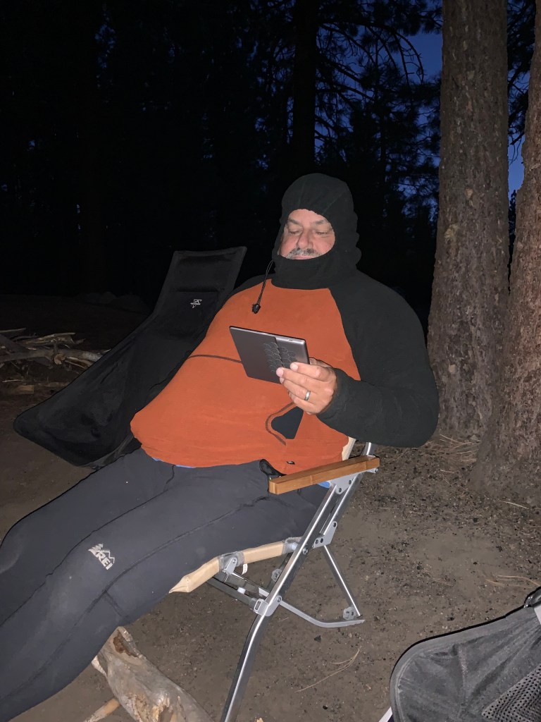
It was really not that cold. Seriously.
SUCH a nice campsite!
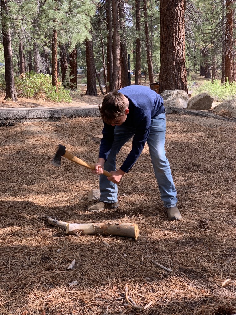
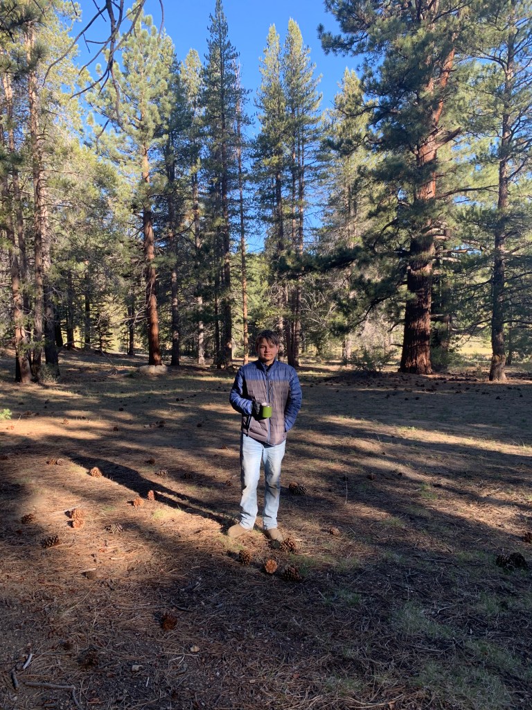
Lane’s friends said he looks like a dad in this photo.
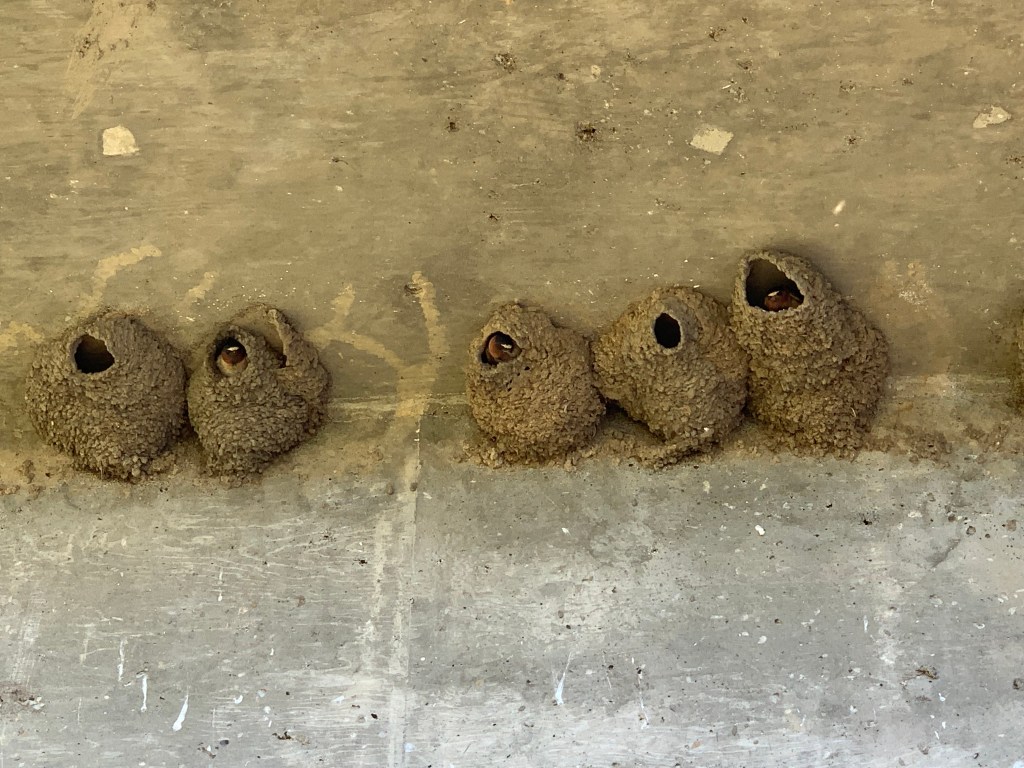
Swallows!
Heading out of the mountains along Nine Mile Canyon Road
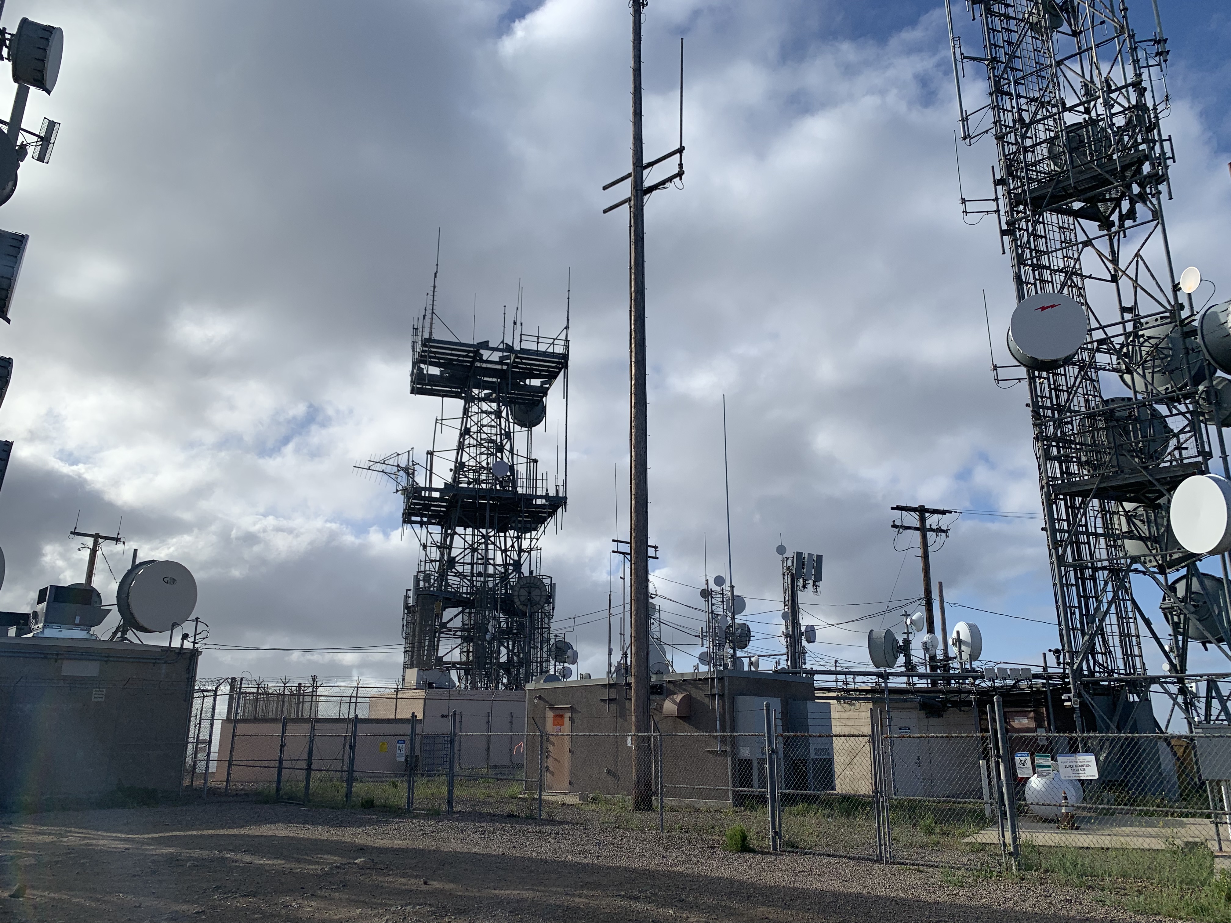
Yay, another relatively cool weekend to knock a few more low-elevation peaks off the list before it gets too hot! All three peaks this weekend were up the 15, each progressively further away. On Saturday we started with Black Mountain in the Rancho Penasquitos area. I have dabbled near this peak before, once or twice bike riding in the area, and a couple of hikes – but never to the peak, at least as far as I can remember. There are multiple trails up to this peak, and we picked the Nighthawk trail starting from Hilltop Community Park. We made quick work of the gradual climb, reaching the antenna-covered top in no time. We encircled the summit, taking a little side slope back to the trail and were back at the cars in about an hour and a half. Peak #67.
(After the hike, I spent the next 1.5 hours trying on every mid-sized day pack at REI starting from right after they opened at 9am. I am still undecided.)
On Sunday we headed further up the 15 to hit Stanley Peak. This hike starts at Daley Ranch, which is a well-known San Diego hiking area… that I have never been to. Like yesterday, there are many trail options, and we chose the Creek Crossing Trail, heading up from the west side of the preserve near Dixon Lake. We arrived before 7am … and man, it’s the place to be! The parking lot – which was not small – was more than half full despite the early hour. It looked like mostly mountain bikers. We started up the trail and, despite the busy parking lot, we saw no one else on trail until we got closer to the summit. The trail was gradual and lovely until close to the summit when it got somewhat steeper. Arriving at the top we poked around the bushes, guessing where the high point was. Also at the top were some mountain bikers, and as we started back down, they flew – I mean FLEW! – past us. They were crazy!
On the way back we took a slightly different route, past Mallard Lake, and then to the parking lot – where waiting cars were happy to take our spots. Peak #68!
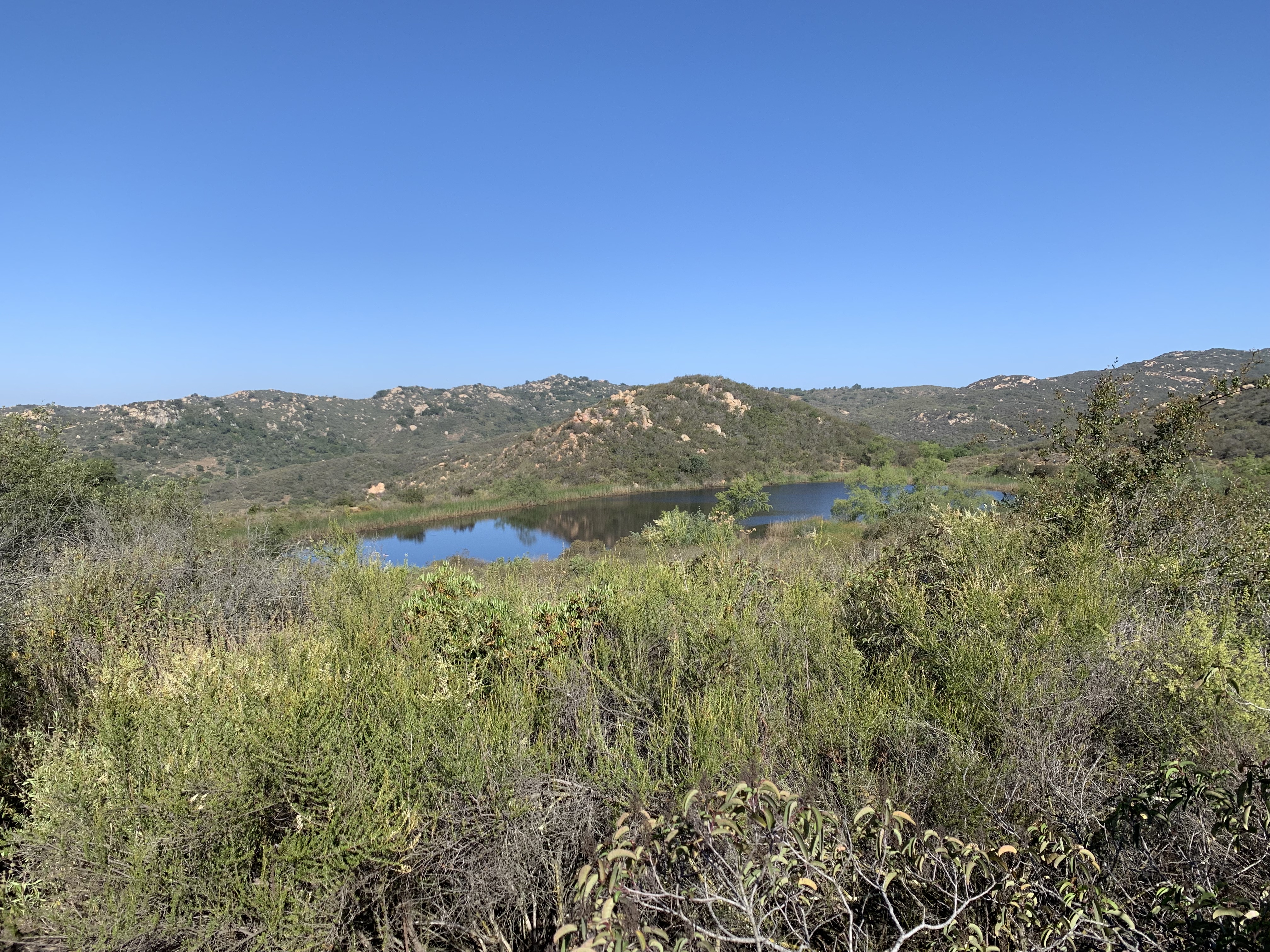
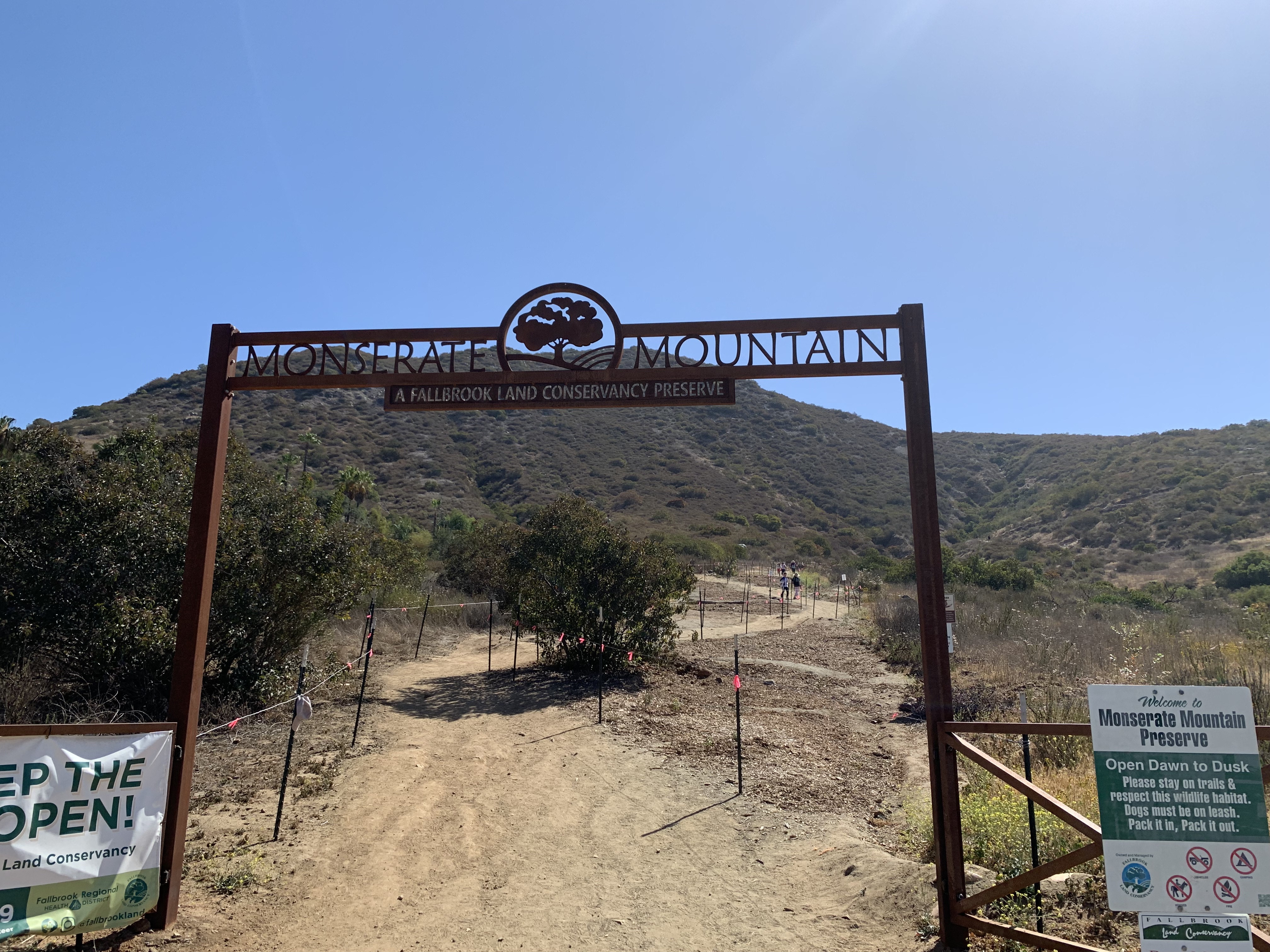
Kali & I continued northward up the 15, to Fallbrook and the Monserate Mountain trailhead. As the crow flies, this is one of the furthest peaks from my house, along with the other peaks along the northern border of San Diego county – so it was good to get it DONE. By the time we got to the trail, it was getting warm – there is a reason we usually hike so early in the day! There were plenty of people on the trail despite the blazing sun. We had heard that this trail was the Cowles Mountain of North County, so it was not surprising.
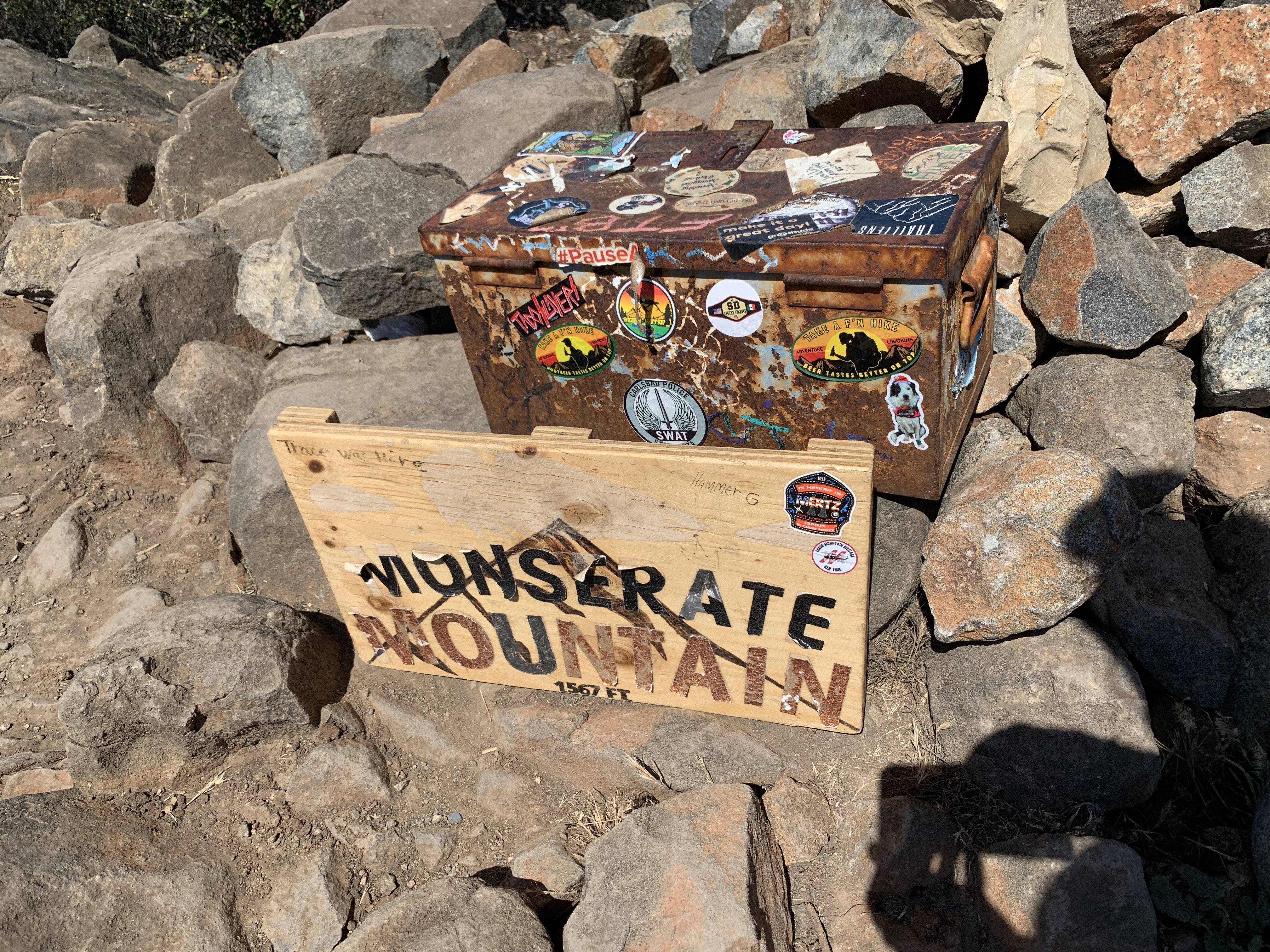
This trail was not kidding. If you look at the mileage versus elevation gain you’ll see that this trail is pretty freaking steep for a ho-hum urban hike. And it did not waste any time, I’ll tell you that. It was hard doing this after we’d already done nearly six miles climbing Stanley Peak. I was glad to have my sun umbrella with me and popped it up early in the hike to lots of admiring looks (and one child saying, “Oh! I wish I had that umbrella!!”). About a mile into the hike I bumped into a friend – yep that happens all the time when we hike! We finally got to the peak, took our pics and headed back down. (There was a huge ammo box with all kinds of junk in it, but I was not in the mood to paw through it and I opted not to sign anything.)
A cool thing about this mountain is that it’s a 9/11 memorial. As the trail climbs, at what would be the vertical distance of every ten floors in the World Trade Center towers is a marker. I have heard that on 9/11 the local fire department climbs the mountain in full gear. Sounds hot. On a related note, yesterday afternoon there was a brush fire not far from here, and on our way back we passed the fire fighters cleaning up – interesting.
We were done by around noon, which makes 8+ miles and a long drive feel like an accomplishment. Peak #69, baby!
Red Butte May 19, 2021 Miles: 3.33 Elevation Gain: 352 ft Gaia Track* 100 Peaks Challenge #66 Afoot & Afield, 5th ed., Trip #12 (mostly)
*Ok I don’t know why this track has me drop down to -66,617ft – nearly twice as deep as the Marianas Trench – but I think that’s marvelous and I have no intention of trying to figure out how to fix it.
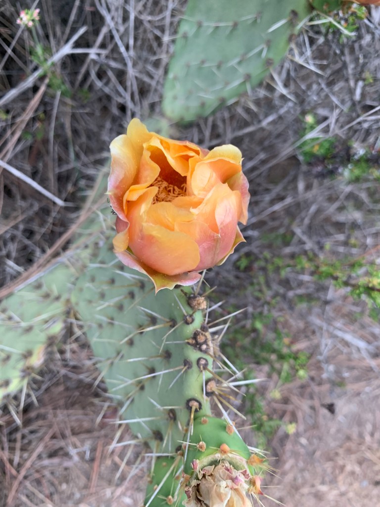
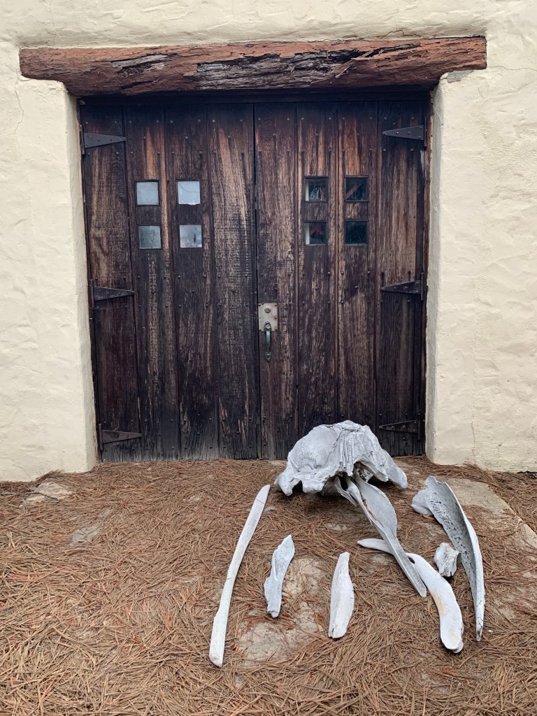
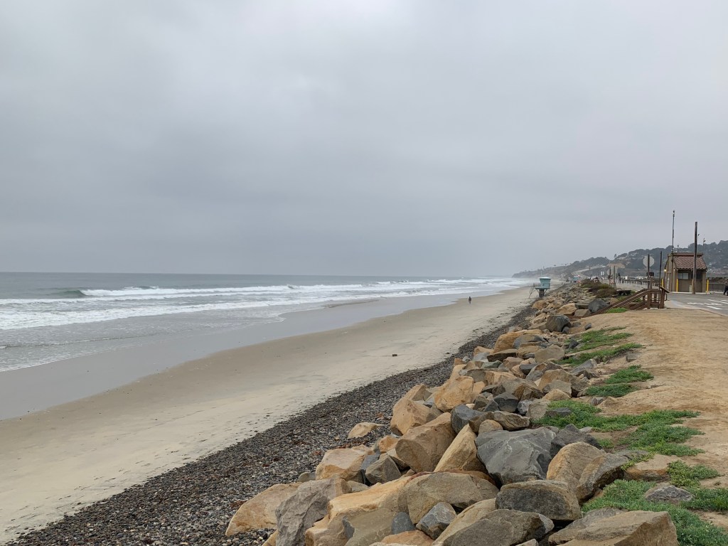
Torrey Pines State Park is one of the first places I visited when I first moved to San Diego, way back in 1995. Then in the early 2000s, when I was living in University City, I would come here to do hill repeats on my bike – we’d pedal up the park road and speed back down the main road, keeping pace with the cars. I remember once doing this with a hard hangover – best hangover cure ever. And then there was the time Tad and I strolled through the park to a lovely viewpoint to “crash” our good friends’ family-only wedding – with me pregnant with Lane.
More recently, in 2017, I systematically hiked every (open) trail in the park. It was while I was recovering from chemo/radiation (hey hey, Project Perky!) and I was between projects at work, with lots of free time. I would drive in to my nearby office early to avoid traffic and head straight to the beach. Park at the bottom and hike on up to the top, working my way around all the trails amongst the rare Torrey Pines, then head to work.
But until the 100 Peaks Challenge, I had never heard of Red Butte. It’s not exactly a “peak,” and I’m not quite sure why it’s included in the challenge; but I love that it is! This area is a special place, classic San Diego; and including a hike or two along the coast balances out the many desert hikes.
Red Butte is one of a few peaks that my hiking buds and I have decided we’d do on our own. They are easy, short, and can be done any time of year. In fact this would be a great hike to do as a family – we could walk around the state park, bag the peak, and hike down to the surf. The steps down to the beach are pretty cool and I’m sure the kids would enjoy it, especially the “down” part.
And maybe I’ll do that someday; but on this day I was having breakfast with some friends in La Jolla at 7:30am – so the timing was perfect to squeeze this one in beforehand. I can always do it AGAIN sometime with the kiddos. I did the same routine as I used to do in 2017 – I arrived early enough to park alongside the beach, and jogged up the hill. Yes I said “jogged” – all the trails in this park are perfect for trail running, so that’s what I did. Ok, yes, I walked when it got too steep; but otherwise I mostly kept up an easy jogging pace. I decided to “summit” Red Butte first, since that was my main objective. I made my way down the familiar trail to the bluff that I’d surely passed before but never climbed. I climbed it today, and boom, peak #66!
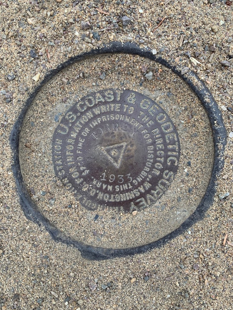
After getting the job done, I still had time before my breakfast, so I jogged around the visitor’s center, then up to another marked peak in Peakbagger, Torrey Pines Hill 365. It was off-trail and a bit of a bush whack – I hesitated since off-trail hiking seems like something that would not be allowed here; but there were no signs or fences, and there was a clear use trail… so I went for it. After that I headed back down the road and bagged the Torrey Pines Benchmark (aka High Point) – which seems like it’d be more likely to be on the 100 Peaks list, except that it’s really more of a pathway with a staircase, not a trail. And with that, I headed for breakfast.
I have always just hiked or jogged past this thing!
Bell Bluff May 15, 2021 Miles: 7.33 Elevation Gain: 1,673ft Gaia Track 100 Peaks Challenge #63
Gaskill & Lawson Peaks May 16, 2021 Miles: 7.47 Elevation Gain: 2,050ft Gaia Track 100 Peaks Challenge #s 64 & 65 Afoot & Afield, 5th ed., Trip #192
My original plan for this weekend was to renew my Wilderness First Aid certification. The class was scheduled for two eight-hour days, starting at 9am each day. My fabulous peak bagging pals were willing to work around my schedule – we were going to hike two easy/short peaks early both days so that I could get to the class on time. But a few days before the weekend I was given the option of switching to a one-day, six-hour recertification class later in the summer. YES PLEASE!!! Given the forecasted cool weather it was great not to waste the opportunity, and instead to tackle some harder peaks.
First up was Bell Bluff. This peak is one I’d not heard of prior to embarking on this challenge; ironic, since it was just about in my backyard! My car routed me to the trail head via backroads about twenty minutes away. We parked on a lovely neighborhood street in the town of Alpine and hit the trail. The hike initially passed some homes and we encountered a friendly woman still in her pajamas walking her dog – unleashed, because clearly this was their daily routine and she usually has the trail all to herself. The dog was growly and barky – oh no, intruders!!
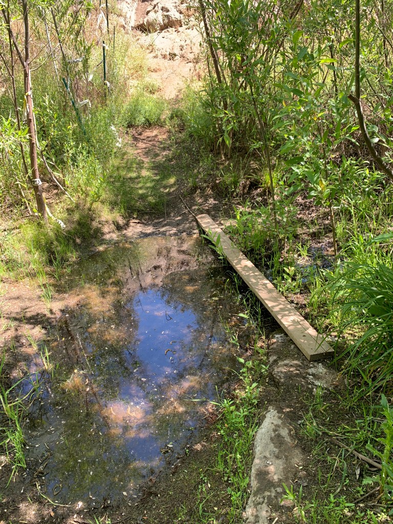
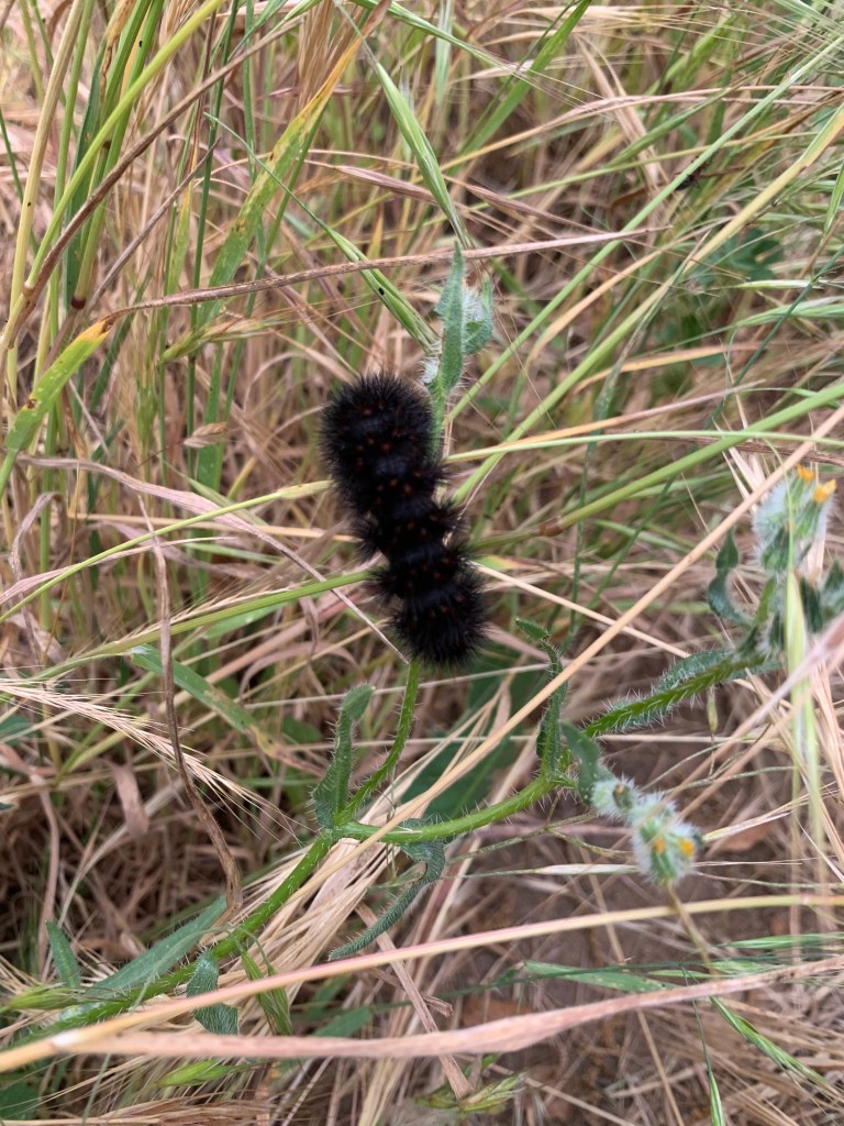
Very soon the trail dropped steeply down to cross a murky green branch of the Sweetwater River with a board to help cross it. Up the opposite bank we waded through tall grasses, noticing at least one tick, a couple of fuzzy caterpillars, a ladybug, and a few other bugaboos within the space of a few paces. I did a tick check when I got home, for sure! It was short-lived and soon our normal San Diego hiking terrain took over.
Bell Bluff’s hiking profile is sort of a witch hat – gradual up the brim, then sharply upward for the hat. Actually the hat part was small, so maybe more like a witch’s tit? The whole way we were hiking on the brim we were looking toward our peak, looming over us. We’re gonna climb that, really?? And yes, that was it! Of course I blew right past the well-cairned turnoff to the steep bit. A quick backtrack and we began our climb. There was only one sketchy slippery section, and one small tricky bouldering section. Other than that it was just steep, and soon enough we were at the summit. Peak #63!
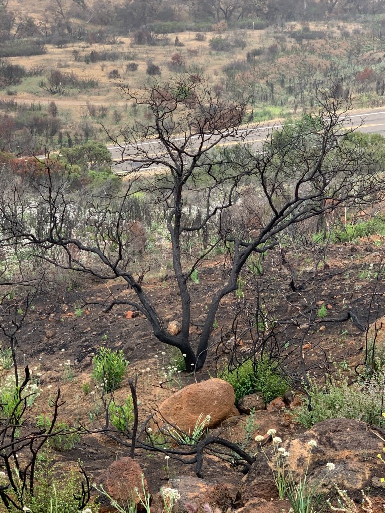
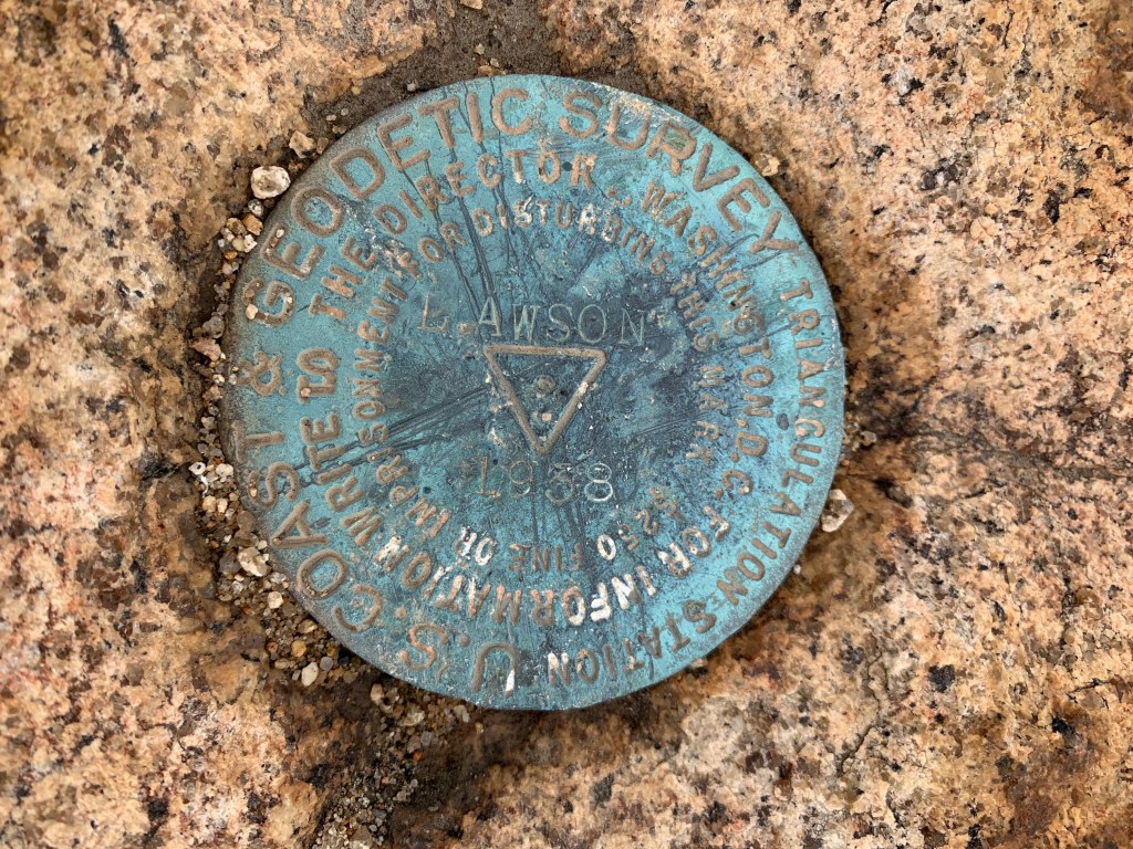
Sunday was even cooler than Saturday and called for something a bit harder. We somehow managed to collect a pretty good-sized group of nine super strong hikers and we hit the trail to the dual peaks of Lawson and Gaskill. Yes, I said Lawson! Not only is this hike also in my backyard, but it is named after ME! And yet somehow I’ve never done it – how can that be!? Less than a year ago this area burned in the Valley Fire, and for a while the road up to the peaks was closed. We never found explicit confirmation that the trail was open, but plenty of trip reports led us to believe that it was good to go, and so we went. This hike starts on a fire road – in the past the gate would sometimes be open and we have friends who have driven up, but now it has enormous boulders across the road that seemed to have been placed there intentionally to keep vehicles off. No one’s driving this road nowadays.
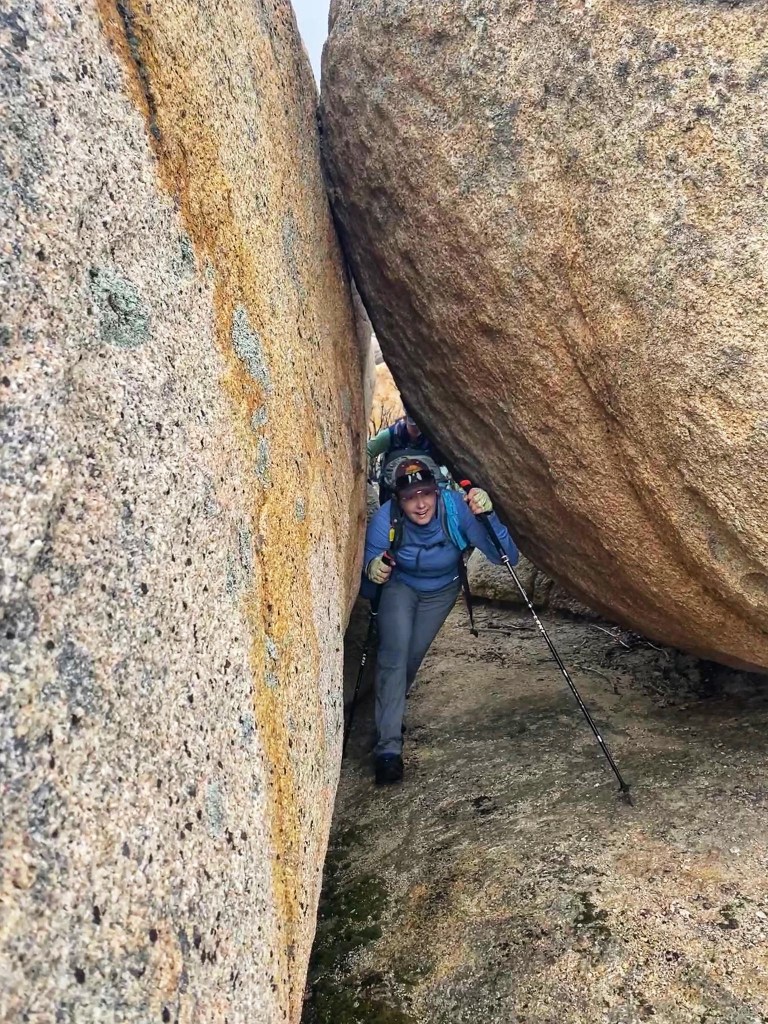
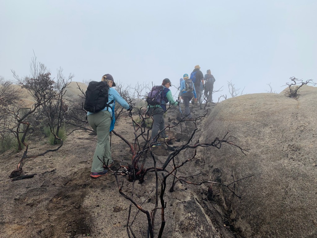
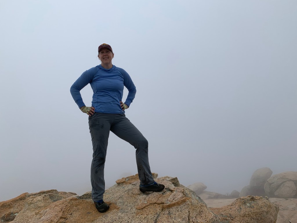
The trail first passes by the turnoff to Lawson Peak and we decided to continue on to bag Gaskill first. There are two routes up Gaskill: one continues along the fire road, and the other turns at some cairns to bushwhack up. We decided to make it a loop and headed up the bushwhacking route first – which was probably not nearly as bushy as before the fire. The weather today was cool and foggy, and the views were obscured all day. The mist swirling around the burned out tree skeletons made for an eerie scene. It was fun navigating through the gloom, and soon we arrived at the summit block. We worked our way around it until we found a good route up, through a rock crevice and then up to a tricky spot. I’d brought some climber’s webbing but there was no great place to attach it to – and everyone did fine with us all helping each other up. The weather atop the summit block was even cooler with a bit of a breeze – lovely! #64!
Down the backside of the peak back toward the road, we crossed the most beautiful portion of the hike yet, with wide open meadows and “pioneer” flower blooms abounding. (Unfortunately this included the feared poodle dog bush, beware!) I was starting to fall behind the speedy group because I could not stop taking photos!
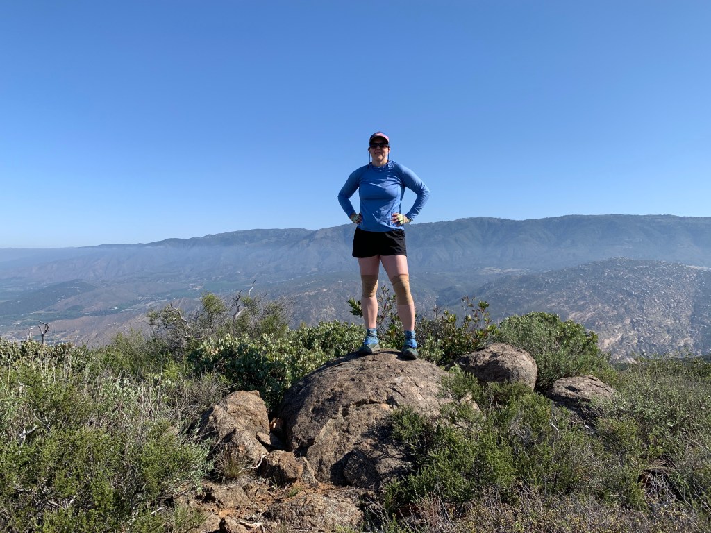
Finally we arrived back at the saddle and started up the shorter – but more boulder-y – spur trail to Lawson Peak (after talking some other hikers out of attempting it with their small dogs). We picked our way up the trail until we arrived at the infamous Lawson chimney. A rope was in place, but it kept pulling out which made me nervous, so I did my best to climb up without it (mostly successful) until I was able to inspect it. It was fine, and the others worked their way up as well. The chimney tops out inside of a cave (very cool) and then up through an opening, a bit more bouldering, and then we were at the summit. #65!
Bell Bluff
Descending between private property signs
Sweetwater River (maybe not so sweet…)
We are gonna climb that!
Yep, I blew right past those cairns! (In my defense, so did everyone else, LOL!)
Paradise Mountain May 8, 2021 Miles: 7.8 miles Elevation Gain: 1,881 ft Gaia Track 100 Peaks Challenge #61
Boucher Hill May 8, 2021 Miles: 0! Elevation Gain: 0! No Gaia track! 100 Peaks Challenge #62
In our continuing effort to hike peaks now that we won’t be able to do when it gets truly hot, we headed out to Valley Center (I think that’s where we were??) to Hellhole Canyon Preserve to bag Paradise Mountain. We arrived at 7am… to find the gate closed. We were able to park just outside the gate and walk up the hill to the huge parking area at the trailhead proper and use the exceptionally clean facilities… when the county park ranger arrived to open the gate (an hour early)! After moving our cars, we started the hike.
This is an inverted hike (not an introverted hike, LOL!) and we descended, steeply at times, to Hell Creek – still flowing and lovely. The hike headed uphill from there but never got too steep. Compared to last week’s hike in South Clevenger Canyon, the flowers were not as showy; but the views were impressive, especially gazing over toward Rodriguez Mountain. We arrived at the summit, but had to check our phones – was this it? I think it was the most inconspicuous peak we’ve done yet. We paused to take some photos and admire the view, then continued on. (#61, yeah!) After crossing a saddle we rose again to a secondary peak – Ditch Benchmark – then continued looping around back – and more steeply – back to the trail we’d come up. We saw a few people – and one rattlesnake warning (but no sighting) – as we began the ascent back up to the trailhead.
When we were planning this hike, I was looking for ways to combine this peak with others on the list for the sake of driving efficiency, since this peak is pretty much in the middle of nowhere. I saw that Boucher Hill was a 45 minute drive from this trailhead. That may not sound very close; but from my house, Boucher Hill is an hour and 45 minutes. So heading up from Paradise trailhead would save two hours round trip – let’s do it!
This was the first peak in the challenge that we drove up to – there will be a couple more that we’re saving for hot weather. When I was first considering taking on this challenge, I figured that for these driving peaks I would walk at least a mile each way, just to keep in the spirit of the challenge. Welp, we didn’t do that. First of all, we’ve hiked this peak before. Secondly, we just hiked nearly 8 miles! Lastly, there is a parking lot right at the peak – and no parking along the way. It was all or nothing.
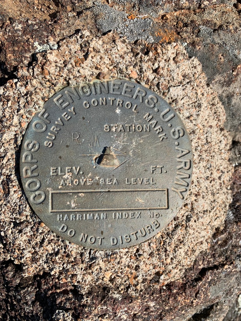
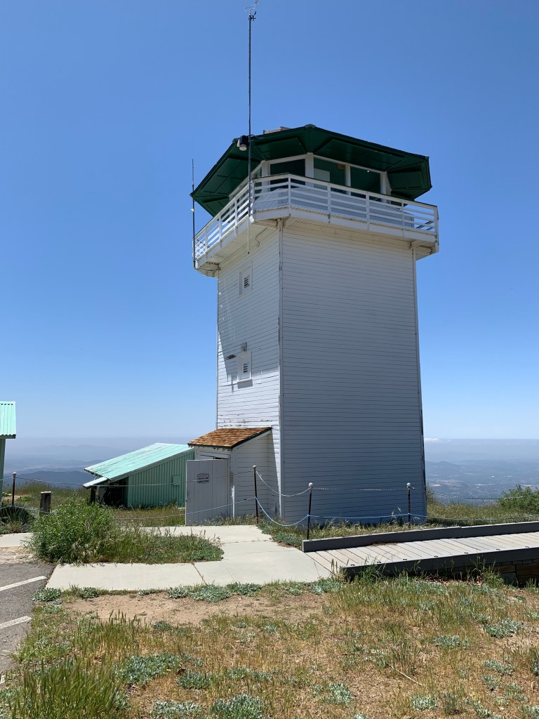
We arrived at the summit just before noon. The fire lookout tower volunteer was home, and he enthusiastically pointed out the nearby summits for us. He also settled an age-old debate: how is this peak pronounced? Apparently it’s “BOOKER” – and this was corroborated by the spelling on the peak’s benchmark. We walked around, took our photos, and began the long drive home. Peak #62.
The next day was Sunday, and it was Mother’s Day. I had intended to bag yet another peak (it’s Mother’s Day, and I like to hike, right?), but my family expressed interest in a nearby trail that is a favorite of mine, and I’ve wanted to go to for a family hike for a while. So we did that, and it was great! A nice relaxing stroll through a local park. Afterwards, at home, Lane made breakfast – eggs Benedict, that he’d been practicing with his grandmother Mackie. Delicious!
Hell Creek, en route to Paradise Mountain – of course!
Paradise Mountain, #61
Ditch Benchmark
From Ditch Benchmark, looking back on Paradise Mountain
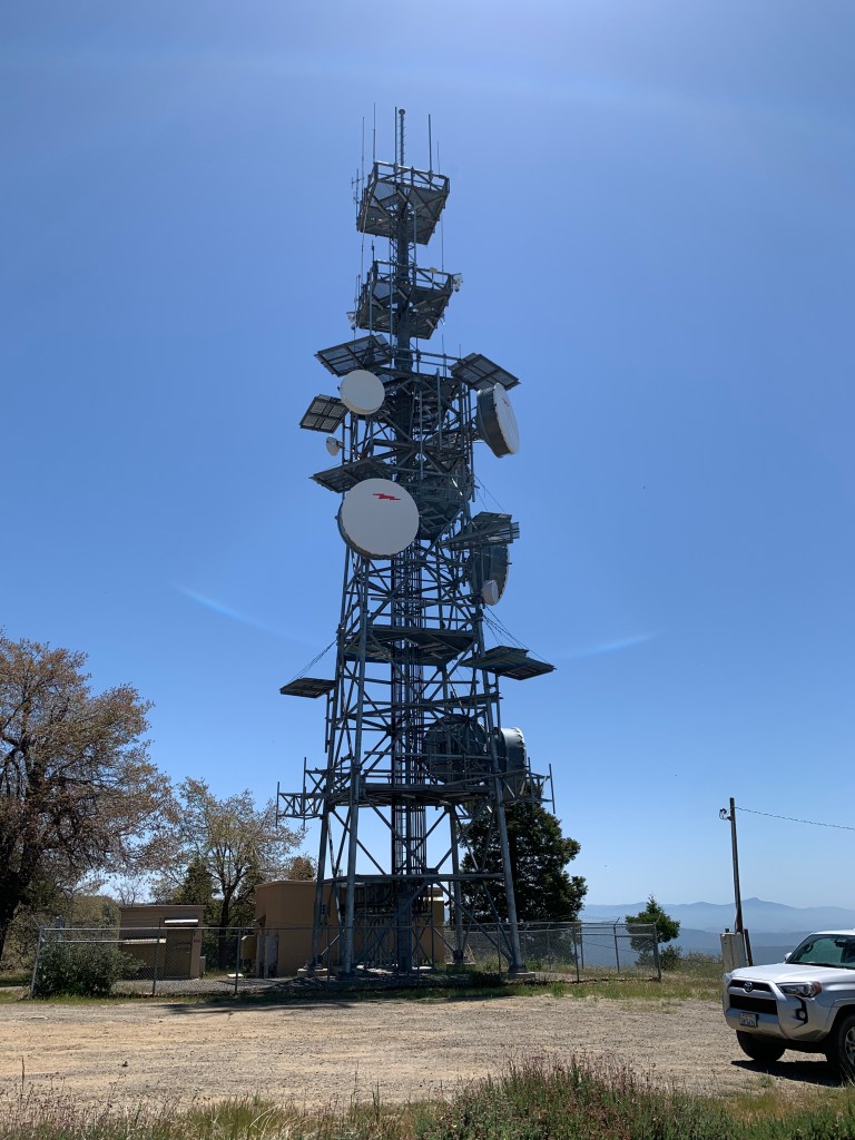
Radio tower atop Boucher Hill – we could see this tower from Paradise Mountain
Hot Springs Mountain May 1, 2021 Miles: 9.8 Elevation Gain: 2,094 ft Gaia Track 100 Peaks Challenge #59 Afoot & Afield 5th ed. Trip #137
Peak 1755 and the South Clevenger Canyon Trail May 2, 2021 Miles: 4.6 Elevation Gain: 1,132 ft Gaia Track 100 Peaks Challenge #60 Afoot & Afield 5th ed. Trip #50 (“San Pasqual Trails, South”)
Last week’s weather left us San Diegans with our heads spinning. Monday of last week, it poured rain and never got above 60. Then by Friday, the high temp at our house hit 101. Saturday was in the 80s, and by Sunday it was in the 60s again, with a little rain. What the heck?? Is this really southern California? Isn’t this part of the plot of L.A. Story??
And I gotta say, we managed the weather perfectly. We decided to hike Hot SpringsMountain on Saturday. The forecast was warm for hiking, but since this is the highest peak in San Diego County we knew we’d be in cooler weather after the first few miles. This peak is on the Los Coyotes Indian reservation, and the gates don’t open until 8am. When we arrived we saw that there was an “after hours” drop slot for our $10 per-person payment, but the signage still indicated that hikers aren’t allowed in after hours. Hm, confusing.
Past the security gate, we drove to the start of the trail at the campground, which was in the process of getting some trees trimmed to get it ready for reopening. This hike’s profile is “mound-shaped” – it starts somewhat steep, gradually becoming less so as the scrub bushes make way for pine trees. The trail is a degraded Jeep trail – Tad & I drove up to this peak about two decades ago, before the road was closed. This was my second time hiking it. The peak is now part of the San Diego Six Peak Challenge, and the signage has significantly improved. Near the summit is a derelict fire tower, beyond which is a much narrower but well-marked trail leading about a quarter mile to the summit block itself.
We arrived at the summit block and managed to climb atop it – aided by some bolts and ropes. It was not a hard climb but had a minor exposed bit that required a few deep calming breaths. A bigger challenge was that up there on the block the wind was howling! We squeezed in to take our summit photos and then hustled back down.
Aside the block, sheltered from the wind, we had some snacks and were about to head back down when another pair of hikers arrived – I immediately recognized Gina from one of my Facebook hiking groups! She is an avid hiker who helps the tribe with keeping this trail accessible to the hiking community, coming up every weekend to check things out. Today she and her friend were replacing the summit register – we got to be the first ones to sign the new notebook. She also clarified that they are in the midst of changing the gate entrance hours to, indeed, allow hikers to start before 8am – using that after hours mail slot we’d seen. Yeah!
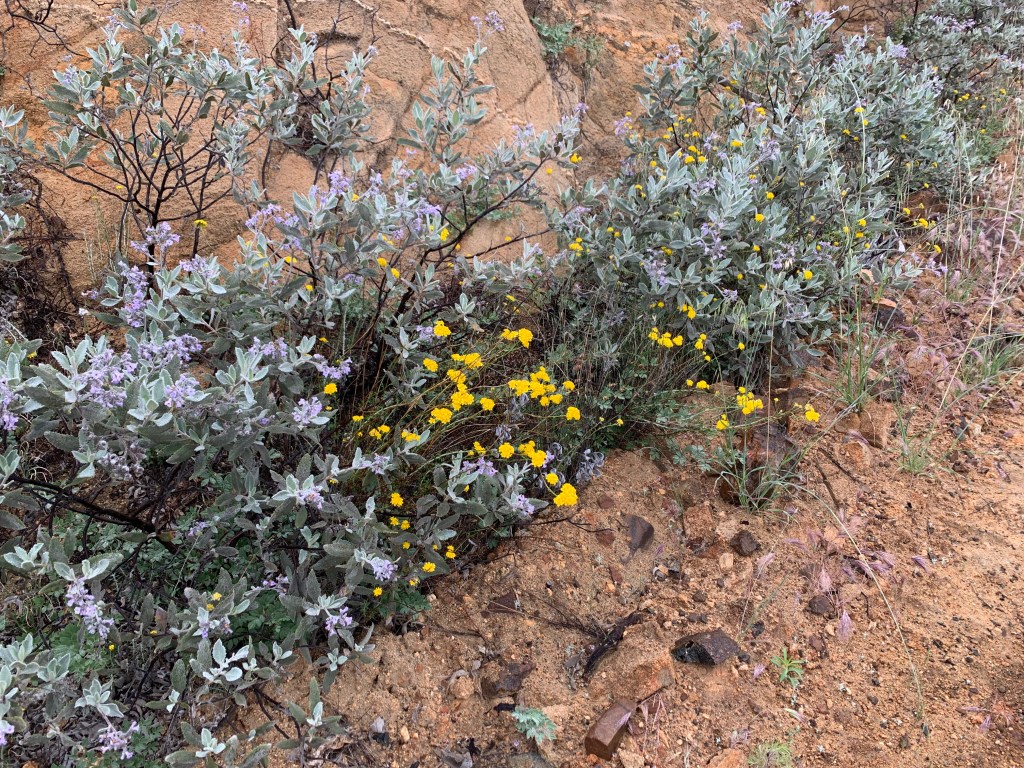
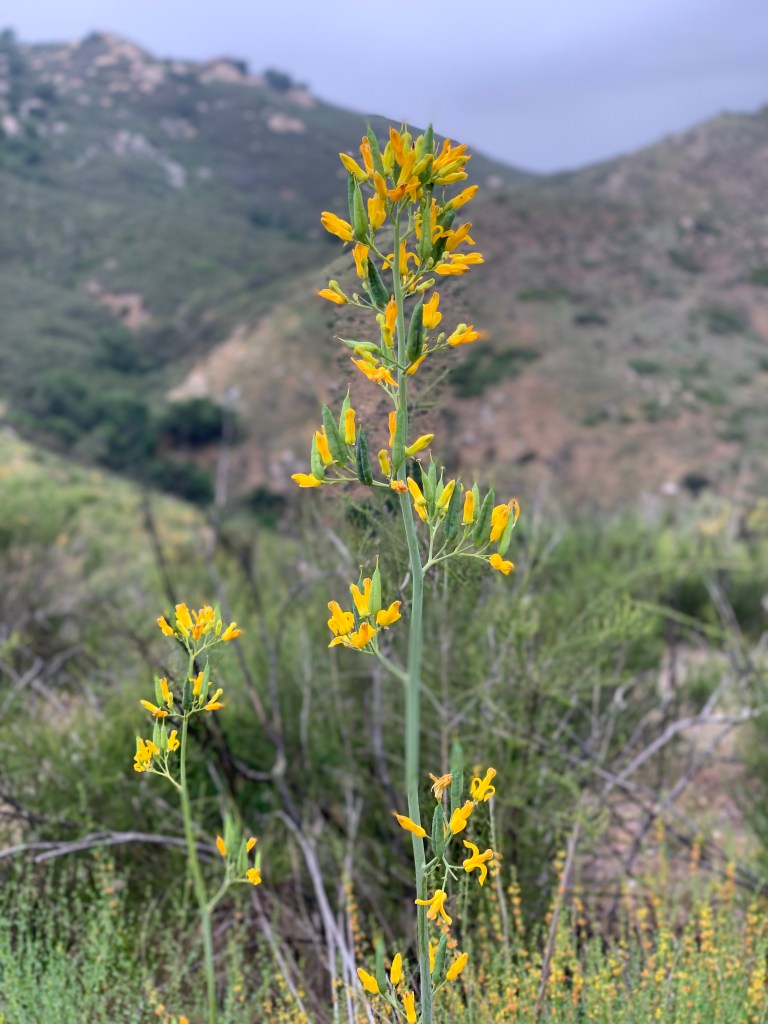
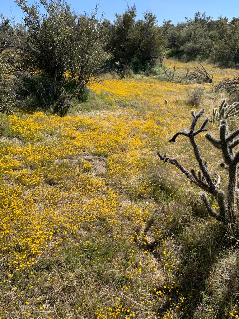
Sunday was much cooler, so we picked a trail that would not have been much fun in the heat. The trail that leads to Peak 1755 is sometimes called South Clevenger Canyon, and sometimes the San Pasqual Trail – South (the latter name is used in Afoot & Afield, with the word “Clevenger” appearing nowhere in the text). So this hike with three names was our target this morning. It was a long drive for a relatively short hike, but it was worth it – the flowers were over the top! So beautiful!
To add yet a fourth way to refer to this hike, it is also known as the “chairs hike.” Near the end of the trail, bolted atop a boulder, is a pair of lawn chairs – perfect for the ‘gram, amiright? We hiked past the turnoff to our peak destination since of course we could not do this hike without going out to the chairs. We took our pics, then continued along the last bit of trail to the very end (which is apparently Peak 1635). We picked up our true goal, Peak 1755, on the way back. On my drive home it was raining. WTF?
With that, I’m personally at 60 peaks bagged so far in my 2021 100 Peaks Challenge. The desert is done except for some that we’re saving for the end. We’re nearly out of weekday hikes, except for a few minor peaks that we’ve agreed to do on our own. We are now focusing our planning on the hikes that can’t be done when it’s very hot. We’ll pencil these in and if the weather decides not to cooperate, we’ll swap them for the mountain hikes. That’s the plan at least – we’ll see how much this whacky weather cooperates!
Hot Springs Mountain
Great new signage!
Hot Springs Mountain is the highest peak in San Diego County. The forest near the summit is like a different world!
Mount San Jacinto in the middle foreground, and San Gorgonio (hard to see) behind it
The question is, how’d they get that concrete block up on top of the summit?? We could barely stand up there, I can’t imagine pouring concrete.
Hot Springs Mountain, Peak #59
Yay, new register!
Love meeting new people on my hikes!
Fire tower
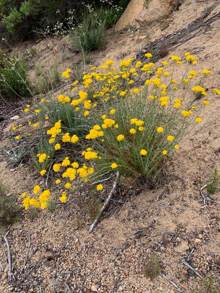
California poppies
Nearly done!
Peak 1755 / Clevenger Canyon South
Pick a name already!
San Pasqual Valley. (I think.)
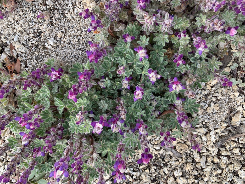
Penstemon, says Uncle Jimmy!
Peak 1755, Peak #60!!!
Bad ass. Need a group name still!
Deerweed
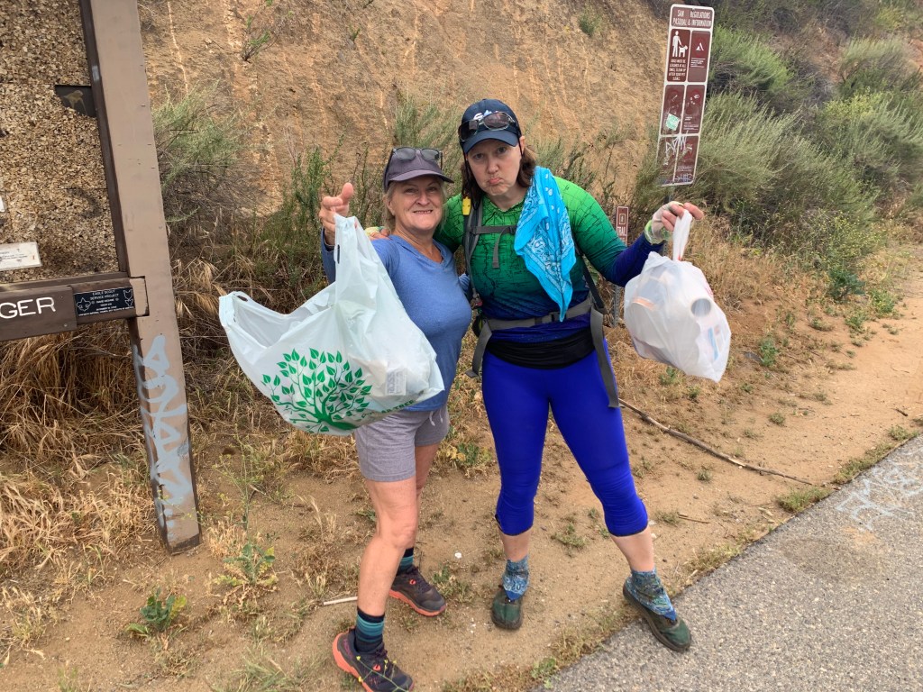
There was a LOT of trash at the trail head. We cleaned it up.
Chariot Mountain April 24, 2021 Miles: 5.68 Elevation Gain: 1,279 ft Gaia Track 100 Peaks Challenge #57
Oriflamme Mountain April 24, 2021 Miles: 4.37 Elevation Gain: 856 ft Gaia Track 100 Peaks Challenge #58
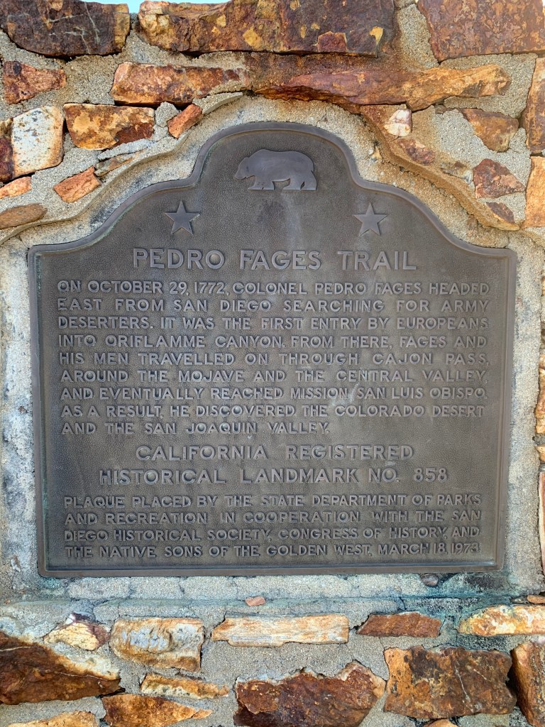
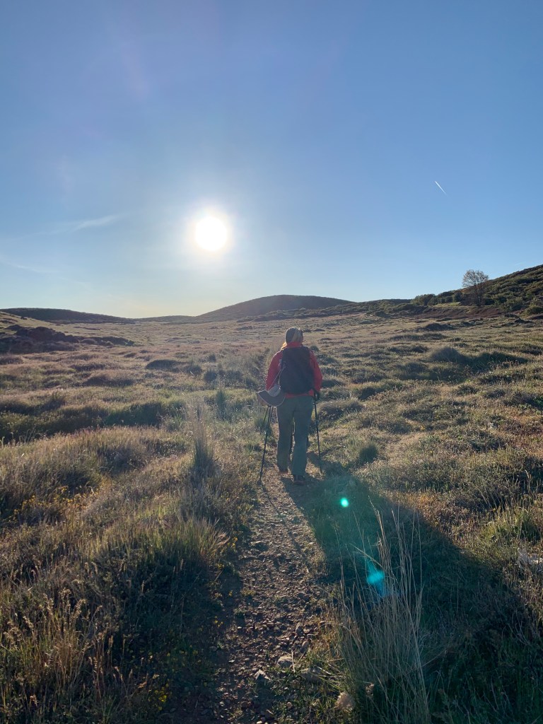
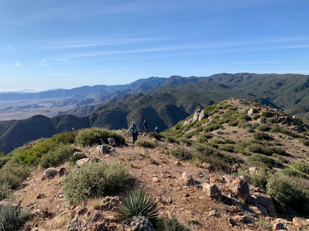
The trailheads for both of these peaks are along Sunrise Highway north of the Mount Laguna Recreation Area. But both peaks are east of the Laguna Crest, with the trails descending into canyons before rising up again to their respective peaks. Even though these seem like “Mount Laguna” hikes, they are really both desert hikes, nearly all within the boundaries of Anza-Borrego Desert State Park (Oriflamme’s peak itself is on BLM land). So even though I have said we must be done with the desert until the fall, we thought we could squeeze these two in before it gets even hotter.
This weekend seemed perfect – the weather was forecasted to be cool and breezy. Also Tad & I were planning on heading up to our property near Mount Laguna this weekend to get some work done (building a latrine), so it was convenient for me personally. When we have multiple hikes planned, we always like to do the harder hike first, and that was Chariot Mountain. At 7am we met at the Pedro Fages trailhead. Today we had company – Bianca joined us! Yay! I have not hiked with her in quite some time, so it was great catching up with her.
Both of these hikes are inverted hikes, meaning they descend before ascending. The route to Chariot started along a singletrack trail but soon diverged across an open grassy meadow – there were even two small marshy streams we had to hop across. At just under a mile we intersected with the Pacific Crest Trail and then soon descended steeply along a drainage channel with some minor bushwhacking until we arrived at the Mason Valley Truck Trail.
We had discussed possibly driving part of this route to shorten the hike. Kali & I had hiked this section of the PCT recently and encountered a few cars, so we knew it was possible. I did not do much research, but I’m pretty sure it’s a long dirt road that makes its way up from Banner, way over past Julian. Given the short length of this hike versus the logistics of a long 4wd drive, it was not worth it. So, we road walked this portion instead.
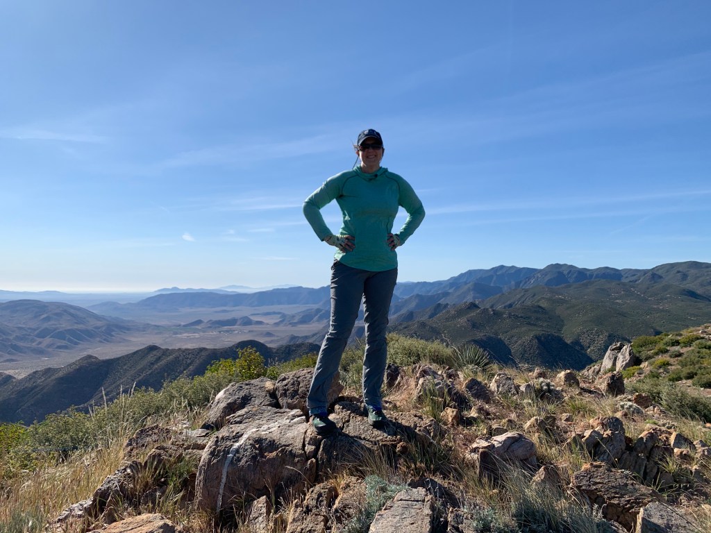
Finally we came to the turnoff toward the peak, “marked” by a pile of woody dead brush. The slope was not too steep and soon we reached the ridge and then the summit. The peak marked in Peakbagger as “Chariot Mountain” is not the same as the summit with that name on all of our maps. I don’t know why there is a difference, but since the peak labeled on our maps would have been a much longer and more difficult hike, we were ok with it.
On the way back the conversation was flowing and the navigation was forgotten for a moment until I realized I was briskly leading us down the wrong ridge – whoops. (That’s the little detour you can see in my Gaia track.) We got back on track quickly. The hike back up the steep drainage was hard – inverted hikes are always demoralizing. (Except the Grand Canyon. Hiking in the Grand Canyon is never demoralizing.) As we neared the top, a biplane came buzzing over our heads low to the ground – this trail is near an airstrip off the S2 and we guessed it came from there.
The flowers in the meadow were stunning in this direction. On the way out, the wind was blowing their little faces away from us; and also we were hiking into the sun. On the way back all the flowers were facing toward us and it was like we were walking on sunshine! 🎶
Back in our cars we headed south to the next trail. I swung by the Sunrise Trailhead to drop a few gallons of water and some snacks at the cache there for the PCT hikers – the spigot that is there is broken, so us local trail angels are trying to keep it stocked with water jugs (that’s a tough water carry).
I joined the others at to park at the Lucky 5 Ranch turnout – we had not carpooled today and squeezing another 5 cars in there was tight. The trail to Oriflamme Mountain was entirely along a dirt road. There was ample evidence that the road is used, but back at home studying my map I can’t figure out how a driver would get there. Another inverted hike, but fortunately this one had no off-trail steep bits. Another hike with beautiful flowers – it’s that time of year, after all. The off-trail trek to the summit was straightforward with a bit of a use trail here and there. The summit itself was broad, with a couple of boulder piles, and it took us some poking around to find the register (it’s on the southwest pile) and decide which boulder pile was the highest (the northeast one).
We were done for the day just before 1pm. It ended up being pretty warm despite the forecast so we are glad we got these two peaks done now and did not save them for the summer. This is an easy weekend for me – I’m taking Sunday off!
Chariot Mountain
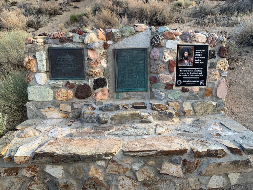
Hey look! This guy “discovered” the Colorado Desert!!!
Palomar High Point April 17, 2021 Miles: 0.6 Elevation Gain: 180ft Gaia route (I did not record the track) 100 Peaks Challenge #54
Eagle Crag & Agua Tibia April 17 & 18, 2021 Miles: 21.6 Elevation Gain: 3219ft Gaia track day #1 (Eagle Crag) Gaia track day #2 (Agua Tibia) 100 Peaks Challenge #s 55 & 56 Afoot & Afield 5th ed. Trip #123
I like hiking, and I really like peak bagging. But you know what I love? I love backpacking!! Eagle Crag and Agua Tibia peaks, north of Palomar, are remote enough that we decided an overnight trip was called for. They can be done as day hikes – two looong day hikes – but that just sounded hard. And you don’t really need to twist my arm to convince me to go backpacking. Yes, it would be a dry camp (i.e., we’d have to carry all our water), but I’ve done plenty of those (I live in San Diego, after all) – and honestly, we’d need nearly as much water on a super long day hike too. These are the only peaks on our 100 Peaks Challenge list that would be a backpack trip, and I was excited.
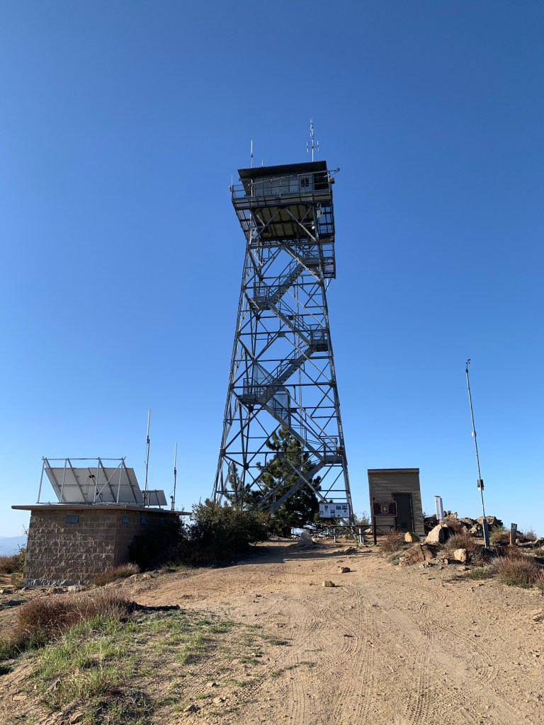
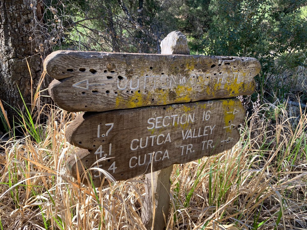
We decided to do this as a point-to-point hike, from the Cutca Trailhead to Dripping Springs. We got an early start, dropping one car at our end point, and carpooling over to our start. The Cutca Trailhead is en route to a third peak: Palomar High Point. We were considering doing that one on Sunday afternoon, but we made a last minute decision to do it right off. We drove the windy dirt road all the way up the north side of Palomar Mountain, and parked at the gate leading up to the high point itself. It was a short road walk to get to the top. Atop Palomar High Point is a fire lookout tower – one of three in San Diego county. Visitors cannot climb the stairs but there is a nice open area around the base. We took our pics and looked around for a bit, then headed back down. Peak #54!
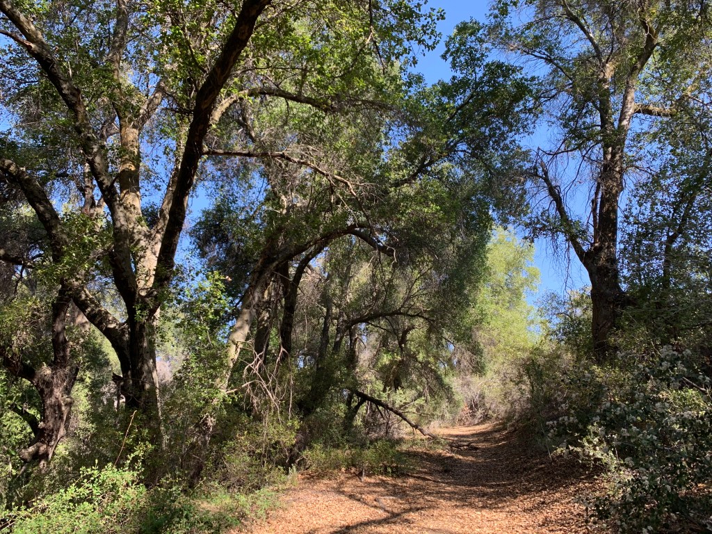
We started our big hike around 9am. One of the reasons I was glad we were doing this as a point-to-point hike is that it allowed us to include the Cutca Trail, which is remote and hard to get to, and has been on my to-do list for a while. Afoot & Afield considers this hike to be one of the “best backpacking routes” in the book. The trail starts out inauspiciously – descending steeply and overgrown for the first mile, to a dry stream.
This trail really did have everything – good, bad, and beautiful. It was a long hike that meandered through beautiful lush oak groves; ceanothus tunnels; desert-like chapparal shrubs and manzanita; and open meadows. Spring flower blooms were stunning, and the smell of the lilacs perfumed the air. The first few streams were dry, but as we continued we found water in pools and some even flowing (albeit a bit green). We literally saw no other hikers all day and in this remote part of San Diego county it felt like another world, and like a true adventure.
As for the “bad,” well, there was poison oak everywhere, and ugh, the bugs!! I inhaled at least four of them. We all had bug nets and made good use of them, but they are hot and impair visibility so all day I was pulling mine on and off. But the worst part was that the portion of the trail along the stream just below the switchbacks was completely washed out. It seemed to have suffered a flash flood sometime within the last several months. For about three quarters of a mile we were climbing over ripped-out trees and boulders, and scrambling up the sheer sides of the drainage to get past obstacles – at least once requiring descending a sandy cliff back to the streambed. It was exhausting, and a little after noon we stopped for a nice long lunch break (I took a nap).
We got started again and ascended up the switchbacks until we arrived at the intersection with Palomar Divide Road. Our first possible campsite was here, but we wanted to get further first – and it was still early afternoon. We continued on to the base of Eagle Crag, dropped our packs, and “cameled up” – gulping down some water so that we did not need to bring any with us. The off-trail route to the peak began extremely steep but with a fairly clear use trail. Eventually the route leveled out and the bushwhacking began. We arrived at the rocky outcrop that was our destination. Peak #55!
Back on the main trail we continued northwest, descending now. The ceanothus were really encroaching on the trail here but I had no more shits to give – I was just plowing through them. It’s a miracle I never drew blood. Finally we arrived at Crosley Saddle, and right at the intersection with the Wild Horse Peak Trail, several camping sites appeared, and we stopped for the day.
It was only 4:30pm but it had been a long, hard day. I’d gotten my pack base weight down to 10 pounds, plus 17 pounds of water and 3 pounds of food for an even 30. I decided that with this glorious weather I’d skip the tent and bring only my bug bivy, and my warm weather quilt. It was the right call. Our campsite was lovely, with a bit of shade and a view of Pauma Valley to the south.
We got started early on Sunday morning. We knew from trip reports that our hike from here to Agua Tibia Mountain would involve a notorious blow-down section with several downed trees to navigate, as well as about 800 feet of climbing. We soon reached the blow-down area and worked our way over and under the limbs and branches … and then we were through. I think we were past the downed trees in about twenty minutes. Well that was nothing! Compared to our obstacle course yesterday this was a piece of cake.
Sooner than expected we arrived at Agua Tibia. The off-trail jog to the peak was a simple walk-up, and soon we were at the summit block. All four of us were able to do the quick climb to the top for our photo shoot. We admired the view and signed the register and then kept going. #56!
The rest of the hike, descending the Dripping Springs Trail, was easy but long. Finally around 8am we encountered our first other human on the trail – a super fast trail runner who had started his run only an hour earlier. We encountered a few more folks on this steady and well-maintained downhill – it was a lovely trail, but downright boring compared to yesterday’s adventure. A few miles from the bottom we even bumped into someone we knew (this actually happens fairly often – it’s such a cool hiking community here in San Diego).
Finally we got to the bottom, arriving at the Dripping Springs Campground, and began the drive to retrieve the car we’d left at our starting point. Doing this as a point-to-point hike took some time to deal with the car shuttles but in hindsight it was a fantastic way to tackle these peaks.
Day 1 Photos
Palomar Fire Tower
Palomar High Point, Peak #54
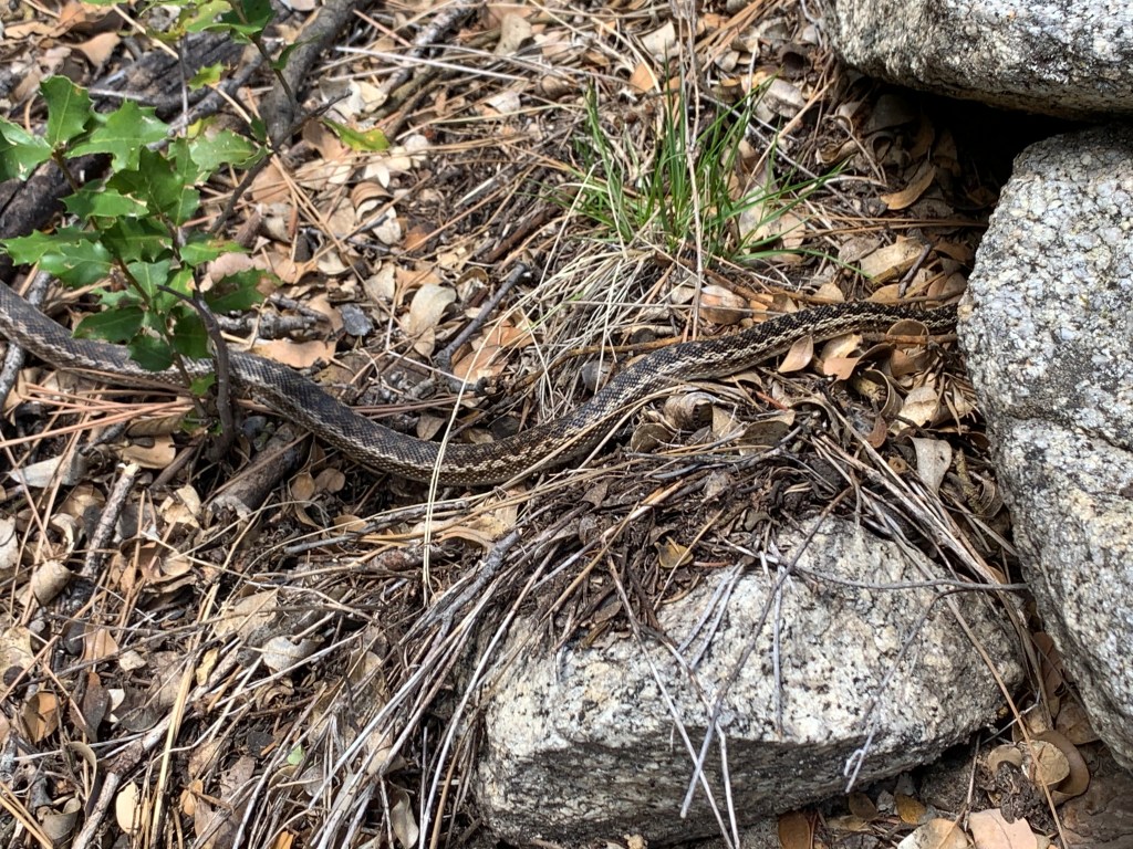
It’s a gopher snake! I also saw a garter snake.
Eagle Crag, Peak #55. Notice the fly photobomb, LOL!
Our campsite
My bug bivy
Day 2 Photos
Downed trees section on Palomar-Magee Trail – really not that bad.
The Thimble & San Ysidro Mountain April 10, 2021 Miles: 4.48 Elevation Gain: 1,915 ft Gaia Track 100 Peaks Challenge #s 48 & 49
Bonny & White Benchmarks April 10, 2021 Miles: 4.07 Elevation Gain: 1,048 ft Gaia Track 100 Peaks Challenge #s 50 & 51
Pinyon Ridge & Wilson Benchmark April 11, 2021 Miles: 8.61 Elevation Gain: 1,243 ft Gaia Track 100 Peaks Challenge #s 52 & 53 Afoot & Afield 5th ed. Trip #240
Back in early March, when we hiked Mile High Mountain, I said to my husband Tad that our overnights in the desert were done, at least until the fall. I figured the hikes up by the Ranchita area would not be too hard to squeeze in before it got hot; or if not, they could wait until fall. But we had a weather window and in a surge of ambition we decided to bag ALL SIX IN ONE WEEKEND. Tad was like, yay. Ok now THIS is the last desert overnight until the fall, seriously, for real this time!
We knew we’d have our work cut out for us. The Thimble is particularly notorious for having a lot of bushwhacking, and if you don’t approach the summit block from the correct direction, it can be almost impossible to summit. The other benchmarks north of the main road were no slouches either, despite the moderate stats. We were doing this because the forecast predicted relatively cool temps, but “relative” is the key word – it would still be in the mid-70s and sunny by the afternoon.
We headed up early on Saturday morning and met up at the PCT trail junction at Barrel Springs just west of Ranchita. From there we piled in to Shadow (Tara’s trusty Jeep) and, turning left onto Lease Road and right onto Landmark Lane, arrived at the trail head for our first objective: The Thimble. These rural dirt roads were not bad – high clearance would have been sufficient. When we arrived we were not that surprised to see Travis Curry there! Love following all these other peak baggers around as we all work down our lists! Travis was shooting for East San Ysidro so had an even longer day in store than we did. Our trails started together so it was fun walking with him as we hiked up the dirt road which wound its way around an unnamed hill to our right. We arrived at our cross-country turnoff for the route that our friend Chris recommended. Travis continued on his journey and we began our bushwhack.
Chris’s route was spot on. There were definitely some bushes that required whacking (I brought some clippers and did a little landscaping along the way) but nothing too severe. We arrived at the scramble to the summit and had no trouble. Peak #48 was done!
We opted to backtrack down our known route rather than try to make a beeline to the northwest toward our next objective – that just looked sketchy and we knew from our research it would be tough. So we sucked up the extra distance for a ways until we finally cut toward the north and bushwhacked to the wash leading up toward San Ysidro Mountain.
San Ysidro proved to be straightforward if a bit straight up in places – nothing we had not encountered before. The summit was broad with a few boulders to climb and check out the trio of benchmarks. There was another pair of hikers atop the summit. They introduced themselves as being from Orange County and working on the Sierra Club Hundred Peaks Section list.
After a rest and a snack we made a straight shot back to the car and debated whether we wanted to continue. Yes, it was hot, but not that hot. We had not done a lot of mileage but we had still worked pretty hard to get these summits. Should we call it a day and do something closer to home tomorrow? Or even drive back out in the morning to do tomorrow’s planned hikes?
Well we are nothing if not determined, and we decided to stick with the plan and DO THIS! In hindsight it was hard and if we weren’t so tired I’m sure we would have enjoyed the next pair of hikes more, but it was also good to get them done.
Bonny and White Benchmarks were straightforward. No trails to either of them, but the cross-country hike was clear, with no bushwhacking or steep sections, thank goodness. We summited Bonny Benchmark first – and were disappointed that we could not find a way to climb atop the summit block! We searched around the boulders a bit and found a possible route up the south side, but it was just too windy on that side. This challenge has no “rules” per se, and typically for these peak lists, if the climber is not comfortable with the exposure, or not able to get atop the summit block due to the technical difficulty, you can still “count” it. So far there have been a few other examples – Tooth Rock (of course – who would climb that??) and Mt. Woodson are standouts, although I’d like to take another crack at Woodson when the summit block is not covered in ice. But it was disappointing. I also regret not finding a better spot to take my summit photo. Maybe I have to revisit this one someday.
White Benchmark redeemed us – the hike from Bonny to White was absolutely beautiful. We were scampering (ok, trudging…) on a carpet of flowers, with wide open meadows and views all around. The summit block only required a tiny bit of easy climbing yet it looks really impressive on the photos. We took turns up there and then started heading back.
There are several other benchmarks in this immediate area including Clyde (of course – right next to Bonny), Hut, and Chimney. Most people collect these as they go. This was another drawback of us doing this hike while tired and hot – there was no way we were going to do anything other than what the challenge required of us! FOCUS!! Maybe another reason to come back to this area and explore more.
Our original plan was to camp at Culp Valley. Not surprisingly, it was totally full. We headed over toward the Paroli Homestead to camp there, but there were “no camping” signs. (I still have not figured this out – it’s marked on all maps as “Paroli Homestead Primitive Camp,” but it’s within a cultural preserve where camping is not allowed. Something to investigate on a future exploration.) By now we were just done. We ended up driving around toward tomorrow’s trail head and as soon as we had crossed out of private property and onto the state park, and found room to pull off the road, we stopped. It was not the most pleasant of campsites – I squeezed my tent between Tara & Casey’s cars, where they slept (Kali had headed home to deal with some work issues) – but it was fine. Once hiker trash, always hiker trash!
The plan for Sunday was to meet at the turnoff from the main road. To get to today’s trail head, the driving route headed south on Wilson Road and then left onto Old Culp Valley Road. The first part of this latter road is severely rutted – in fact we were impressed that Casey got her RWD pickup through – go Casey! We had stealth camped just past the rutted section, so Tara & I climbed into Shadow to backtrack to the S22 and pick up our hiking companions who had departed from San Diego at o’dark thirty to join us. On our way to the trail head, beyond our shitty camp site, of course we passed some gorgeous spots!!! LOL! Turned out if we’d been just a wee bit more patient we would not have had to sleep in the gutter! Oh well. As I have said before, one of my favorite things about this challenge is getting to know the nooks & crannies of San Diego County better – and here’s a great example.
Unlike yesterday, today’s hike was along a trail, with no bushwhacking or significant steep sections. Today was less breezy than yesterday so it was good to be getting started early. The trail passes by Pinyon Ridge before continuing on to Wilson, so we decided to hit Pinyon first. The off-trail section was straightforward with only a few minor navigational decisions to get around some boulders and bushes, and we soon arrived at the base of the summit block. This block was not as exposed or challenging as Bonny. Kali scampered to the top without hesitating. For the rest of us it was not so easy. There is no doubt in my mind that I could have climbed up there, but I just wasn’t feeling it today. Now as I sit at my desk typing this I am regretful – I barely even tried, and I wish I had. I’m really racking up the reasons to come back to this area sometime!
We cut cross-country due east, eventually meeting back up with the trail. Wilson Benchmark was just off trail. We chose to mostly follow a route that was marked as a trail on my Gaia layer but not on the USGS layer. This worked out well for us, with no bouldering required. The summit block was photogenic and not challenging. The summit area was broad and lovely, and we enjoyed our lunch and a rest. From there it was a fast four miles straight back to the cars. We all really loved the hike out to Pinyon & Wilson and agreed we should come back sometime for sure (reason #4??), maybe on a cooler day. In fact Kali pointed out that this would be a great WBC trip – something to consider in the future.
Hey look who we found!
Fucking mylar balloons…
Our destination – The Thimble!
The Thimble, #48
Next stop, San Ysidro Mountain
San Ysidro Mountain, #49
We tried so hard not to walk on them!!!
Bonny Benchmark, #50
White Benchmark, #51
Chimney Rock
OMG the flowers were amazing!
Hiker trash, yeah
Breakfast with a view!
Chollas glowing in the morning sun
Monster rock!
Seriously, I should have tried harder. (Yes, you can see my butt ventilation in this photo)
Pinyon Ridge, #52
Last stop of the weekend – Wilson Benchmark in the distance. (It was closer than it looks here.)
Little snakey snake!!!
Coming down off Pinyon
There was a fire here in 2012. These looked to me like dead zebras buried with their feet in the air. Ok maybe I have too much imagination…
Looking north toward where we were yesterday. I should label this photo but for now – the white-ish peak just above the round foreground rock just left of center is Thimble, and SY is to its right.
Bad Ass Peak Bagging Babes!!!
Wilson Benchmark, #53
Not clear exactly where the Wilson summit was so we took more photos…
Such a pretty trail!
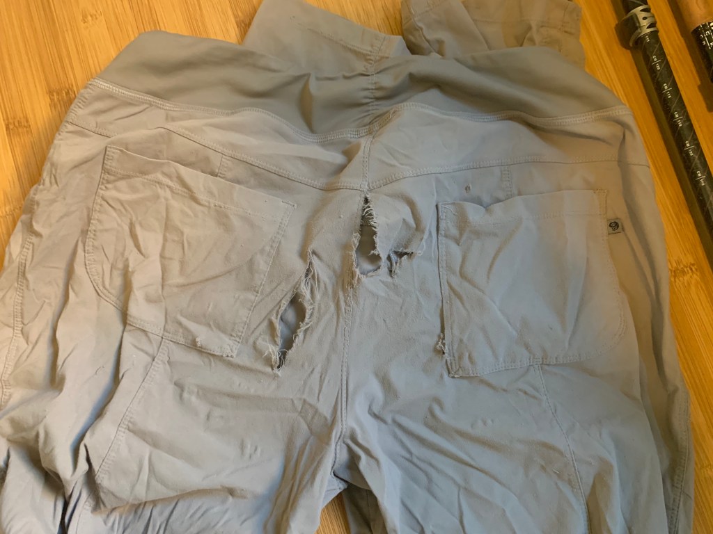
Bye bye to my favorite hiking pants! Well I have not thrown them away yet, I might still repair them and use them just for bushwhacking, we’ll see…