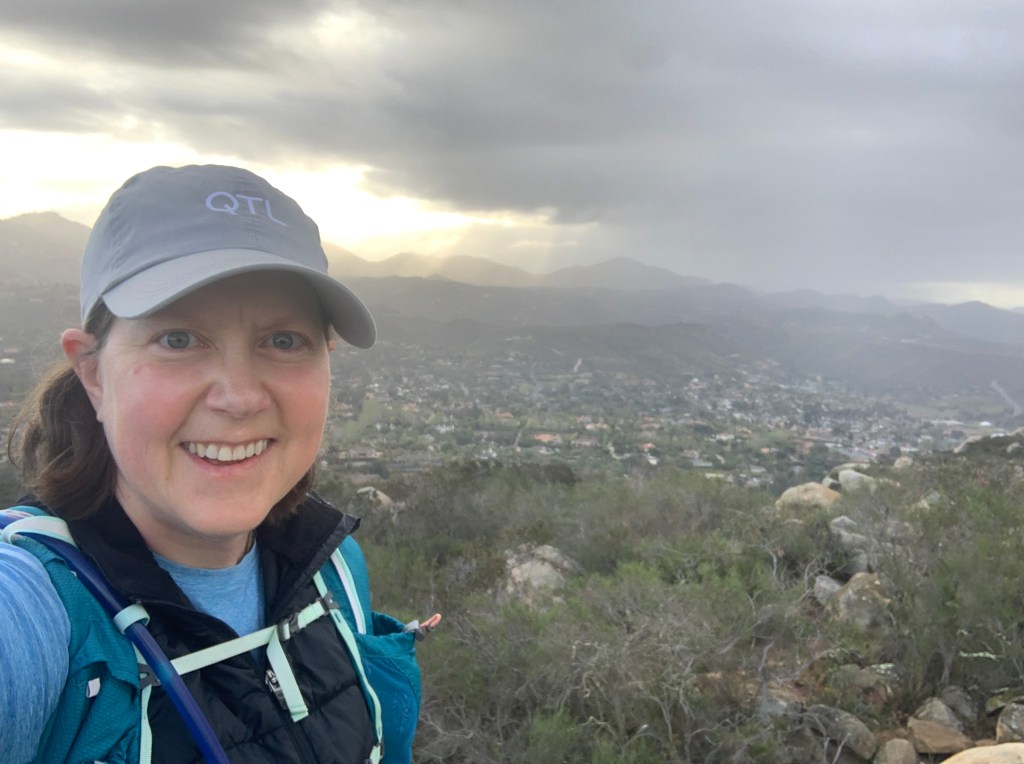
Long Valley Peak April 6, 2021 Miles: 4.1 Elevation Gain: 1,109ft Gaia Track 100 Peaks Challenge #47
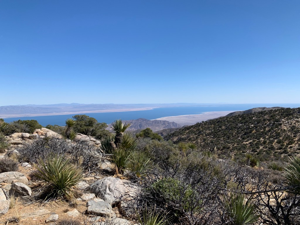
I had intended to hike Long Valley Peak a couple of weeks ago on another weekday, but hit Cowles & Pyles instead. My hesitation was that it’s long enough that I’d have needed to start well before down, and LVP is fairly remote. I don’t mind hiking in the dark; and I don’t mind hiking solo; but not both at the same time on this trail. Last weekend while enjoying spring break in Tucson, a couple of my peak squad knocked LVP off their lists, and I wanted to get it done too, so when Casey agreed to join me for a weekday hike I jumped at the chance. It was particularly nice of Casey to join me since it’s a long drive for her.
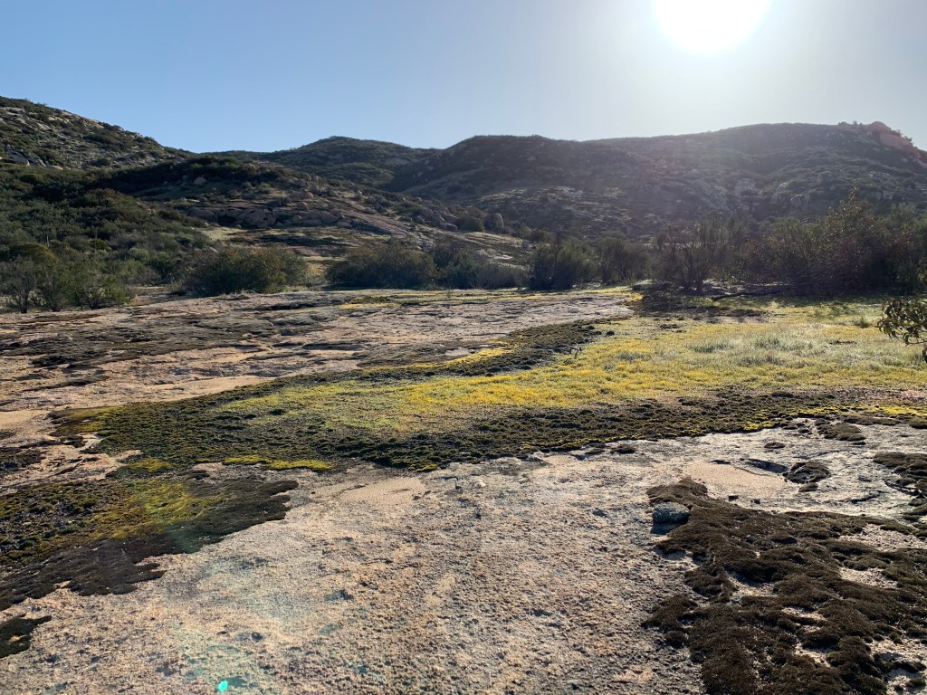
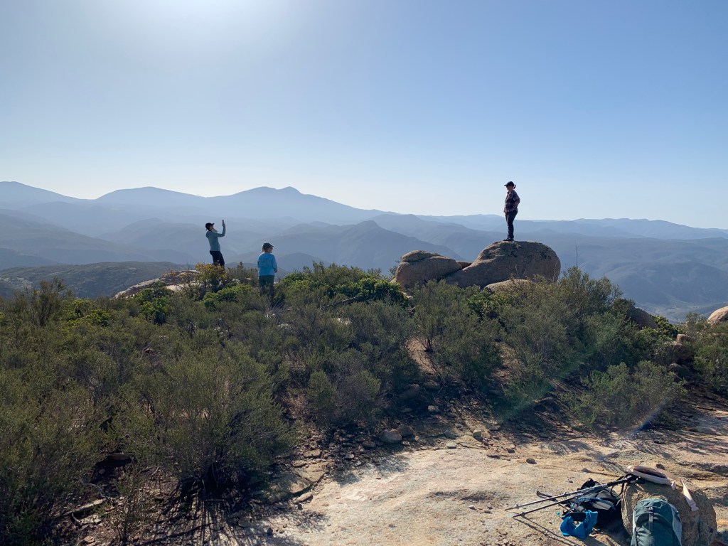
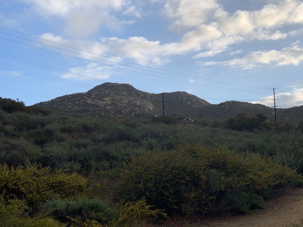
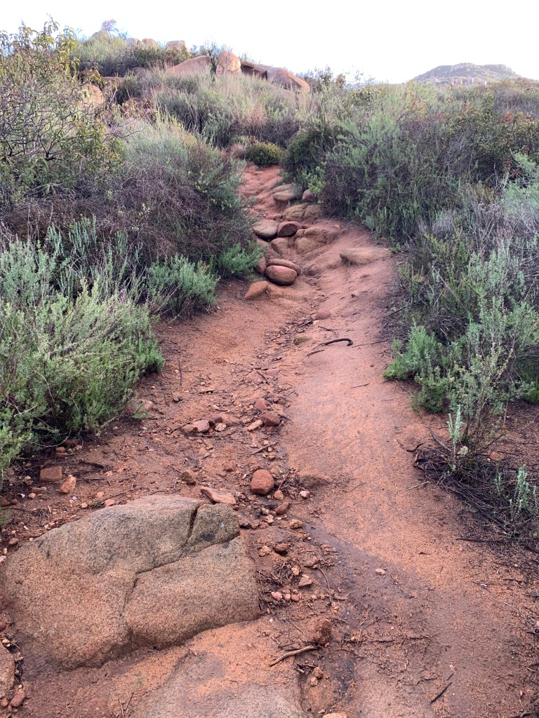
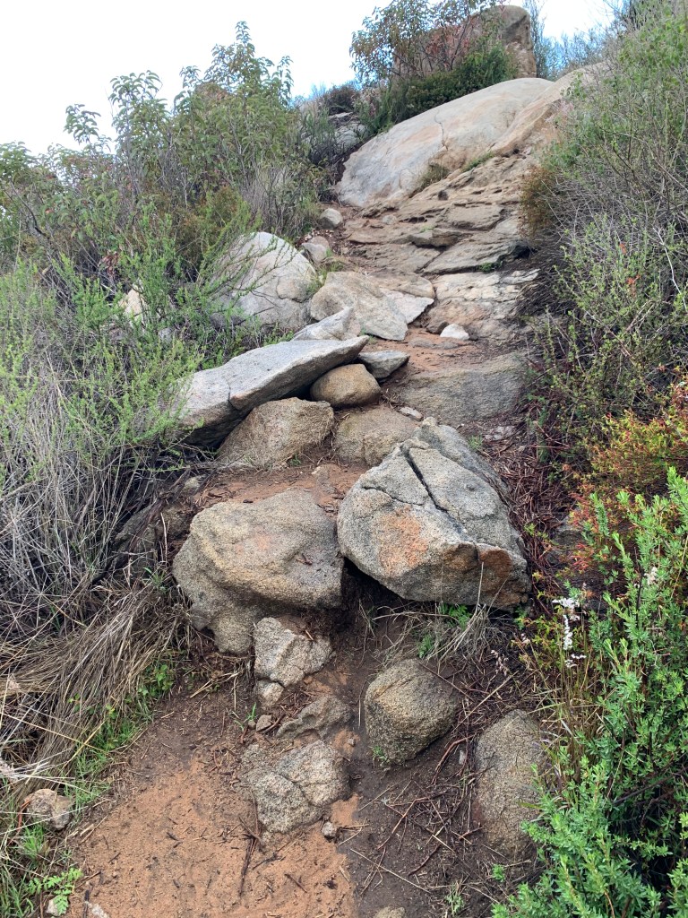
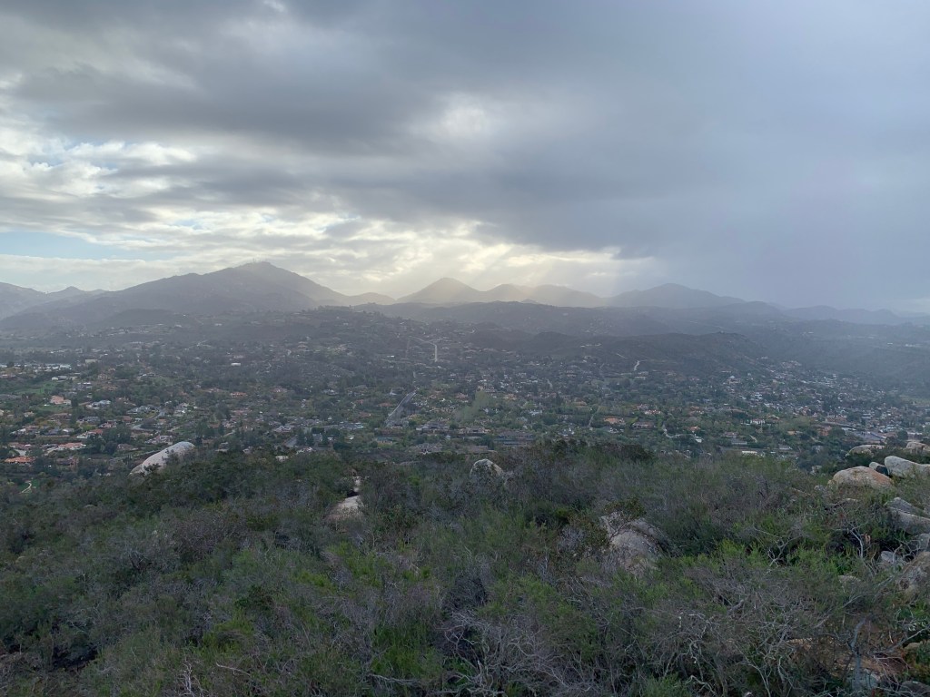
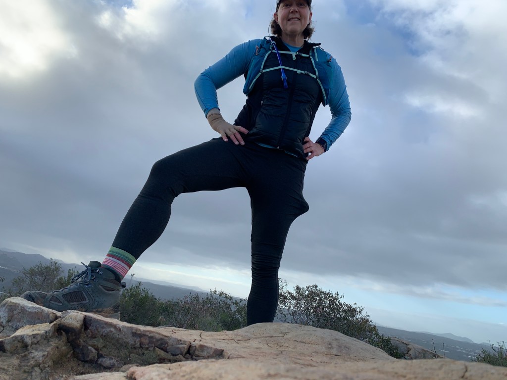
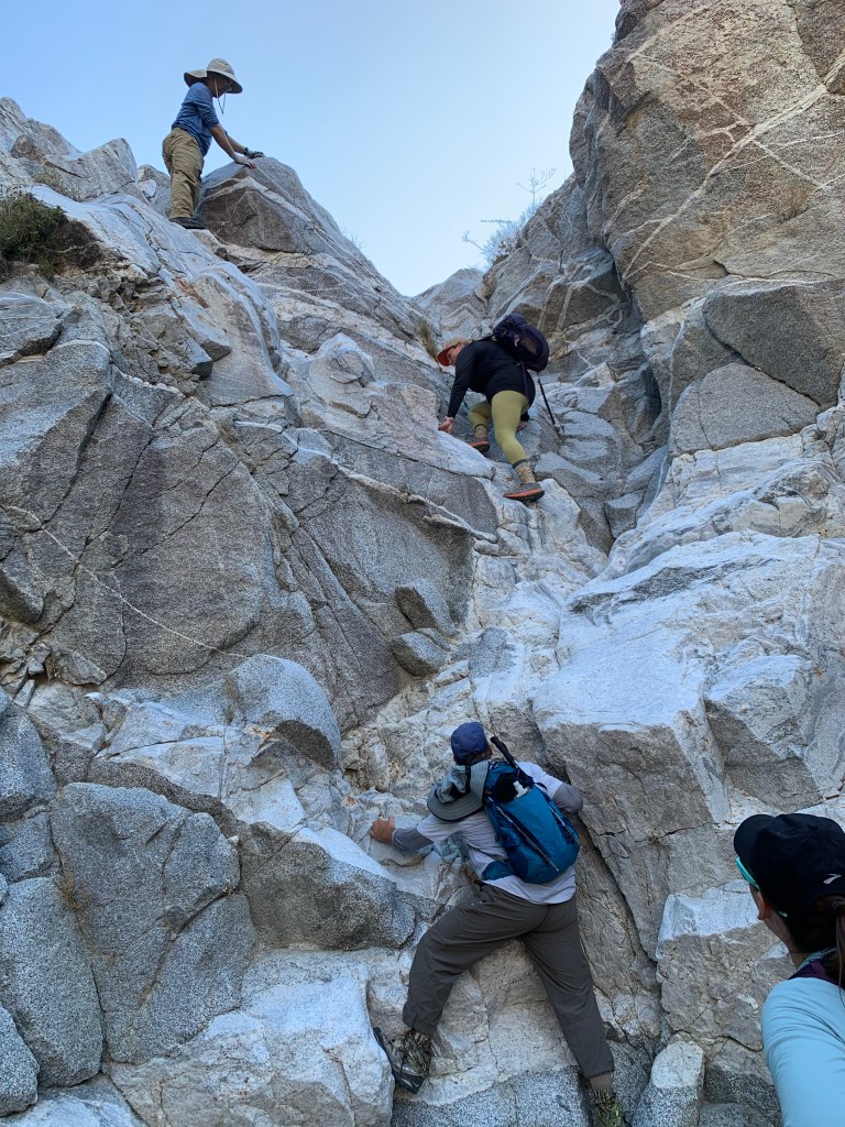
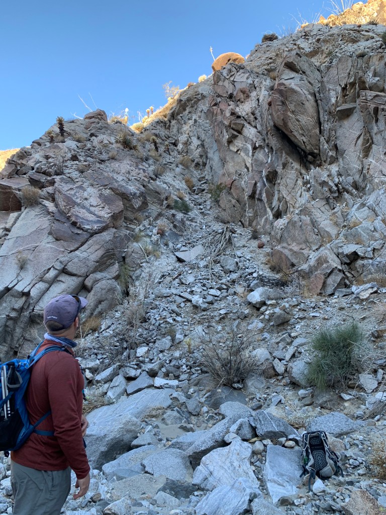
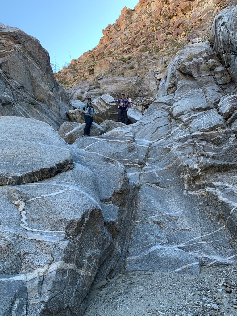
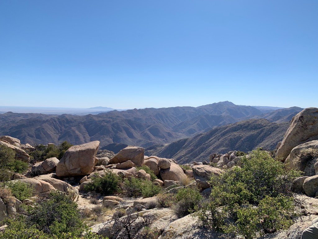
We planned to meet at the trail head around 6am and we were both about twenty minutes early – since I had a 9:30am meeting, I was eager to get started. This trail head is immediately off the freeway in Pine Valley, and appears to be a popular spot for motorbikes. The trail wasted no time in climbing up a steep slippery slope immediately. The first mile and a half or so followed a rugged Jeep road in a straight-line to the southwest before taking a sharp left turn onto a narrow trail. The trail soon started ascending – motorbike tracks were with us for a while but eventually gave out as the bouldering started. The bouldering near the summit was minimal, not exposed, and super fun. We made quick work of it and soon emerged at the summit. The trail is almost entirely on the west side of the peak, so it was not until the top when the early morning sun burst into view.
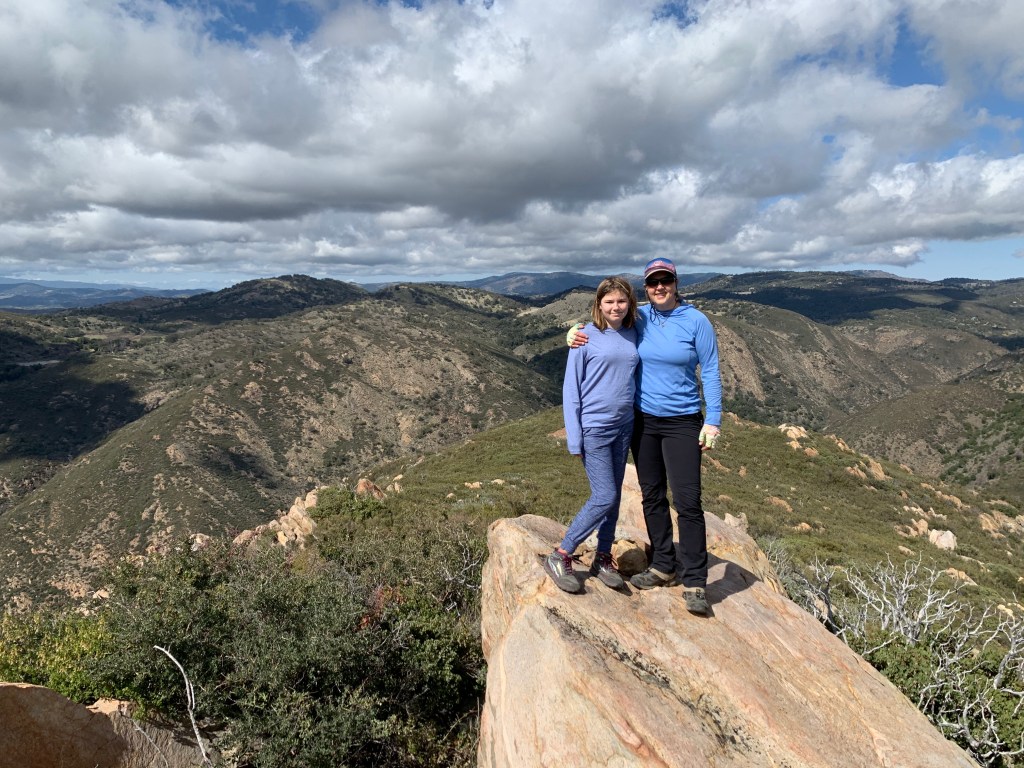
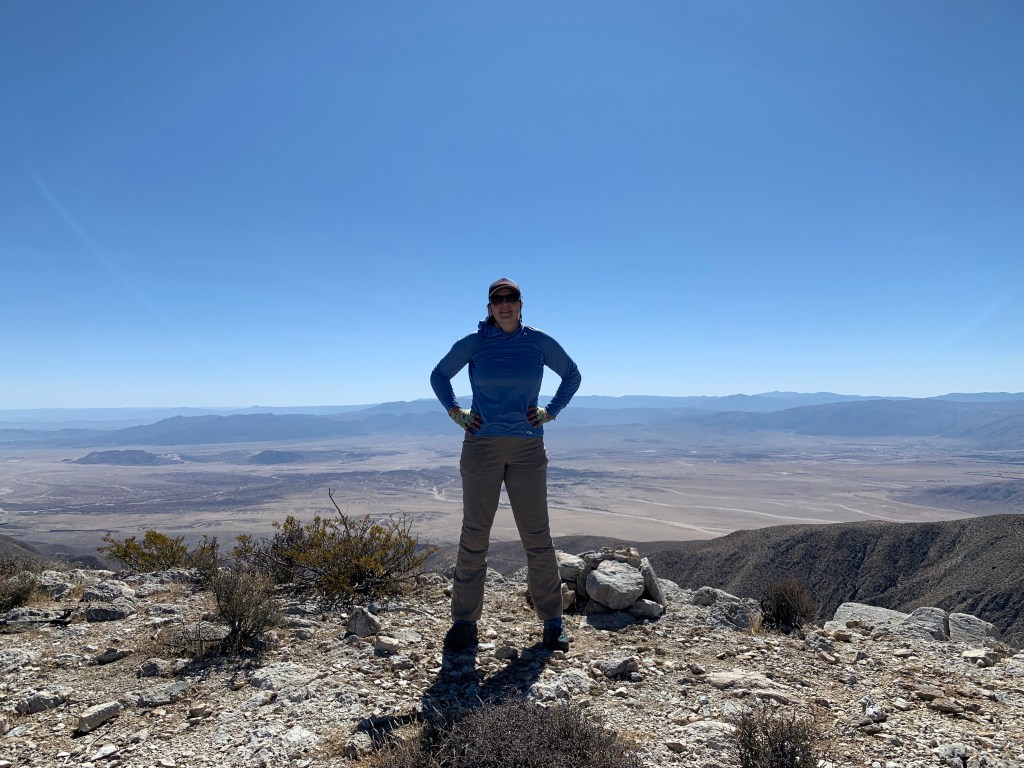
There was a register at the summit but it was full. I had a scrap of paper with me but forgot to replenish my pack with a fresh book – I try to keep an all-weather notepad and a pen with me just for this reason, oh well. We left our names, took our photos, and started heading back down.
We were moving along but not running – it felt like a good pace. The weather was perfect, nice and cool and shady. When we compared our moving time with our friends, who hiked this in the middle of a hot day, the times were surprisingly similar. And the moving time was also identical to another hiker whose track we followed. I guess 2:22 is the magic number for this hike! Ok, forty seven down.
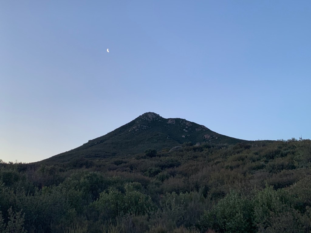
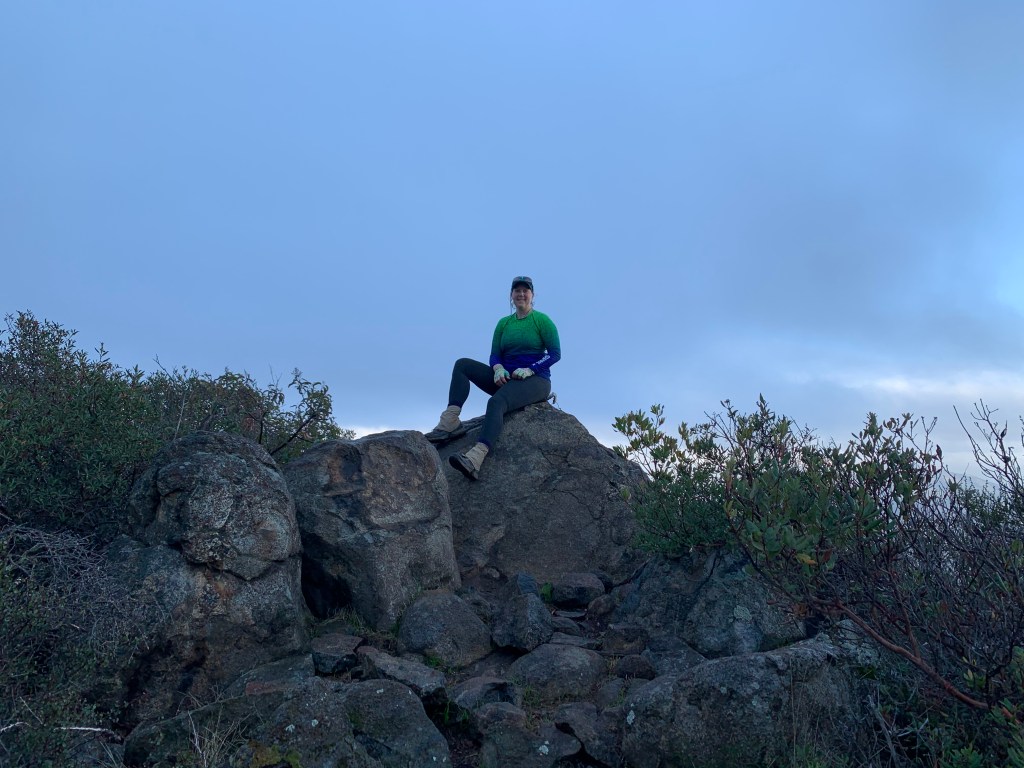
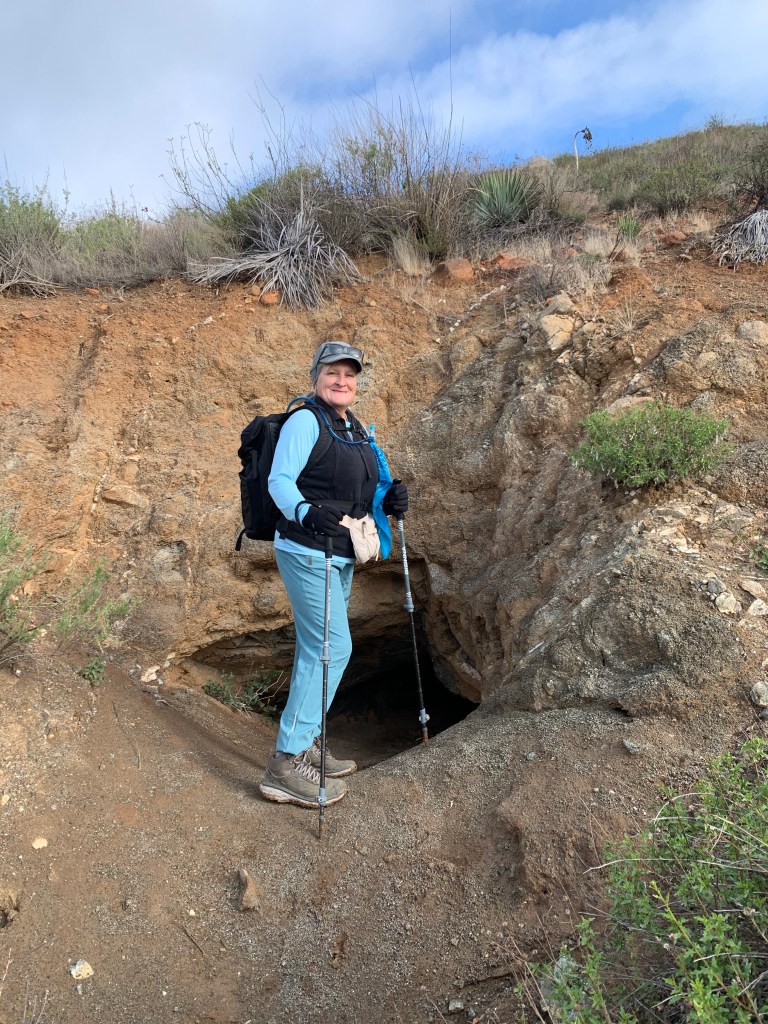
Long Valley Peak under the crescent moon
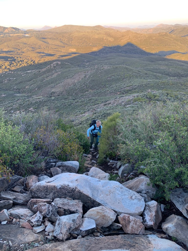
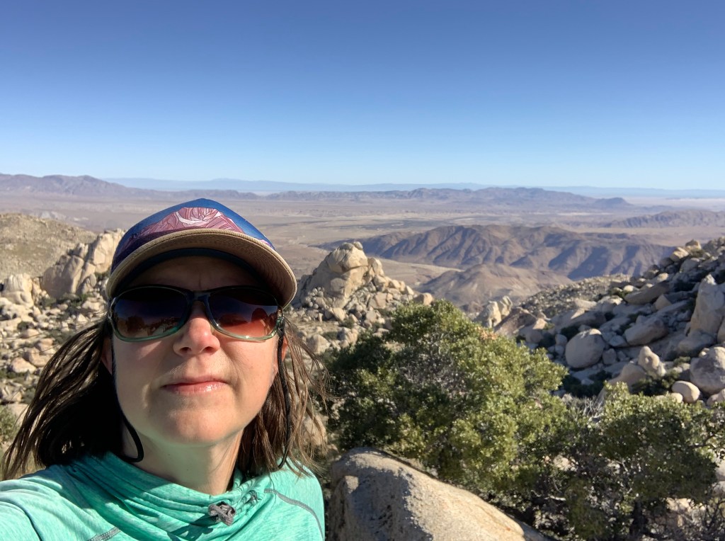
I like this photo because in addition to the lovely Casey in the foreground, you can see Long Valley Peak’s shadow behind her!
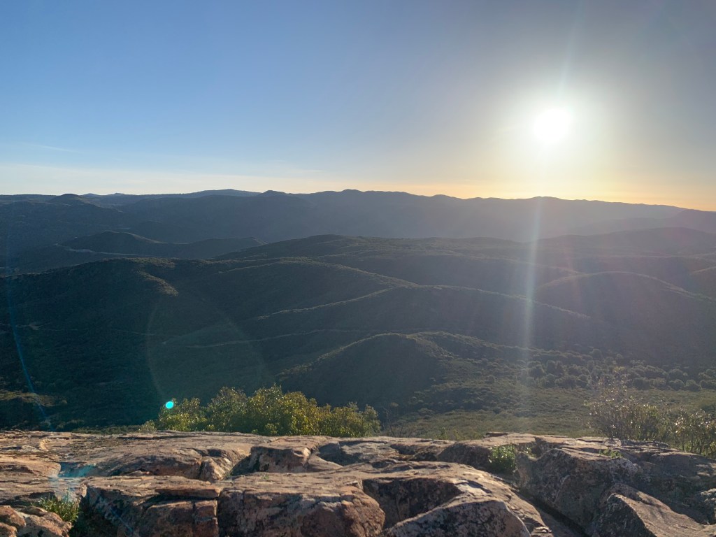
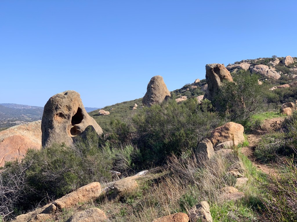
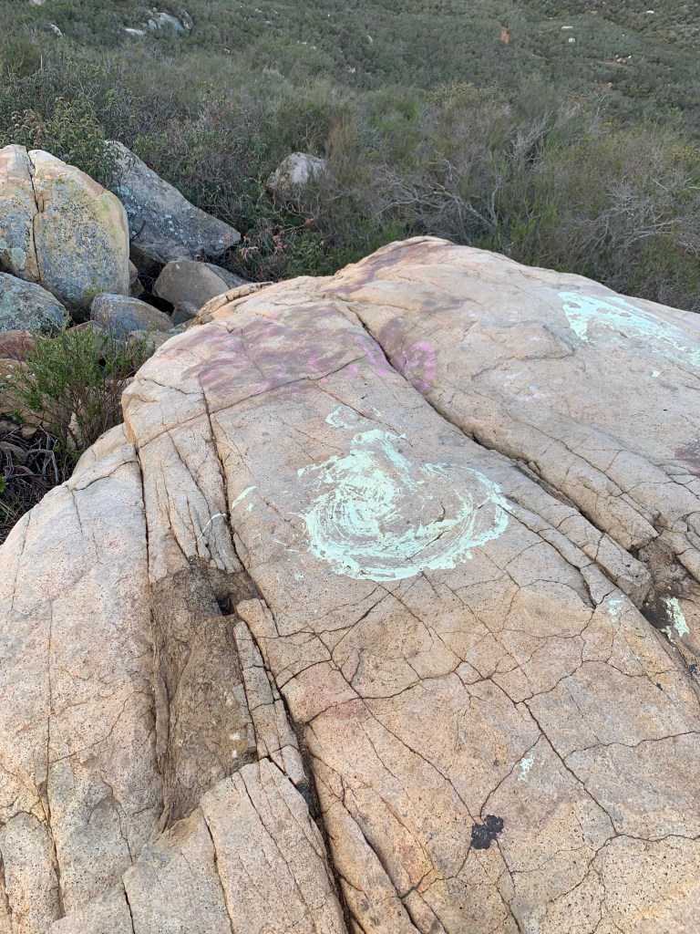
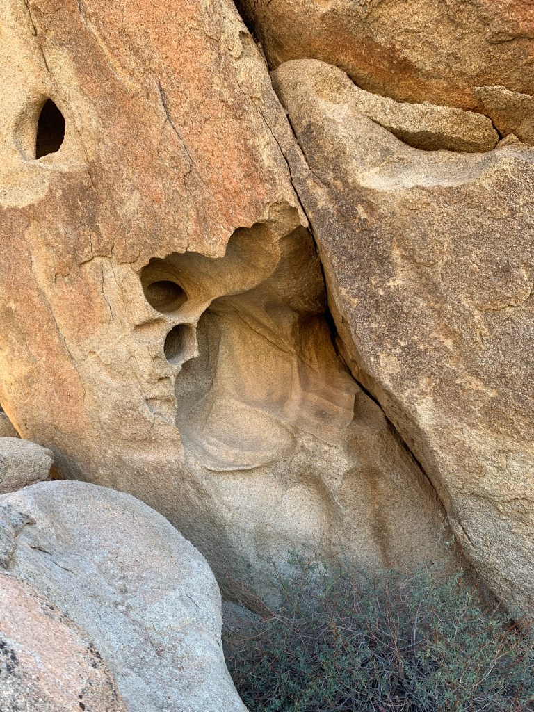
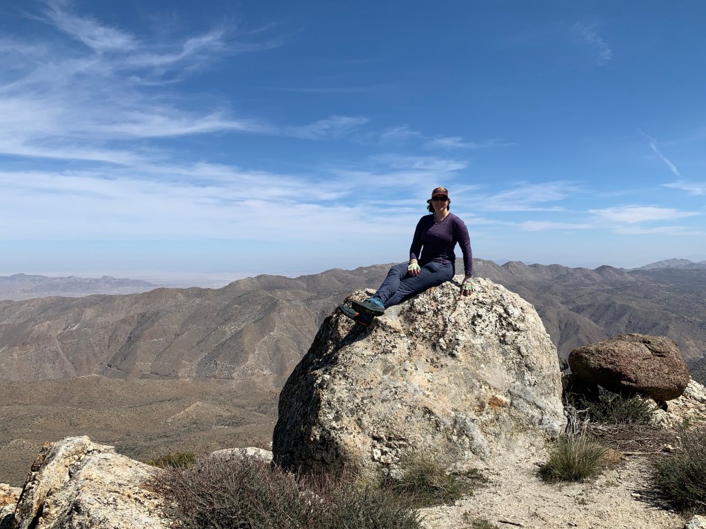
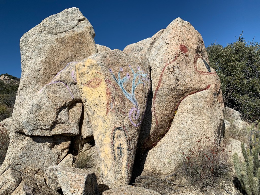
Summit block. Actually I think the true summit was behind this which is where we took our summit photo.
Battle Mountain April 3, 2021 Miles: 0.45 Elevation Gain: 273 ft Gaia Track 100 Peaks Challenge #44
Bernardo Mountain April 3, 2021 Miles: 7.32 Elevation Gain: 793 ft Gaia Track 100 Peaks Challenge #45 Afoot & Afield 5th ed. Trip #46
Mount Israel April 3, 2021 Miles: 4.37 Elevation Gain: 961 ft Gaia Track 100 Peaks Challenge #46
Last weekend was a trinity of hikes appropriate for the day before Easter Sunday. Battle Mountain was our first peak of the day. In the pre-dawn light we climbed up the short-but-steep neighborhood hill toward the brightly-lit white cross that beckoned from the summit. Later in the day there would likely be Easter services held here, so getting this one done before daylight was, ahem, a Godsend. Before heading out on this hike, Casey sent me some info about this peak – apparently the cross atop it is to memorialize the nearby Battle of San Pasquale. Scroll down to the “Legacy” section of the Wikipedia page to learn that the cross was erected on Easter Sunday in 1966!
After knocking that one out in a half hour or so, we took a short drive over to the Bernardo Mountain trailhead, alongside highway 15. This was the longest hike of our day, but logistically it made sense to do this one second. As with all the hikes today, I had never done this one before, so I was not aware that adjacent to this trail is the Lake Hodges Bridge, which is apparently the longest “stress ribbon bridge” in the world! The day had dawned thick with fog, limiting the views but keeping the temps nice and cool. The climb was gradual and lined with lilacs. There were a few other hikers on the trail but not too many. This one is harder to squeeze into my Easter theme, but certainly there were plenty of Saints Bernard, so hey, it fits.
Our third hike today was a bit further west. Most folks know of this peak as just an Elfin Forest overlook. We only learned of its name, Mount Israel, from doing this challenge – certainly a fitting name for our Easter weekend of hikes. Elfin Forest is a popular area, and it was getting to be late morning and sure to be crowded. Thanks to Casey’s local knowledge, we drove to an alternative trail head off Del Dios Highway, and it was a good call. The trail to the summit was a bit shorter from this trail head, which usually means steeper, and this was no exception – it was a butt burner! The weather was our friend all day today – the sun did not break through the clouds until we started on the descent. We made a bit of a loop on the way back just for some variety, and to enjoy the views over Olivenhain Reservoir.
Three more hikes down and it wasn’t even noon on Saturday, yeah!
The cross on Battle Mountain
Battle Mountain, #44
Flowers along Bernardo Mountain Trail
The world’s longest “stress ribbon bridge”!
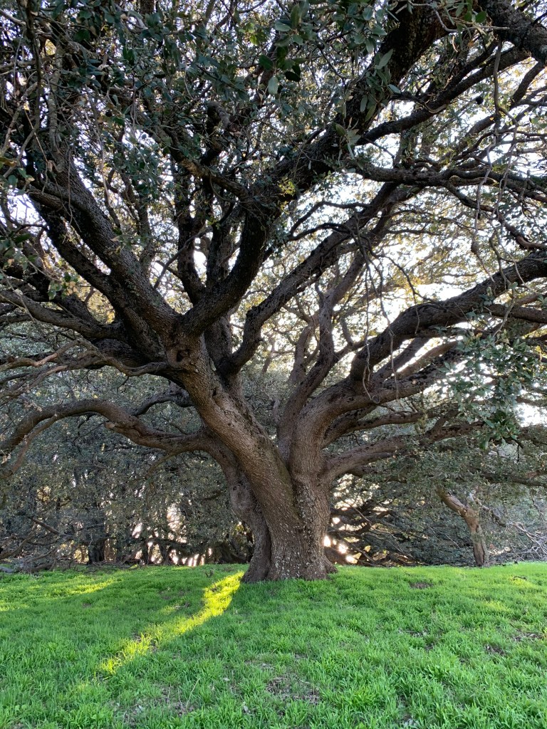
Lovely oak trees
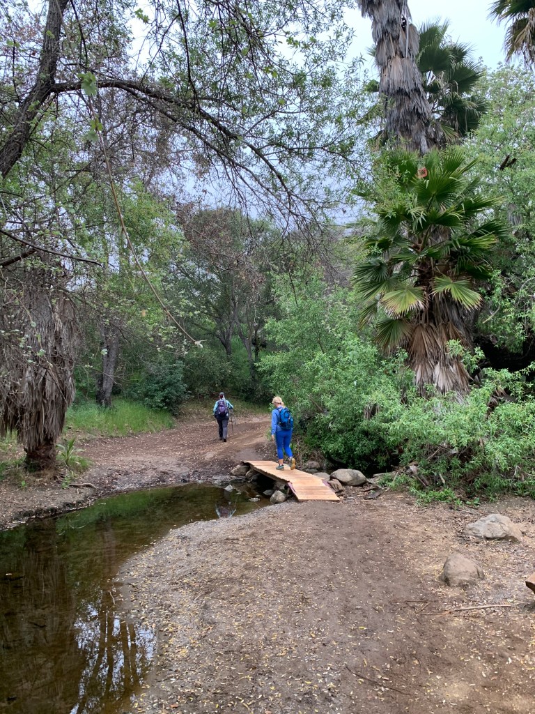
Crossing Felicita Creek
Turnoff to start the climb
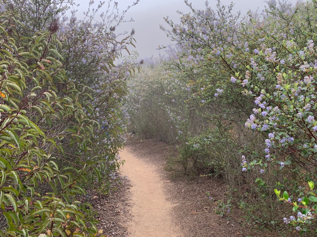
Lilac hallway
Bernardo Mountain, #45
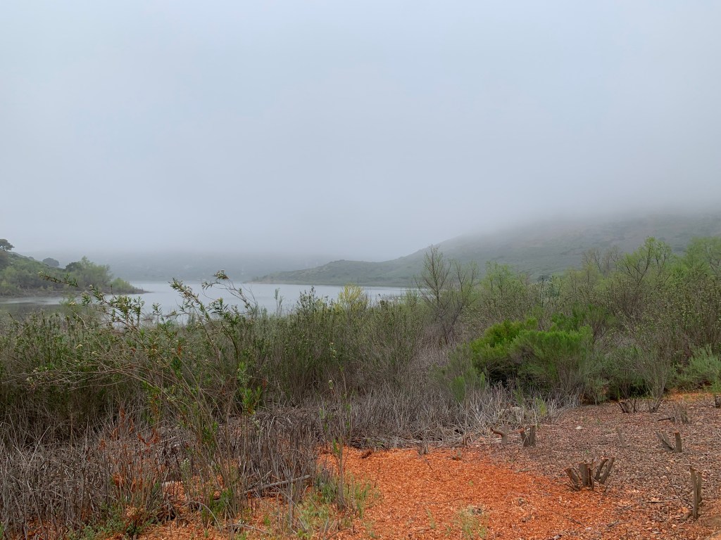
We can finally see Lake Hodges
Lilac & Monkeyflower
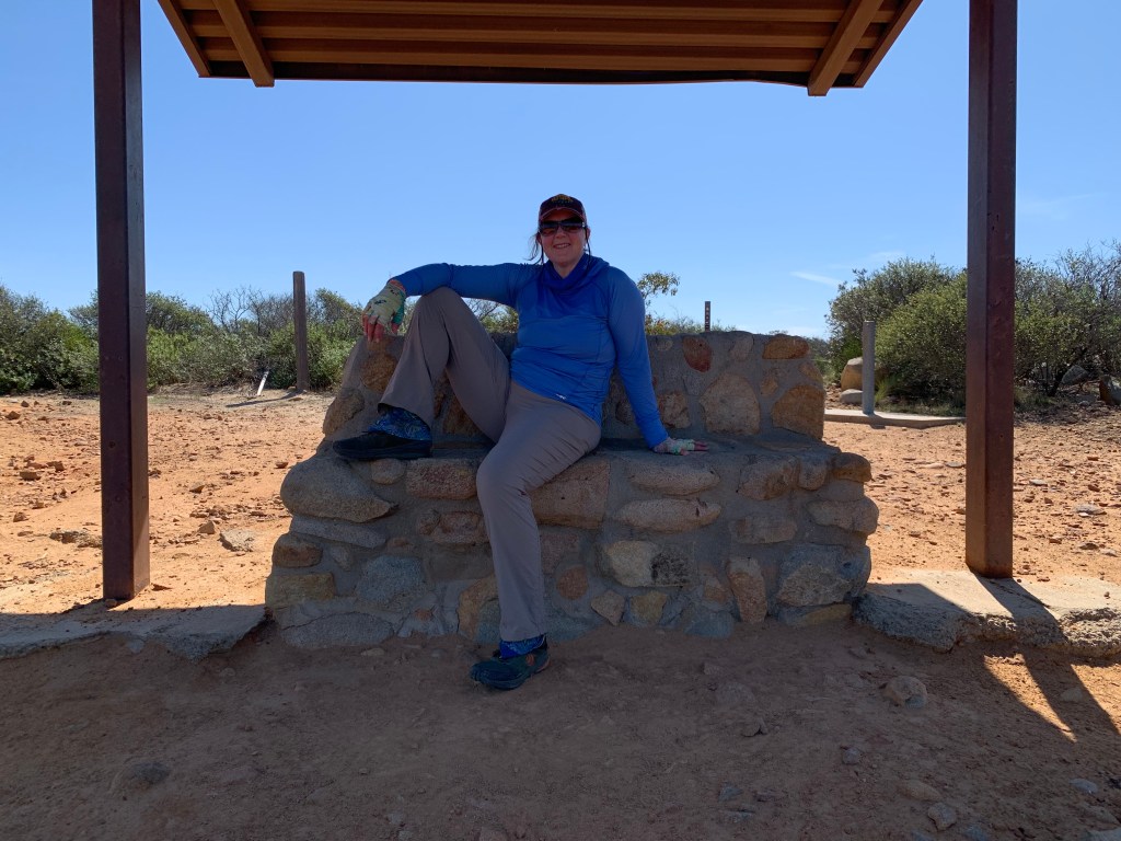
Resting at atop Mount Israel
Awwww!!!
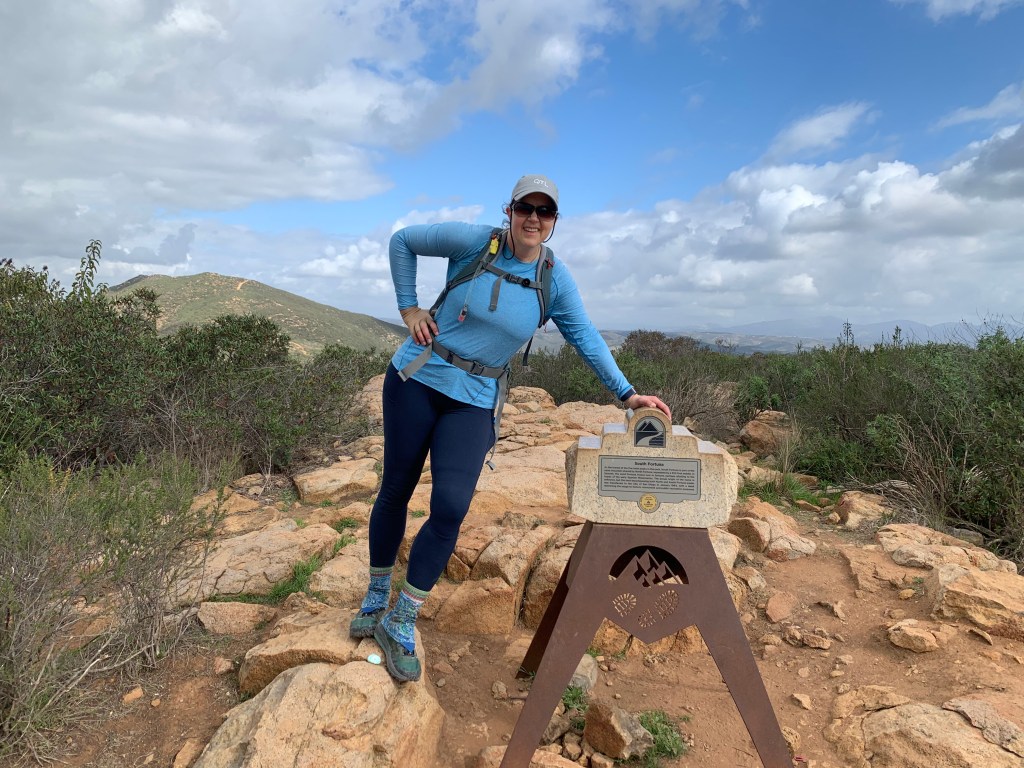
Mount Israel, #46
Olivenhain Reservoir
This is a well-loved area
The sun broke through just as we were nearly done – our umbrellas came in handy.
This morning for my weekday hike I had planned to do Long Valley Peak. Next week we’ll be out of town for spring break. My hiking companions plan to do this one, and we are trying to stay somewhat in sync. But when I started figuring out the logistics, I realized it wasn’t going to work. The hike is only four miles, but a 30-minute drive (each way). To be done in time I’d have needed to start well before dawn. For a somewhat remote hike that I have never done before, and that may require some off-trail navigation, I was not comfortable doing it solo in the dark. Oh, and there was rain in the forecast. That’s a nope.
So I changed my plans and hit literally the most popular hike in San Diego County: Cowles Mountain. And Pyles Peak, of course – the trail to Pyles first passes by Cowles, so they are a two-fer. Cowles Mountain is in Mission Trails Regional Park, and as the highest peak in the city of San Diego, it gets a LOT of visitors. I have also done these peaks several times. The main trail up Cowles is fairly rocky, but well-marked and even though I was hiking solo I knew I would not be alone. The out-and-back was longer than Long Valley, but with no qualms about starting well before sunrise, it was a perfect choice for a dark, damp morning.
I arrived at the main trailhead parking lot at 5:45am and it was already nearly full. I pulled into a spot and started the climb. I have done Cowles many times but usually from Big Rock Park, so it was actually nice to hit the main trailhead. At this early hour on a weekday I did see other hikers but not too many. In just a little over a half hour I was at the summit.
I barely paused to take a blurry photo of the summit marker in the dark and kept going straight to the Pyles trail. In fact I meant to avoid the summit so that I could say I did Pyles before Cowles, but it was dark and the trail naturally led me to the summit. The trail to Pyles starts with a gradual downhill to the saddle between the two peaks. It’s less rocky than the Cowles trail, and was a perfect time to pick up the pace. I jogged on the flats and the downhills, and hiked briskly on the uphills, over a few intermediate peaks on the way to my destination.
I arrived at Pyles within just a little over an hour – I was pretty proud of that! The day was dawning to fog and dampness, but no rain, and not cold at all – in fact I was a bit warm. I saw a few other people on the Pyles trail but had it mostly to myself. I first hiked Pyles in April of 2017 and vividly remember feeling like I was inside an issue of Sunset Magazine – the flowers were in full bloom, like they had been landscaped. Today, some flowers were blooming, but I know there are more to come in the next few weeks.
Heading back I jogged my way across the saddle and back up to Cowles. Now that it was light out, it was worth stopping for my summit selfie. Back down the rocky main trail, with lots more people coming up. I got to the parking lot in just a little over two hours. Perfect timing. With these two peaks I am done with the five peaks on the list that are in MTRP.
Ant Benchmark March 20, 2021 Miles: 1.6 Elevation Gain: 328 ft Gaia Track 100 Peaks Challenge #39
Sunshine Mountain March 20, 2021 Miles: 3.5 Elevation Gain: 828 ft Gaia Track 100 Peaks Challenge #40
Mount Gower March 21, 2021 Miles: 7.2 Elevation Gain: 1691 ft Gaia Track 100 Peaks Challenge #41
This weekend we were planning on heading up to Mammoth, but that didn’t happen due to work conflicts. So we put together a last-minute plan to knock out Ant Benchmark and Sunshine Mountain on Saturday, two peaks we had intended to do after Eagle Peak, but didn’t due to my bad decisions on navigation. It was good to get these two peaks out of the way as this area can get hot. Also it’s weirdly annoying to drive up there (the long and winding road…).
We had some mini-hikers with us on this day. Tara had Madelyn with her and I brought Paige along. My husband & son had plans that day (which is a whole ‘nother story) and I couldn’t leave Paige home for that long alone. She could have gone to her grandmother’s house, but I enticed her with promises of bushwhacking and bouldering. She later said, “Mom, you said we were going on a hike. You didn’t say we were going on TWO hikes!”
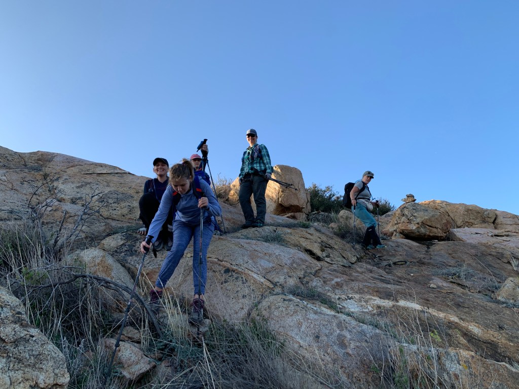
We were doing these hikes in the afternoon, which is unusual for us, due to Kali’s work commitment. We decided to do Ant first and drove up through Cuyamaca and along the winding Engineer’s Road (yay! A road I’ve never been on!) to Boulder Creek Road, where we parked at a turnout after getting a bit distracted by cows (there always seem to be cows in this area!). The others arrived, and we suited up – Tara had some boots for Paige, which was nice – and headed out. Ant Benchmark is a short, trail-less hike. We walked down the road a bit before turning up a use trail through oak and manzanita groves – in fact some of the biggest manzanita trees I’ve ever seen! Soon the route cuts across a field to the base of the mountain, and the climbing starts. There was some bushwhacking but not too bad. Lots of fun bouldering, and we soon arrived at the summit.
The summit had an informal register but with no pages left, so we did not sign in. We found two survey markers, but they were blank! I don’t know what that means – Tad thinks maybe they were installed unofficially for some local surveying.
We headed back to the cars at a slower pace than usual due to our additional companions. Back in the cars we headed over to the Three Sisters trailhead. Our plan had been to drive along the dirt Cedar Creek Road to the Sunshine Mountain trailhead, and shave a mile round trip off the hike … but alas, the gate was closed. Every time I’ve been up here, and in every trip report of this hike I’ve read, the gate has been open. Why today, of all days, when we had grumpy tweenagers in the backseat, was it closed!? Sigh. We guessed that it was due to the recent rains.
Well we were there, so we were going to hike. We parked in the Three Sisters lot (which was half empty due to the late hour) and began our trek down the dirt road. We turned north where we would have parked, and followed a relatively clear use trail past the dry pond and up the slope. Eventually we had to depart from the use trail and bushwhack in earnest. We did not have to bushwhack far, and in fact there were lots of little clearings amidst the shrubs, so it was kind of fun – like following a corn maze. Finally we arrived at the base of the rocky mountain.
By this point, the girls were done. We coaxed them up to a rocky outcrop and got them settled with candy and promises not to climb around too much while we were gone. I gave Paige my InReach satellite messaging device, with tracking enabled. I showed her the SOS button but cautioned her not to press it unless it was a TRUE DEADLY EMERGENCY – like one of their heads falling off! And with that, off the grown-ups went to bag the summit. From there we were able to follow a cairned route most of the way up the rocks until we arrived at the top. Took our pics, signed the log, and hustled back down to the young ladies in waiting.
The rest of the hike back was fairly uneventful – the girls got a second wind from their rest, and downhill is easier, so Paige was chatty on the way, and we enjoyed the early evening scenery. By the time we were back at the cars and headed home, the sun was setting over the canyon. It was a harder day than Paige expected but we both enjoyed the mother-daughter time together.
And now on to Sunday. I probably should make these into two blog posts but this is easier. For Sunday we decided to make an attempt on Mount Gower. My first hike on this challenge was a “failed” attempt on Mount Gower – I prefer to think of it as “practice” though. There are three summits in (or just beyond) the Mount Gower County Preserve, and the peak that most people think of as “Mount Gower” is actually False Gower. The next one on the ridge is Middle Gower, and then finally the actual Mount Gower. I hiked False Gower back in December when I had decided to do the challenge, and scouted the beginning of the bushwhack across the saddle to the other two summits. It looked doable, and with the hike so fresh in my mind I decided to do it as my first summit of the challenge. As you can read in that post, the bushwhacking defeated me.
After that experience I did more research and learned about a route that skirts False Gower entirely and wends around to the other side of the peak. The review I read said there was no bushwhacking and that it was a cairned route. We also decided to shorten the mileage a bit by taking the shortcut by the water tower.
On Sunday morning our crew met up on the side street in the San Diego County Estates neighborhood and headed up the paved pathway. We skirted around the barbed wire fence enclosing the water tank and joined the main trail. Gower is a tough hike, and the steep ups & downs took work. Finally we arrived at the “dragon’s teeth,” which is where we’d normally turn off for False Gower, but we continued straight along the main path. Here the trail descends a bit and curves around to the east. Soon we departed from the main trail – an easy point to miss – to head cross-country nearly due west toward the peak.
As we crossed the flat open space we marveled at the ground cover – red-hued grasses and yellow flowers were abundant. The rocks were covered with multi-colored bunches of moss and lichen. As we ascended we passed lush rock gardens with streamlets trickling across the granite. Dudleya were peeking up between cracks in the rocks, and yucca blooms were emerging from their spiky leaves. Cairns were well-spaced and very clear. Where the brushes became thick, someone had recently trimmed them back! This was turning out to be one of the loveliest trails I’ve hiked during this challenge, maybe in all of San Diego! We were astonished.
There were some rocky bits to climb over, and some care with footing, but in general it was a straightforward climb to the summit. The top of True Gower turned out to be broad and wide, with amazing views and a flat granite slab on which to have our snacks. We could have stayed up there for lots more time, but we’d promised our families we wouldn’t be out all day. Reluctantly we packed up and headed back down. We all agreed that this hike is in our top ten, maybe even top five, for San Diego County.
One note: Yes, we took the possibly-not-quite-legal shortcut up past the water tower. If you have more time and are up for the challenge, doing the whole hike from the preserve’s trailhead (with it’s surprisingly clean bathroom, according to Tara!), it is much more challenging (probably over 10 miles), but the little canyon it drops into is also lovely. So definitely do it at least once.
Ant Benchmark
That’s where we’re headed!
I’ve never seen a “blank” survey marker before.
Ant Benchmark, Summit #39
Ant Benchmark, Summit #1!
Mother-daughter outing
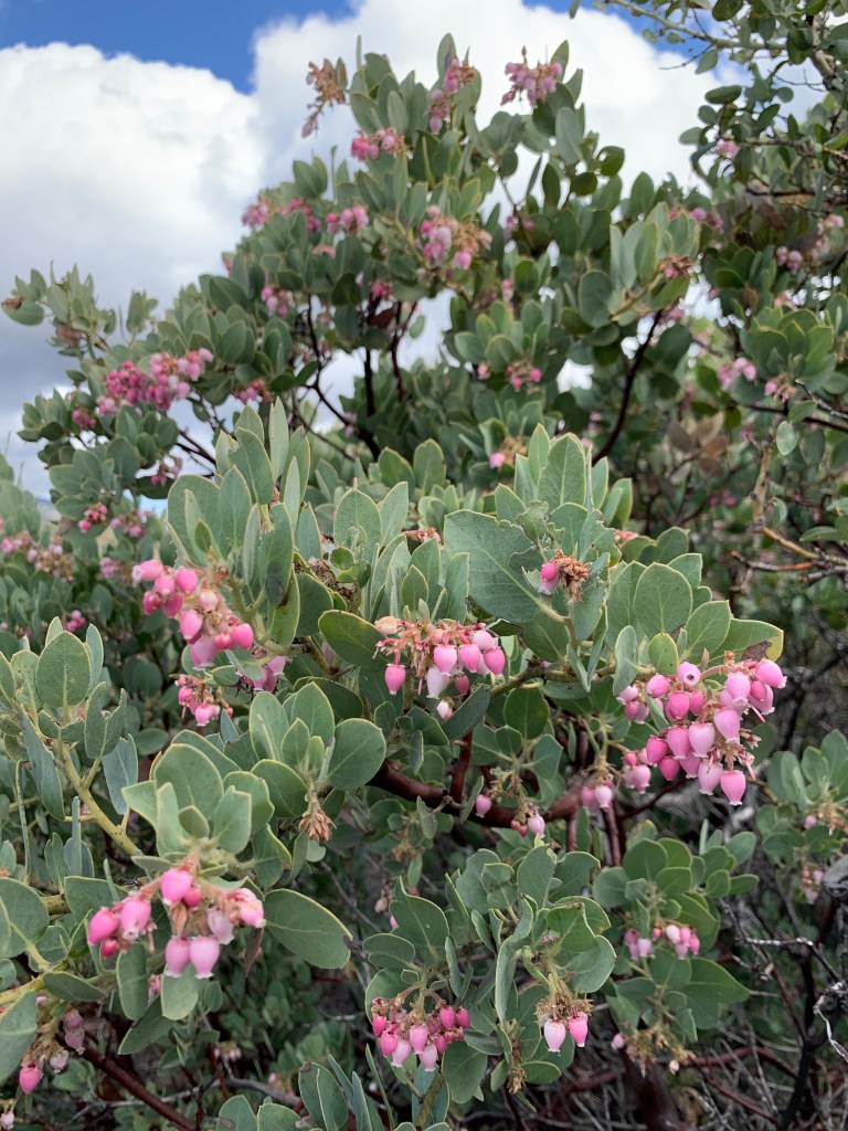
And as if the manzanita weren’t pretty enough, here they are blooming!!
Paige let me put a ponytail into her hair at this point, LOL.
Crossing the meadow
Through the groves of trees
Sunshine Mountain
Sunshine Mountain: Summit #40
She did not hit the SOS button but she did figure out how to send messages!
Twin Peaks (well, one of them anyway…) March 16, 2021 Miles: 2 Elevation Gain: 600ft Gaia Track 100 Peaks Challenge #38 Afoot & Afield 5th ed. Trip #53
I am a trail runner convert. I wore Hoka Speedgoats for all fifteen days of my John Muir Trail hike last summer. More recently I’ve switched to Topo Ultraventures – more toe room. Nothing beats trail runners for the cush factor, and the “trail feel.” They are much lighter than boots, which is absolutely key on long-mileage days. And with Lock Laces, I don’t miss camp shoes (mostly) when I go backpacking.
But there are times when the conditions call for a sturdy pair of old-fashioned hiking boots. Obviously, if there is snow on the ground, and spikes or snowshoes are required, boots are better. Last February when we hiked Oakzanita I wore my trusty boots. Over my microspikes I was getting some hotspots and I wanted to confirm that they were caused by the spikes, and not due to my feet being too un-used to boots. Last weekend when we hiked McGinty right after a rainstorm was a perfect opportunity. The combination of steeply rutted and rocky trail, plus some mud, seemed like it called for boots. This turned out to be a good call – my Vasque Breezes handled it all with ease. The length of the hike – only four miles – meant that the boots didn’t really have a chance to weigh me down. And, no hotspots.
I made the same choice on today’s weekday hike. I hesitated doing this hike today because I’m already ahead of my hiking companions for the 100 Peaks Challenge and I want them to catch up – we need to finish together! But I again had a doctor’s appointment (yes, I have a lot of those – have you seen my sister blog, Project Perky?) in Rancho Bernardo. A quick Google Maps check and I realized that the trailhead for Twin Peaks was a mere seven minutes from the doctor’s office – and almost 40 minutes from my house. I couldn’t NOT do it!
The trail starts in Poway at Silverset Neighborhood Park. I laced up my boots and started up the gravel-covered path. I had to pay more attention to my map than expected, as there were several trail junctions to work past at the beginning. Soon the path narrowed and started to climb steeply toward the mountaintop. It we never really muddy, but there were a few rocky climbs and rugged sections, and I was glad to have my boots. For such a short hike, my feet were grateful.
Soon I arrived at the summit. By myself, I played a bit with my Apple watch (need to get more familiar with that) and took my summit photos. It was fun climbing around on the top and checking out the views. But I had that appointment, so I had to keep moving. I headed north off the peak to take the “long loop” down the mountain.
The boots were nice on the way up, but trail runners would have been better on the way down. The backside loop descent was more gradual, and I was in the mood to run. I ran anyway, despite the boots – it was so short my feet did not complain. The trail came surprisingly close to one large home, complete with a gate door leading to the trail (I can’t decide if I would want to live there or not), and then turned back to the southwest, eventually to regain the main trail. As has been the case for all these urban hikes outside my own part of the county, I was left impressed by this trail that I’d not even been aware of, and hoping to someday come back. Back at the car I was grateful for my now-muddy boots, and made it to Dr. Champ’s office with plenty of time to spare.
My destination
A little muddy, not too bad
Yes, the trail got a bit rocky in places
View from the top
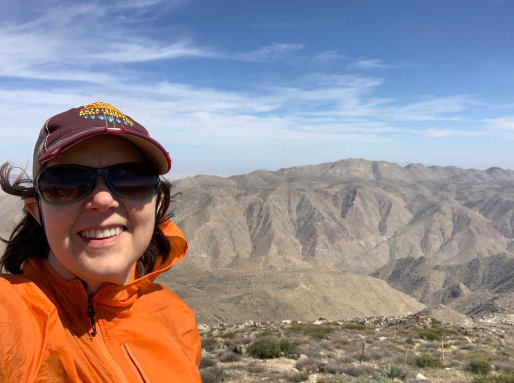
I always wear my work hat on these weekday hikes. In fact I had two work-related text conversations on this particular hike.
Still have some practice to do with my Apple watch camera remote control…
No sign or peak register at the summit but unfortunately some paint splotches. I don’t think you can even call this “graffiti.”
Jacumba Mountain March 14, 2021 Miles: 3.1 Elevation Gain: 1,090ft Gaia Track* 100 Peaks Challenge #36
Mount Tule March 14, 2021 Miles: 0.8 Elevation Gain: 403ft Gaia Track 100 Peaks Challenge #37 Afoot & Afield 5th ed. Trip #271
*Follow our route back, not our route up.
It was nice to get a break this weekend. We did manage to bag three peaks, but all three were pretty easy – a respite from the last couple of weeks of hard hiking. Two of the three peaks were still desert peaks that had to get done before it gets hot, so we still feel accomplished!
Saturday morning we hit McGinty Mountain. I had this one pencilled in as a weekday hike – at a little over 4 miles it would have been doable. It’s also the closest trailhead to my house, so there’s that. But one of our group had an obligation on Saturday, so we needed a hike that fit our schedule, and McGinty fit the bill nicely. I have hiked McGinty several times – as mentioned, it’s super close to my house. In fact I led a Sierra Club hike on McGinty once, and it’s where I met Kali! What is funny to me about McGinty is that all along the mountain’s spine there are alternate side trails that lead to local peaks along the way, and I don’t think I’ve ever climbed this darn mountain without inadvertently taking one of these diversions. It’s never a big deal, as they always lead back to the main trail. But one of these days I’ll get a clean track, I swear!
McGinty is an interesting mountain in that there are some rare plants that grow here, due to the nature of the bedrock (called “gabbro,” according to Afoot & Afield) that makes up this mountain. I looked into this a little before leading that Sierra Club hike, and had no luck identifying these unusual plants. To my untrained eye the Dehesa bear grass (for example) looks like all the other chaparral grasses that I see everywhere else. It would be fun to do this someday with a naturalist who could point them out.
This trip up McGinty was after a couple of days of rain, so we were lucky to be greeted by a full rainbow! I decided to wear some proper hiking boots today – I normally hike in trail runners, but given the mud and the rocky terrain I thought the boots might be useful, and I was grateful to have them. We made excellent time – certainly faster than my previous trips up this peak. We were done in no time, and even with running a bunch of errands afterwards, I was still home before lunch.
Sunday was our desert day. We had two more peaks to finish in the southeast “low desert” corner of the county. Our original plan for this weekend was to backpack Agua Tibia Mountain and Eagle Crag, but those – on the north side of Palomar Mountain – almost certainly got a bunch of snow this past week. Other peaks in the desert that are on our list require driving over the mountains – and through the snow. So, Jacumba Mountain and Mount Tule – straight east on highway 8 – were our obvious Plan B. Also, it was the morning of “spring forward” Daylight Savings Time, so it was nice not to have to get up excessively early.
The challenge with both of these peaks, especially Jacumba Mountain, is that the trailheads require some serious 4wd driving to get there. Jacumba Mountain has three possible routes to the summit. One is an extremely difficult cross-country traverse from Mortero Palms – that’s a nope. The other two require a rugged 4wd ride from the In-Ko-Pah exit off the 8. First you come to the trail head for a six-mile hike option. If you continue on the dirt road you can get to a three-mile hike option. I was under the impression that the truly difficult four-wheeling was the section between the two, but that turned out not to be the case: if you can make it to the first trail head, you can certainly make it to the second. Tara’s trusty Jeep and her mad driving skills got us right up to the shorter option – but it took nearly an hour of offroading once we got off the highway, so budget time for that.
The hike began by crossing a wash to the base of the climb. Somehow I managed to lead us to the wrong drainage at the beginning of the steep part. It ended up requiring some bouldering, which was fun, but not the easiest way to go. Eventually we met up with our intended route, attaining the ridge, and making our way to the summit. Aside from our little bouldering diversion, it was a lovely and straightforward hike, with cool and windy weather.
Back in the Jeep, we headed back down the rugged road and back to the 8. Next stop was McCain Valley Road, up a ways to the Sacatone Overlook road, which led to the Mount Tule trailhead. The road was fairly rugged and flooded in areas – high clearance is definitely required. The route described in Afoot & Afield has you park just past the turnoff to the road leading up Mount Tule. We decided to check out the road up the mountain and save a little bit of mileage. It turned out to be a perfectly fine Jeep road, and again Tara made it up with no trouble. This cut off about 3/4 of the hike! For me to count an Afoot & Afield hike as “completed” I typically require myself to hike the full hike as described in the book – but in this case it would have annoyed the crap out of me to drive a rugged road, park, and then walk along an equally rugged road that I could have easily driven! So this one is getting a checkmark in the “done” column, thankyouverymuch.
We parked just below a section of jagged rock that would have been unwise to do without another vehicle – and that turned out to be perfect as the road ended just above there anyway. From that point we were able to follow a clear trail the whole way to the summit. This was a lovely hike, with no steep sections, no navigation issues, and no prickly plants trying to attack us. We were on top of the peak in less than 30 minutes. It was cool gazing back at Jacumba Mountain, where we’d just been. Unfortunately we found no peak register. We took our photos and headed back down the mountain.
In all we did about four miles of hiking on Sunday … and about five hours of driving. Yikes!! But that’s what the list required. I don’t object – there is a whole blog post in this, but briefly, one of my favorite things about this challenge is getting more familiar with all the nooks & crannies of the San Diego desert and outer areas.
McGinty Mountain
Old mine
McGinty Mountain, #35
Old mine or natural cave??
Jacumba Mountain & Mount Tule
Our “wrong turn” on the way up Jacumba required bouldering, and some of the boulders were pretty cool.
There it is!
Look what we found!!!
Summit of Jacumba Mountain, #36
On the way back down the CORRECT drainage, looking at the rocks we’d had to climb over on the way up
Mount Tule gave us a great view of the railroad bridges along Carrizo Gorge. Yikes!
I think there used to be a summit sign at Mt. Tule maybe?
Mount Tule (#37), with Jacumba Mountain in the background
We were just right there!!!!
I’m still learning how to use my watch-controlled camera feature. Need to practice more.
North & South Fortuna Mountains March 8, 2021 Miles: 5.6 Elevation Gain: 1,134ft Gaia Track* 100 Peaks Challenge #s 33 & 34
*I don’t really recommend this route due to one section that is better for mountain bikers. See post for full details.
Our typical routine for this challenge has been to hike both days on the weekend: one hard day and one easier day. Well, last weekend’s challenge – Mile High Mountain – was hard enough for both days, and we took Sunday off. By Monday, Casey & I decided we were up for something not too hard, and we opted to stretch our legs on North & South Fortuna in Mission Trails.
I have hiked both of these peaks a few times before. There are probably a half dozen routes that can be taken, with one of the nicest being a 6.5 mile loop starting from the West Fortuna Staging Area in Tierrasanta – do it clockwise and you get to descend on the infamous South Fortuna stairs. Today, however, I needed to get the thing done – I could only play hooky from work for so long. So I pulled up a map and pieced together the shortest route I could find – a five-mile out-and-back route that also started in Tierrasanta, from the Corte Playa Catalina trailhead.
Casey & I met up in the quiet neighborhood and got started. There is construction taking place at Mission Trails right now, and it is in full swing in this location, but we got past it quickly. This route turned out to be a bit of an inverted hike, as the trail descended initially, crossing a dry stream with a wooden footbridge.
This portion of the hike is clearly used more for mountain bikers than for hikers, and we did see a couple of bikers out there. The trail rolled along with sudden up and downhills. It looked like fun, if you were on a bike. It was pretty annoying as a hiker. Eventually the roly poly trail merged with the main route and climbed steeply to the familiar Fortuna saddle.
We hit North Fortuna first. We got to the point on the map that was marked as North Fortuna – both in Gaia and on Peakbagger – but apparently this is not where the park thinks the peak is. We looked around for the summit marker for a moment, but quickly realized it must be further along the trail – and there it was.
We were hustling, and we wasted little time backtracking to the saddle, and then up the slightly longer but more gradual trail to Fortuna Mountain’s slightly lower southerly neighbor. The trail was perfumed with blooming lilacs, and I almost stepped on a toad. Got to the broad summit, took our pics, and headed back the way we came.
I almost made it home in time for my first conference call – five minutes short, so I dialed in from my car. My favorite thing about these weekday hikes is that I just feel so accomplished after I get home – I’ve started my day by being outside and enjoying nature. The downside is feeling rushed, which I did today. Oh well, it’s still a walk in the park.
Studying the map a bit more afterwards I am now thinking that a better short route would be to start from Mission Dam. It’s only a few tenths of a mile longer than the route we took, and would be a more enjoyable hike, avoiding the roly poly trail. Of course parking at Mission Dam has its challenges (the gate has to be open, and there are few spots) – but better if you can pull it off.
Mile High Mountain March 6, 2021 Miles: 14.5 Elevation Gain: 4365ft Gaia Track 100 Peaks Challenge #32
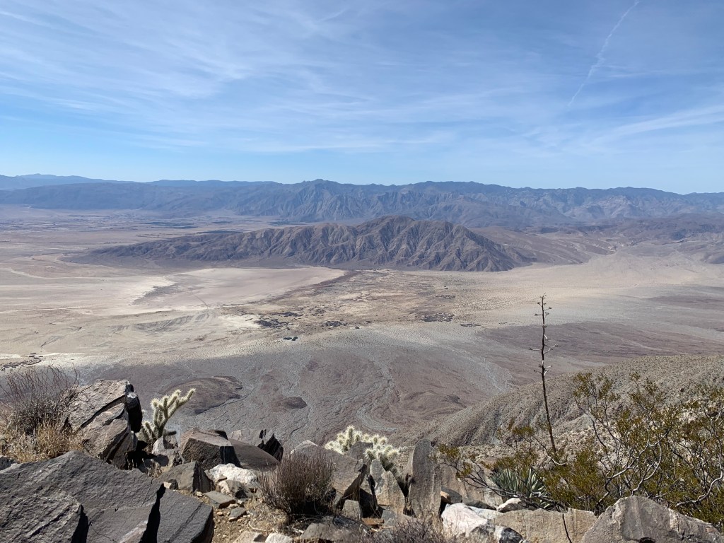
And here it is, the peak we’ve been building up to. I don’t want to take anything for granted, and you never know what challenges lie ahead, but at least based on statistics we have now completed the hardest of the desert hikes on the 100 Peaks Challenge list: Indianhead, Villager, and now this one, Mile High Mountain. This is a huge relief as it’s already starting to get too warm to hike out there. This also completes the hikes in the immediate Borrego Springs area, although there are still several elsewhere in the desert, and plenty others that are a long drive away.
This hike was tricky to plan. No matter what, it’s a long, hard hike. There are four routes to choose among and they all have significant challenges. My initial inclination was to take the most direct ridge route. This is the route described in Afoot & Afield (5th ed., trip 223). In fact, I have heard that there is discussion of renaming this peak – at least colloquially – to “Jerry Schad Mountain,” after the original author of this book, as this was one of his favorite peaks. This route takes Palo Verde Wash up the first few miles, then ascends the ridge above the wash, which it traverses all the way up to the summit. It seemed to me to be the most direct and least technical route.
The biggest problem with this route is that … no one seems to go this way. We typically research these hikes by checking Peakbagger.com, public tracks on Gaia and AllTrails, and other sources. We found almost no tracks taking this seemingly direct route. My theory as to why that is is that most hikers want to bag an additional peak – Rosa Point. This requires taking a different ridge up, and adds a bit to the mileage and elevation. In the interest of staying focused, we did not want to add in Rosa Point. In addition to being longer, this route still includes some steep scree-filled sections, according to reports.
The third route used the Villager ridge, which we’d hiked last weekend, and knew to be fairly easy. The problem with this route is that the saddle between the Villager and Mile High ridges is infamously brutal.
Finally, there is the route we ended up taking: up Rattlesnake Canyon. We enlisted a guide on this hike – Susie’s friend Matt graciously offered to take us up this route, which is his favorite of the options. The advantage of this route is that the majority of the hike is relatively easy as it follows a narrow wash up between the two ridges, passing Rattlesnake Spring. The elevation gain is gradual and steady, and the footing is solid. The challenges with this route are three (3!) dry waterfalls (aka exposed rock climbs), and then, well, at some point you need to get up off the canyon floor. So 7 miles of easy wash hiking followed by 1.5 miles of straight up.
We camped out Friday night and met up at the trailhead at 6am on Saturday. I knew immediately it was going to be a tough day. First of all, I am a dumbdumb, and I did something to my hamstrings at my normal weekly workout on Thursday. I did not think it was a very intense workout at the time, but two days later and my hammies were still sore. That is not good when you’re about to climb 4000+ feet. The second huge challenge of the day was that it was HOT. The weather forecast was originally low-70s, which would have been bad enough; but now the updated forecast was for over 80 degrees. And not a breath of wind until we were much higher up. In hindsight we should have rescheduled but with nine people on the trip that would have been annoying. Also, summit fever – wanna get this done!!
All this challenge added up. It was a looooong day. I’m sure if my hamstrings were less angry, and it was cooler, this hike would not have taken so long. The hike up, for me, was miserable. The rock climbs and boulder scrambles were super fun, but otherwise trudging uphill in the heat with angry legs was an additional challenge I did not need. We began the brutal climb out of the canyon at midday, and the heat really started getting to a couple of us. It was insanely slow-going. There was a false peak that at least I did not realize and it almost killed me with demoralization. Tara & I were both near heat exhaustion, but we both recognized this and kept a close eye on each other, and moved very slowly. At long last the summit was underfoot, and the Salton Sea – previously hidden behind the peak – came into full, unobstructed view. It was glorious, and we were relieved to summit… but it was also 1pm. Way too late to be up there.
We rested a bit and had some snacks, did our usual summit chores. While we ate, Susie read to us the many repeated entries of the infamous Sierra Club climber Steve Fausset – sounds like he comes up here every Tuesday! I guess it’s one of his favorite peaks too. We debated our options for descending. Our original plan was to split into two groups, with my group heading back the same way, and the other group proceeding toward Rosa Point & Pyramid Peak. But it was getting too late to bag additional peaks, and quite honestly we needed the help getting down. I can’t articulate how grateful we are that the others abandoned their plans to stay with us.
We descended a ridge slightly further south from the one we came up, which most of us found slightly easier (although at the bottom it was harder to get back to the main canyon). We were now chasing daylight. The upper waterfall cannot be avoided and fortunately was the least technical of the three. At the middle fall, the group split, with folks not comfortable with down-climbing hitching up and over. Those of us who decided to down-climb realized that we needed a spotter … but none of us were capable of getting down without one, so we were stuck. We were about to backtrack and join the others, when they appeared over the ridge. A few minutes later, the incredible Matt arrived, and, scampering over the waterfall like Spiderman, he helped the four of us find our footing. It was not difficult with the help, but impossible without it. At the last fall we split again, and this time Matt spotted us before helping the others. Again his help was essential. Again his agility and willingness to go back & forth was inspiring.
For me, heading back down the wash was truly fun and I was able to enjoy myself – by now it had cooled off, and my leg issue appeared to be isolated to my climbing muscles; my descending muscles (quads) were fine, and hopping down the rocks was super fun. That said, all the bypassing and one-at-a-time guiding down the waterfalls took a very long time. Fortunately we’d gotten past all the tricky spot before it got dark, but we still had several miles to go. Out came the headlamps as we rushed down the canyon. At the canyon’s exit, we were a bit spread out, and Kali & I zoomed right past the cairned turn to the south toward the cars. We realized it pretty quickly and backtracked. Another mile and a half and we were at the cars.
Normally after these hikes we rush home for a late dinner with our families, but at this point we were clearly not going to be home until 10pm – so no need to rush. Instead, we made one last stop at Los Jilbertos in Borrego Springs where we are practically regulars at this point. Since with this hike we are done with the hikes in the immediate BS area, it was like a goodbye dinner.
Let’s go!
I’m thinking Silver Cholla
First waterfall
The bypass of the first waterfall is not much better…
There was super fun bouldering along this whole route! I would go back again for a shorter hike.
We found weird things on this hike. There must have been a flash flood recently. Here is a critter cam. We also saw an uneaten MRE, and clothes. The weirdest thing was a full-sized wooden baseball bat!
Matt demonstrating the way up the second waterfall
Just to the left of the second waterfall
The third fall was the easiest
From the top – unobstructed view of the Salton Sea!
OMFG I made it!!!!
If you look closely, you can see our cars from the top.
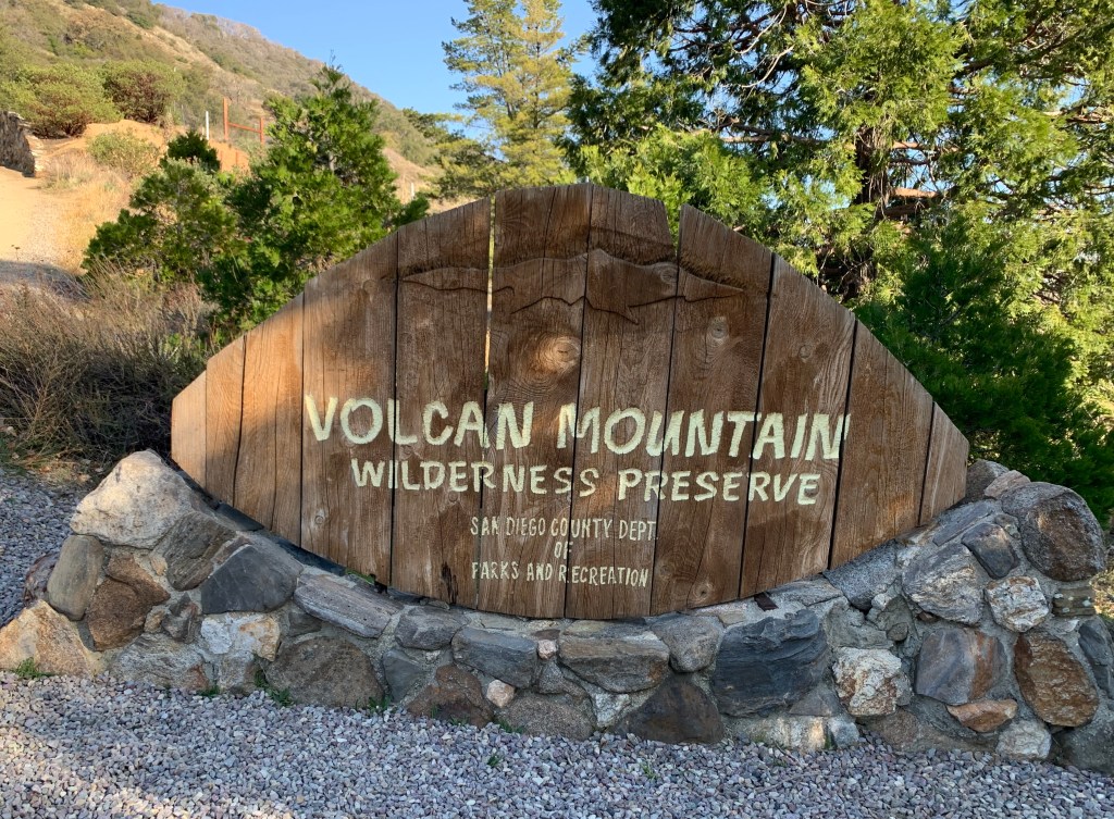
Volcan Mountain February 27, 2021 Miles: 4.6 Elevation Gain: 1,121 ft Gaia Track 100 Peaks Challenge #30 Afoot & Afield 5th ed. Trip #154
Villager Peak February 28, 2021 Miles: 13.6 Elevation Gain: 4,826 ft Gaia Track 100 Peaks Challenge #31
(And the third “V” peak, Viejas, I did last month!)
This weekend’s main event, Villager Peak, is one I’ve been anticipating for years. I first heard of this challenging hike during the Wilderness Basics Course which I took in 2016. Villager is the first peak arrived at when heading north/northwest along the main Santa Rosa Mountains ridge, and is often mentioned together with the next peak up, Rabbit Peak. The two peaks together form a long, waterless backpacking challenge that is infamous within the San Diego hiking community. We discussed attempting the full two-peak overnight challenge but decided against it. Rabbit is not on the 100 Peaks list (it’s technically in Riverside County – not San Diego County), and we decided we needed to stay focused.
Doing Rabbit & Villager together as a one-night backpack is a challenge, but there are much crazier people out there. In researching this hike, Casey shared a Youtube video with us of a couple not backpacking the route over two days, but doing it as a one-day trail run. Holy crap. This led me to discover a Villager-Rabbit ultra-run called Fear the Rabbit (cancelled last year, of course), with a “Bad Ass Division” requiring women participants to carry a 30lb pack, and the men to carry a 50lb pack. WTF!?
But the truly craziest adventure on this ridge that I learned about once I fell down this internet rabbit hole (HA!) was of a 2015 point-to-point traverse of the entire Santa Rosa ridge in one shot – 20 hours over 41.8 miles and 14,755 feet climbed. The traverse crossed Villager, Rabbit, Dawn’s, Toro, and Santa Rosa Peaks, starting at highway S2 in Anza Borrego all the way to highway 74 in Riverside County. Ho. Ly. Shite.
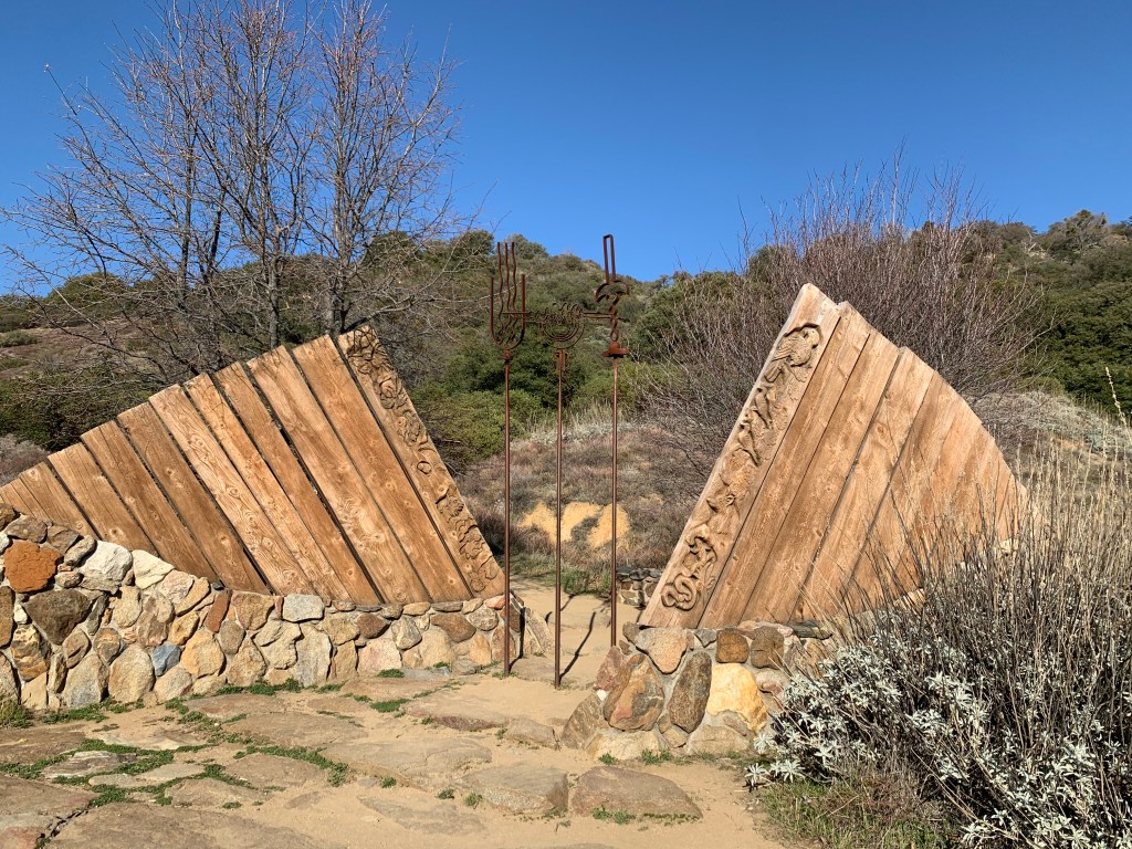
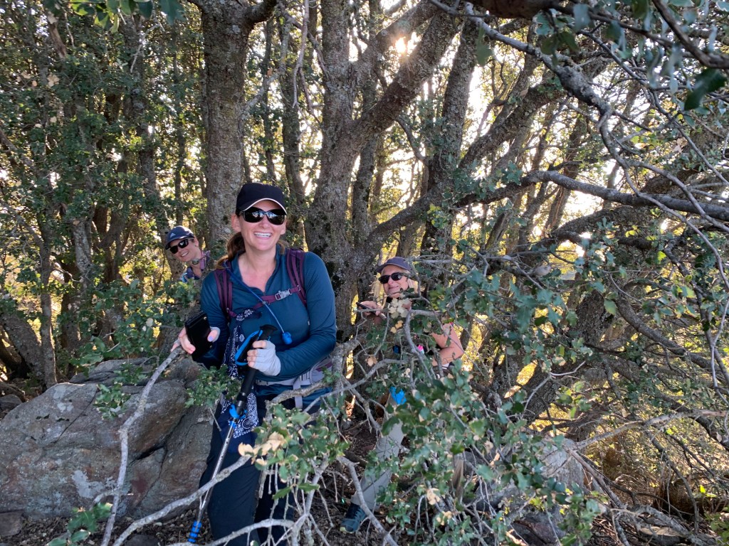
This all put our cute little walk up Villager into perspective, I suppose. We’ve been building up to this hike for several weeks now, and felt prepared. We decided we had enough in our legs to do a pre-hike, and Volcan Mountain in Julian, en route to the desert, fit the bill nicely. On Saturday afternoon we met at the trailhead and started up this lovely hike. There were a few other people there, including a local Meetup group with some acquaintances – always fun to see people we know out on the trail. We made our way up the main trail, enjoying the oak tree lined switchbacks, amused by a woodpecker and other lovely birds. At the top we bushwhacked our way to the benchmark amongst some trees and explored the broad summit. This peak is clearly well loved by its local caretakers. We made a beeline back down the mountain, again staying on the main trail, and were done with the hike in less than two hours, including our break at the summit. We had places to go!
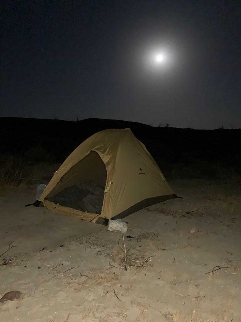
From there we drove down the Banner Grade into Borrego Springs. Stopped again at Los Jilbertos to pick up dinner (don’t forget, it’s cash only!), and then continued along to the Arroyo Salado primitive campground. It was a gorgeous evening under a full moon, without a breath of wind. We were too hungry to wait so we dove into our burritos before bothering to set up our tents.
The wind did arrive however. A couple of hours after hitting the sack it picked up and it was not kidding around. When I set up my tent I did not know which direction it would be coming from, so of course that meant it was broadside to the wind. The smart thing to do would have been to get up and guy it out, but I didn’t wanna… So I did not sleep much. But with the excitement of the looming challenge, I still felt plenty rested the next morning.
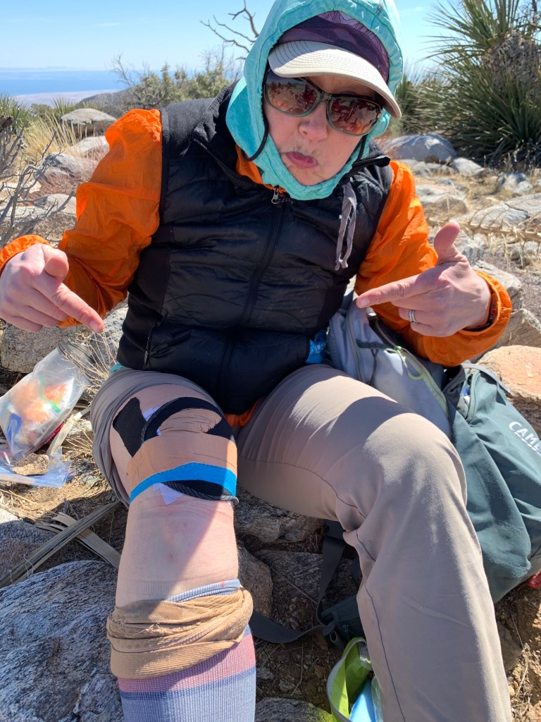
We arose early and packed up under the bright moonlight. My right knee pain has been flaring up, having bothered me on Volcan Mountain despite the tape job my PT had done on Friday, and another layer that I’d added on Saturday. After adding yet a third layer of tape, we made the short drive to the trailhead and started our hike at 5:50am.
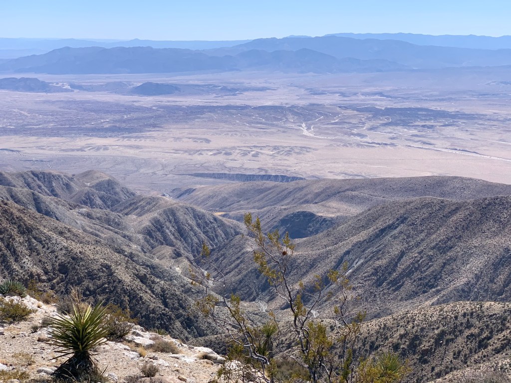
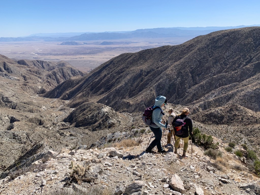
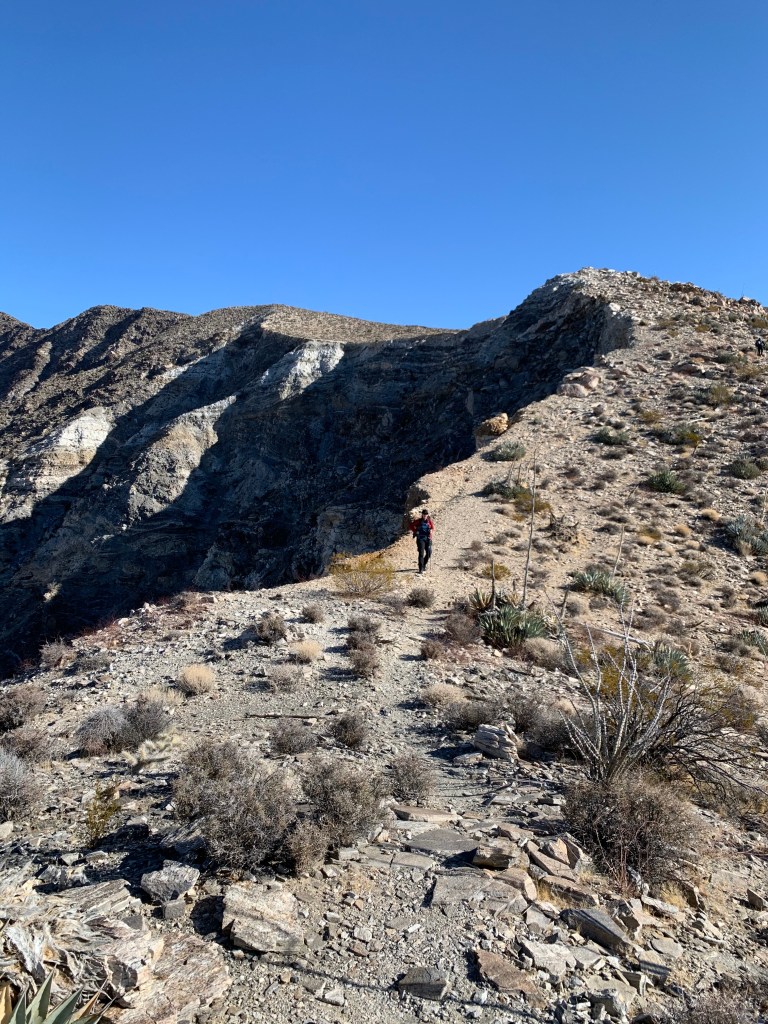
The first 1.5 miles of the hike are flat and fast. We were slowed down a bit by soft sand and an evil stealth cactus attack (ouch, poor Tara’s foot) but soon arrived at the base of the ridge. The hike up Villager is not technically difficult. Unlike other desert hikes we’ve done during this challenge, little navigation was required thanks to a clear use trail and a solitary ridge meandering its way up, up, up to the peak. It was steep and rocky in sections, but with very little scrambling. In places the ridge was exposed, with a cliff dropping straight down on the west side – this was beautiful on the way back down, but on the way up the wind had not yet died down and I found it a bit terrifying. But the real challenge for this hike is its length. You seem to go up steadily forever. In no time we were eye-level across the dry Clark lakebed with Coyote Mountain, which we’d hiked only two weeks ago – it had not seemed that low when we were on it, but from here it looked like this peak’s kid sister – and we weren’t even halfway to the top.
On our way up we met another gal named Torrey who’d spent the night only about halfway up to Villager. She had been berated the day before by another hiker who was on her way back down the mountain, telling her she was nuts to camp atop Villager; that she’d die in the wind. She was intimidated enough to stop early, setting up camp in a rock shelter that had been erected by past hikers. But this morning she was irritated, realizing that she certainly could have made it. She was young and strong and flew past us in no time. Near the summit there were plenty of places to camp – windy, sure; but we were wind-blown on the desert floor too. Hike your own hike, people.
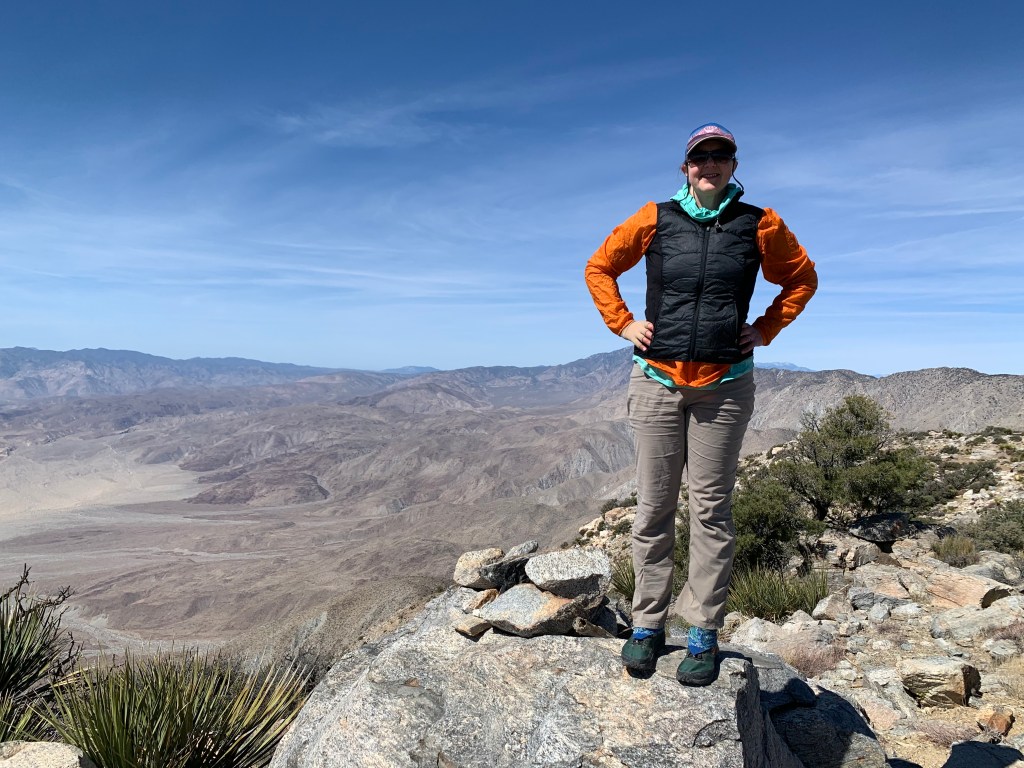
We finally arrived at the summit. We were famished, so after retrieving the peak register (I added a new notebook to it) we settled in for our lunches. By the time we were done with all our summit chores – eating snacks, signing the register, taking photos, peeing – it was time to head back down.
My knee only hurts on the descent, so I was nervous; for me, the hard part was about to begin. I decided to add to my summit chores and redo the tape job from scratch. I ripped all the old layers off, and started afresh with my last two strips of sport tape. This turned out to be an excellent decision: once we got going and my muscles warmed up, there was almost no pain. Thank goodness!
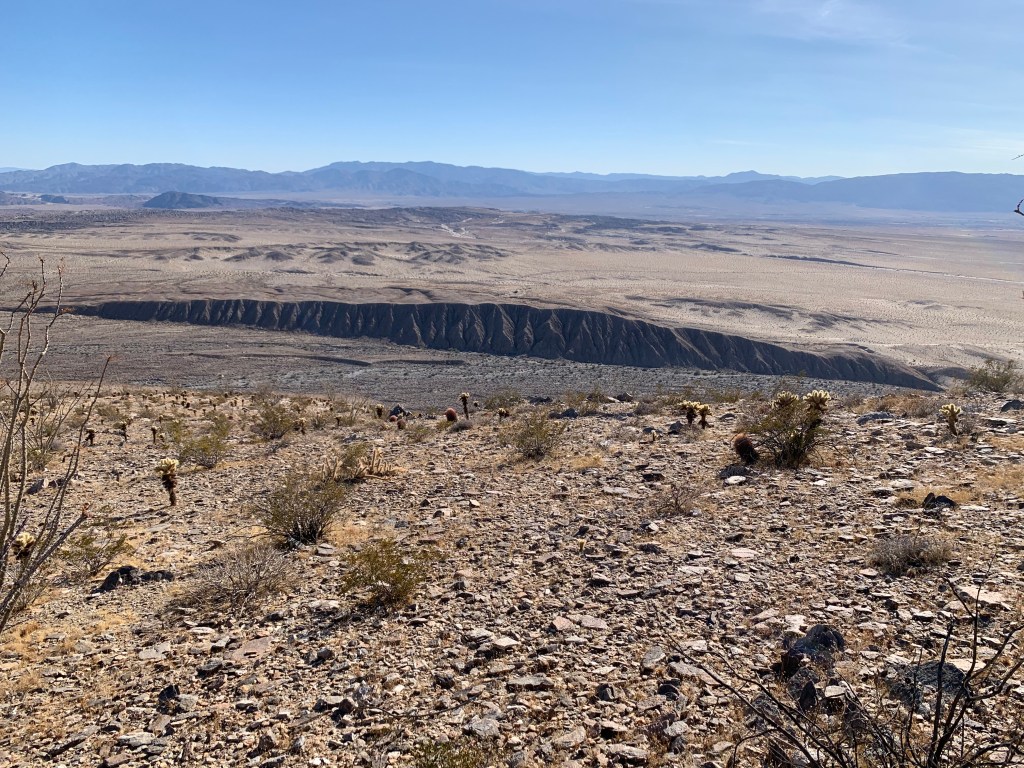
We made good time getting back down. In fact maybe we went down too fast – by the time we neared the bottom, all eight of our feet were screaming at us to slow down. At the base of the mountain is a geological feature called the Lute Ridge, the largest fault scarp in North America. Of course we passed it on the way up, but now it took center stage as we descended. Somewhat demoralizing was our bird’s eye view, from over two miles away, of the cars reflecting at us in the trailhead parking lot. Cruel, to be so close yet so far!
In the end the hike took us about 10.5 hours, including a little over a half hour at the summit. It was long (did I mention it was long??) but we kicked butt. Ready to come back next week. What? Yes, it’s true – next weekend’s plan is to hit Mile High Mountain, on the ridge just east. We are ready!
Volcan Mountain
Let’s get started!
Gateway to Volcan Mountain
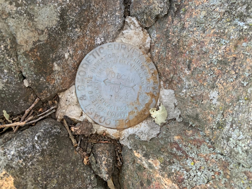
Volcan Mountain benchmark
Peering out from the trees
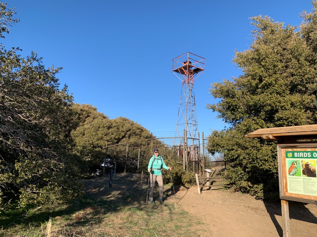
In front of the Volcan Mountain light tower
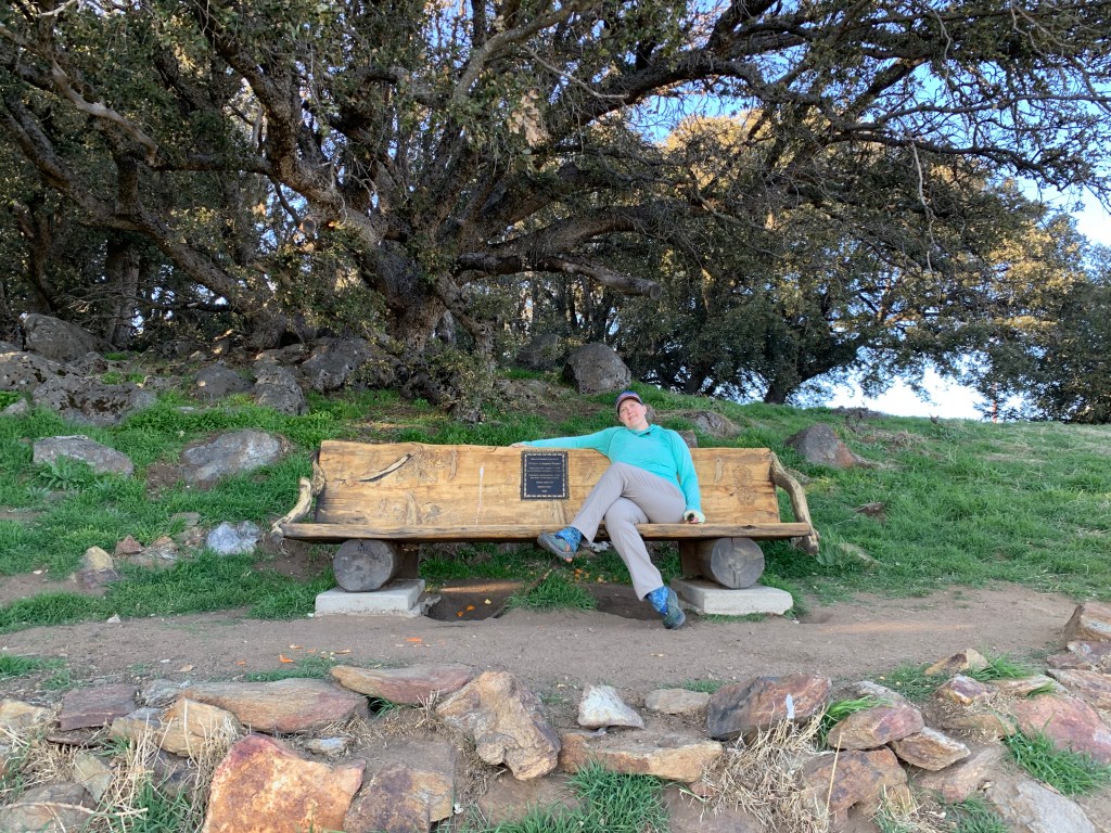
Lovely bench overlooking the view
Oak tree near Volcan summit
Villager Peak
Camping under a full moon
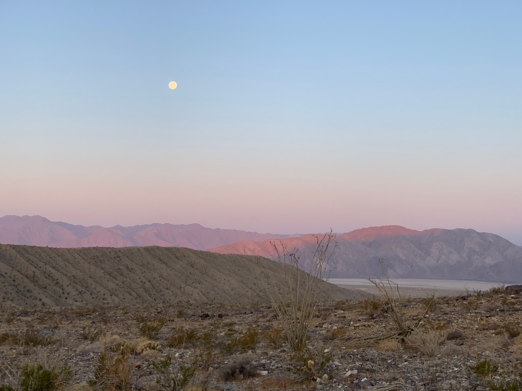
Setting moon
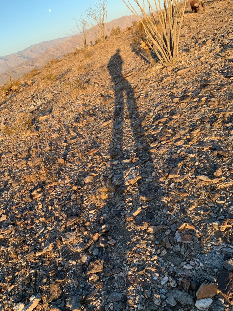
Morning shadow
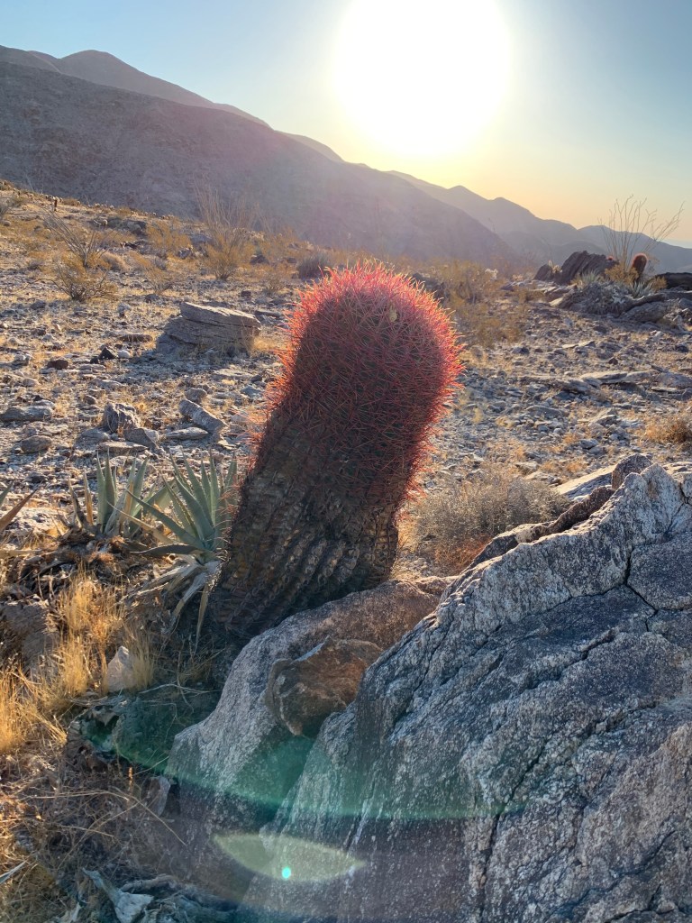
Barrel cactus
Bit of a cliff to the west…
Ok yeah let’s start this taping job over…
We made it!
Salton Sea
Looking down on Coyote Mountain – it looks so tiny and cute!
El Cajon Mountain February 20, 2021 Miles: 11.1 Elevation Gain: 3210ft Gaia Track 100 Peaks Challenge #28 Afoot & Afield 5th ed. Trip #102
Peak 3339 February 21, 2021 Miles: 5.8 Elevation Gain: 1083ft Gaia Track 100 Peaks Challenge #29
Saturday
I’m sorry to report that we only completed two peaks this weekend (she says, hanging her head in shame…). This was an inverted weekend – usually the “hard” hike is in the desert, but this weekend the harder hike was in-town. We kicked things off with my first ascent (believe it or not) of infamous El Cajon Mountain. It is often referred to as the “hardest hike in San Diego County.” That is simply not true, if you consider the many challenging hikes in San Diego’s desert. In fact I don’t even think it’s the hardest non-desert hike on the 100 Peaks Challenge list – we have not done them yet, but I am expecting Agua Tibia and/or Eagle Crag to claim those titles when the time comes.
All that said, it’s still pretty damn hard. The hike begins along a driveway heading up from Wildcat Canyon Road, passing some private properties, until the “official” trail starting point. From there until the “saddle” I found it to be a very long version of Sycuan or McGinty Mountain – steep in sections, occasionally rutted and rocky. However it also had some tree-lined sections, and there was even water trickling across the trail in places. Beautiful views at every turn.
The trail reached the saddle, with El Capitan to the right, an overlook (now closed, due to nesting Eagles) straight ahead, and a well-marked (some might say excessively so…) but steep rock scramble to the left heading to the El Cajon peak. We turned left and made our way up through the rocks to the summit. Took our photos, found the three benchmarks, chatted with others up there already, snacked… the usual summit activities. Then we headed back down.
It had been relatively quiet on the way up, since we started at 6am; but on the way down we passed lots of people making their way up – this trail has become ever-popular since it was included on the San Diego Six-Pack of Peaks Challenge. We even encountered some friends making their way up, including our friend David hitting the peak for his 110th time!!! (That is NOT a typo!)
I had some issues heading down. I have a knee problem that flares up every once in a while that is probably a bone rub of some kind, as it is a sudden sharp pain that responds extremely well to sports tape… which I had not applied, and did not have with me. This caused me to slow down significantly. Every steep section I descended by hunching forward and limiting the range of motion my knee had to go through. Finally we got to the bottom and to our cars. It was noontime, so I swung by Panchos to pick up some Mexican for lunch. At home I was much more sore than I should have been – hunching forward to descend had taken its toll.
Sunday
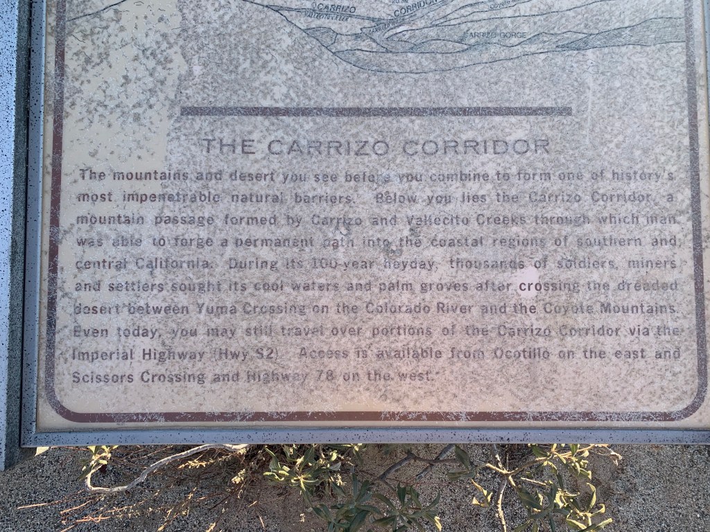
During this challenge, our Sunday hikes have normally been more mellow, in-town hikes. Following our backwards theme for this weekend we instead went out to the desert today, for a hike that was just a wee bit too long to combine it with others in the area, but perfect for a less-strenuous day. What really made this a backwards hike, though, was the fact that it is “inverted” – the downhill portion is at the beginning of the hike, with only a modest ascent to the summit. As far as I know it’s the only inverted hike on the list.
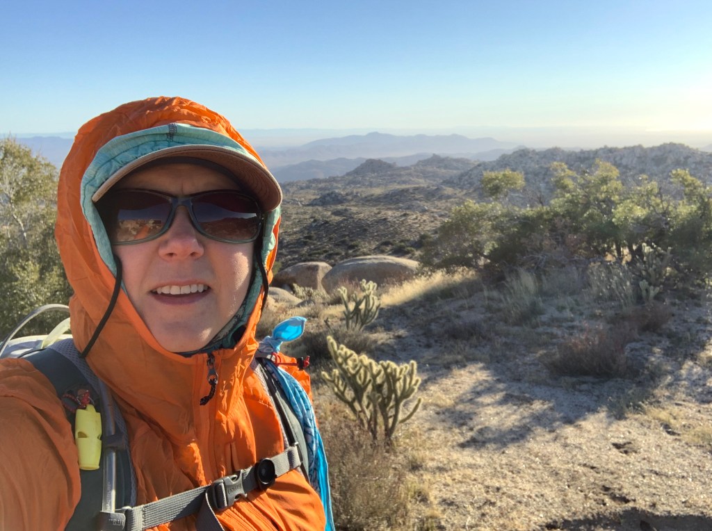
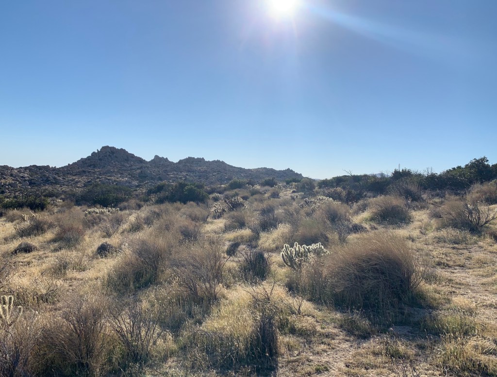
The trail started in McCain Valley, at the Carrizo overlook. We arrived after an hour drive at about 7:30am. It was windy! But that was not a bad thing – it was chilly to start but we warmed up, and the breeze kept us nice and cool. Most of the hike – unlike nearly all our desert hikes so far – started on a clear and well-defined trail. In this case the trail is used by dirt bikers, and had lots of bumps – are these just natural features enhanced by the dirt bikes? I don’t know, but for a hiker, they are pretty annoying. We undulated our way across the desert, enjoying the peacefulness provided by the steady breeze, and – unlike yesterday – the lack of literally anyone else out there. All day we saw not a single soul besides us four. Finally the route departed from the dirt bike trail and we began bouldering our way to the summit.
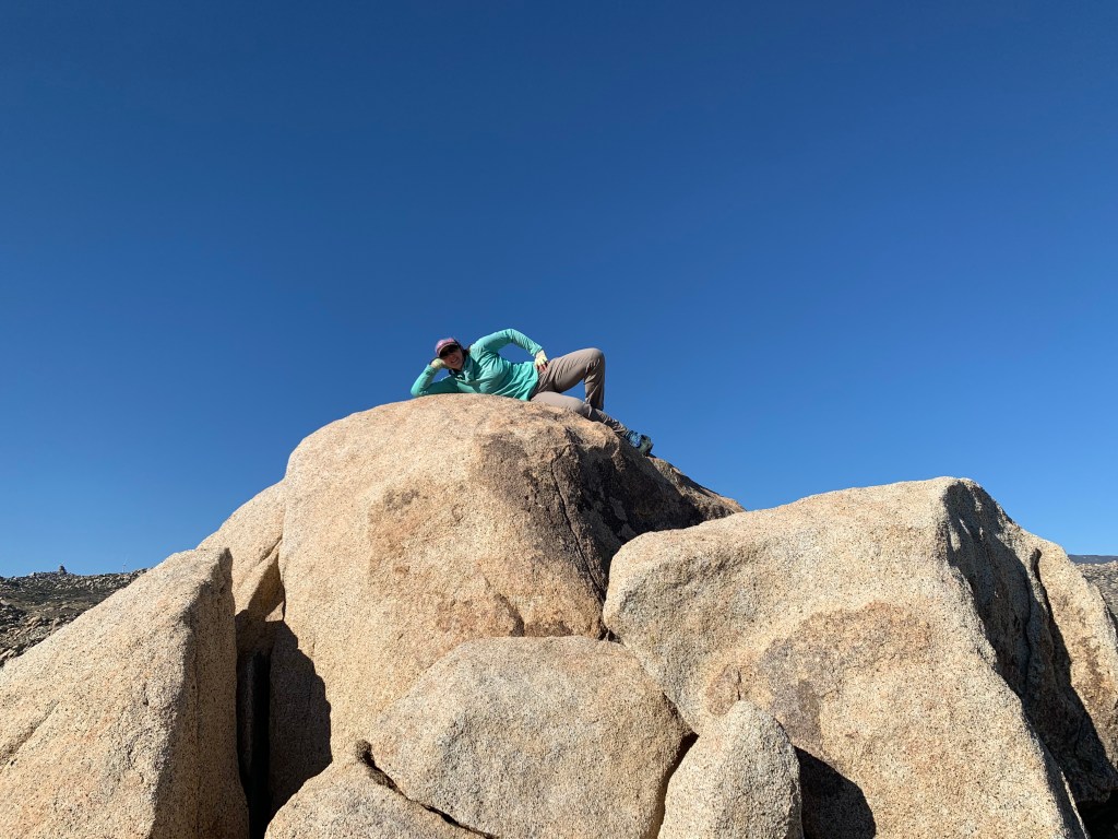
There are a few rock piles in this area, and we had to keep an eye on the GPX tracks we’d downloaded to figure out exactly which one was Peak 3339. To get near the summit, we crawled through a rock tunnel. Locating the highest point on the summit – a large boulder with some small rocks placed on top – we decided this would be good enough. We probably could rock climb up it, but it was exposed and windy. Not worth the risk! We found the register (two, actually) and selected our photo shoot spots. Back below the windy summit we enjoyed the view and a snack, then headed back … UP! … to Tara’s waiting Jeep.
We arrived back at the Carrizo overlook around 11:30am, and I had a hankerin’ for a cheeseburger – and no one argued with me. We were really in the middle of nowhere, so hopes were not high; but on Google maps, in the town of Boulevard, I found a place called Matthew’s Live Oaks Restaurant. It turned out to be a fully-stocked convenience store with a built-in restaurant. We ordered from the cashier, and his wife cooked our food. They had a small, empty seating area that they let us use. It took awhile but the food was good, and the service was friendly. It hit the spot.